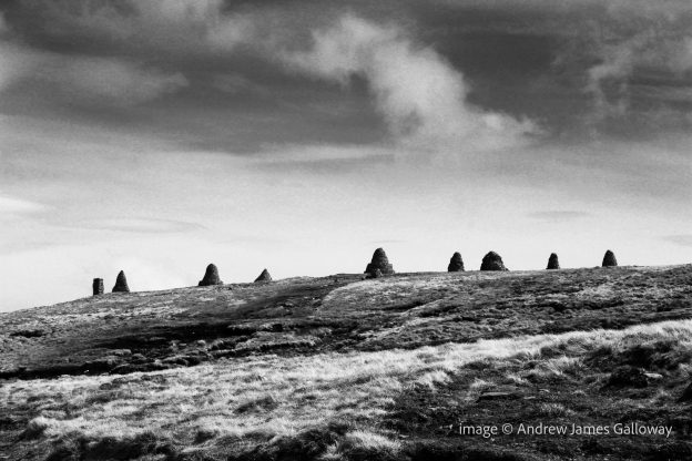
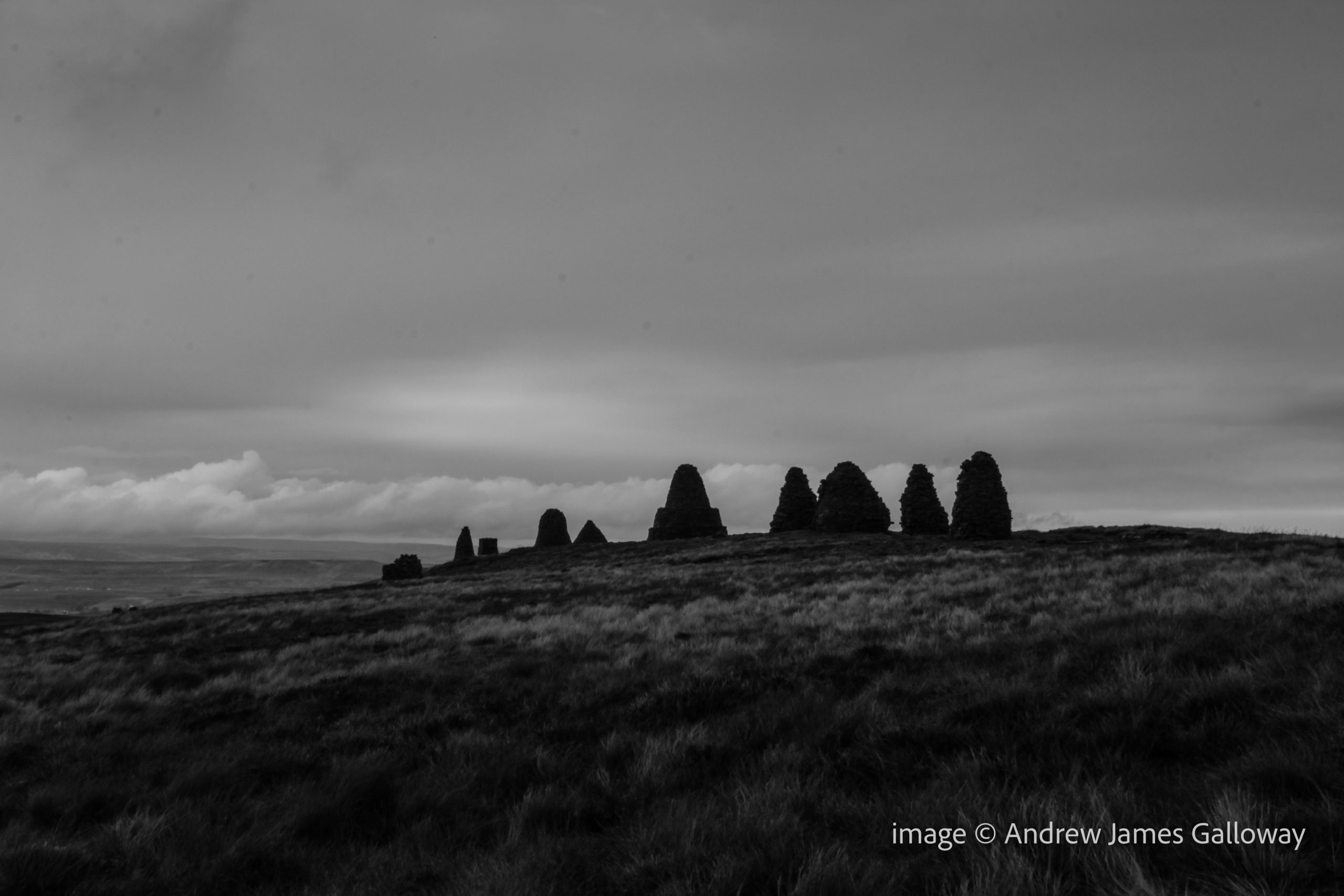
Nine Standards, a line of nine dry-stone cairns, standing proud on the skyline above the Cumbria market town of Kirkby Stephens, approximately half-way along Wainwright’s coast-to-coast route and just seven kilometres west of where the Pennine Way passes the famous Tan Hill Inn, provoke the inquisitive hiker to ask questions about their origin. One might imagine there would be many local legends and stories to tell about these enigmatic sentinels, placed by some unknown party high upon the gritstone moorland. But ask a local livestock farmer or passing farrier about the origin of these hurrocks of stone and you are more than likely to receive a shrug of the shoulders than any elaborate mythological tale. Fascinated by the prospect of an unsolved mystery linked to two of the country’s most famous long distance footpaths, I set out from Kirkby Stephens early one morning to investigate.
The path climbing from the River Eden folded around the ruins of Hartley Castle and entered a coppiced hazel wood where wild garlic grew in abundance. Over thousands of years the water of Ladthwaite Beck has carved its way through the Carboniferous limestone rock like a knife through wedding cake. Tilting steeply to the West, the rocks provided a path of least resistance for the ghyll as it cascaded in parallel to the ancient stratigraphy.
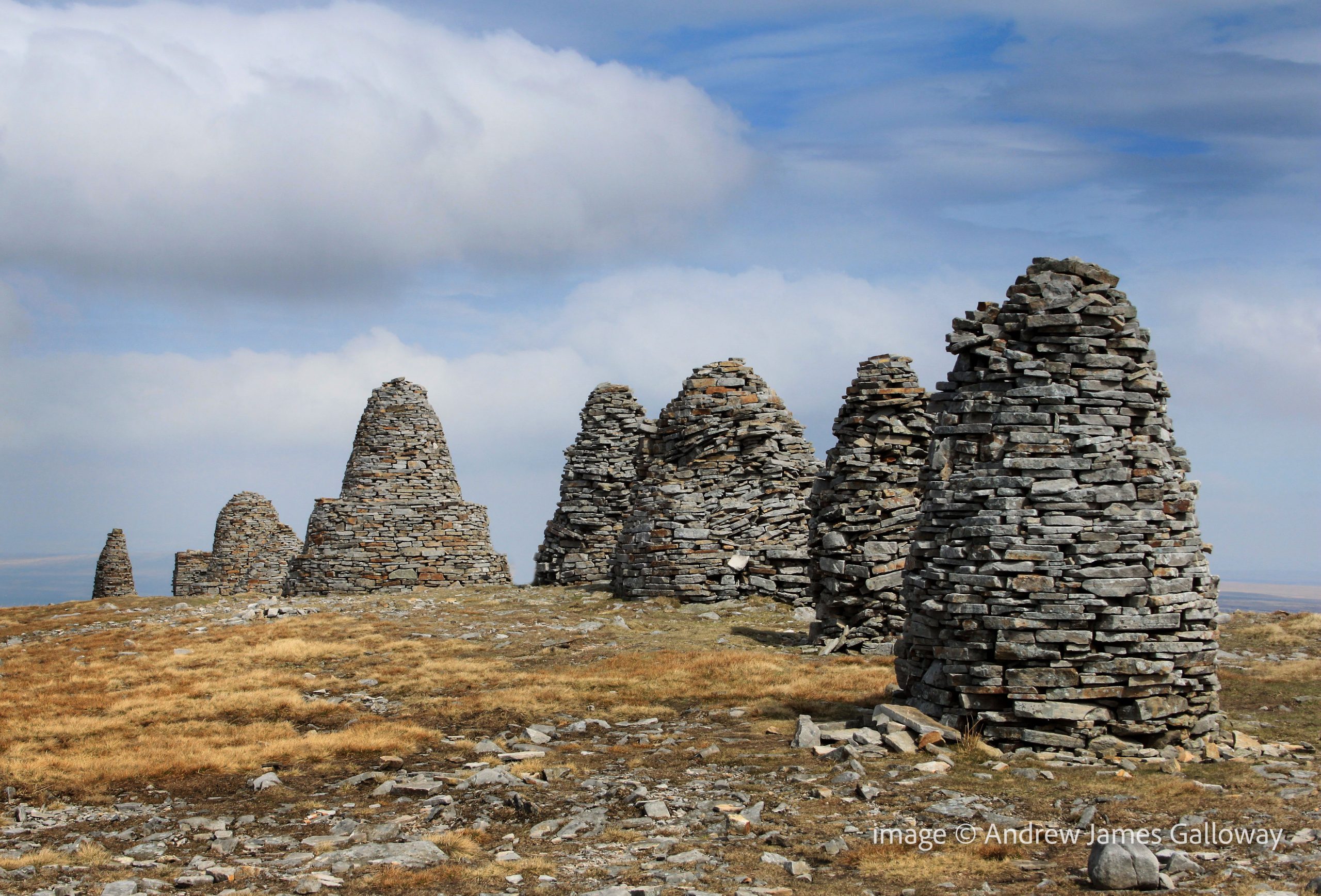
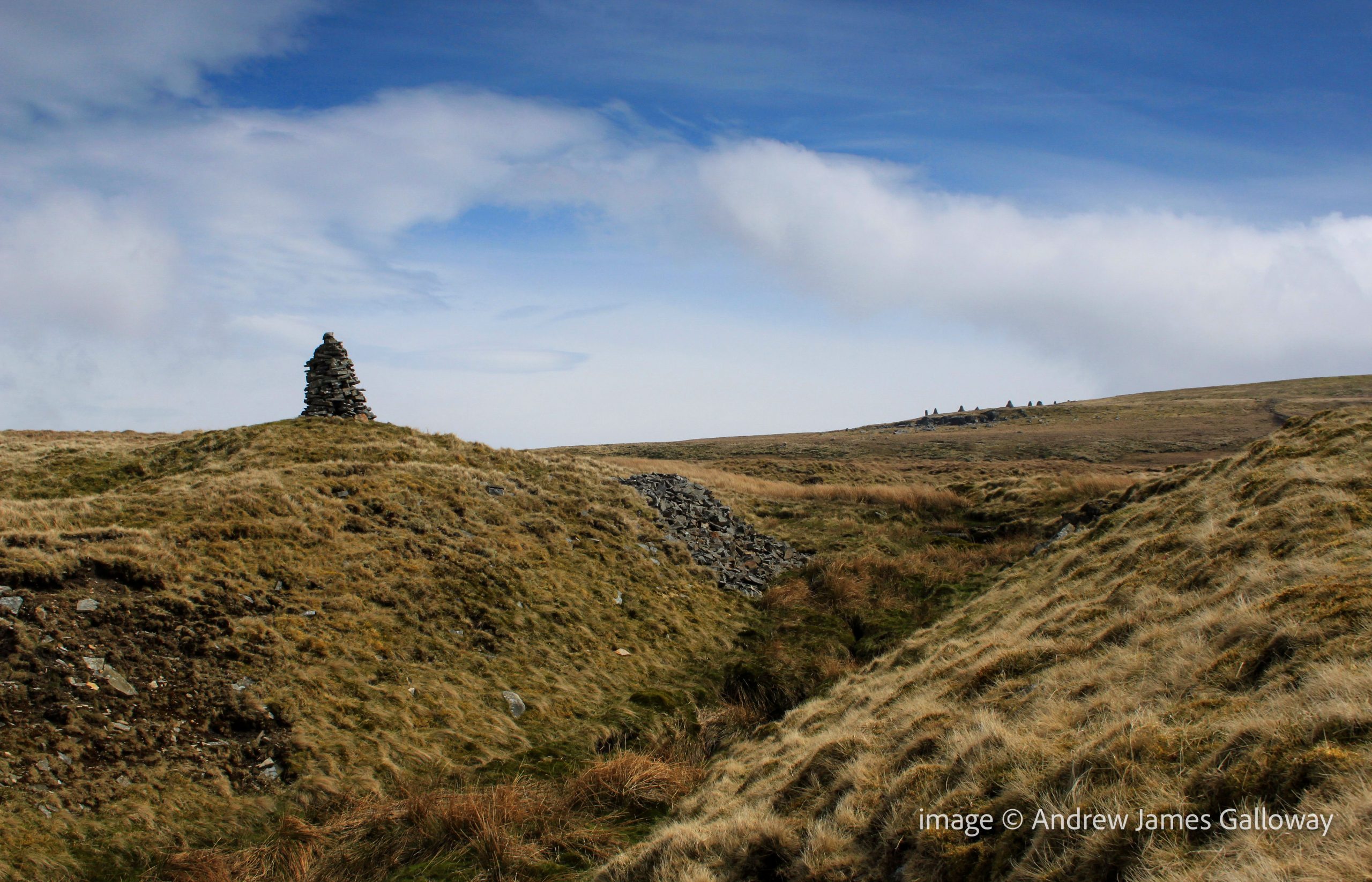
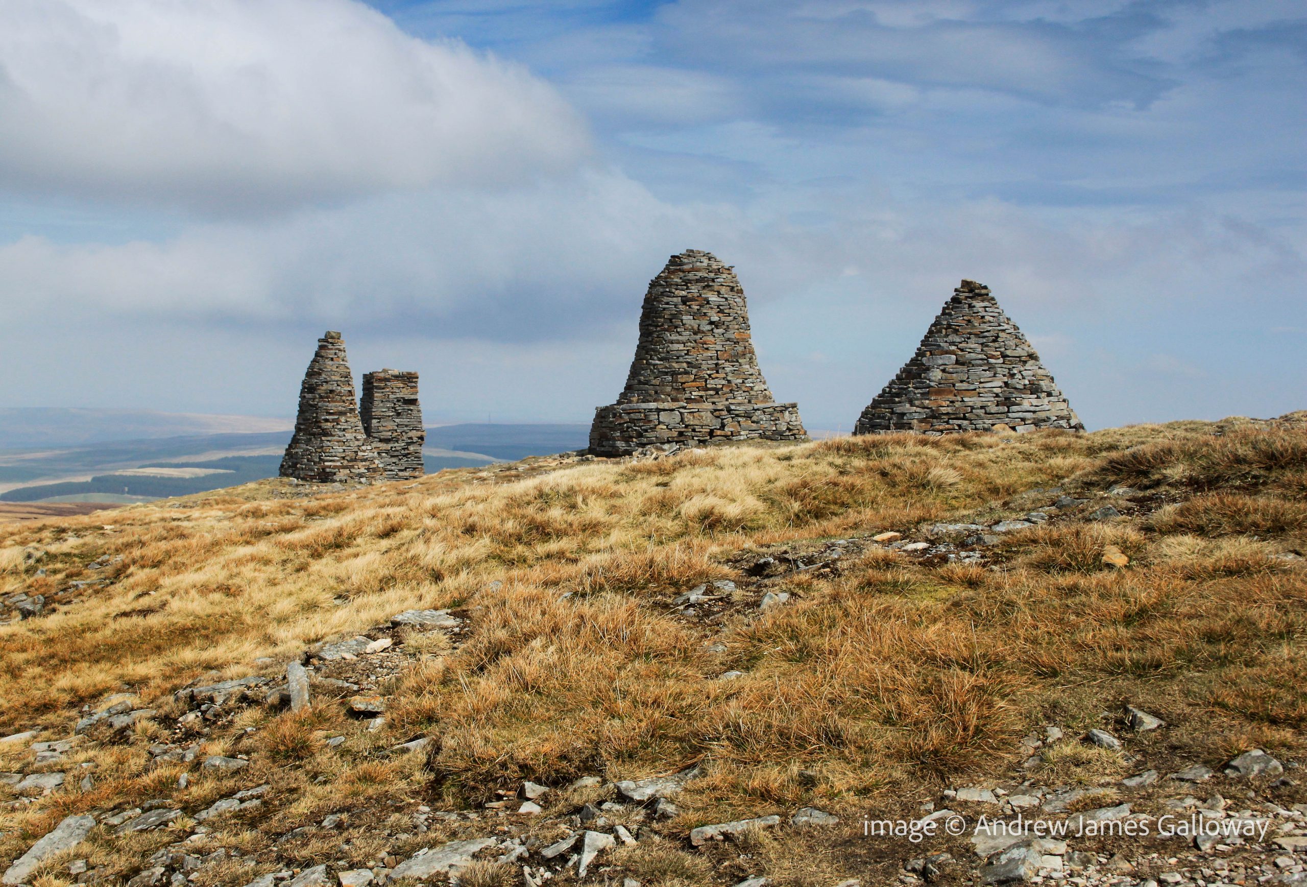
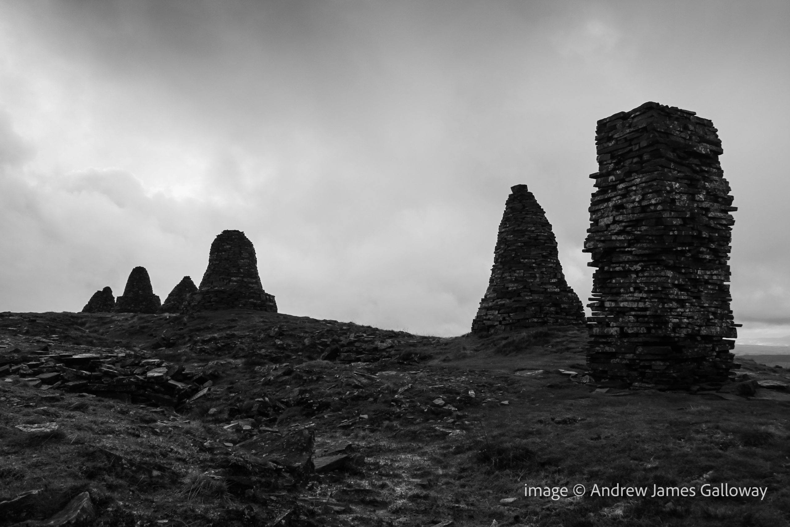
Passing the remote settlement of Ladthwaite the path climbed onto Hartley Moor where the Nine Standards appeared on the horizon like a vanguard of petrified Daleks from a 1970’s episode of Dr Who. A slightly more plausible explanation given for the position of the cairns is that they were built by local people during the medieval wars between England and Scotland to give the impression of an army encamped upon the hill, and hence, the idea suggests, deterring any potential Scots marauders. The clear flaw in this theory being not only that the cairns are only visible on the skyline from the west and not from the north, east or south, but also that there are just nine cairns – no great army. As I drew nearer to the cairns along the path that ran beside Faraday Gill (Ghyll surely Mr Ordnance Survey?), it became apparent that the cairns themselves were of a variety of shapes and sizes and appeared to have been designed to represent more than mere figures standing on a hill.
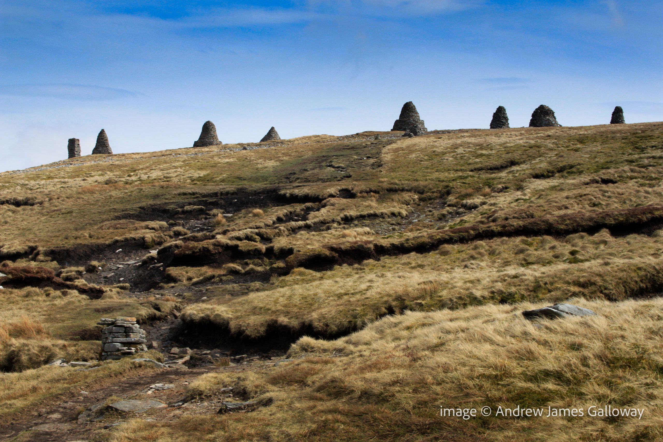
A W Wainwright mentioned them in his description of the coast-to-coast route, and although rightly dismissive of frankly patronising notions that they were built by local miners or shepherds who had nothing better to do, he regarded them merely as boundary cairns. The Standards sit on the boundary between the ancient counties of Yorkshire and Westmoorland, which is also the watershed dividing the Pennine Hills east and west. From here the Eden runs west to the Solway Firth and the Swale runs east to the North Sea. Due to the exposed position of their location, the notoriously harsh winters of the northern Pennine Hills and the natural human instinct to climb on them, the cairns do suffer occasional structural damage and require intermittent maintenance. The last major re-build was commissioned by East Cumbria Countryside Project in 2005, which means that the cairns are currently in pretty good condition. Visitors are requested to treat them with respect, ensuring no stones are removed.
But what of their origin? How old are they and who built them? If we disregard the rebellious Scot deterrent theory, we must look elsewhere. Dr Stephen Walker, himself of Kirkby Stephen, has undertaken an extensive search of archives both local and national in an attempt to establish the facts about these strange cairns. His findings are remarkable.
The cairns appear on the 1862 Ordnance Survey Six Inch (1:10,560) First Edition maps of Westmorland. They are marked on a variety of tithe, enclosure and estate maps dating from as early as 1738. They are mentioned on many boundary rolls, or perambulations as they are also known, written between 1400 and 1699. A perambulation was simply a list of landscape features which marked the boundary of particular estates, parishes or townships. The oldest historical reference to the cairns is contained within a transcription of a perambulation of Gilbert Gant, Lord of Swaledale, dating to sometime from the late 12th or early 13th century, thus proving that the Nine Standards cairns were standing above Kirkby Stephens no more than a hundred years after the Norman Conquest.
Prior to 1066 there is currently only speculation and hearsay. In 954 AD, Eric Bloodaxe, the last independent Viking king of York was ambushed and killed by Earl Maccus, son of Olaf, as he crossed the pass at Stainmore, now the route of the A66 from Scotch Corner to Penrith. Tradition held that Eric was buried at Rey Cross, but when the site was excavated to make way for the new dual-carriageway in the 1990’s, no burial was found. Only four miles to the south-west, do the nine standards mark the actual crossing point of the Pennine Hills used by Eric and thus his grave, and those of his noble companions?
Moving further back in time, in 118AD the Legio IX Hispana of the Roman Army was ordered north from York and, according to some scholars, was never seen again, allegedly annihilated by the Picts. It has been suggested that the nine standards are a lasting memorial to the defeated ninth legion. The obvious flaw in this theory being if the legion was wiped out, who was left to build the Cairns?
In his book, Nine Standards: Ancient Cairns or Modern Folly*, Dr Walker is clear and vociferous, “They were not built to give the invading Scots the impression that an English army was camped up there. Nor were they a job creation scheme for indigent lead miners by some eighteenth or nineteenth century philanthropist, still less a ‘folly’ built by one of the more deranged landed gentry, as some have suggested. They are in fact ancient and demonstrably so.” Nor are they simply boundary cairns. In number they are unique in the British landscape, repeated on no other watershed or county boundary from Sutherland to Cornwall. They are undoubtedly a work of art, created by a Damien Hirst or Tracey Emin of the time. Their very presence is meant to communicate a message. We have simply forgotten what the message was.
A striking curiosity about Nine Standards Rigg, the hill upon which the cairns stand, is that its name is derived from the cairns themselves and hence post-dates them. They are not, for example “Old Harry’s Cairns on Backstone Hill”. The implication here is that for the topography to be named after a man-made feature, the feature must be very old indeed. Within the Brut y Bryttaniat, a 15th century manuscript copy of a 12th century script in Kymraec (Old Welsh), which was translated in to Latin by Geoffrey of Monmouth, an account is given of a battle between the Britons and the Saxons at York in 504AD. The manuscript states that the Saxons were routed and fled into the mountains to take refuge at a place named “mynydd daned” or toothed mountain. The Britons rallied and attacked the mountain at night, slaying the Saxons. If “toothed mountain” is taken as a description of Nine Standards, this manuscript may indicate that the cairns date to as early as the 6th Century.
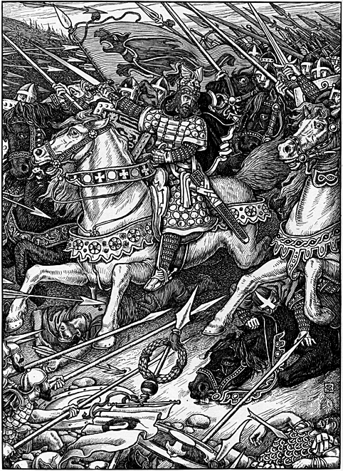
The landscape around Kirkby Stephens contains other mythological echoes. Pendragon Castle, the supposed birthplace of Uther Pendragon lies just 6 miles to the south-west. Some would suggest Arthurian associations with the cairns. The 6th century British cleric Gildas places a Romano-British commander by the name of Ambrosius Aurelianus at a battle against the Saxons at a place known as Badon Hill, location now unknown. It is my own belief, and nothing more than a belief mind you, that Baidon Hill is the lost name of Nine Standards Rigg and that each cairn was built to bear the flag or “standard” of each tribe of the Britons who defeated the Saxon hoards there. The watershed west and east would be a most likely location for these two armies to meet, the Saxons having arrived form the east, Ambrosius Aurelianus from his Welsh stronghold in the west. Could Ambrosius Aurelianus be the historical fact behind the mythological legend we know as King Arthur?
But all this is speculation and conjecture. In the mists and shadows of time, names and places become confused. Distorted and manipulated by subsequent generations the truth rapidly becomes the first casualty of history. It is perhaps astounding then that no formal archaeological investigation of the Nine Standards has ever been undertaken. Until that time, it is only natural that people will look to the cairns and attach their own stories to explain their presence. For now the origin of the curious nonad of dry stone cairns upon Nine Standards Rigg must remain a mystery.
*Dr Walker’s book is available from Hayloft Publishing Ltd http://www.hayloft.eu/
This article first appeared in Cumbria Magazine, February 2014