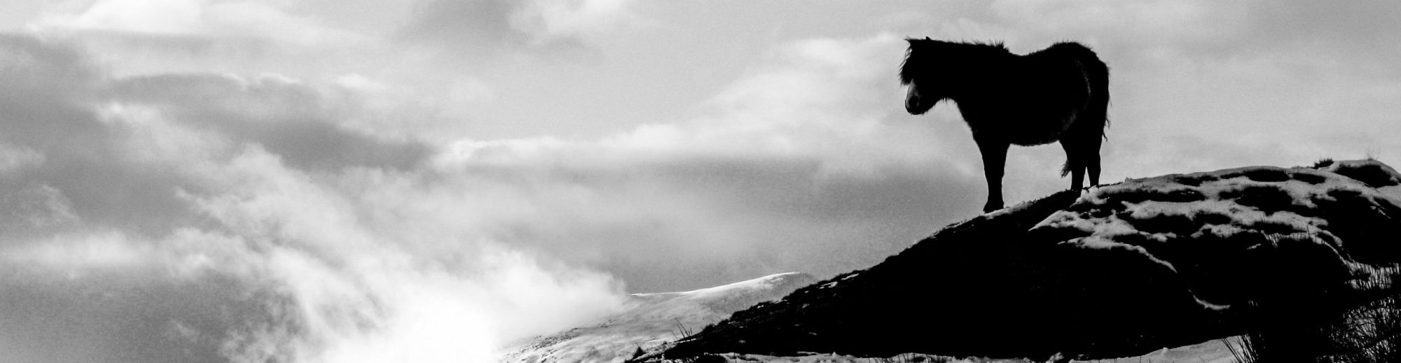
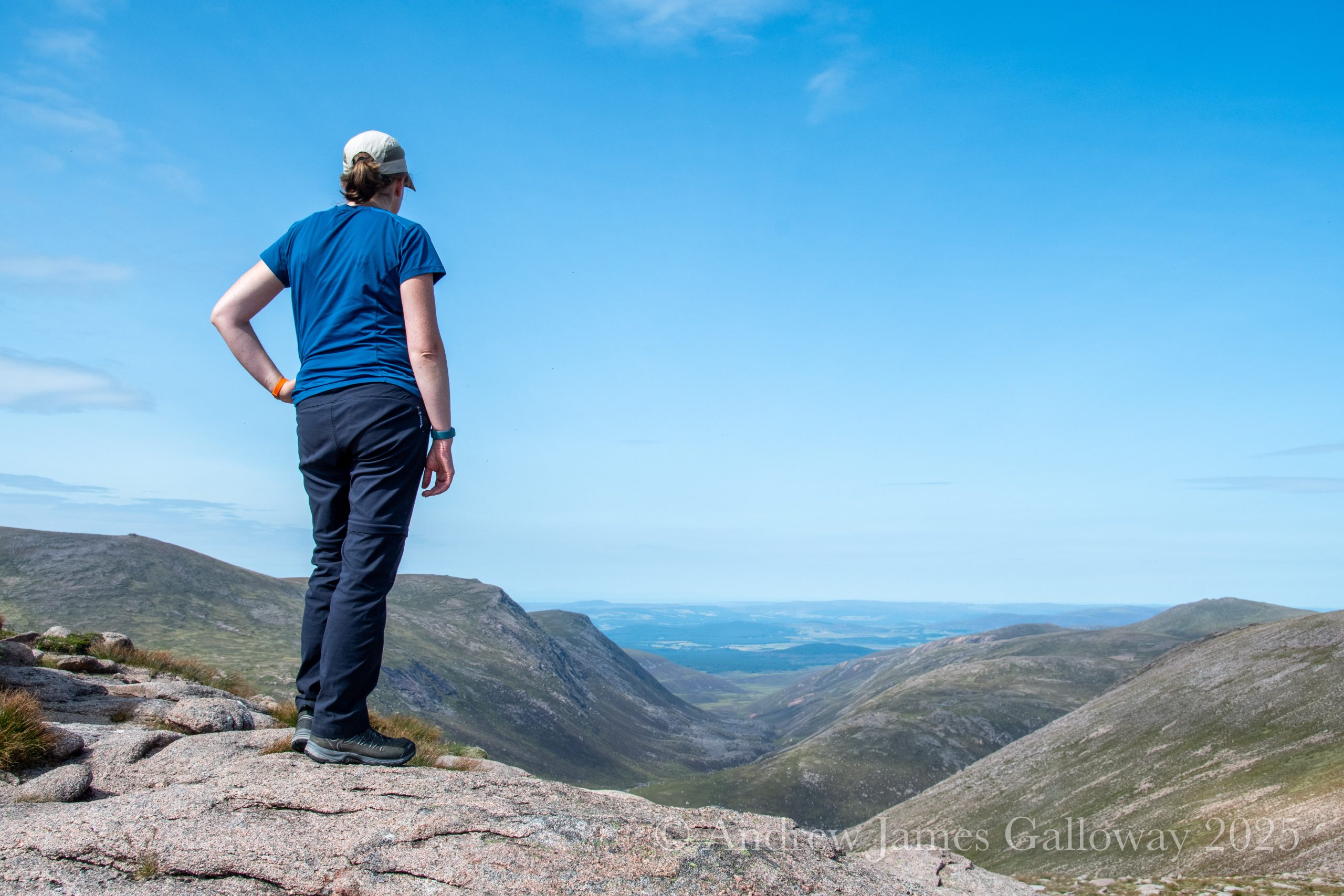
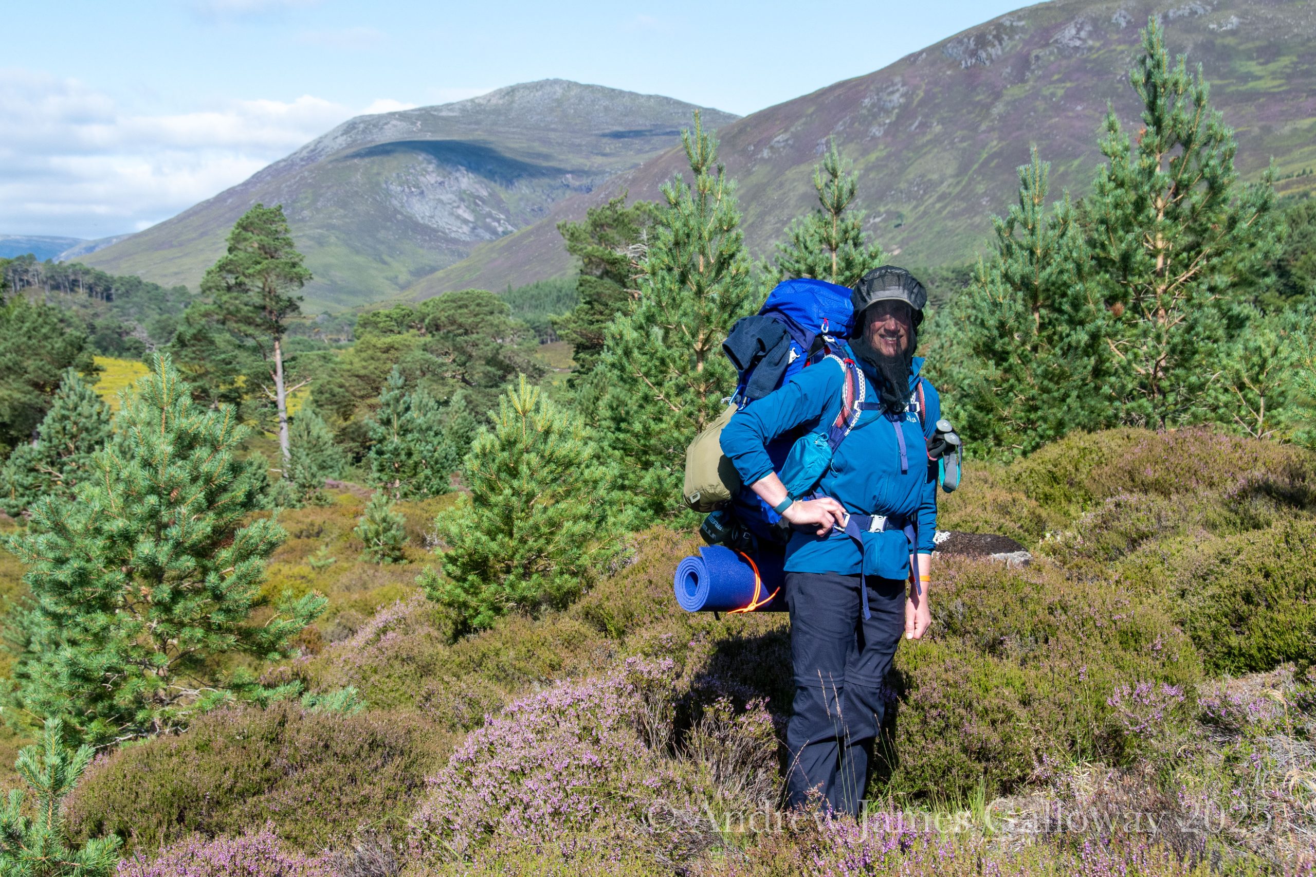
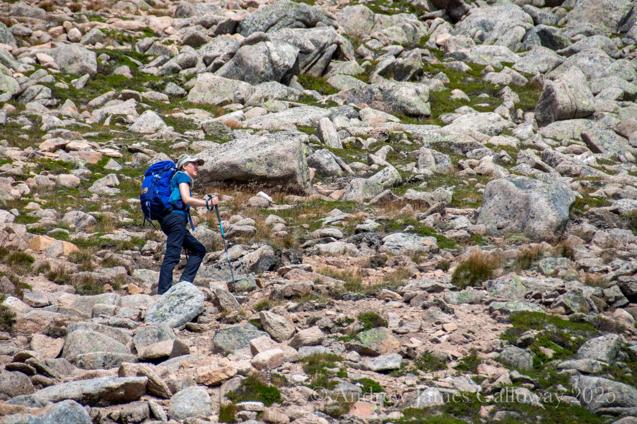
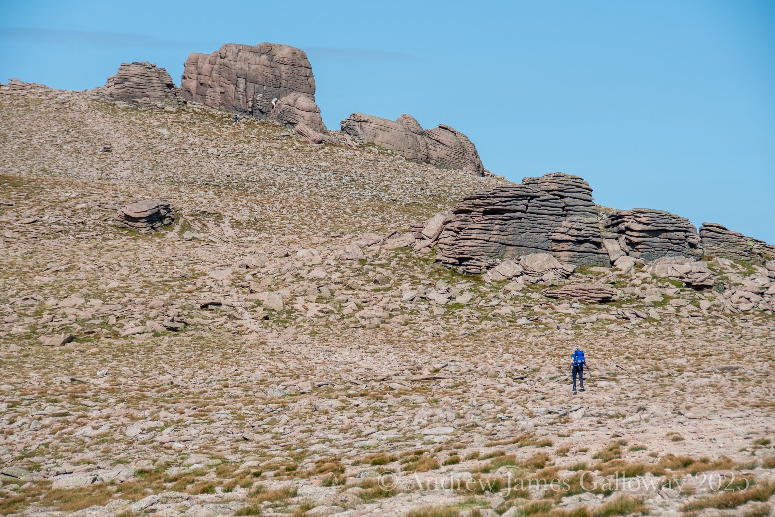
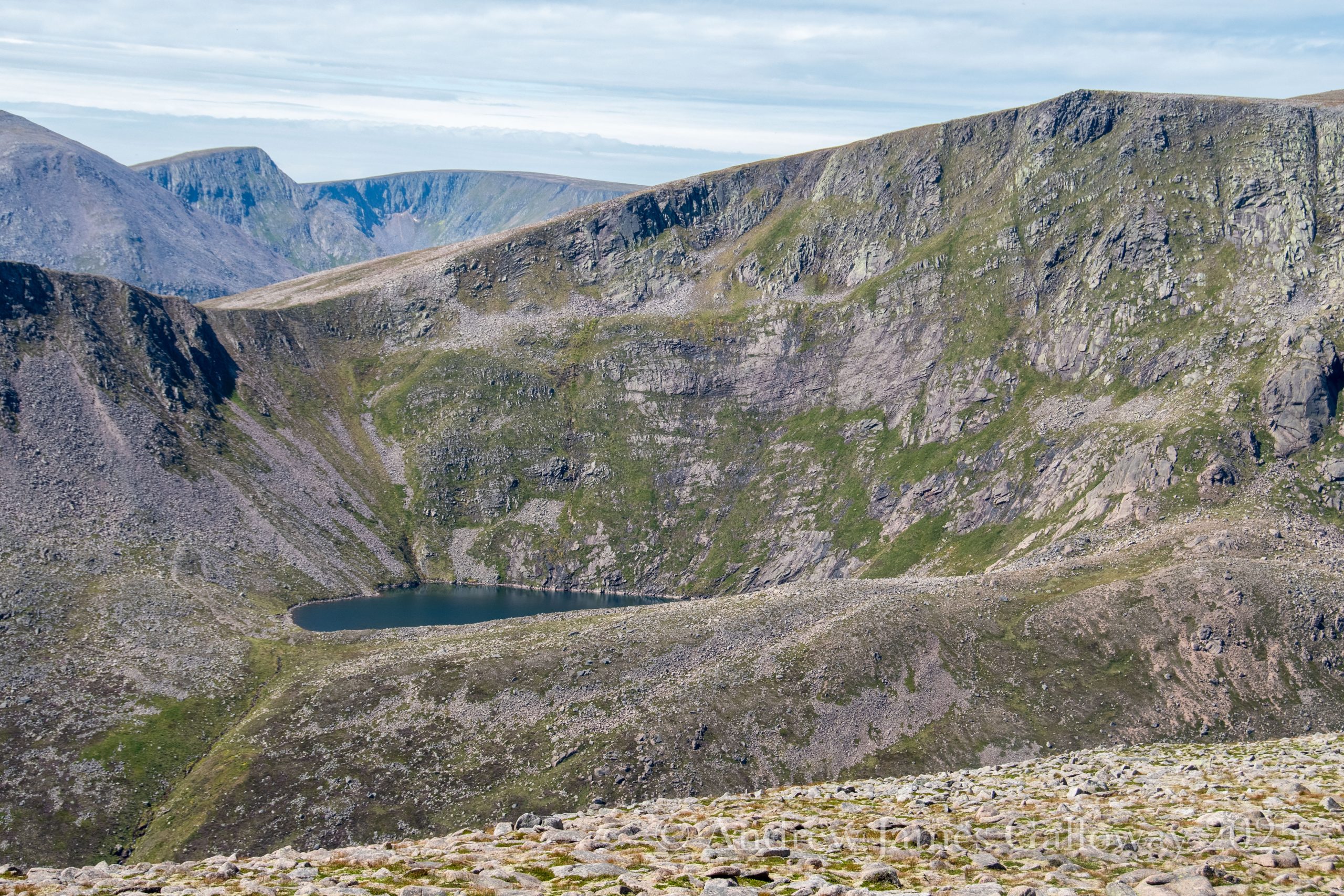
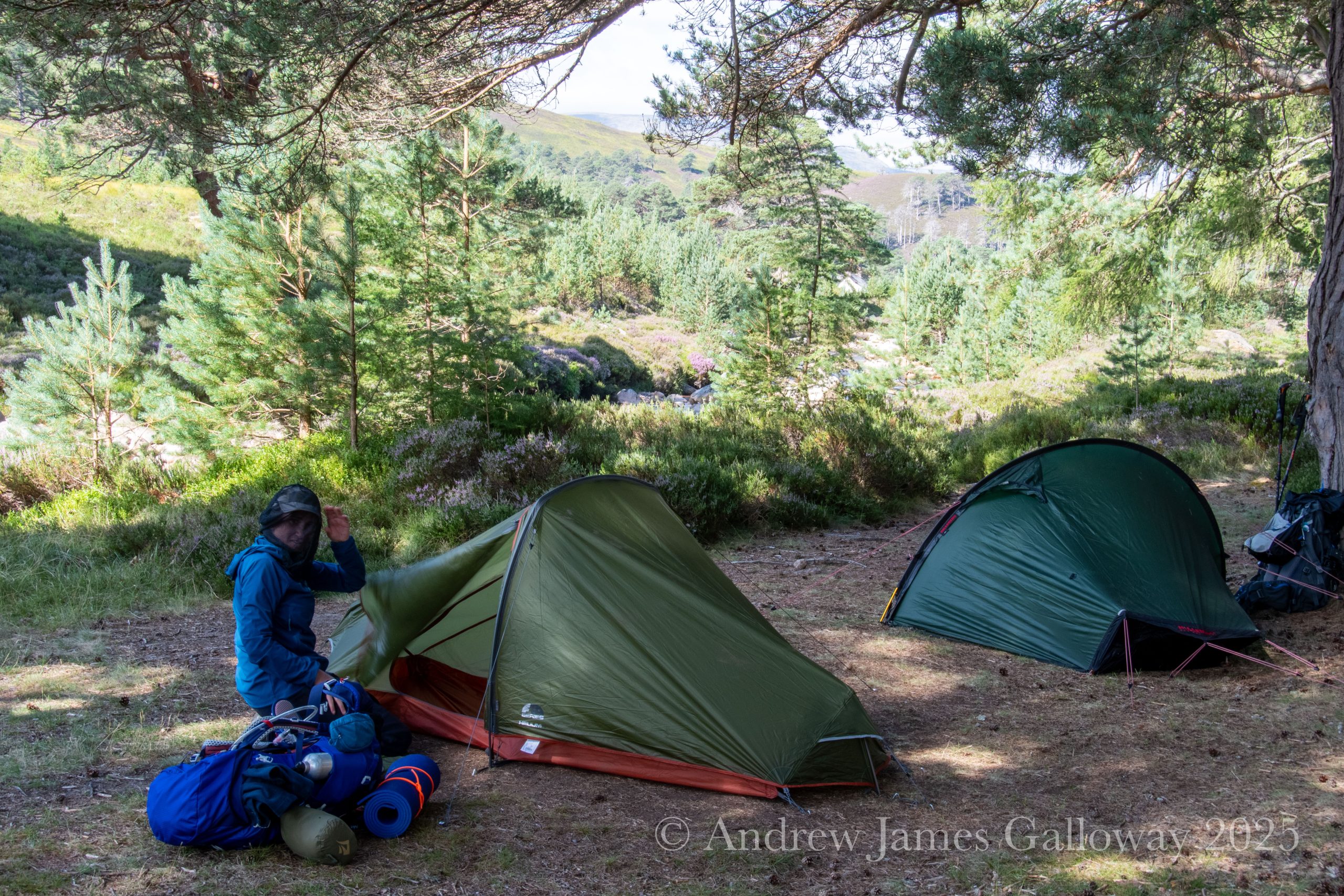
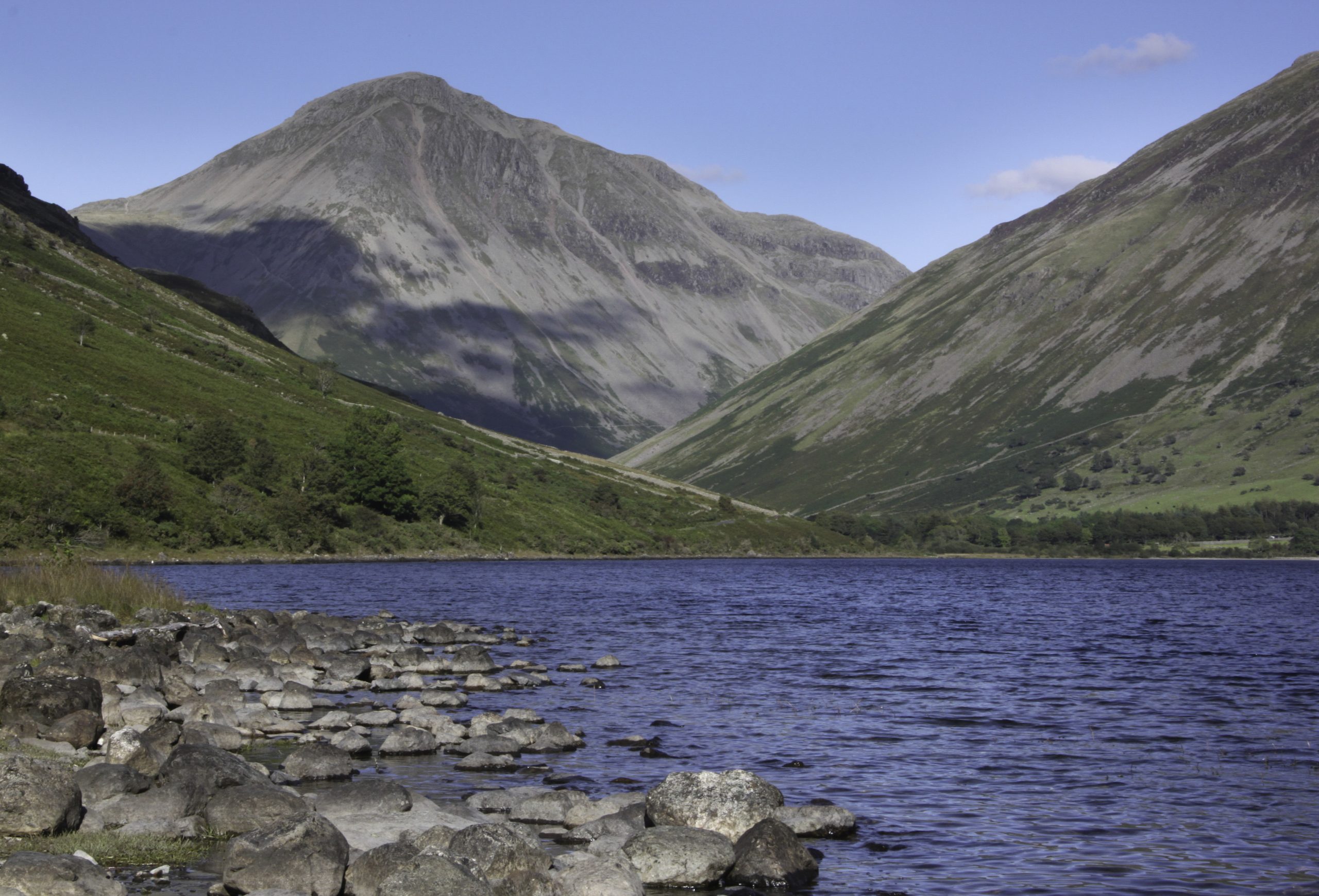
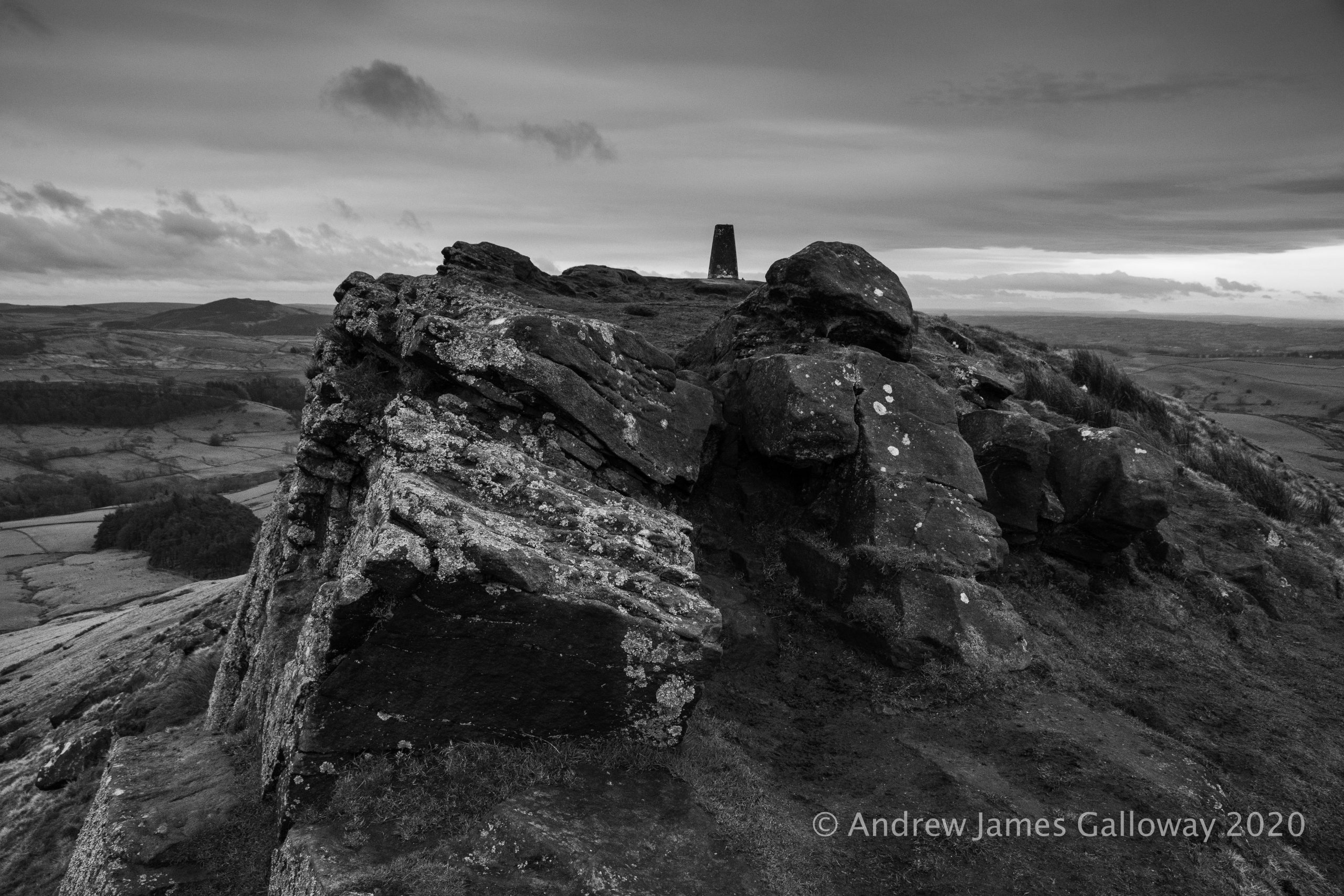
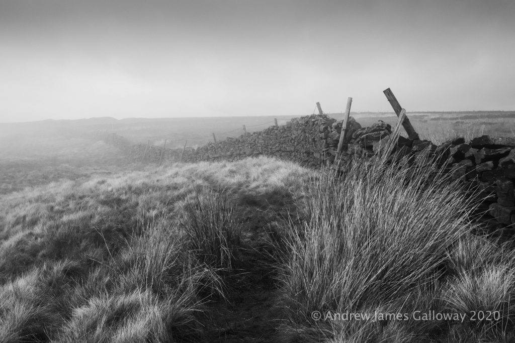
My friend Abi and I had the most challenging adventure in the Cairngorm Mountains. From the Linn of Dee we walked 5km to Derry Lodge and pitched camp among the trees by Luibeg Burn. Having lightened our packs we took the path via Craig Bad an t-Seabhaig and Carn Crom to Derry Cairngorm (1155m). In glorious sunshine we picked our way through granite boulder fields to Loch Etchachan. A steep climb of 400m led to the Barns of Beinn Mheadhoin then onwards to the granite tors atop Beinn Mheadhoin (1182m).
We returned to Loch Etchachan and descended Coire Etchachan to the Hutchinson Memorial Hut, followed by the long walk along Glen Derry back to Derry Lodge. After a well deserved meal of pasta, beans and sausage we crawled into our tents for an early night.
The following morning was damp in comparison to the previous day. With the wee midges out in force we quickly packed up camp (leave no trace) and headed back to the Linn of Dee.
Our reward was the full breakfast at the Bothy cafe in Braemar.
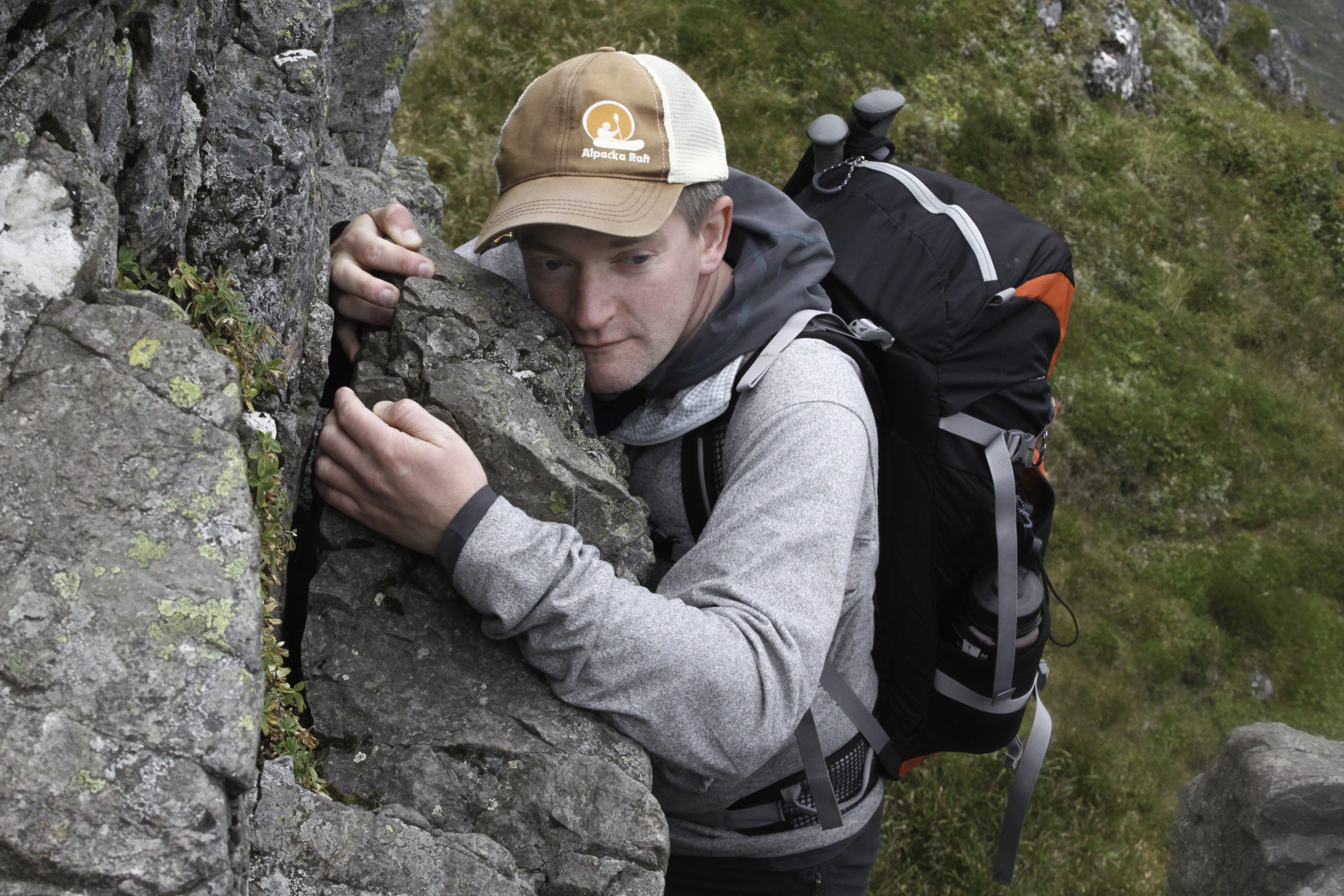
According to a random statistic, which I stumbled upon when Googling about Facebook, and which by no means am I able to verify, the average Facebook user is connected to eighty community pages, groups and events. An exaggerated claim perhaps. I checked. I have fifty-five! One particular Facebook group I am a member of is ‘Munroaming’ a lively, active community run by the blogger and outdoor journalist Fiona Russell for those interested, as so many people are, in ‘bagging’ all 284 Scottish mountains as surveyed by Sir Hugh Munro’s as having above 3,000 feet in height. It was here that one dull Sunday afternoon, as I was watching the Mancunian raindrops stream tearfully down my patio doors, I posted that I was interested in completing the Aonach Eagach ridge in Glen Coe and was looking for a bit of company, being a bit of a Scottish novice (my Munro tally is barely into double figures) and not knowing anyone with the necessary skills to accompany me. For several days my post sat unacknowledged. There was the occasional ‘like’ but nothing concrete, and I began to consider postponing the whole enterprise until the spring, when up popped a notification and suddenly the game was on. I had been contacted by a gentleman named David who had completed the infamous ridge walk once before but who was keen to do it again. Suitable dates were discussed, two other likely suspects were enrolled in the offensive and before I had any second thoughts, I was driving north along the M6 motorway towards Glen Coe.
Glen Coe
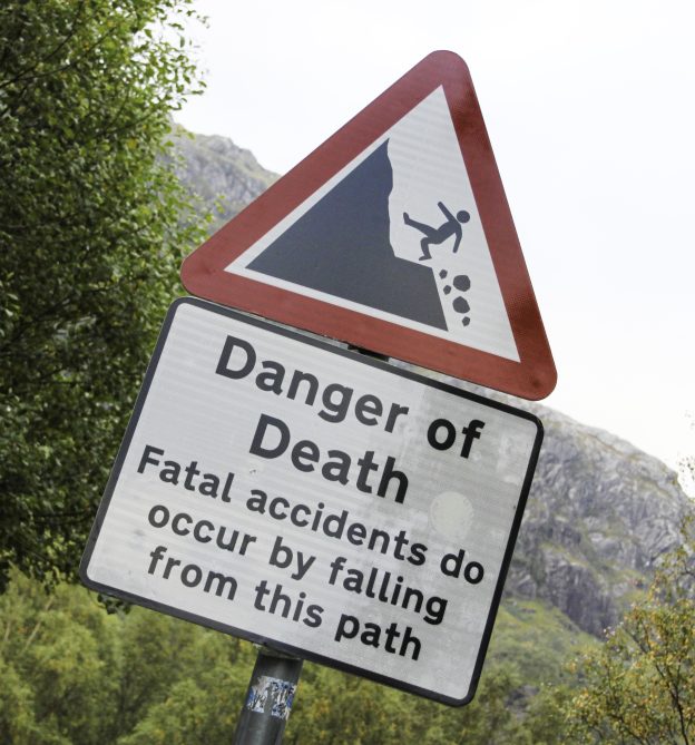
The Aonach Eagach ridge, stretching along the northern side of Glen Coe, is something on an enigma. Often described as the most challenging ridge walk on the British mainland, it is a real feather in the cap of any aspiring Munroist. Part of the mystery of the ridge is artificially maintained by the many tall stories about it, usually in the bar of the Clachaig Inn at the western end of the ridge, but also scattered liberally about the Internet on walking forums. One veteran of the route posted about how he and his friend took a wrong turn and descended too early towards the afore mentioned Inn, his friend sustaining three broken ribs as a result of falling on the steep, lose scree.
It is fair to say that there was something of an air of trepidation around the campfire at the Red Squirrel campsite that evening as the four of us, myself, David, Mick and Stefan, began to get to know each other a little better. Later that night, lying in my tent before I drifted off into a restless sleep, assailed by dreams of being pursued through an unending labyrinth of corridors by an unseen adversary, the thought did briefly cross my mind that although it was statistically unlikely, there was the very real possibility that the very next day could be my last. Thankfully, I was able to dismiss the thought as morbid paranoia.
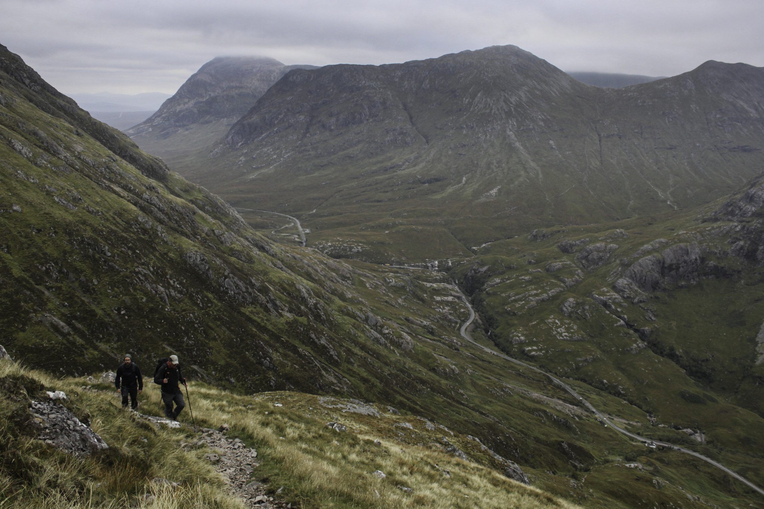
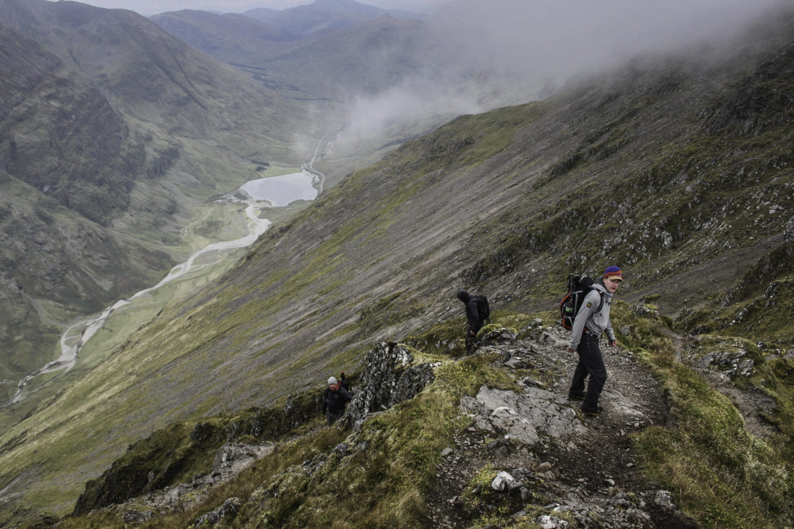
We elected on an early start, the myriad guide books and internet postings indicating that this was going to be a long day, packing ourselves and our day packs into one car, whilst leaving the other at the campsite. From the layby on the north side of the A82, just beyond the Three Sisters’ viewing point, we began the steep, zig-zagging climb to Am Bodach, rising some 800m above the level of the road, a lethargic morning mist still veiling the summit in cloud.
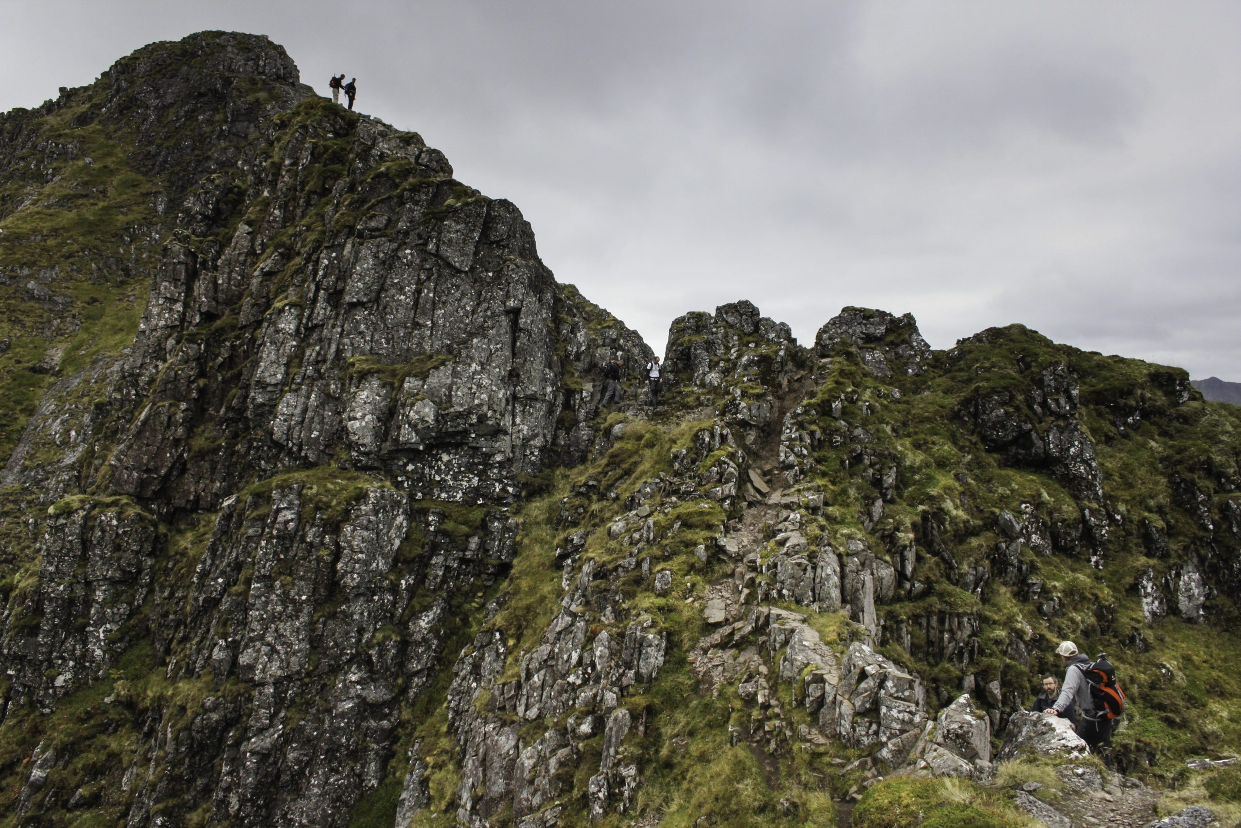
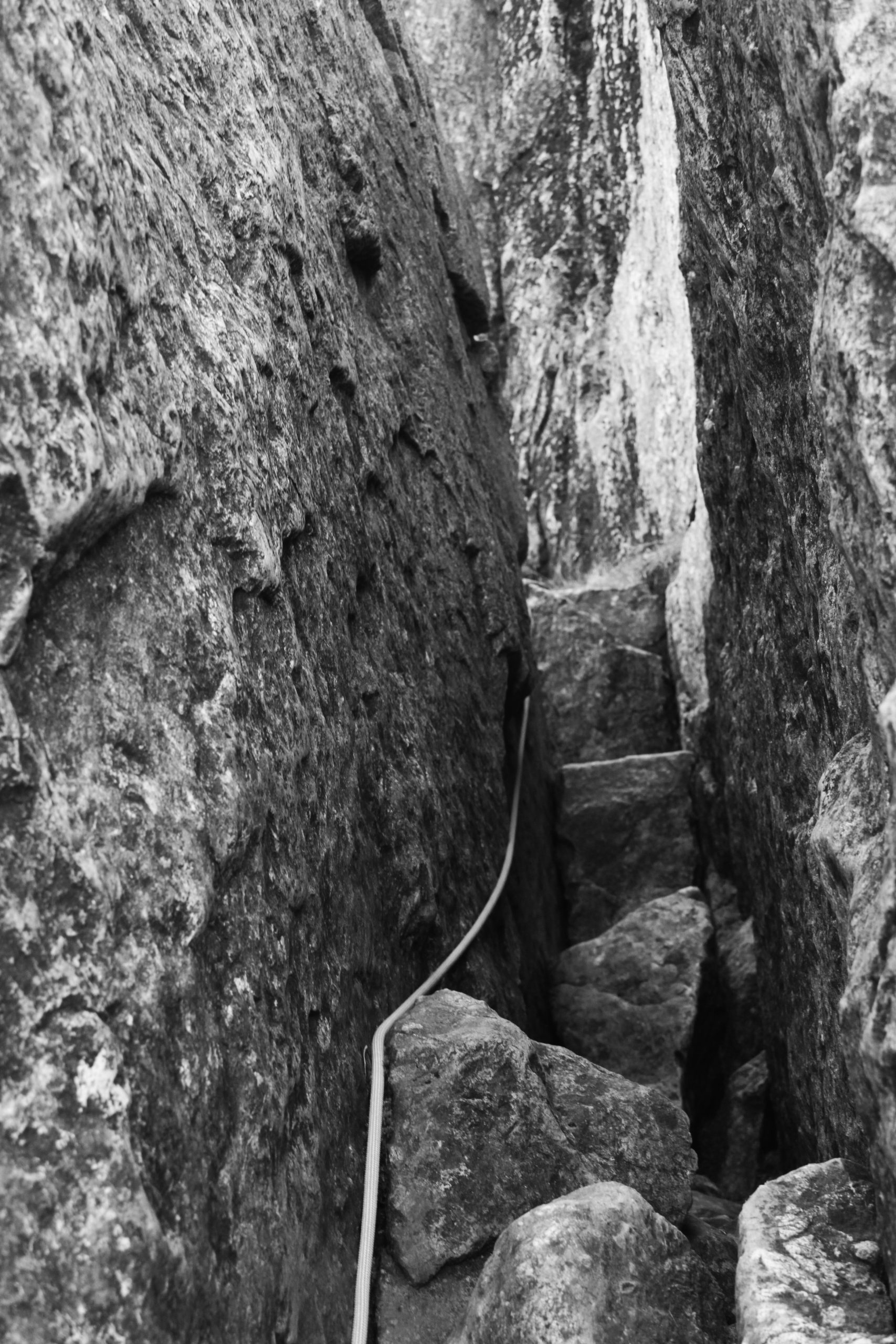
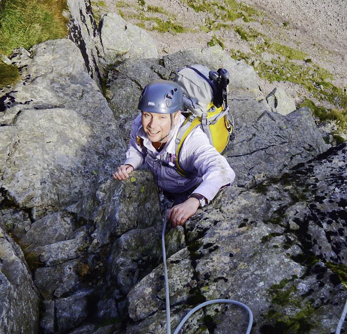
Just to the west of Am Bodach the ground dropped away steeply about 20m and we paused, nervously, for a few minutes to gather composure. We had collectively agreed to take a safety rope with us just in case one of us became cragfast – there was no contingency for all four of us becoming cragfast! But as the swirling mist began slowly to rise above the precipice of The Chancellor beneath us, the presence of two early bird walkers at the foot of the crag gave encouragement. I shouted down to them, asking how difficult they had found the descent. “You’ll be fine,” they shouted back, “just take your time.” So packing away our flasks of tea and coffee we nervously wished each other well and after a very brief discussion about who should lead, “no you first,” “no really, after you,” we set off. In actual fact this first and most nerve wracking down-climb of the ridge, a diagonal descent across the crag, was with close concentration, a firm hand and a slow and steady pace, completed with relative ease. I was reminded just how agile and adaptive the human body can be when put to the task.
The four of us re-grouped at the foot of the crag, glancing back to the glistening wall of black volcanic rock with a collective sigh of “well, that wasn’t too bad,” aware that more challenging ground lay ahead. A clear path snaked its way seductively upward without complications to the summit of Meall Dearg at 953m above sea level. Famously, this was the final Munro to be completed by the Rev. A. E. Robertson in September 1901, making him the first person to complete a full round of the Scottish mountains defined by the enigmatic Sir Hugh Munro. Legend states that Robertson first kissed the summit cairn, then his wife. There is no mention of how they tackled that pesky down climb off Am Bodach.
Meall Dearg 953m
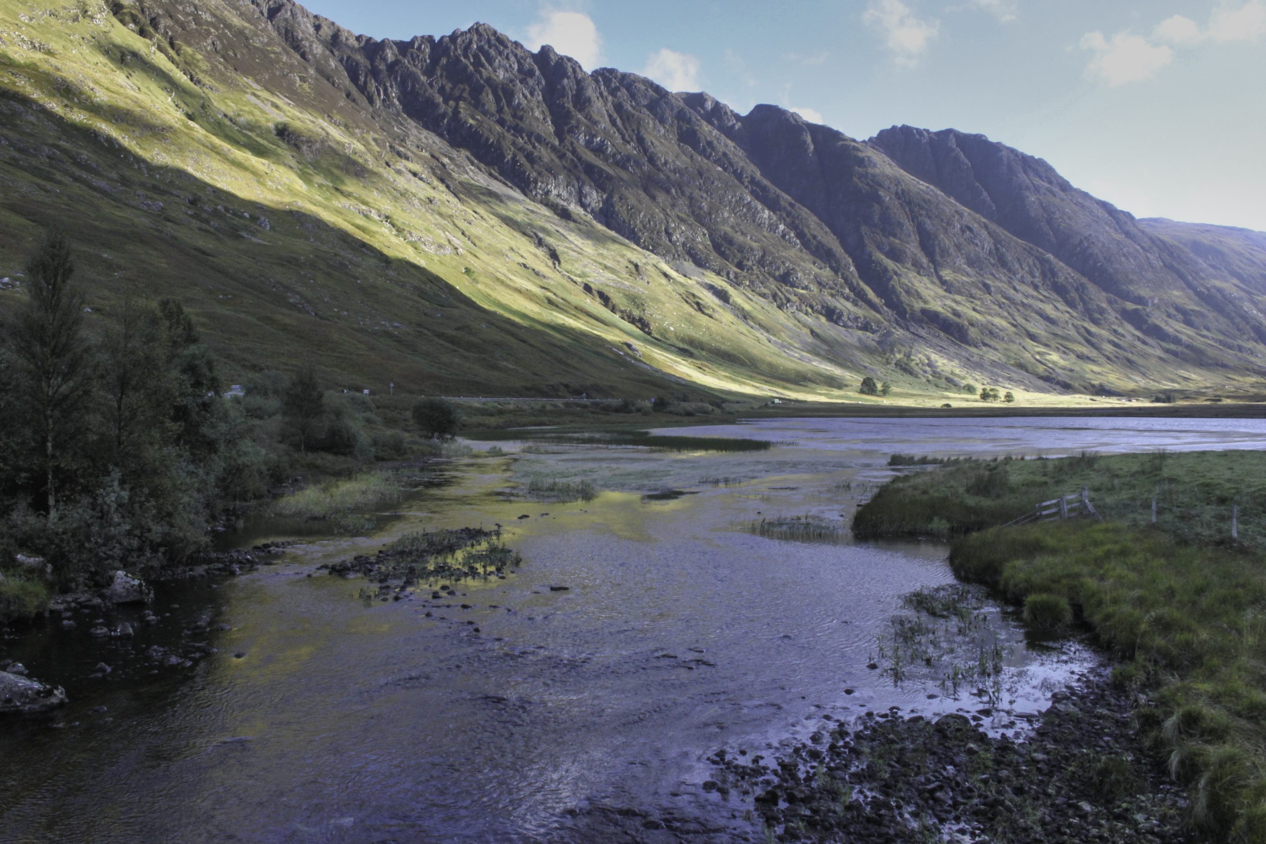
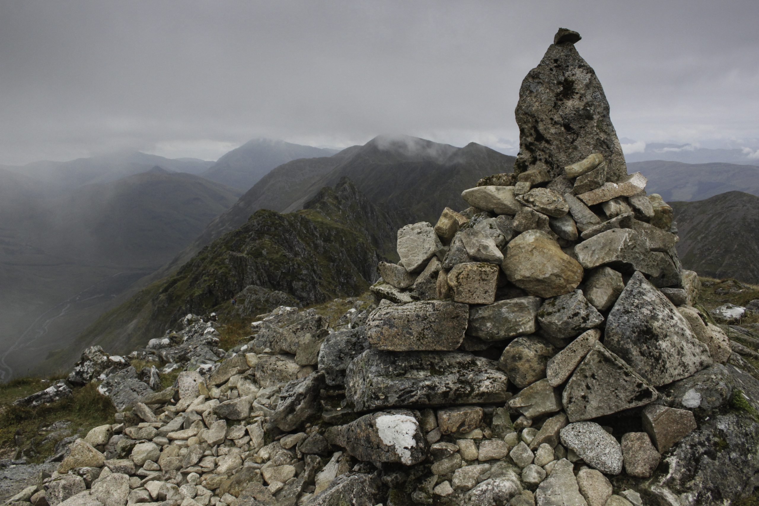
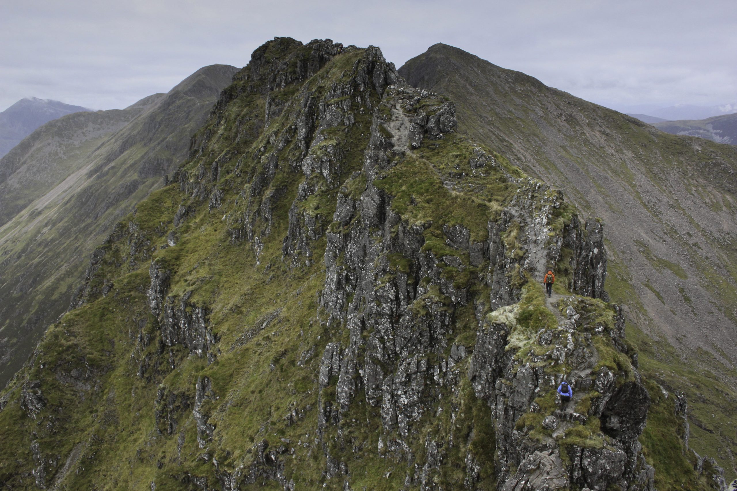
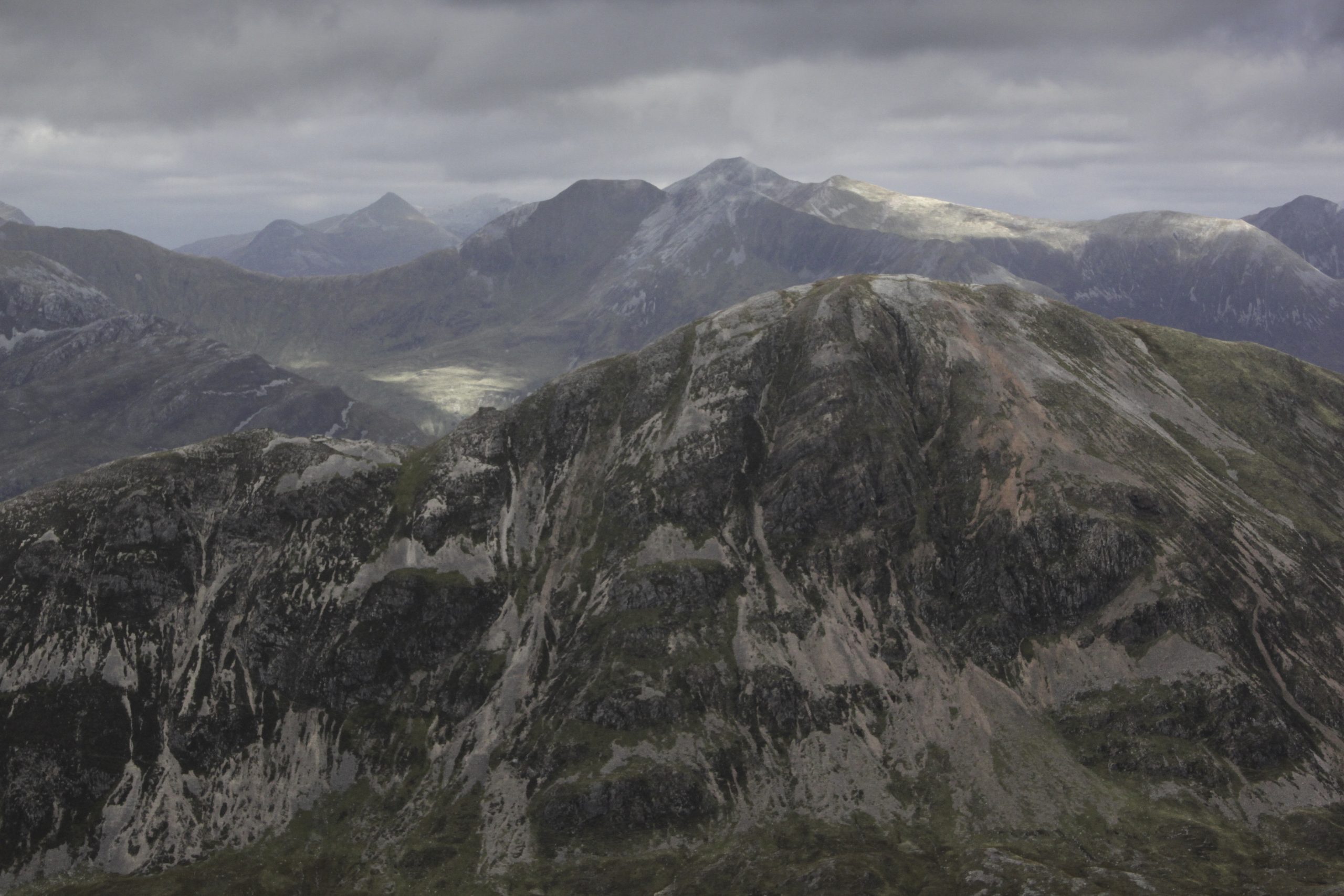
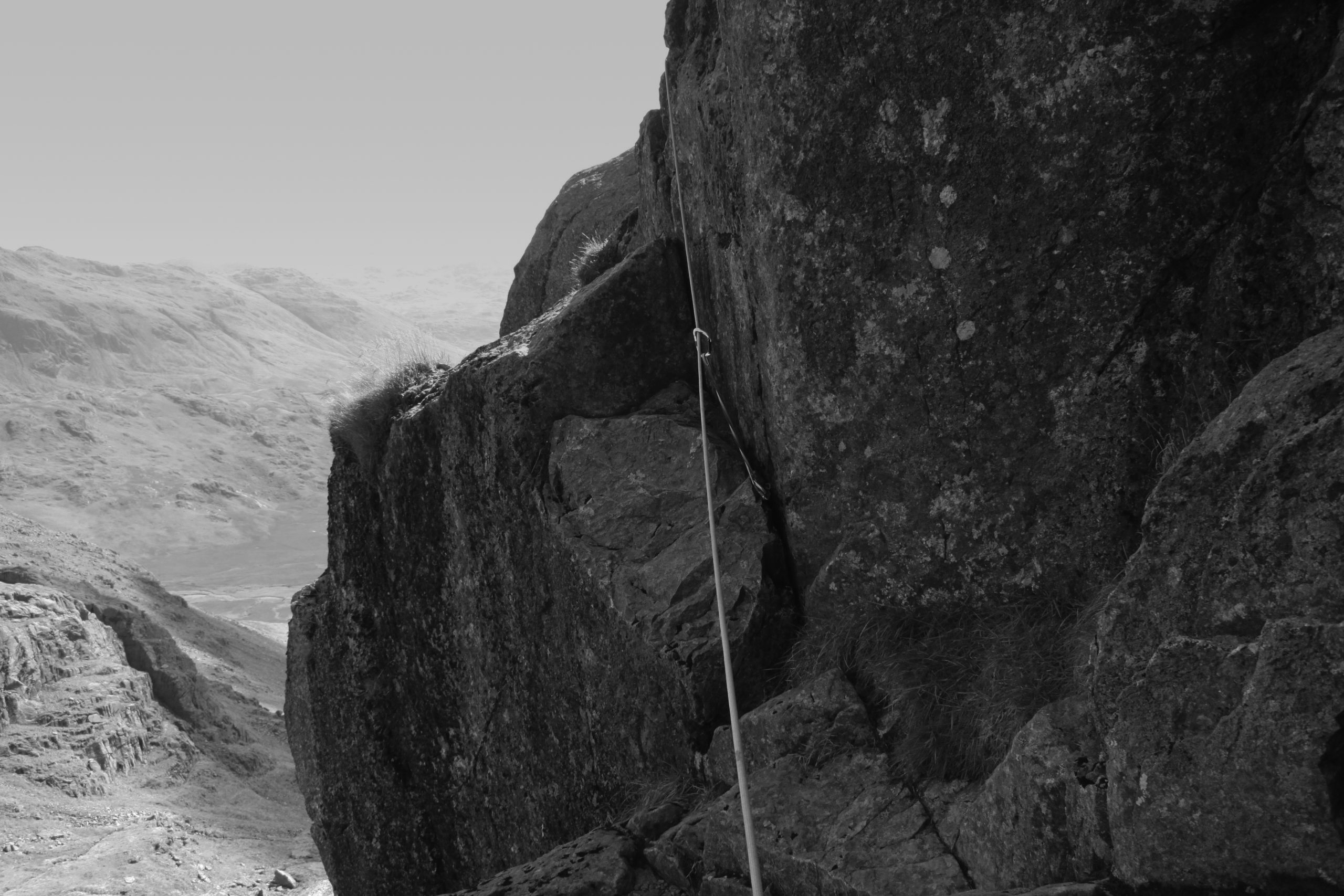
From the summit of Meall Dearg the centre, and most challenging section of the Aonach Eagach revealed itself, like a bride lifting her veil, a veritable rollercoaster of Rhyolitic rock, undulating westwards for two kilometres, its vertiginous flanks falling abruptly more than 800m on either side, meaning a simple stumble could deposit you variously by the shores of Loch Leven to the north or at the foot of the multitudes of sightseers congregated at the Three Sisters’ viewing points on the A82 road.
Taking the appearance of a sinusoid, the main difficulties of the Aonach Eagach occur not in scrambling up the numerous gullies and chimneys facing eastwards, but in having achieved the crest of a razor sharp pinnacle, being confronted with a steep, precarious descent as the sinusoid undulates towards the summit of Stob Coire Leith. My personal preference on such rocky descents is to face inwards to the rock, although I appreciate that this may be an unnerving concept at first, but having gained confidence through practise, this method of making those notorious down climbs gives far greater stability than the facing outward alpine bottom-shuffle we have all resorted to at one time or another.
Second Thoughts?
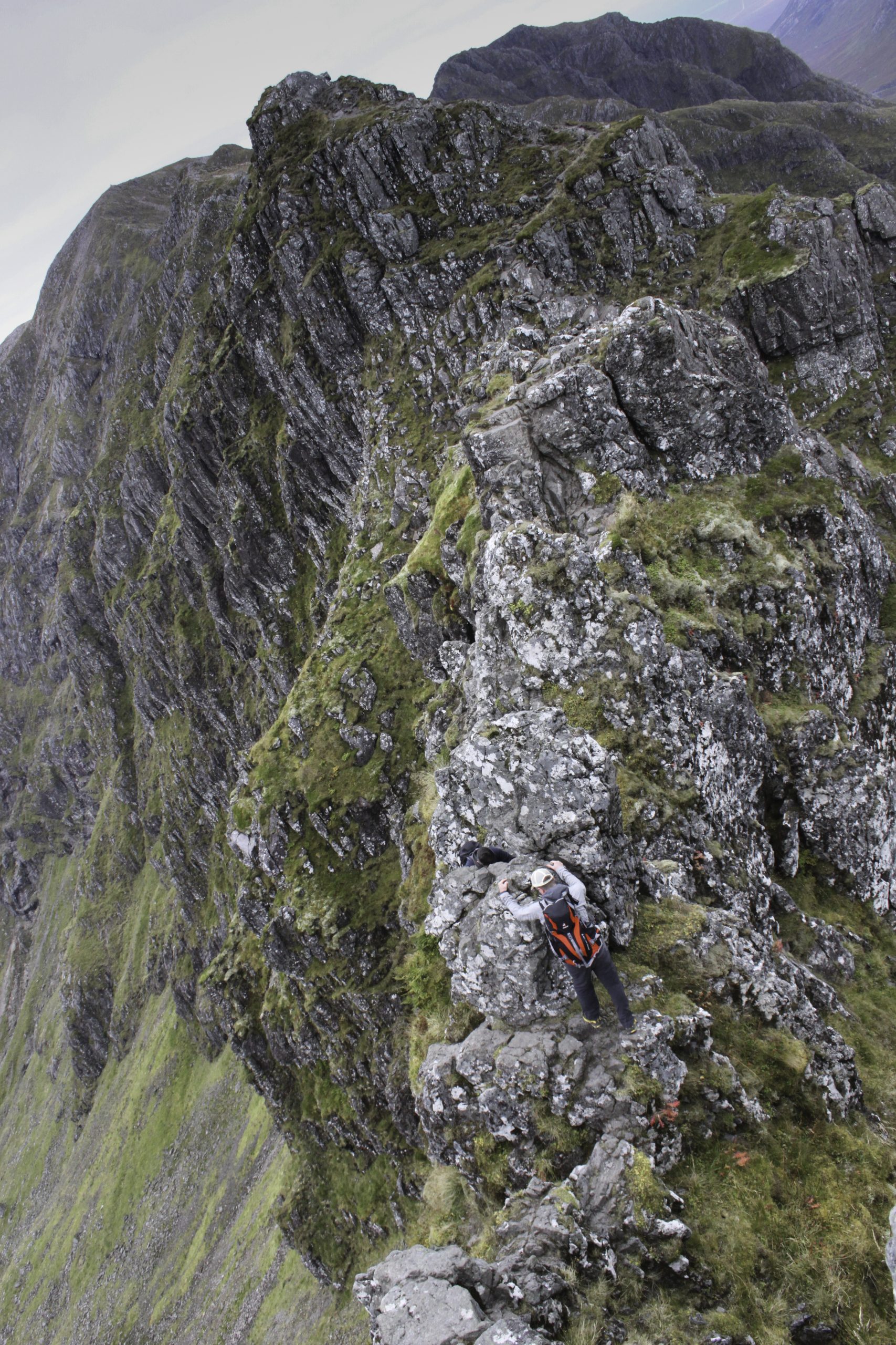
Meanwhile, on the Aonach Eagach, the mojo had kicked in, and the heady combination of exposed altitude, adrenaline and sheer delight, had resulted in a Peter Pan euphoria. Of course such exhilaration brings with it a certain danger, and by the time we reached the crux move of the Crazy Pinnacles, rather than nervously concealing an uncertain anxiety, I was having to restrain the desire to leap onto every piece of exposed rock shouting “hey, look at me Ma!” The crux move on the Crazy Pinnacles of the Aonach Eagach is a very exposed step out to the left with questionable handholds. I had watched a young man half my age struggle to complete it moments earlier, and so despite my state of mountain ecstasy, somewhere in my subconscious the Wendy-like voice of reason shouted loud enough to be heard, “maybe next time,” and I stepped to the right to where a good friend had told me there was a work around of much less risk. That most human instinct of self-preservation had kicked in and the words of alpinist and fellow Mancunian Don Whillans echoed around my head, “The Mountains will always be there, the trick is for you to be there as well.”
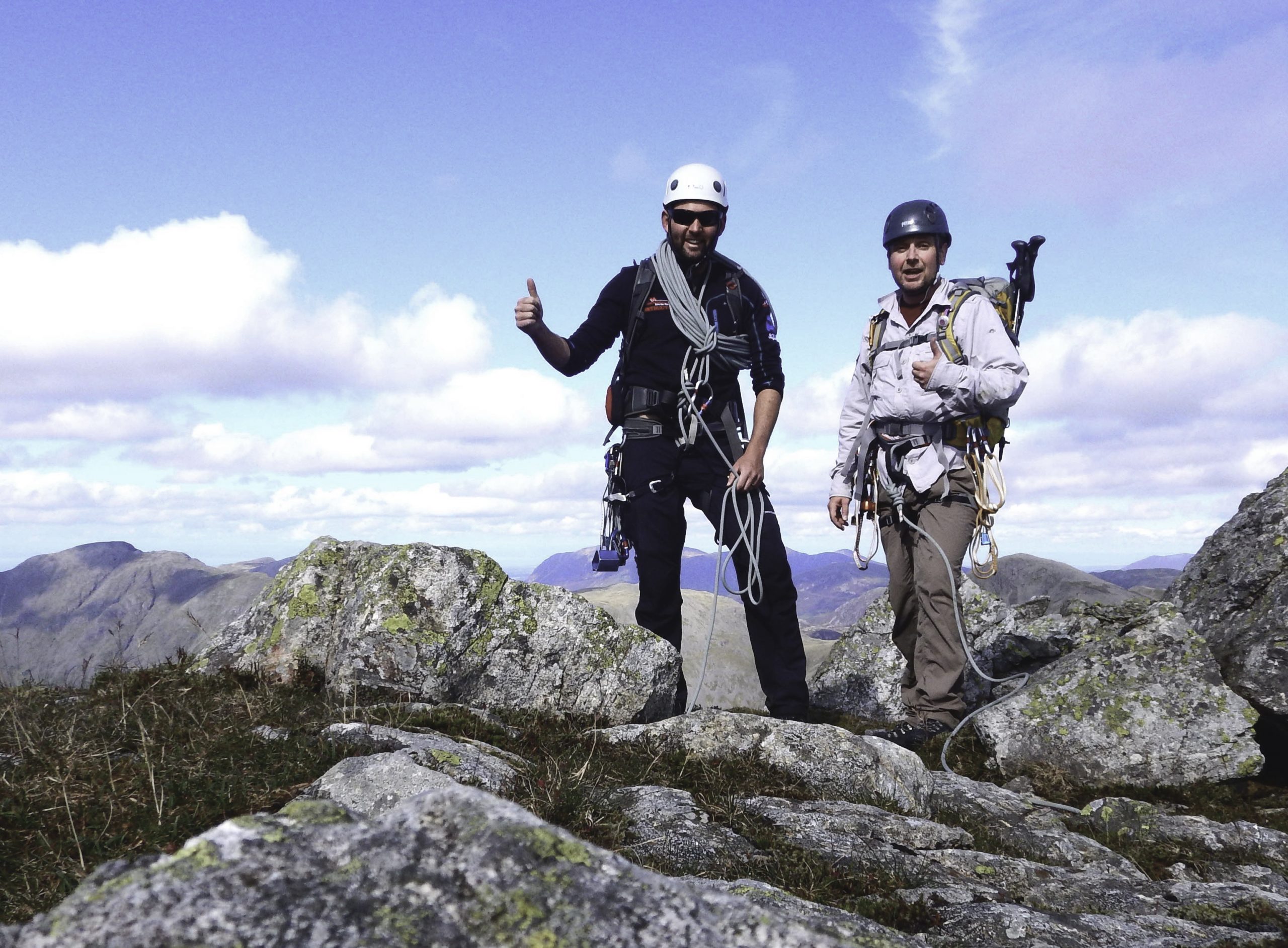
From the col beneath Stob Coire Leith all serious difficulties ceased, and we were able to fully take in the sheer magnificence of our situation in the landscape. On the summit of Sgorr nam Fiannaidh, at 967m the highest point on the ridge we paused for a late lunch before carefully picking our way through the clast strewn boulder fields of Cnap Glas.
Arriving at the Red Squirrel campsite some eight hours after we set off, we were greeted by preparations for the various Glen Coe Marathon events to be held on the following day. On the road from Glencoe village signs had been erected proclaiming “Caution Walkers!” Caution indeed!
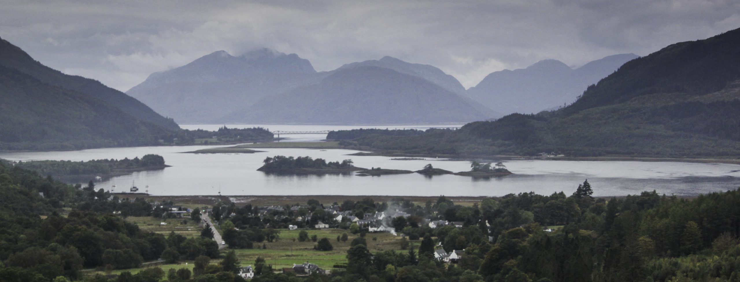
The appointed protocol demanded a rendezvous at the infamous Clachaig Inn, with ale aplenty and mountaineers’ tales as tall as any fisherman’s, but there was the small matter of getting my car back from the top of Glen Coe. Mick very kindly dropped me at the Three Sisters’ viewing point, and as I drove below the Titan ridge we had just traversed, instead of taking the turn for the Clachaig Inn, I swung out towards Glencoe village where the sun was beginning to set beyond the Meccano outline of the Balaculish Bridge. Somewhere to the west, beyond Loch Linnhe, beyond the crepuscular hills of Ardgour lay the Black Cuillin Ridge. A quick glance on the Internet confirmed that more than a Facebook group posting would be required in preparation to tackle that behemoth.
Route:
From the north layby on the A82 just to the west of Allt-na-reigh climb the steep path to the summit of Am Bodach.
With care descend the crag to the west of Am Bodach to reach the beginning of the ridge. Continue westwards without difficulties to the summit of Meall Dearg.
With extreme care negotiate the ridge as it undulates westwards, crossing the “crazy pinnacles” to reach Stob Coire Leith.
Easier ground rises to the summit of Sgorr nam Fiannaidh, the highest point along the ridge.
Descent westwards following the steep path towards the village of Glencoe.
Distance: 10 km (6.2 miles)
Ascent: 1,070m
Time: 8 hours
Start/Finish: The path to the summit of Am Bodach starts from the north layby on the A82 just to the west of Allt-na-reigh. It is sensible if possible to leave a second vehicle somewhere at the western end of the ridge. If this is not possible then shanks’s pony or hitching a lift work just as well.
Maps: Ordnance Survey 1:25,000 Explorer Map, Glen Coe & Glen Etive 384 Harvey’s Mountain Maps 1:40,000 Ben Nevis & Glen Coe
This article first appeared in the October 2016 edition of TGO Magazine.
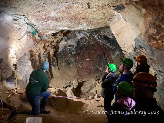
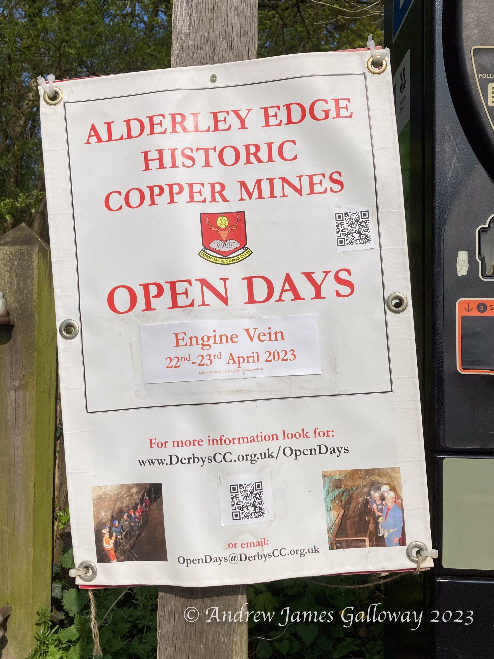
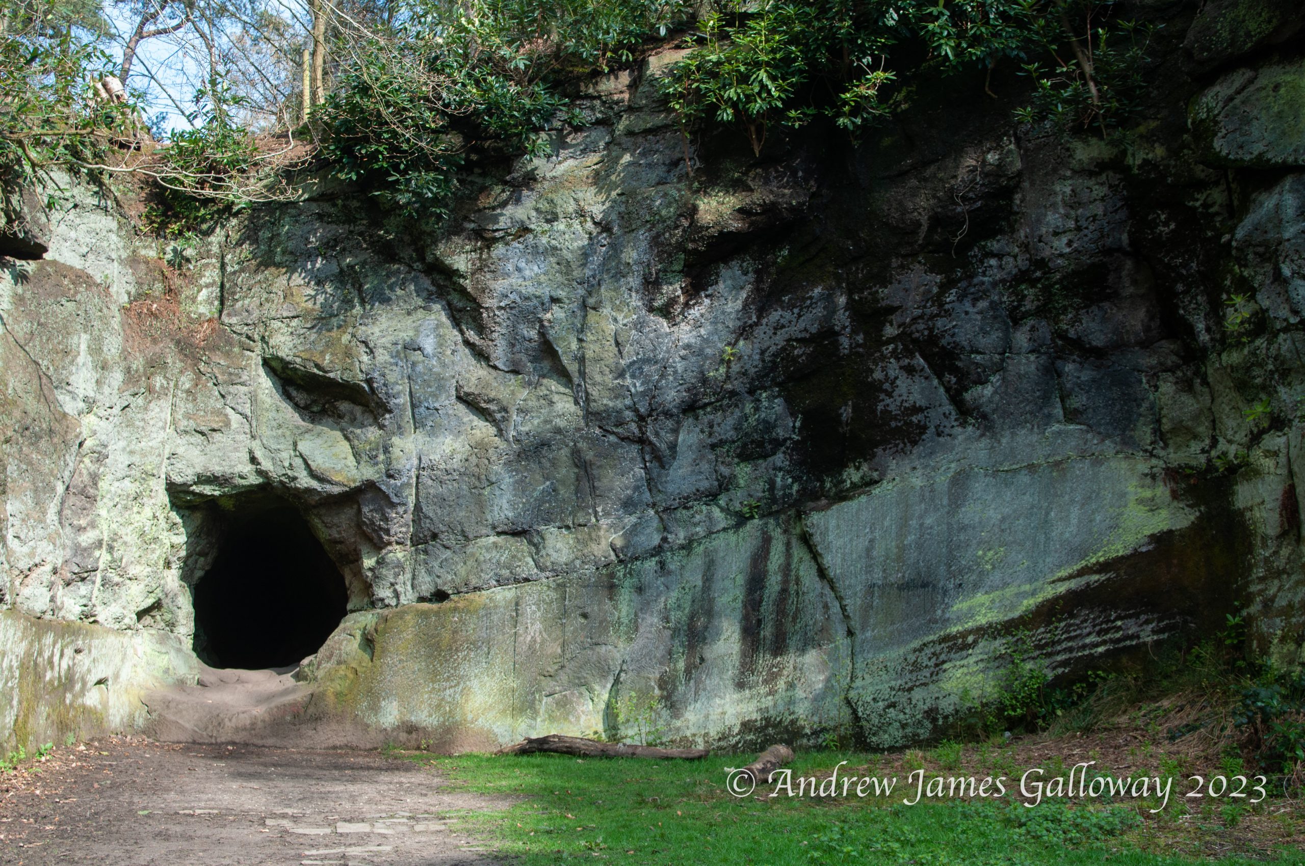
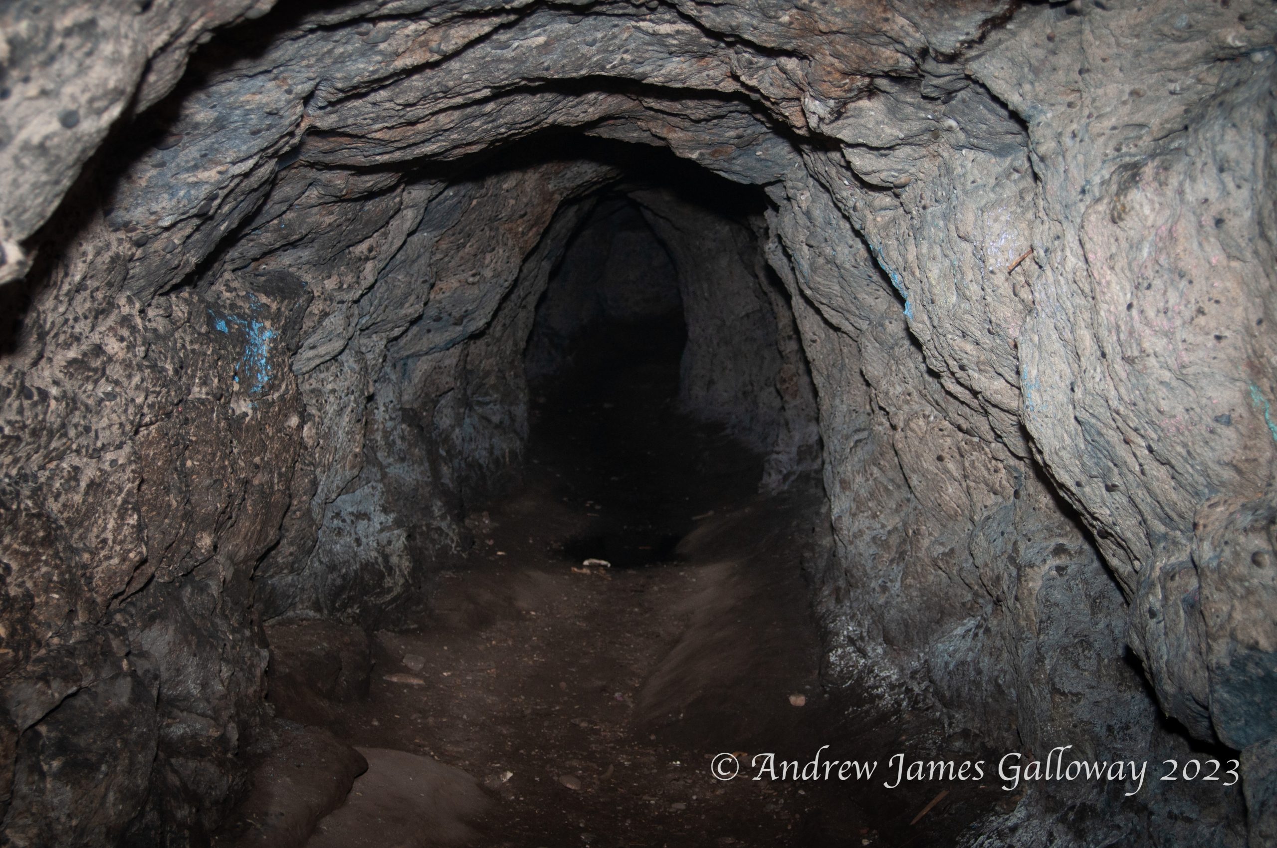
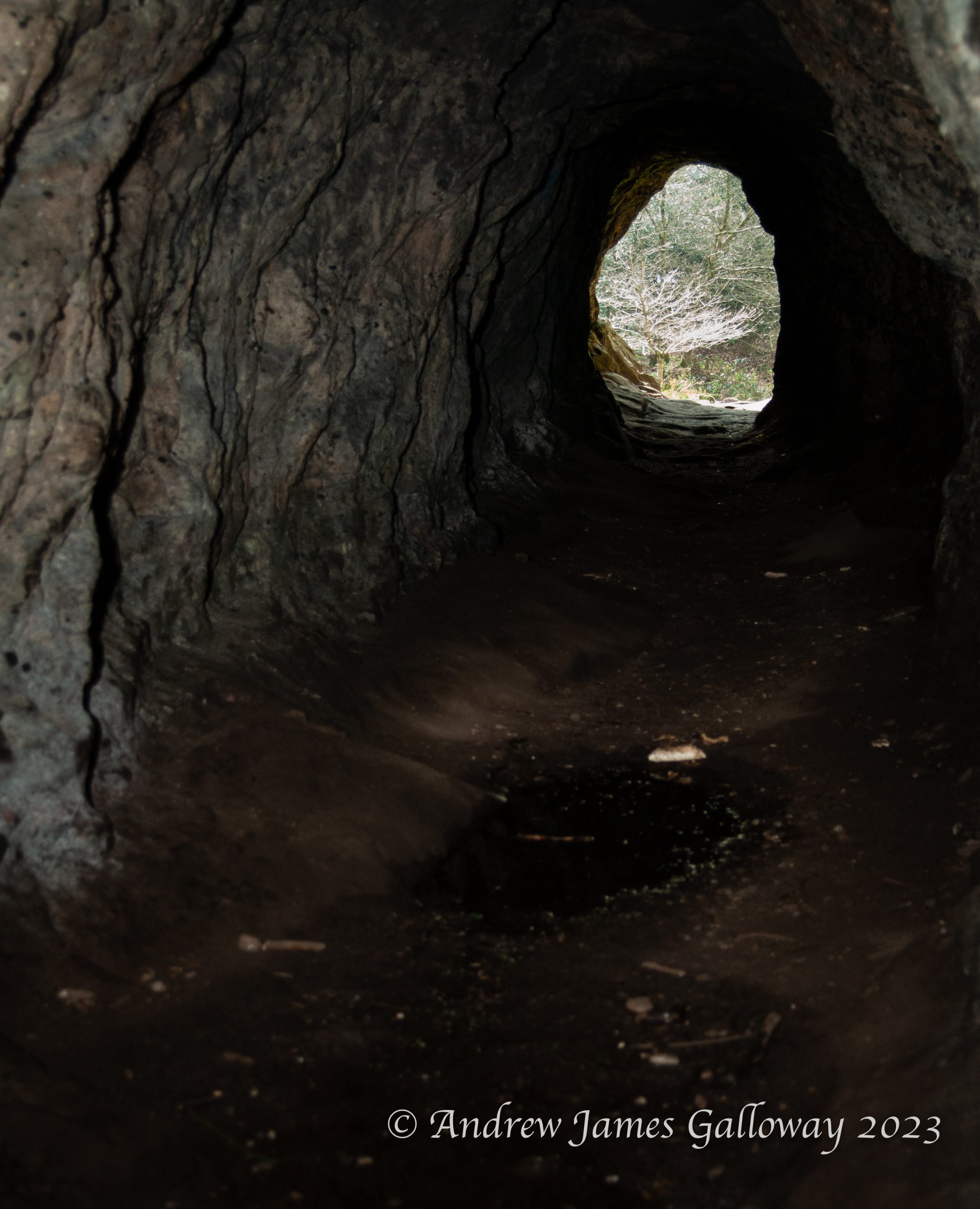
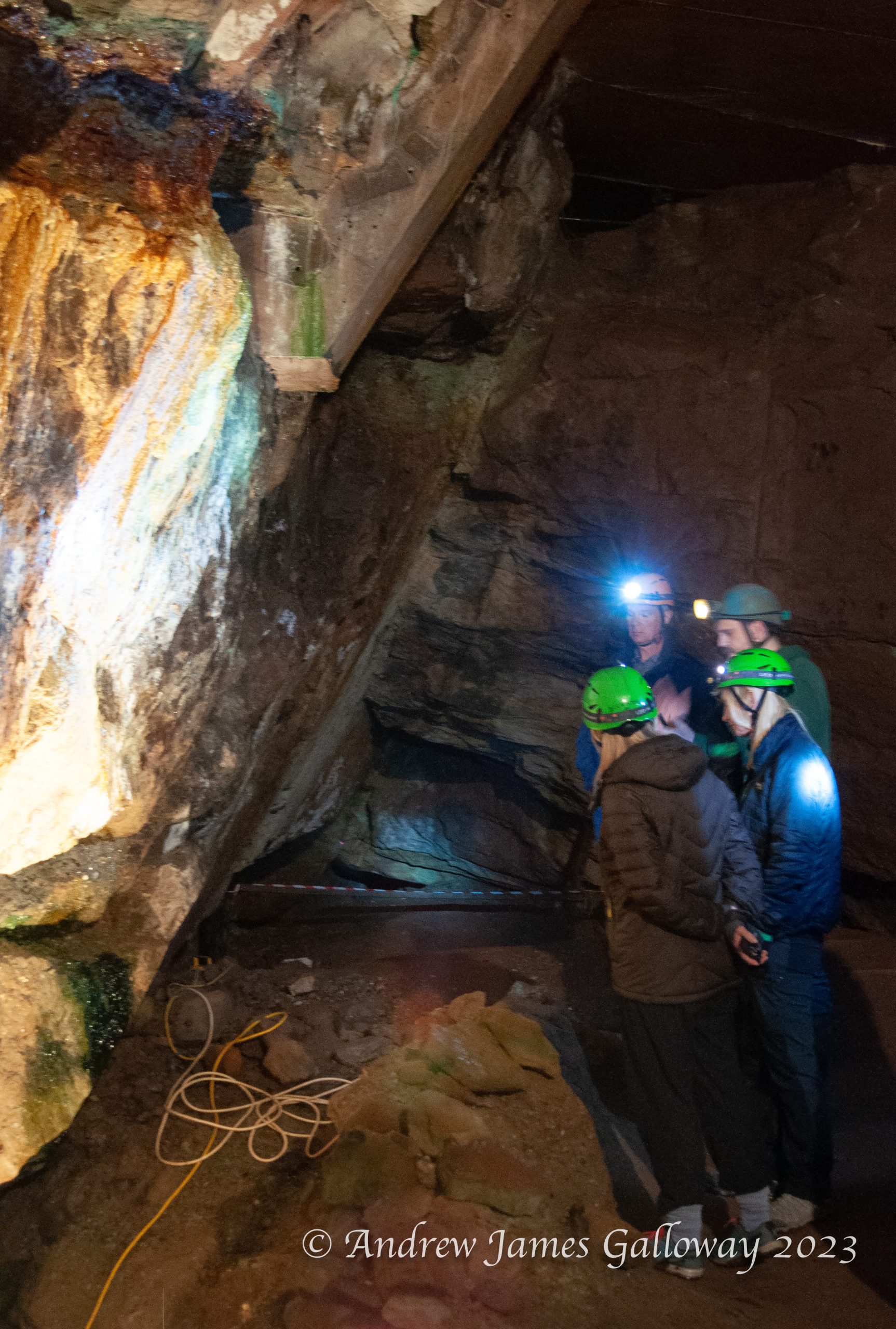
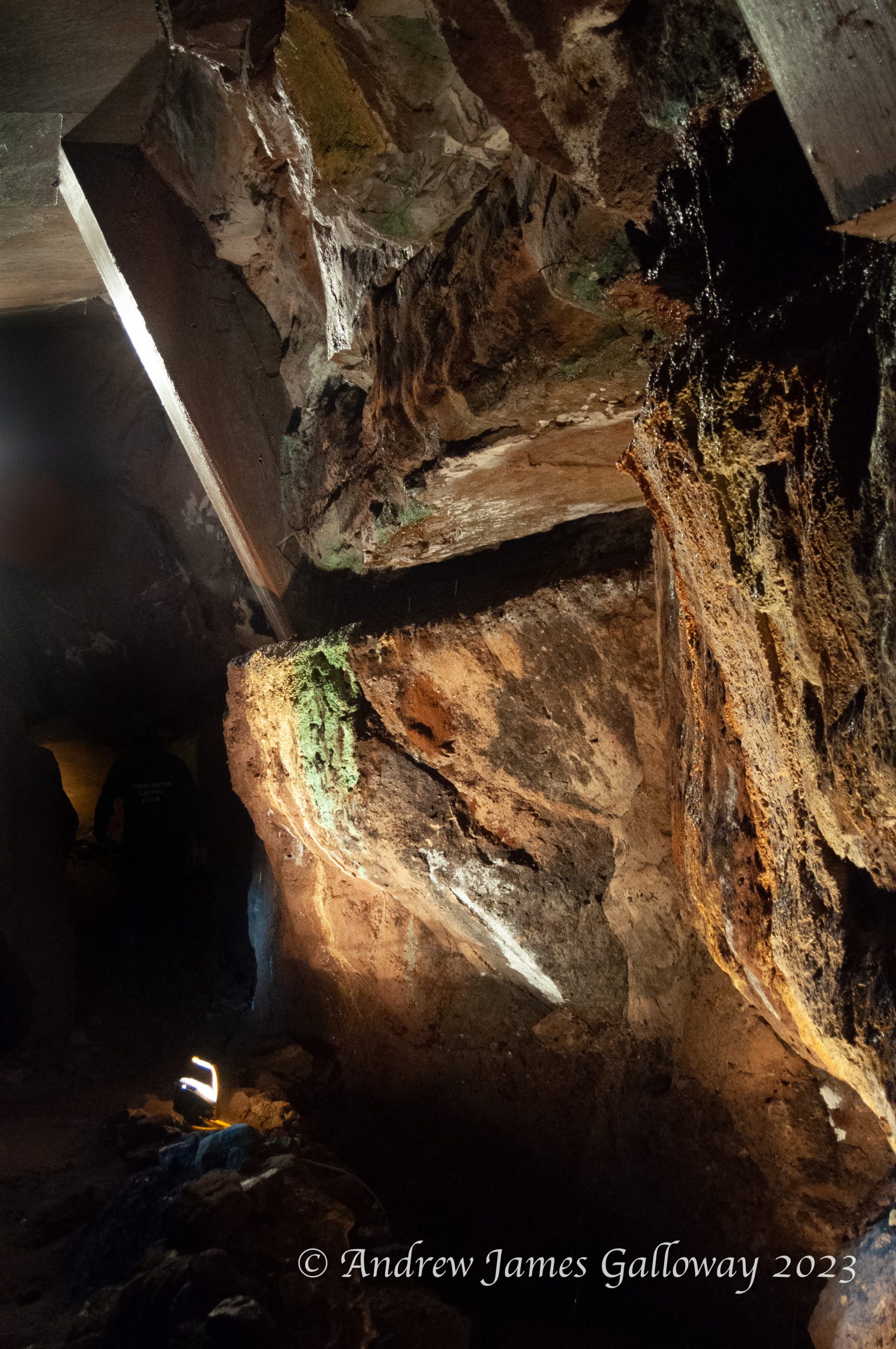
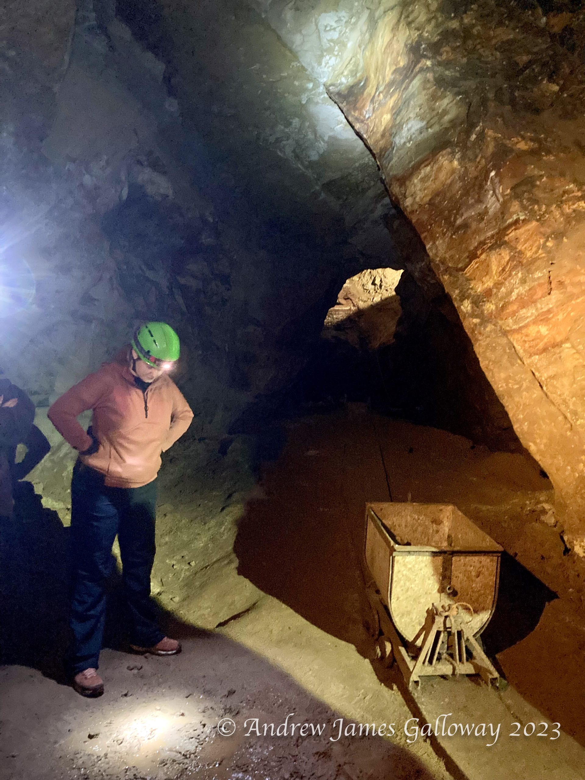
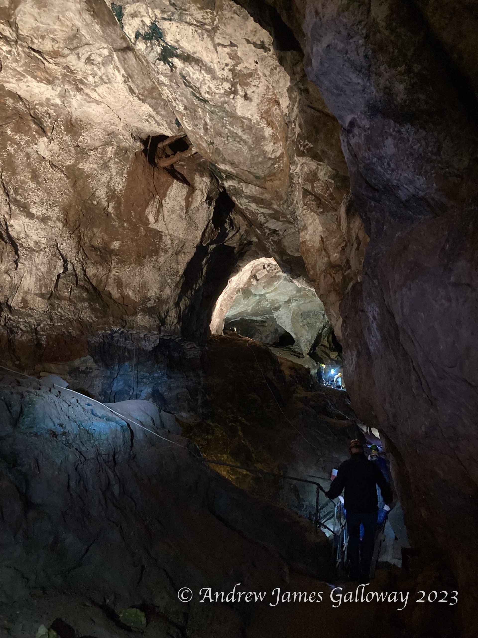
Twice a year the Derbyshire Caving Club (DCC) open up one of the old mines at Alderley to visitors. It’s a great opportunity to experience some of the history of mining at Alderley and to get a glimpse of the extent of historic excavations. I went along to reacquaint myself with subterranean Alderley and to take some photographs.
The sandstone escarpments of Alderley Edge, as distinct from the residential town, have been described by the relatively recent Alderley Edge Landscape Project (AELP) as “an anthropogenic landscape, of remarkable richness, rarity and antiquity”. The AELP was a co-operative undertaking of The National Trust and The Manchester Museum at the University of Manchester, conceived in 1995 and formally wound up on 2005. Further information about the project can be found on the DCC website at https://www.derbyscc.org.uk/alderley/current_aelp.php
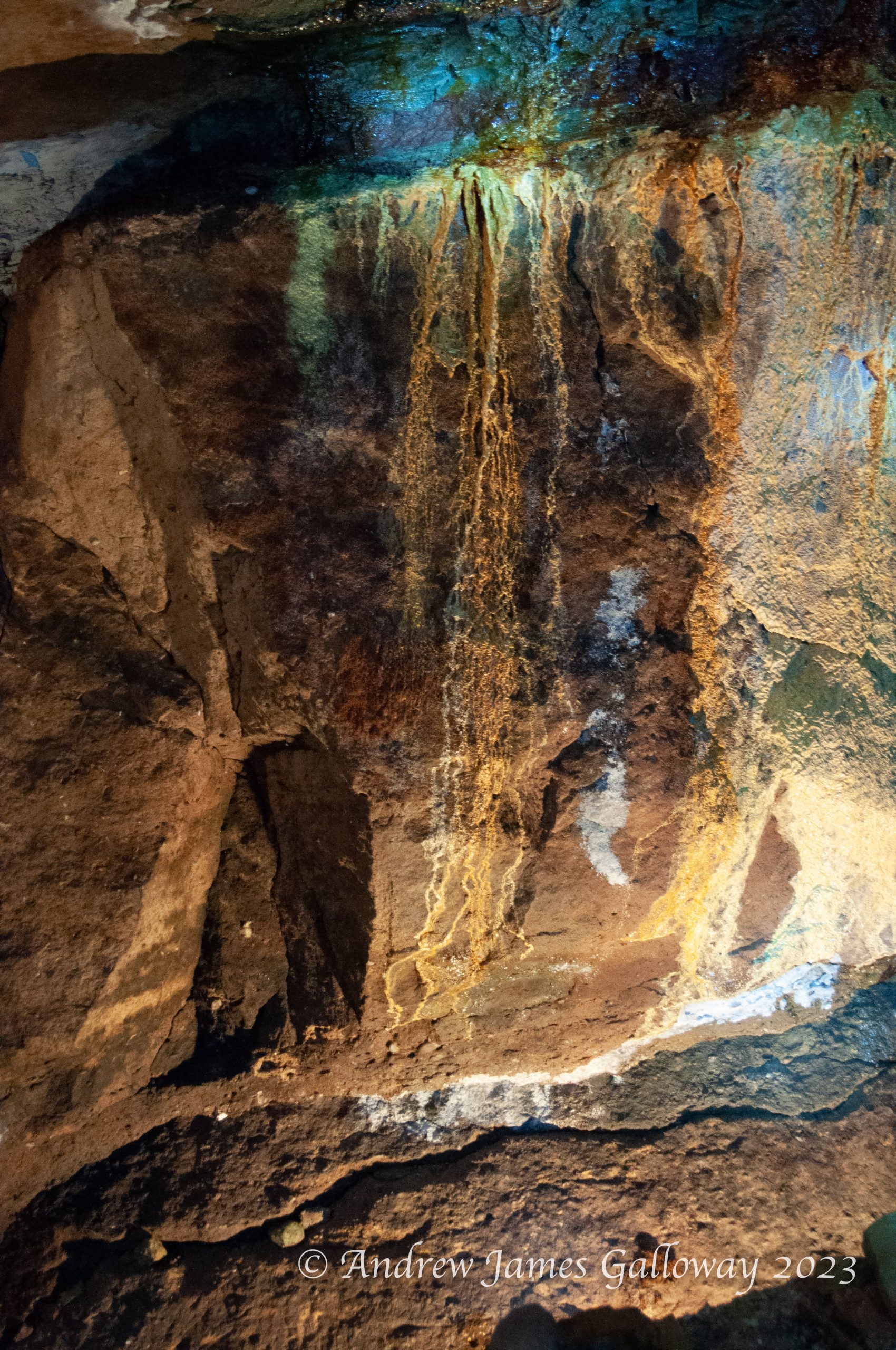
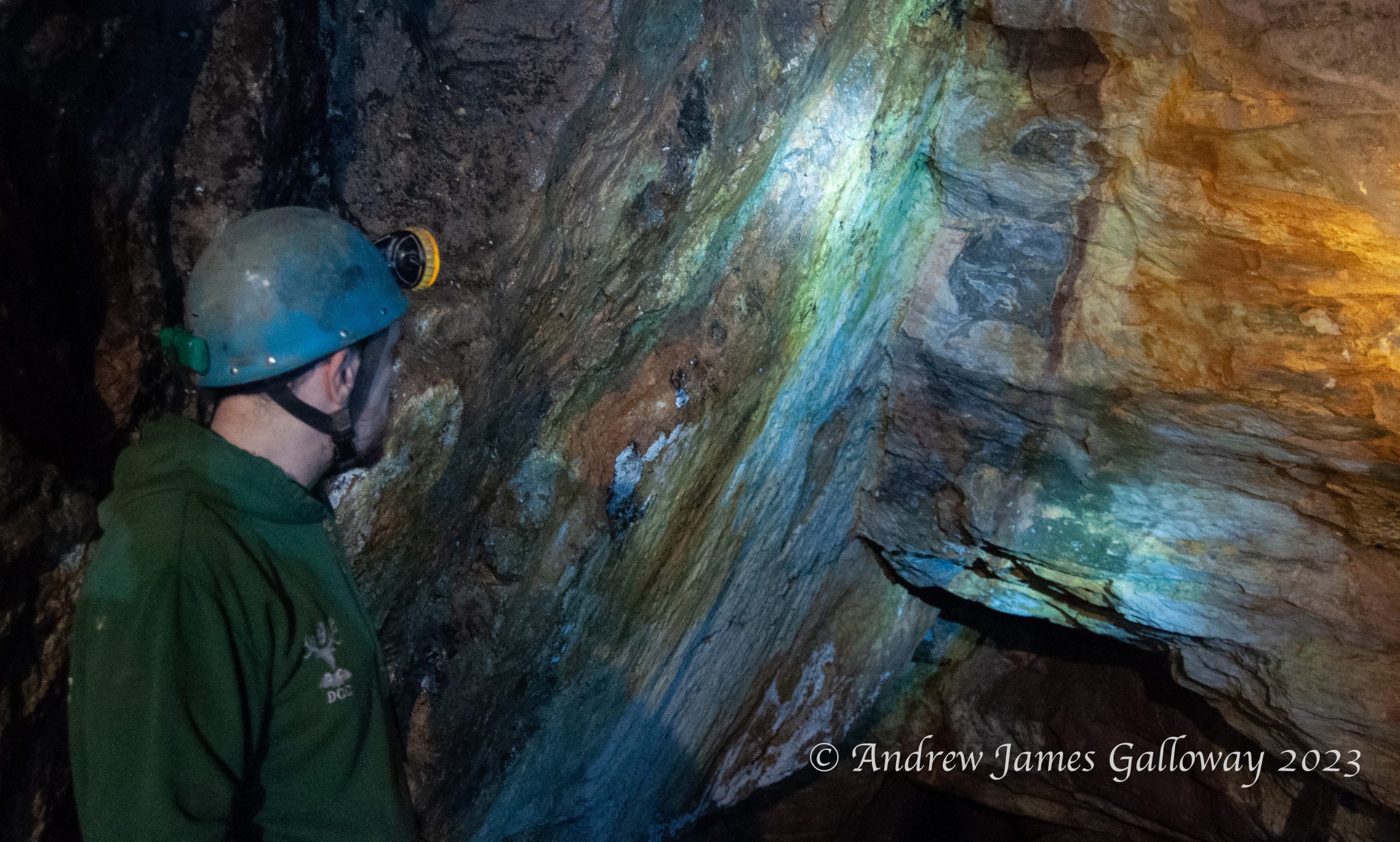
Geologically, the Alderley escarpment is composed of Triassic conglomerate sandstones some 240 million years old that were laid down in an arid environment prone to flash floods, which brought down debris from the surrounding mountainous areas, rich in mineral deposits. The earliest evidence of mining at Alderley dates to the Bronze Age. The main ore extracted was copper, but cobalt, iron, lead, silver and even gold were also found. In their book Prehistoric Cheshire, Victoria and Paul Morgan recount how an oak shovel found by 19th Century miners in a section of mine at Brynlow to the south west of Engine Vein, has been radiocarbon dated to approximately 3,700 years old. A large number of stone hammer heads and similar tools were also discovered in material that had been used to backfill the open cast mine.
Broad Stand, as the notorious flight of granite steps on the eastern flank of Scafell is known, is a death trap. A quick look at the Wasdale Mountain Rescue Team website will confirm the number of incidents that have taken place at this accident black spot. These range in seriousness from a family of four and their dog who had become stuck on the ledge half way up the crag, to a fell walker found dead beneath East Buttress on 2 July 2017.
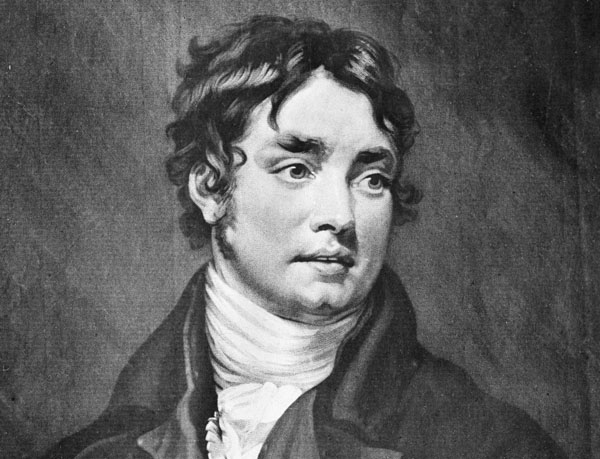
Not recorded on the Wasdale Mountain Rescue Team website is the descent of Broad Stand made by the poet Samuel Taylor Coleridge on 5 August 1802. Coleridge set out from Greta Hall, his home in Keswick, carrying little more than a change of under garments and some simple writing materials, bound up in a “natty green oil-skin” held together in a net knapsack. Through the Newlands Valley he climbed by the waterfall of Moss Force, then descended into Buttermere and took tea at the Inn by the lake. From Floutern Tarn he descended into Ennerdale and spent the night at the home of John Ponsonby at Long Moor.
Samuel Taylor Coleridge in 1802
Coleridge departed Long Moor after tea and arrived late at St. Bees. He was unable to find suitable accommodation and was forced to spend the night in his clothes at a “miserable pot-house”. He lingered at St. Bees a day then walked on to Egremont, from where via Gosforth he followed the River Irk upstream to reach Nether Wasdale.
Having spent the night at Wasdale Head, Coleridge climbed in the fresh morning light to Burnmoor Tarn, then followed the torrent of Hardrigg Gill to the rocky summit of Scafell itself, where on a natural table of granite he took from his knapsack the paper and pens he had placed there upon leaving Greta Hall and began to compose the letter to his friend Sara Hutchinson from which the details of this account come.
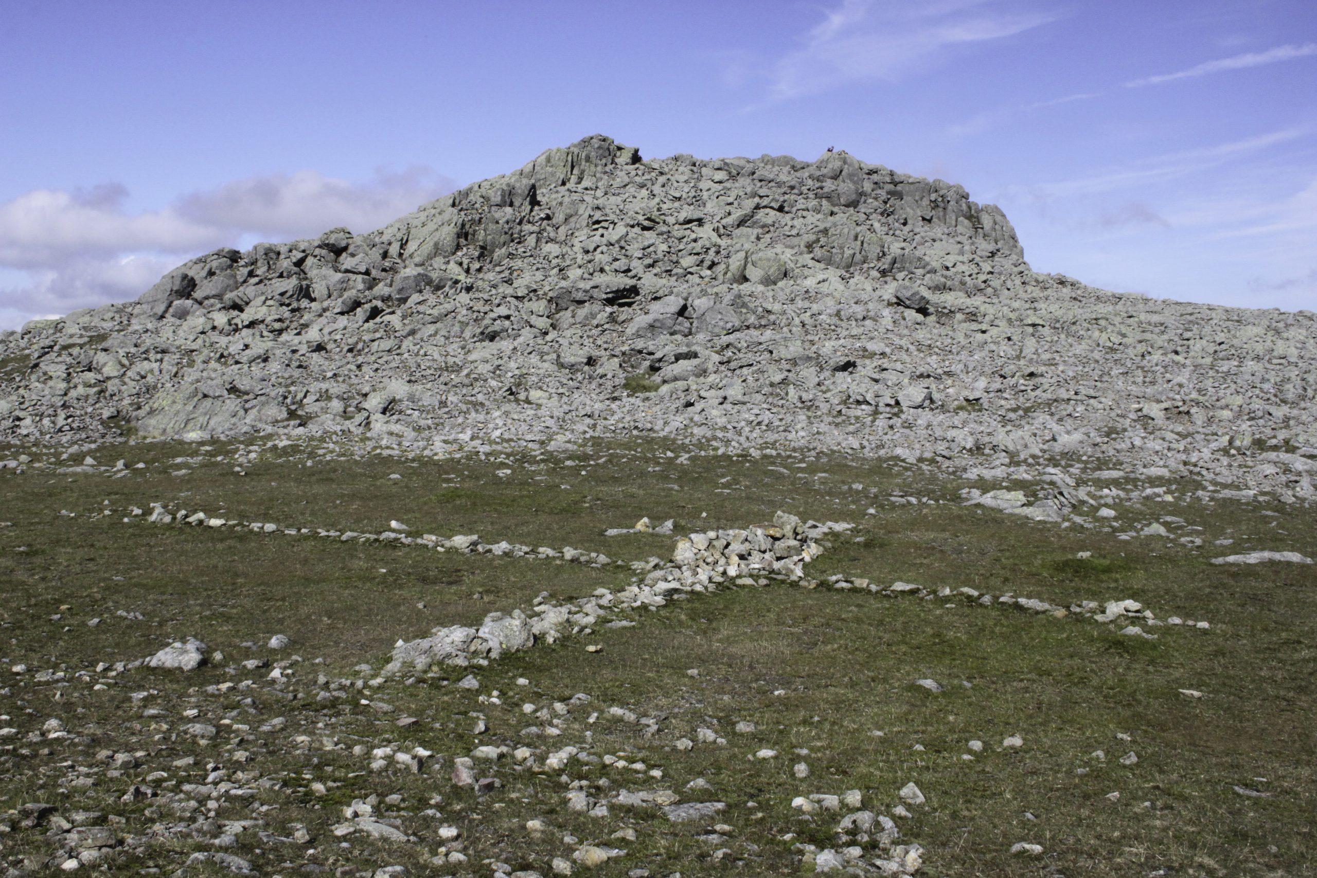
Symonds Knott, Scafell
By three o’clock in the afternoon the wind had begun to gather around the summit such that Coleridge sought his descent from the mountain. He found himself at the narrow gap between what contemporary climbers know as Eastern Buttress and Scafell Crag. It was here that he began to experience difficulties. He lowered himself down a flight of three granite steps to a narrow ledge. Finding himself unable to continue further down the crag he attempted to retreat the way he had come. To his dismay he found the ledges out of reach and became crag-fast.
Lying on the narrow ledge Coleridge describes entering into a “prophetic trance” (possibly induced by a gram of laudanum) during which he became emboldened by the “powers of Reason and Will”. It was then that he noticed a narrow gap in the rock below him, through which with some difficulty, he was able to pass and thus avoid injury. This gap is known to climbers and hikers alike as “fat man’s agony” and confirms the identity of Coleridge’s descent as Broad Stand.
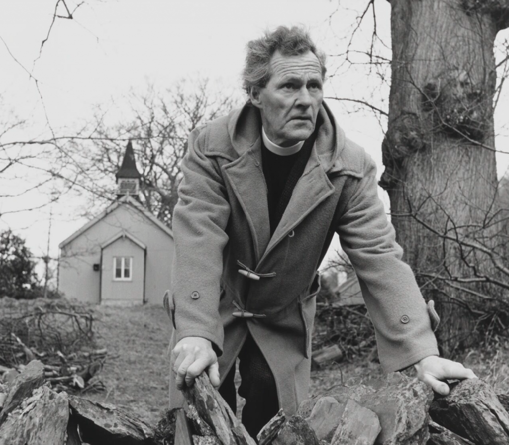
Inspired by Coleridge’s heroic if slightly foolish adventure, I determined to experience for myself the perils of Broad Stand. Considering discretion to be the better part of valour, and not wishing to become a statistic on the Wasdale MRT website, I decided to employ some professional assistance in the form of a qualified mountain guide.
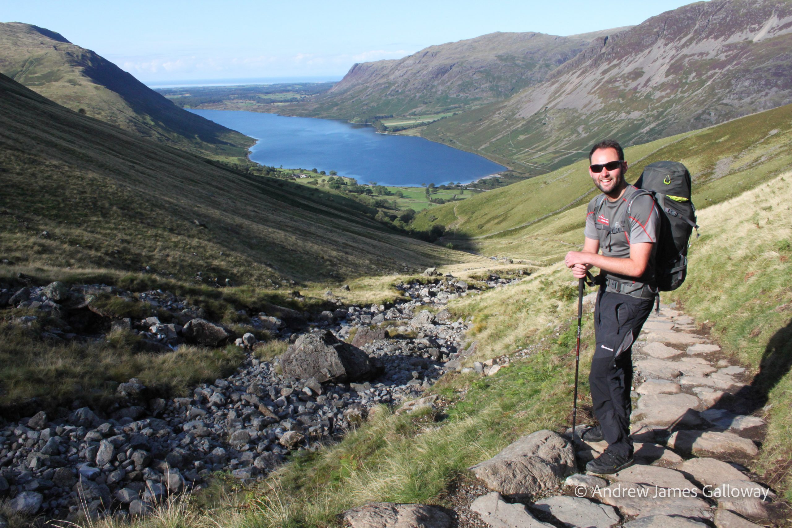
My rendezvous with Matt le Voi was at the Lake Head National Trust car park early on one of those bright, otherworldly Indian Summer mornings that somehow materialise out of the North Atlantic, surprising the human inhabitants of Cumbria as much as the flora and fauna. Along the well-worn path beside Lingmell Gill, Matt and I strode under the September sun, turning now and again to see how it sparkled off the shimmering length of Wastwater, filling the view behind us as we climbed.
Matt le Voi above Wastwater
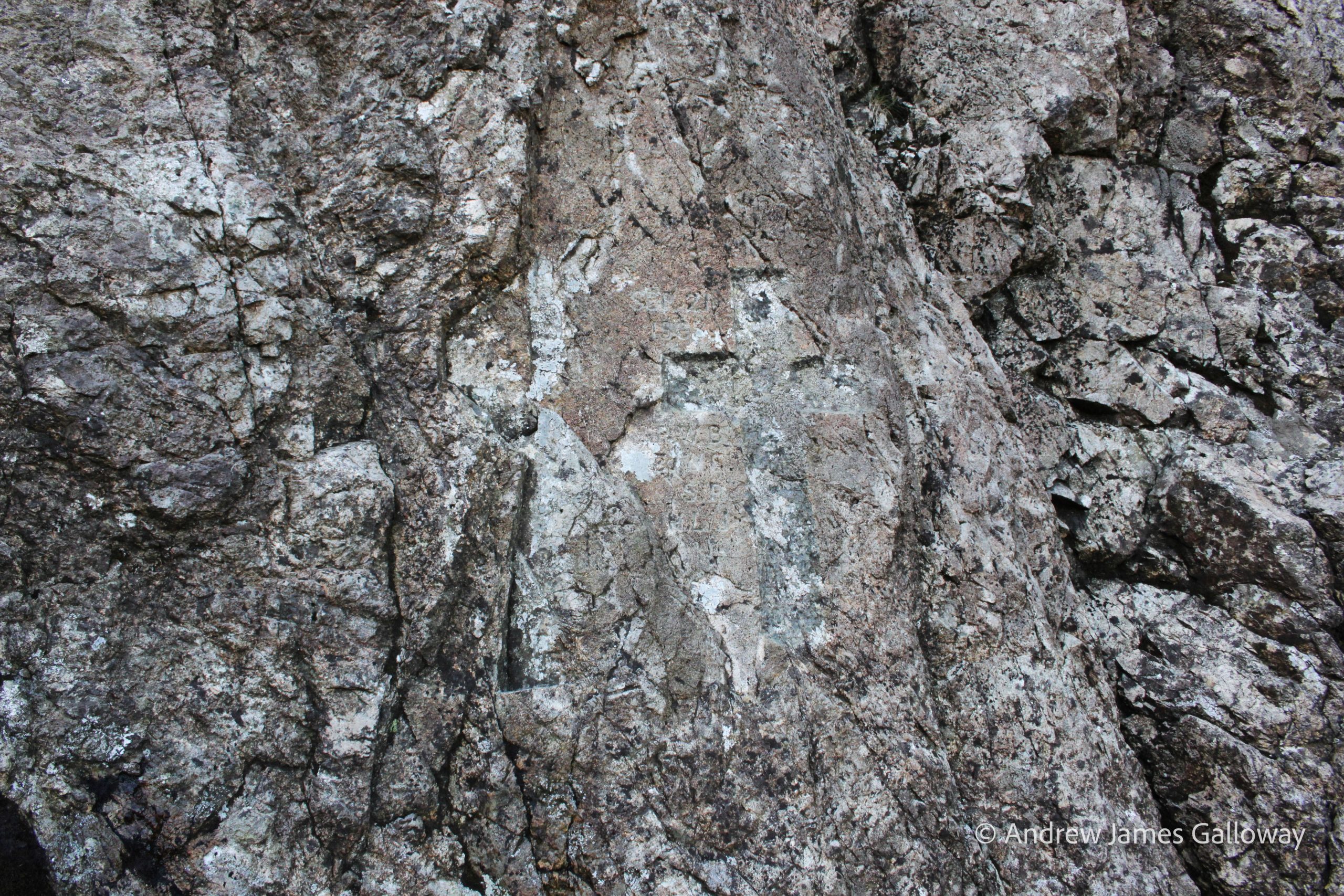
At the approach of Mickledore, Matt suggested we climb the steep scree at the foot of Southern Buttress. Here, carved into the fine-grained andesite of the crag, one can discern the shape of a cross beside which are carved four sets of initials and a date, 21 September 1903. The cross marks the location where four young pioneers of climbing fell to their deaths from the lofty precipice of Scafell Pinnacle above. The names of the four young men killed that day are R W Broadrick, H L Jupp, S Ridsdale and A E W Garrett, all members of the Climbers’ Club, which had been newly founded is 1898. They had been attempting to repeat the ascent of Scafell Pinnacle, which had been first made by Welsh rock pioneer, Owen Glynne Jones some years earlier.
Climbers’ Club Memorial, Mickledore
As the late summer sun crept behind the mountain above us, I felt a chill come upon me, the hairs on the back of my neck standing to attention. Here in the highest ‘Corrie’ in England, bounded on three sides by immense towers of rock, stories of tragedy and death gather like the hooded crows that sweep down from the rocky heights.
Just before the outbreak of the First World War, Siegfried Herford, a mathematics graduate of Manchester University, ably assisted by George Sanson, a zoology graduate from University College London, made the first ascent of Central Buttress on Scafell Crag. The crux of the climb was a flake crack, which Herford was able to surmount by standing on the shoulders of Sansom, acceptable practice in those days, precariously held in place by a rope threaded around a chockstone near to the top of the flake.
Siegfried Herford was killed by a rifle grenade in France on the 28 January 1916. Stories of sightings of Herford’s ghost, lingering around the base of Central Buttress, began to circulate among the climbing community thereafter. The mountaineer and author Bill Birkett describes how, in the early 1980’s he was descending from Scafell Pike on a bitter, snow shrouded November day, when, approaching the col of Mickledore he noticed walking towards him from out of the swirling mist, the figure of a young man dressed in Khaki drill. Birkett thought nothing of it until he noticed the man was wearing puttees above his boots, a fashion more readily associated with the British Army of the early 20th Century than the 1980’s. Some years later the notorious chockstone that had held Herford and Sansom in place on Central Buttress, became dislodged and fell, killing the climber Iain George Newman.
Broad Stand was for once dry. There were no excuses. Aware of the many accidents in this spot we set up a belay from the narrow crack in the seemingly impenetrable defences of Fat Man’s Agony. I watched as Matt disappeared through the narrow gap and found myself alone, the only sounds the clink of karabiners and the down draft of ravens wings. Time ticked away slowly and I began to feel a cramp in my calf, shifting my weight from one leg to the other whilst still maintaining the belay position against the cold grey rock, my knuckles whitening around the umbilical chord of rope threaded through the crevice in the rock. It was a good ten minutes more before I heard Matt’s voice calling down from somewhere above me, informing me that he was safe and I could begin to climb.
Fat Man’s Agony, Broad Stand Myself on Broad StandThe crux on Broad Stand
Being of slight stature, I was able to squeeze through the vice like fissure in the wall without too much hindrance. I popped out onto the first rock step where with ease I was able to follow the line of Matt’s rope to the left via a series of outward sloping ledges onto the second rock step. Here, my heart surged into my mouth and sweat began to collect on the nape of my neck. With Broad Stand you see, the structure is all wrong – or right – depending on your viewpoint. What first appears to be a series of relatively benign rock steps leading to higher, more manageable ground, takes on an altogether more alarming prospect because of the angle of fracture of the rock, dipping at about thirty degrees to the South. This means that the whole structure leans outwards towards the precipice of the Eastern Buttress, making Broad Stand a bit like the House of Fun at an amusement park, but without the laughs.
It was going to be a leap of faith. I shouted for tight rope and pushed out with all my strength, grappling for the finger hold and finding it securely. “Get a grip!” shouted Matt, and I hauled myself up onto the next ledge, eventually finding my feet on the coarse forgiving granite. I crouched there for some time, regaining my composure and allowing the tide of adrenaline now coursing through my circulatory system to subside, looking down into the heart-stopping drop below.
Myself and Matt on Symonds Knott, Scafell
At the summit of Symonds Knott, lazing under a resplendent blue sky, Matt and I ate a celebratory lunch of cheese sandwiches and chocolate washed down with instant coffee before walking to the cairn marking the summit of Scafell. Turning to the West the early afternoon sun shimmered on the surface of Wastwater as we descended the long, grassy slope of Green How, arriving triumphantly at the National Trust car park, where I thanked Matt for his assistance and waved him goodbye.
Having time to spare I wandered around the head of the lake to Overbeck Bridge where a small shingle beach extended a little way into the lake. There being no one around I slipped out of my walking clothes and into the cold, heart-stopping waters, seeing beneath me the rounded cobbles give way to the bottomless blue of England’s deepest lake. I floated on my back for some time, soaking my heat-sore feet in the mountain clear drink. My gaze scanned the rugged skyline to the East, finding the rocky cleft between the peaks where, not three hours ago, Matt and I had climbed on the very rocks that once had detained Samuel Taylor Coleridge, and recalled the words he had written to his friend Tom Wedgewood.
“I do not think it possible, that any bodily pains could eat out the love and joy, that is so substantially part of me, towards hills, and rocks, and steep waters! And I have had some trial.”
Great Gable from Wastwater
A version of this article first appeared in the Spring 2020 edition of The Great Outdoors Magazine.
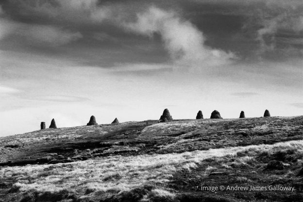
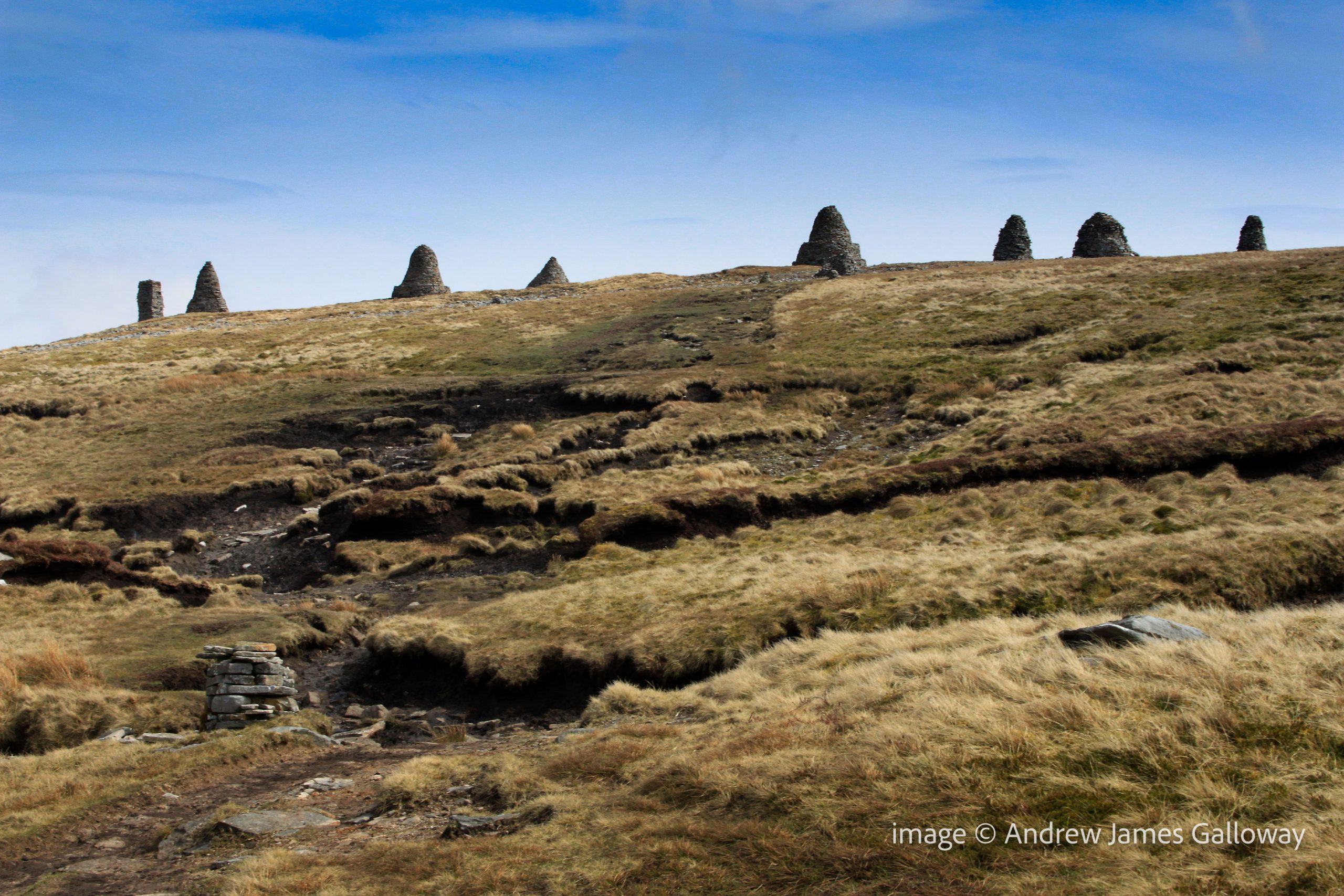
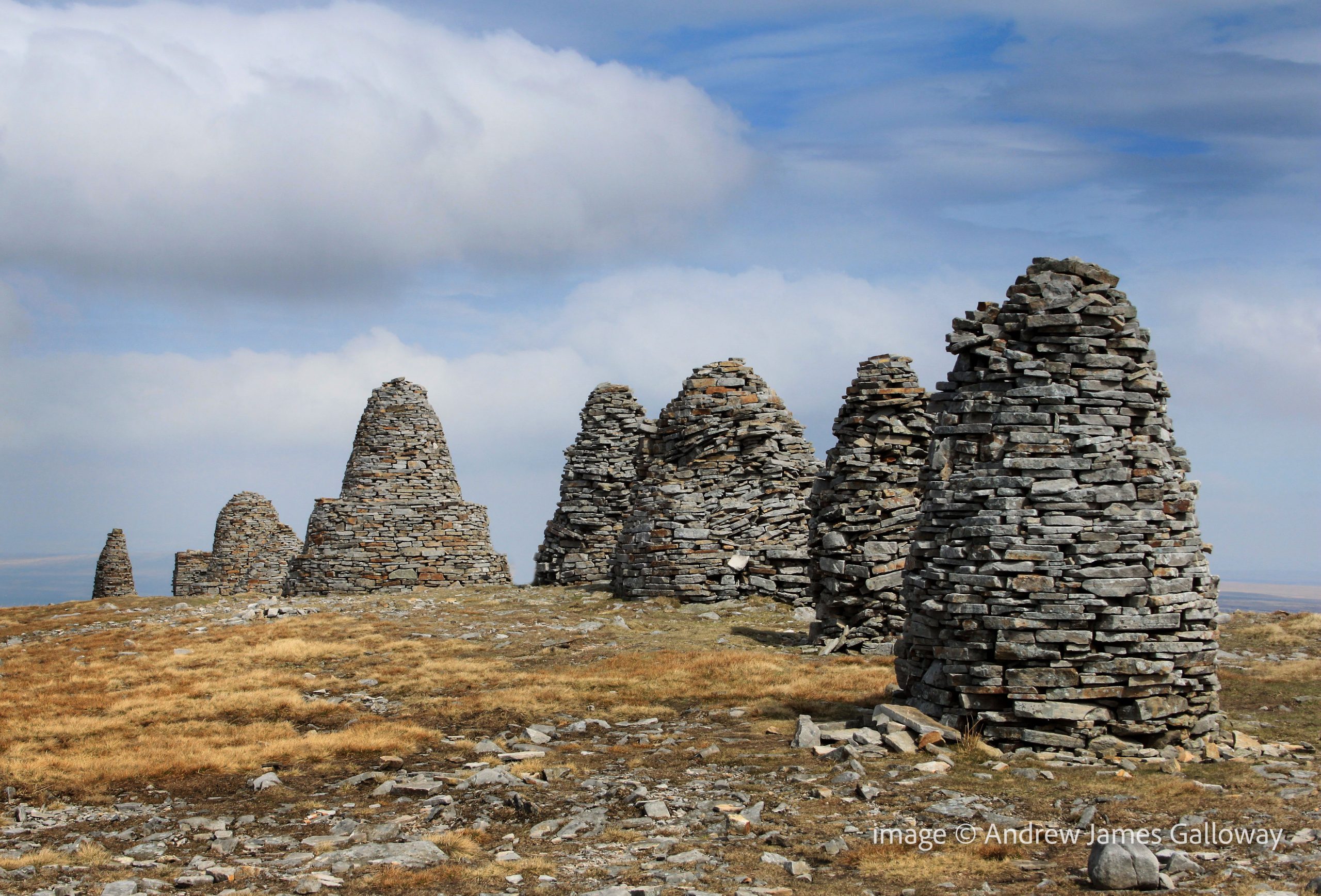
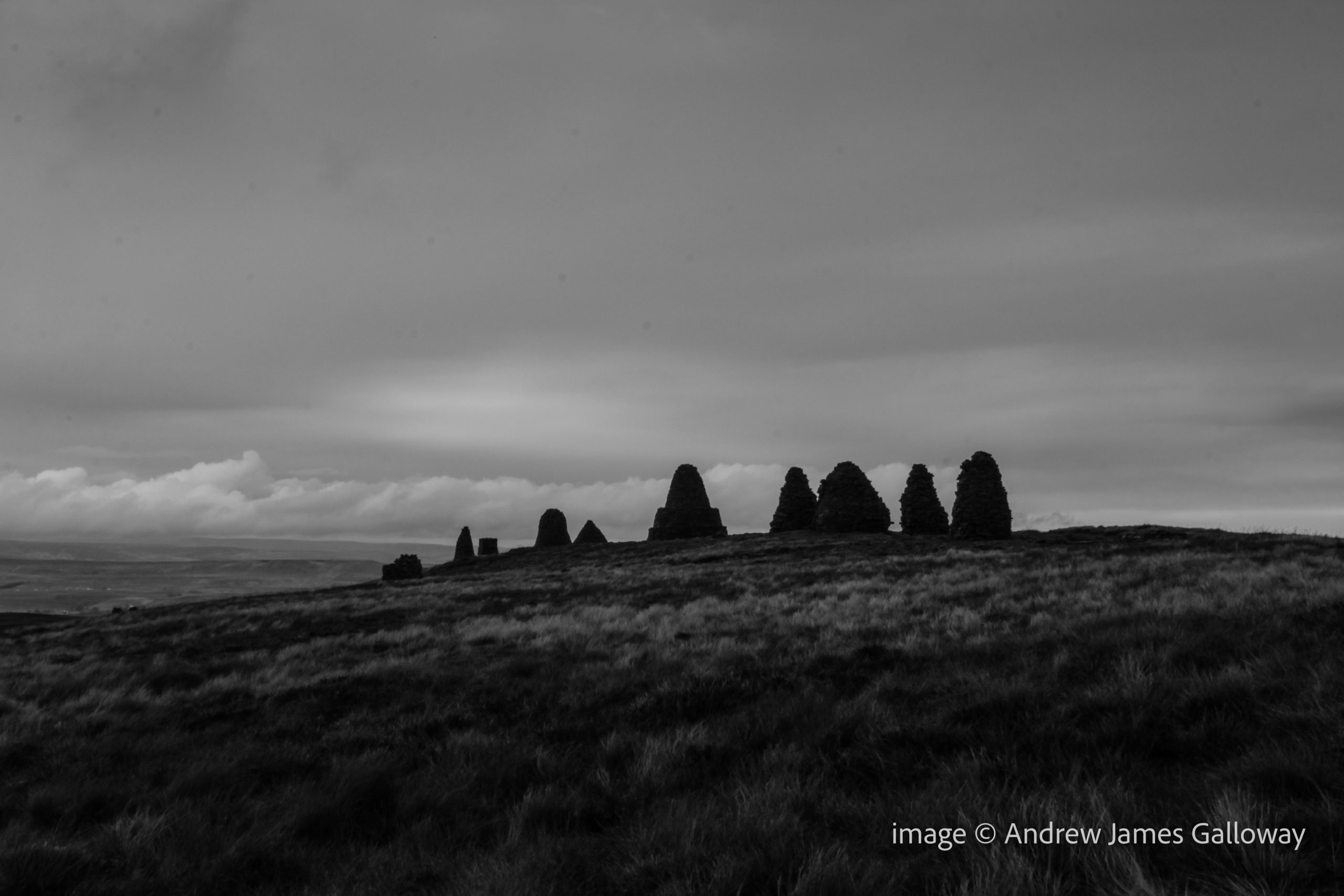
Nine Standards, a line of nine dry-stone cairns, standing proud on the skyline above the Cumbria market town of Kirkby Stephens, approximately half-way along Wainwright’s coast-to-coast route and just seven kilometres west of where the Pennine Way passes the famous Tan Hill Inn, provoke the inquisitive hiker to ask questions about their origin. One might imagine there would be many local legends and stories to tell about these enigmatic sentinels, placed by some unknown party high upon the gritstone moorland. But ask a local livestock farmer or passing farrier about the origin of these hurrocks of stone and you are more than likely to receive a shrug of the shoulders than any elaborate mythological tale. Fascinated by the prospect of an unsolved mystery linked to two of the country’s most famous long distance footpaths, I set out from Kirkby Stephens early one morning to investigate.
The path climbing from the River Eden folded around the ruins of Hartley Castle and entered a coppiced hazel wood where wild garlic grew in abundance. Over thousands of years the water of Ladthwaite Beck has carved its way through the Carboniferous limestone rock like a knife through wedding cake. Tilting steeply to the West, the rocks provided a path of least resistance for the ghyll as it cascaded in parallel to the ancient stratigraphy.
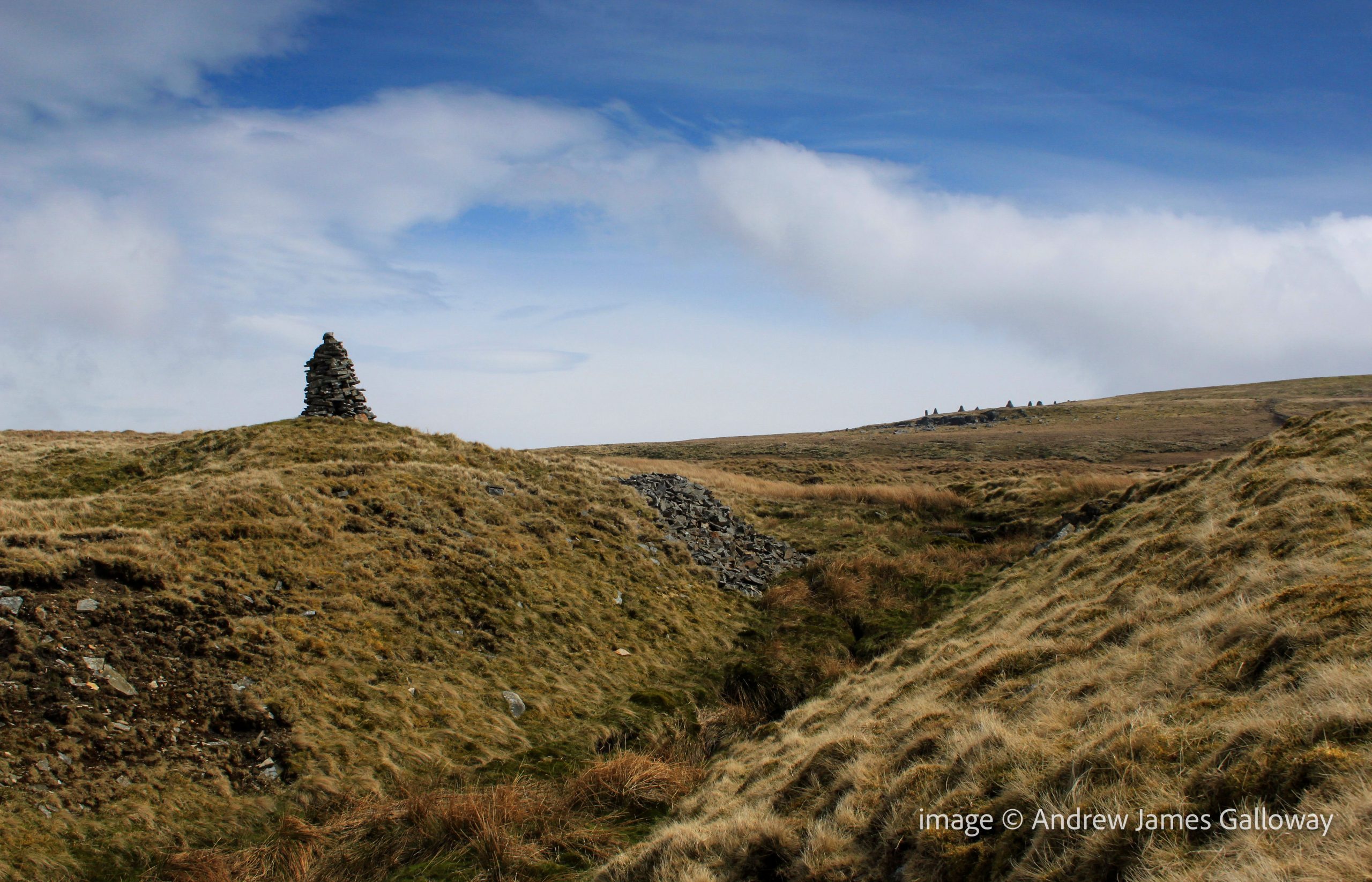
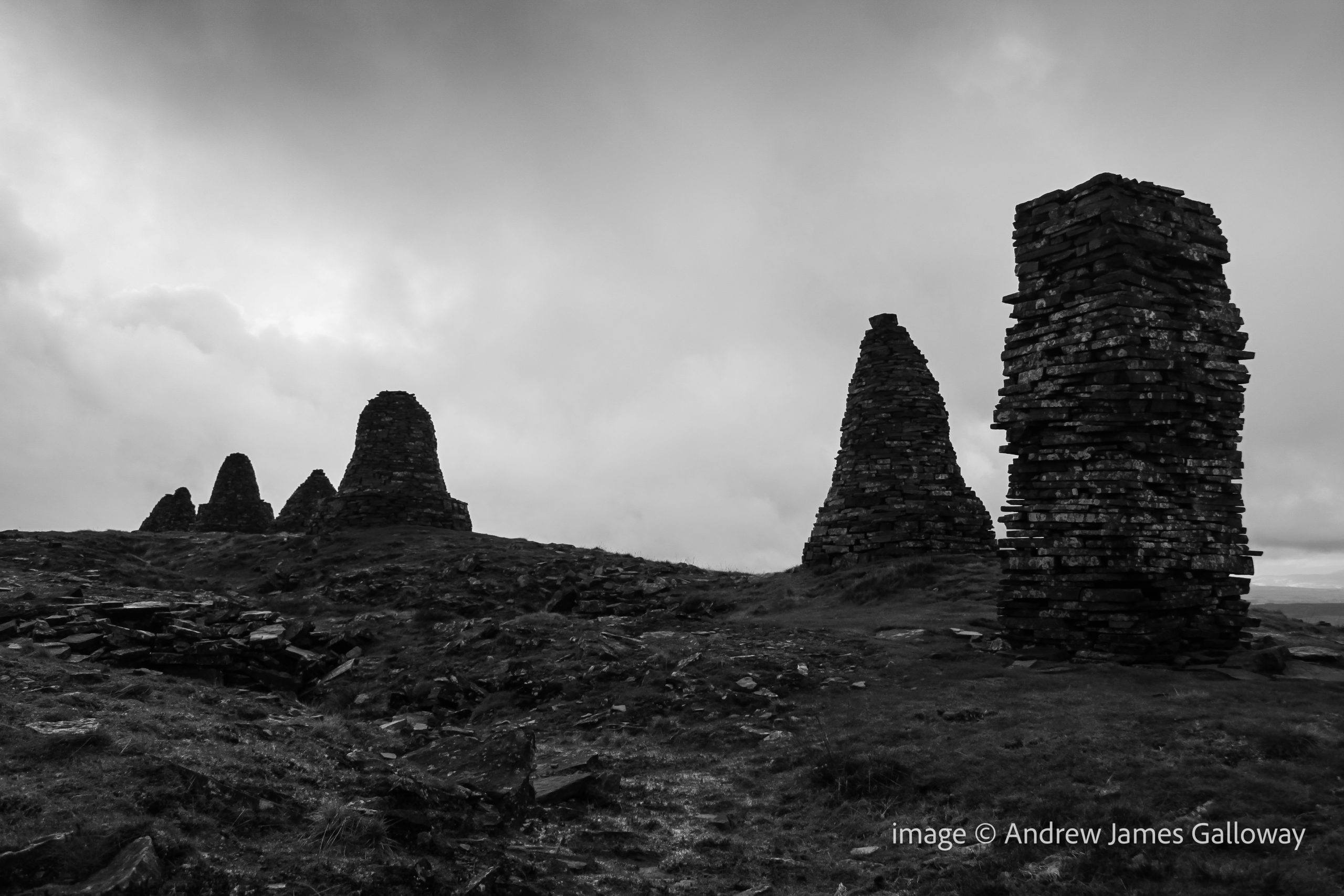
Passing the remote settlement of Ladthwaite the path climbed onto Hartley Moor where the Nine Standards appeared on the horizon like a vanguard of petrified Daleks from a 1970’s episode of Dr Who. A slightly more plausible explanation given for the position of the cairns is that they were built by local people during the medieval wars between England and Scotland to give the impression of an army encamped upon the hill, and hence, the idea suggests, deterring any potential Scots marauders. The clear flaw in this theory being not only that the cairns are only visible on the skyline from the west and not from the north, east or south, but also that there are just nine cairns – no great army. As I drew nearer to the cairns along the path that ran beside Faraday Gill (Ghyll surely Mr Ordnance Survey?), it became apparent that the cairns themselves were of a variety of shapes and sizes and appeared to have been designed to represent more than mere figures standing on a hill.
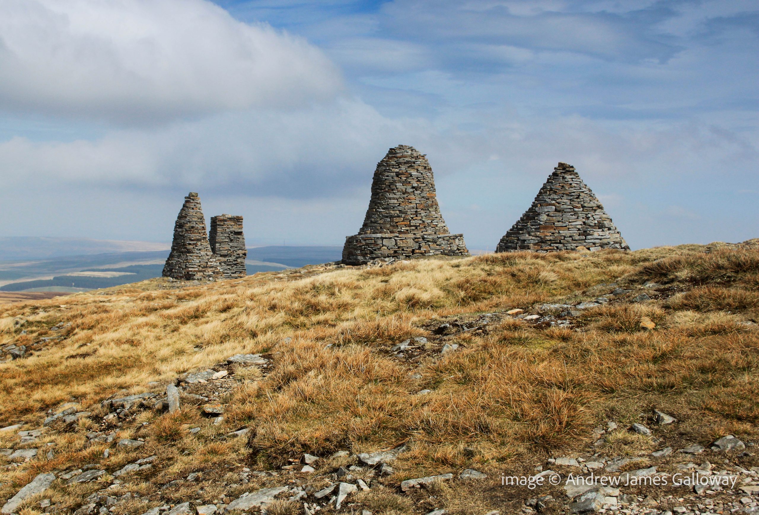
Dry Stone Cairns on Nine Standards Rigg
A W Wainwright mentioned them in his description of the coast-to-coast route, and although rightly dismissive of frankly patronising notions that they were built by local miners or shepherds who had nothing better to do, he regarded them merely as boundary cairns. The Standards sit on the boundary between the ancient counties of Yorkshire and Westmoorland, which is also the watershed dividing the Pennine Hills east and west. From here the Eden runs west to the Solway Firth and the Swale runs east to the North Sea. Due to the exposed position of their location, the notoriously harsh winters of the northern Pennine Hills and the natural human instinct to climb on them, the cairns do suffer occasional structural damage and require intermittent maintenance. The last major re-build was commissioned by East Cumbria Countryside Project in 2005, which means that the cairns are currently in pretty good condition. Visitors are requested to treat them with respect, ensuring no stones are removed.
But what of their origin? How old are they and who built them? If we disregard the rebellious Scot deterrent theory, we must look elsewhere. Dr Stephen Walker, himself of Kirkby Stephen, has undertaken an extensive search of archives both local and national in an attempt to establish the facts about these strange cairns. His findings are remarkable.
The cairns appear on the 1862 Ordnance Survey Six Inch (1:10,560) First Edition maps of Westmorland. They are marked on a variety of tithe, enclosure and estate maps dating from as early as 1738. They are mentioned on many boundary rolls, or perambulations as they are also known, written between 1400 and 1699. A perambulation was simply a list of landscape features which marked the boundary of particular estates, parishes or townships. The oldest historical reference to the cairns is contained within a transcription of a perambulation of Gilbert Gant, Lord of Swaledale, dating to sometime from the late 12th or early 13th century, thus proving that the Nine Standards cairns were standing above Kirkby Stephens no more than a hundred years after the Norman Conquest.
Prior to 1066 there is currently only speculation and hearsay. In 954 AD, Eric Bloodaxe, the last independent Viking king of York was ambushed and killed by Earl Maccus, son of Olaf, as he crossed the pass at Stainmore, now the route of the A66 from Scotch Corner to Penrith. Tradition held that Eric was buried at Rey Cross, but when the site was excavated to make way for the new dual-carriageway in the 1990’s, no burial was found. Only four miles to the south-west, do the nine standards mark the actual crossing point of the Pennine Hills used by Eric and thus his grave, and those of his noble companions?
Moving further back in time, in 118AD the Legio IX Hispana of the Roman Army was ordered north from York and, according to some scholars, was never seen again, allegedly annihilated by the Picts. It has been suggested that the nine standards are a lasting memorial to the defeated ninth legion. The obvious flaw in this theory being if the legion was wiped out, who was left to build the Cairns?
In his book, Nine Standards: Ancient Cairns or Modern Folly*, Dr Walker is clear and vociferous, “They were not built to give the invading Scots the impression that an English army was camped up there. Nor were they a job creation scheme for indigent lead miners by some eighteenth or nineteenth century philanthropist, still less a ‘folly’ built by one of the more deranged landed gentry, as some have suggested. They are in fact ancient and demonstrably so.” Nor are they simply boundary cairns. In number they are unique in the British landscape, repeated on no other watershed or county boundary from Sutherland to Cornwall. They are undoubtedly a work of art, created by a Damien Hirst or Tracey Emin of the time. Their very presence is meant to communicate a message. We have simply forgotten what the message was.
Nine Standards: do the cairns commemorate a long forgotten battle?
A striking curiosity about Nine Standards Rigg, the hill upon which the cairns stand, is that its name is derived from the cairns themselves and hence post-dates them. They are not, for example “Old Harry’s Cairns on Backstone Hill”. The implication here is that for the topography to be named after a man-made feature, the feature must be very old indeed. Within the Brut y Bryttaniat, a 15th century manuscript copy of a 12th century script in Kymraec (Old Welsh), which was translated in to Latin by Geoffrey of Monmouth, an account is given of a battle between the Britons and the Saxons at York in 504AD. The manuscript states that the Saxons were routed and fled into the mountains to take refuge at a place named “mynydd daned” or toothed mountain. The Britons rallied and attacked the mountain at night, slaying the Saxons. If “toothed mountain” is taken as a description of Nine Standards, this manuscript may indicate that the cairns date to as early as the 6th Century.
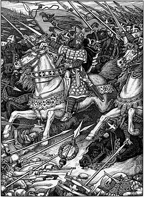
The landscape around Kirkby Stephens contains other mythological echoes. Pendragon Castle, the supposed birthplace of Uther Pendragon lies just 6 miles to the south-west. Some would suggest Arthurian associations with the cairns. The 6th century British cleric Gildas places a Romano-British commander by the name of Ambrosius Aurelianus at a battle against the Saxons at a place known as Badon Hill, location now unknown. It is my own belief, and nothing more than a belief mind you, that Baidon Hill is the lost name of Nine Standards Rigg and that each cairn was built to bear the flag or “standard” of each tribe of the Britons who defeated the Saxon hoards there. The watershed west and east would be a most likely location for these two armies to meet, the Saxons having arrived form the east, Ambrosius Aurelianus from his Welsh stronghold in the west. Could Ambrosius Aurelianus be the historical fact behind the mythological legend we know as King Arthur?
Rhead, George Wooliscroft & Louis. “Arthur Leading the Charge at Mount Badon” from Tennyson, Alfred. Idylls of the King: Vivien, Elaine, Enid, Guinevere. New York: R. H. Russell, 1898.
But all this is speculation and conjecture. In the mists and shadows of time, names and places become confused. Distorted and manipulated by subsequent generations the truth rapidly becomes the first casualty of history. It is perhaps astounding then that no formal archaeological investigation of the Nine Standards has ever been undertaken. Until that time, it is only natural that people will look to the cairns and attach their own stories to explain their presence. For now the origin of the curious nonad of dry stone cairns upon Nine Standards Rigg must remain a mystery.
*Dr Walker’s book is available from Hayloft Publishing Ltd http://www.hayloft.eu/
This article first appeared in Cumbria Magazine, February 2014
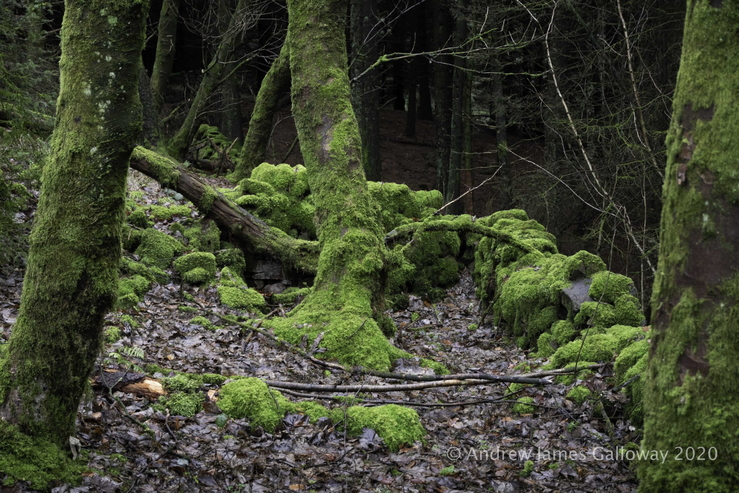
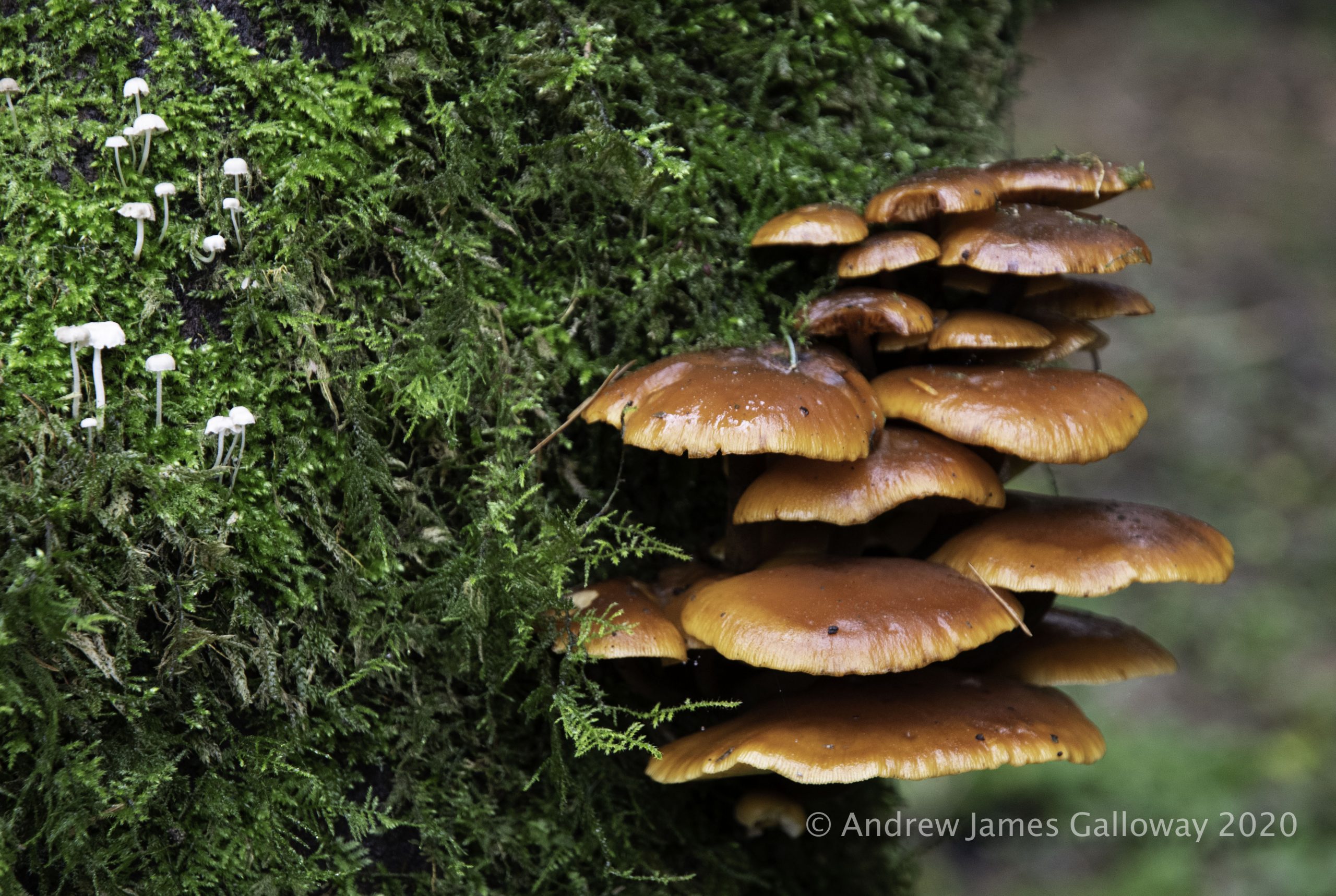
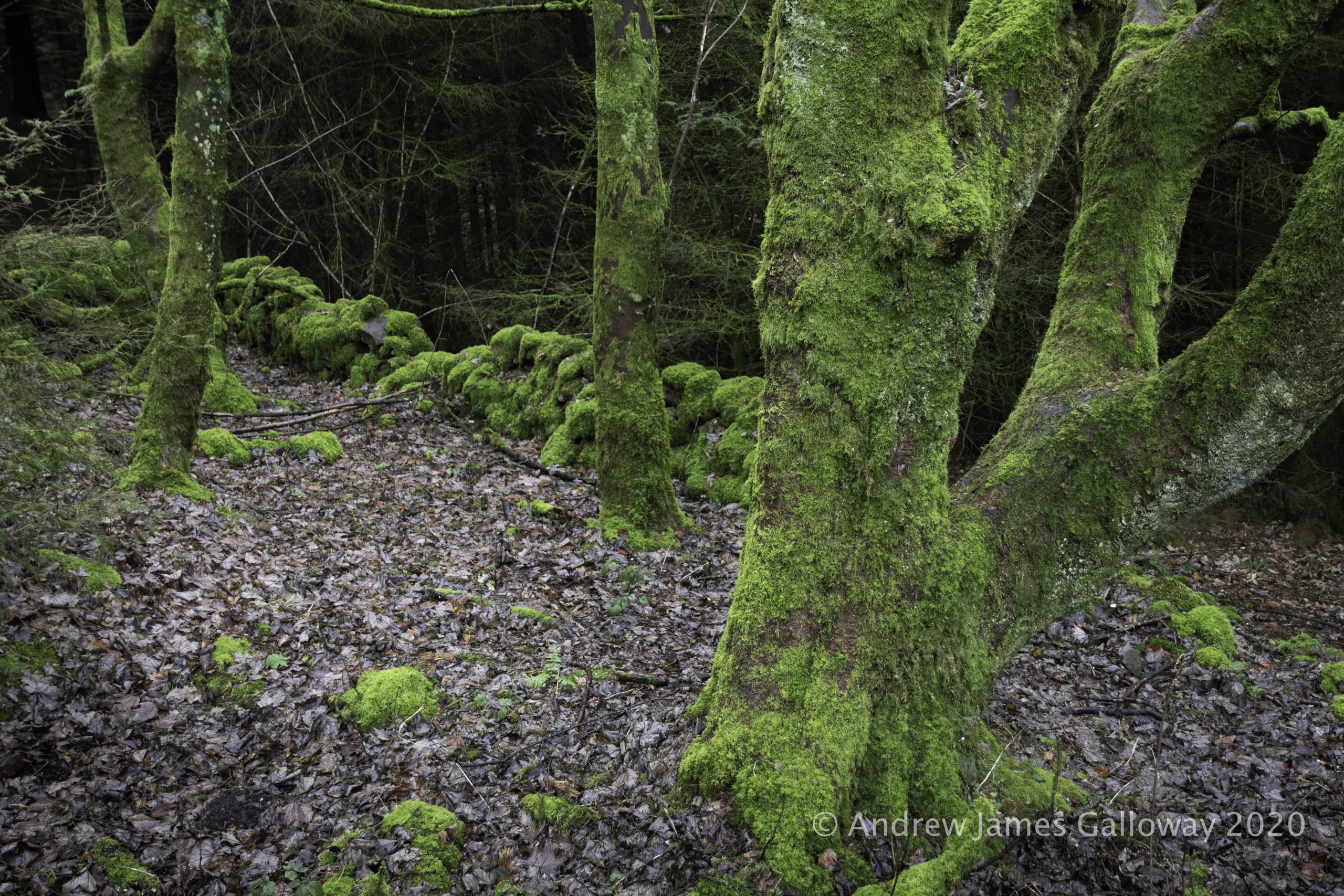
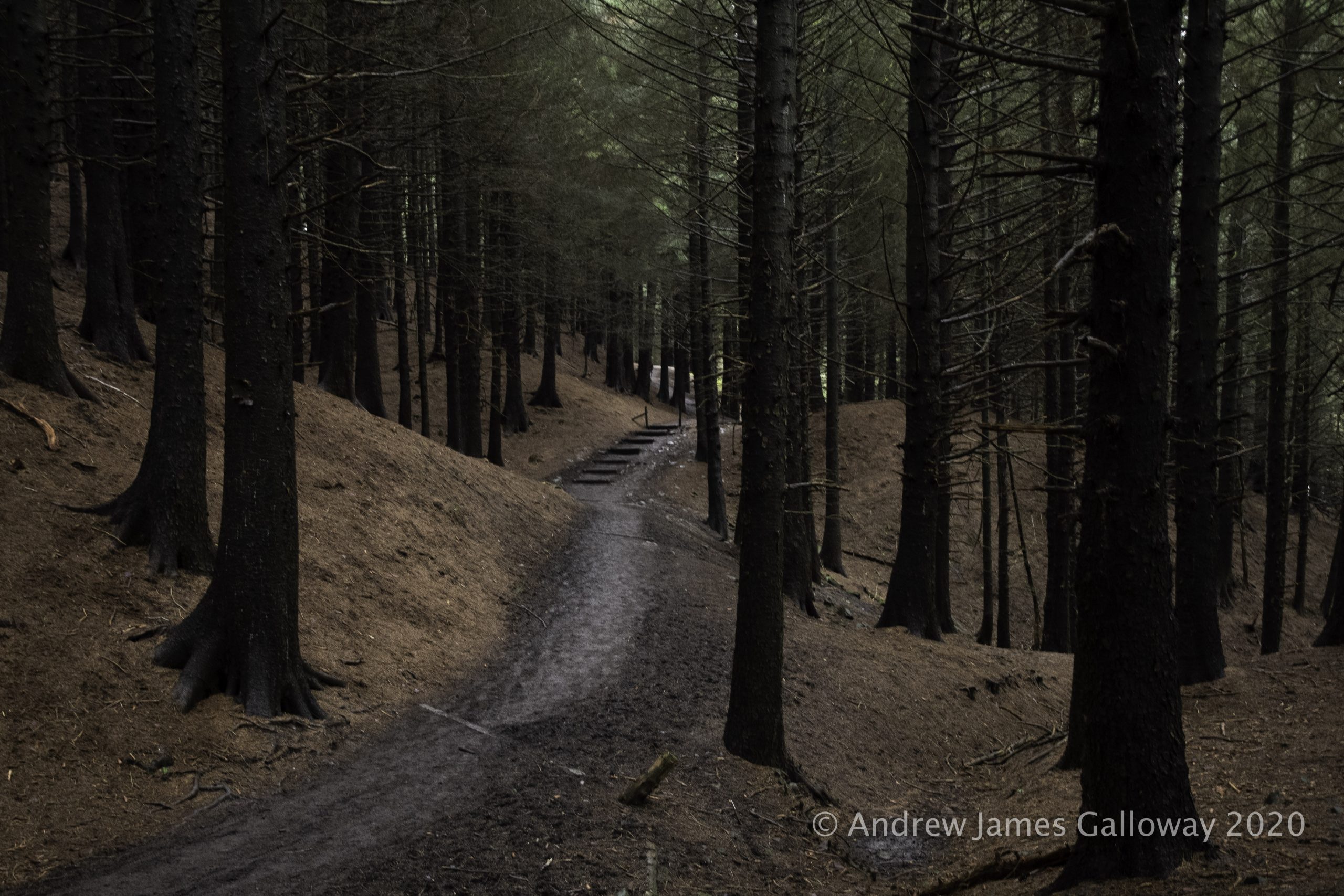
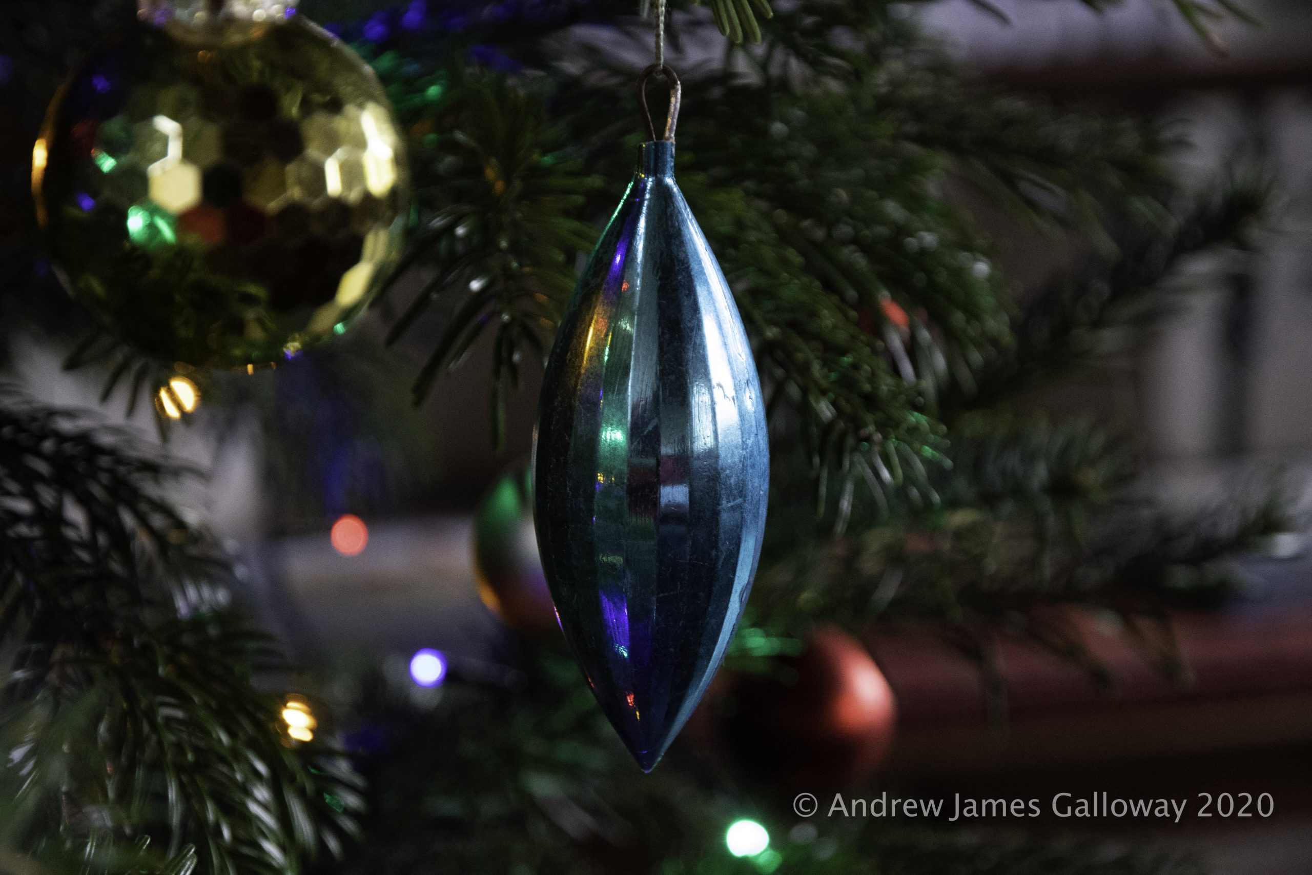
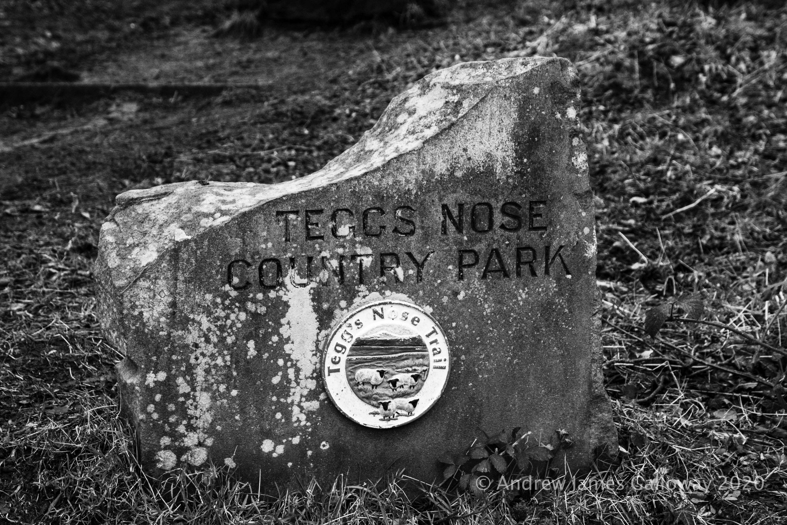
It has become something of a Boxing Day tradition to walk from Tegg’s Nose Country Park, through Macclesfield Forest, to visit St Stephen’s Church, also known as the Forest Chapel. Walking through the forest on the day after Christmas Day the traditions of centuries hang heavy in the air as the tamarisk mosses hang from the naked limbs of the trees.
Mosses, Lichens & Fungi in the forest
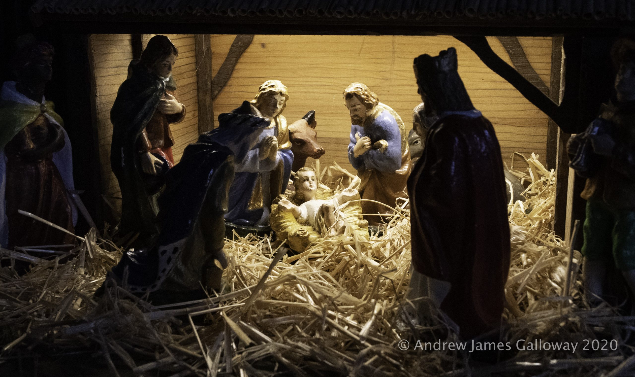
In a quiet corner of the forest, close by the Iron Age earthworks of Toot Hill, crystal clear Peak District water emerges from a spring in the forest floor. Each year at this location someone dresses a small spruce tree with Christmas decorations. A notebook protected in a small plastic container nearby contains comments of passers by and there is a little tin for donations. To whom the donations might go we can only presume as this information is not provided by the mysterious decorator of the tree. I like to think this has some connection with St Stephen’s but the genius loci of the place has more of the votive pagan tradition about it than anything related to the Christian church. I make my offering and descend Charity Lane, leaving the shadows of the forest behind me.
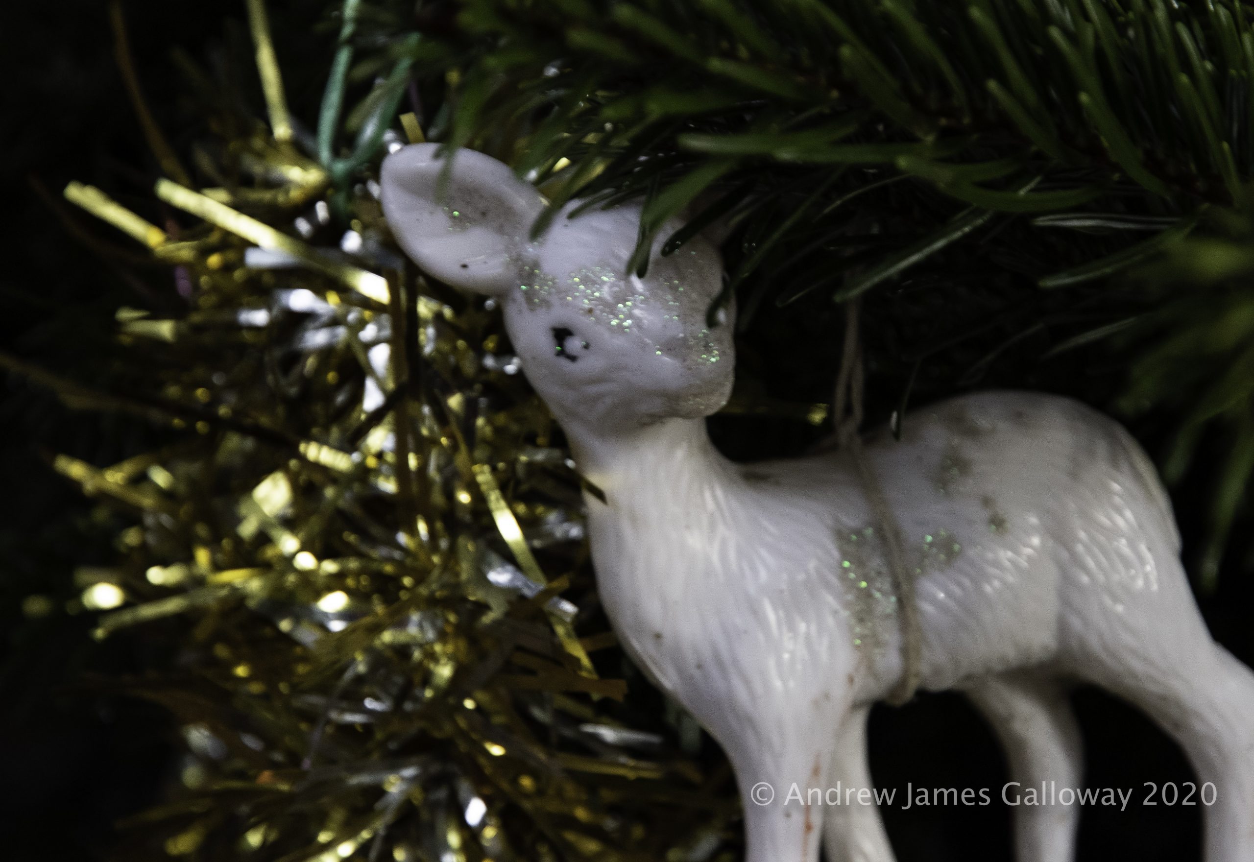
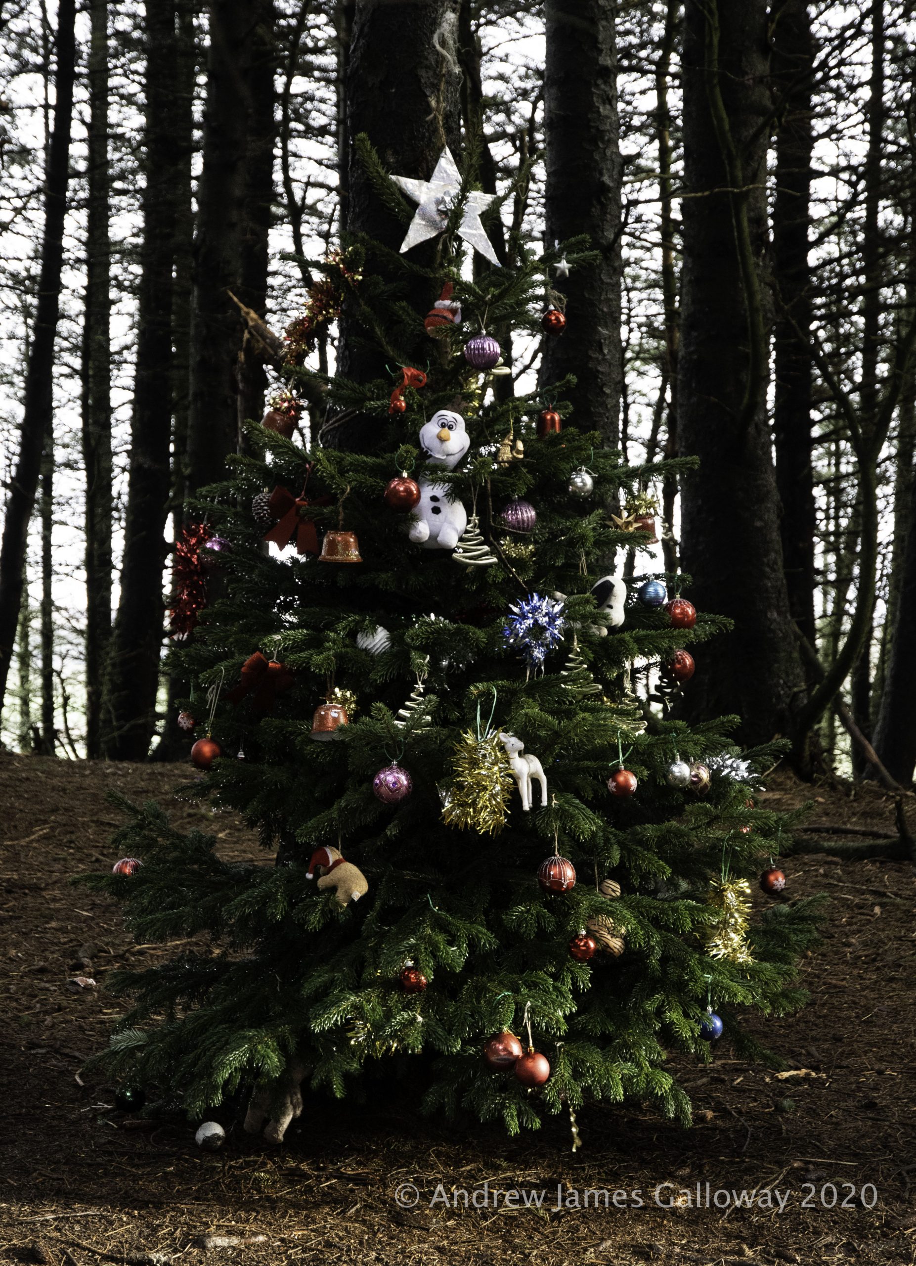
Christmas Tree in the forest
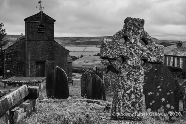
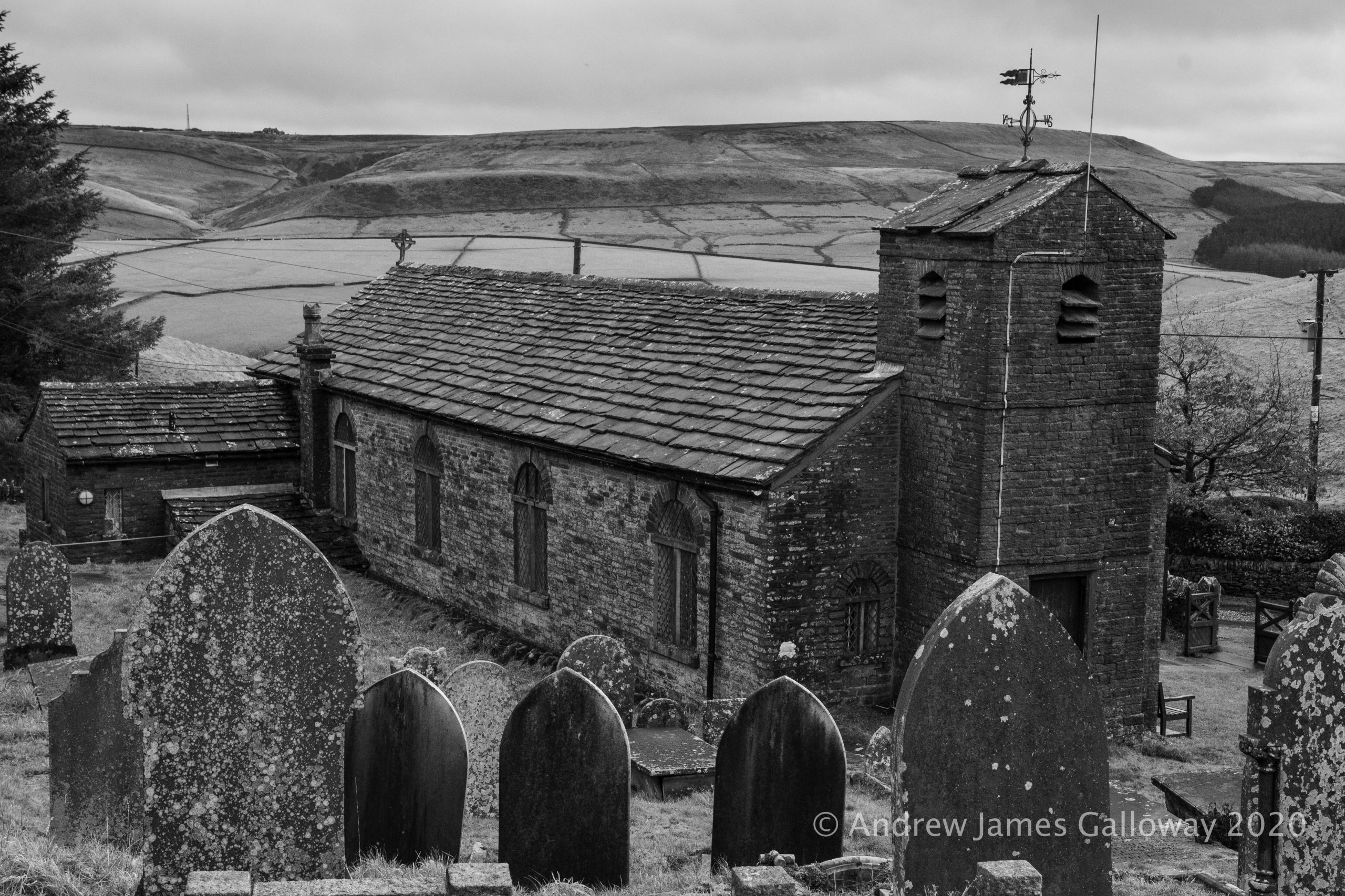
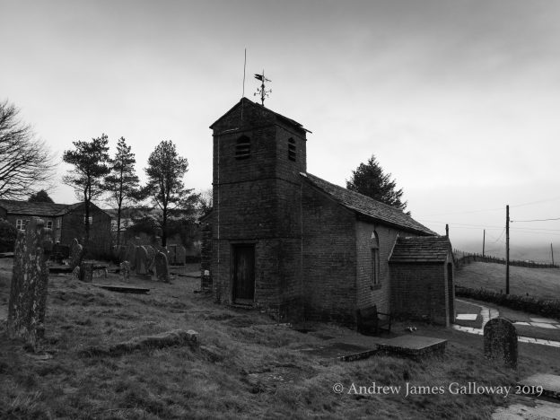
The Forest Chapel stands in a isolated depression among the northern hills of Macclesfield Forest, a stone’s throw from the curiously named Bottom-of-the-Oven.
As the dates above the gabled entrance indicate the chapel was almost entirely re-built in 1834 following a fire, but stands on the site of a former chapel of ease constructed in 1673, the stone bearing this inscription having been preserved from the original building. In about 1720 Francis Gastrell, Bishop of Chester noted that the church had not been consecrated and so was dedicated in the name of the martyr Saint Stephen.
St Stephen’s Church, The Forest Chapel
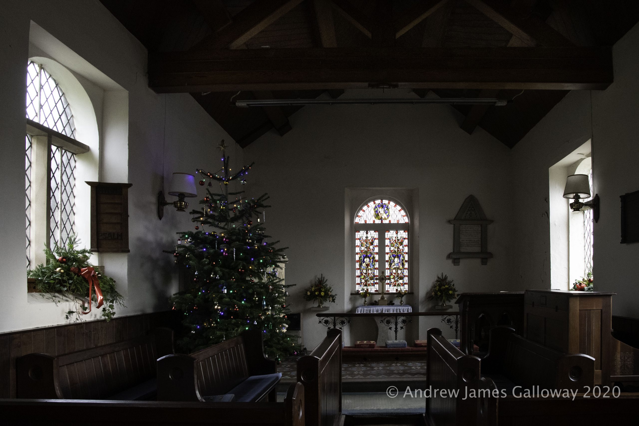
To step inside the Forest Chapel is to step backwards in time to the austere non-conformist existence of the families who eked out a harsh living from the bleak Pennine moorlands for some five hundred years since the Royal Forest of Macclesfield became common land in the 15th Century. The interior is unostentatious, the basic structure being a single rectangular room, the nave and chancel having no discernible division, covered by a simple oak-beamed vaulted ceiling. A simple stone altar set against the east wall is overlooked by a Victorian stained-glass window.
I sit for some time in the peaceful solitude of the chapel. Here too is erected a Christmas tree. In addition to the customary baubles and fairy lights the hand written prayers of visitors hang from the boughs of the tree. I pack away my flask of coffee in my rucksack and head out once again into the forest.
From Standing Stone car park I climb Buxtor’s Hill. A cold damp wind sweeps across Piggford Moor making the ascent of Shutlingsloe arduous. On the crest of the hill I tuck myself into the relative shelter of a fissure in the Chatsworth Gritstone and eat Stollen, thick with marzipan, which I wash down with coffee.
A fissure in the rocks on top of Shutlingsloe
Shutlingsloe is an anchor in my landscape. The little whitewashed summit monument, once of importance to the Ordnance Survey in the measurement and mapping of this anomalistic archipelago of islands we call home, is without doubt the triangulation pillar upon which I have placed my hands more than any other. Here I place my hands once again, now to steady myself against the buffeting wind.
To find shelter I descend once again into the forest, pausing at Nessit Hill to admire the panorama over Trentabank and Ridgegate Reservoirs. By Bottoms Reservoir I pick up the Gritstone Trail and make the arduous ascent to the summit of Tegg’s Nose Quarry. An information board here informs me that the rocks of the quarry date from the Carboniferous geologic period and were laid down in a mighty river delta some three hundred and fifty million years ago. In comparison to this age the quarry men who split these rocks open a hundred years ago seem my contemporaries.
Thoughts and images inspired by the poem Pilgrimages by R S Thomas. #adventbookclub
There is an island there is no going
to but in a small boat the way
the saints went, travelling the gallery
of the frightened faces of
the long-drowned, munching the gravel
of its beaches.
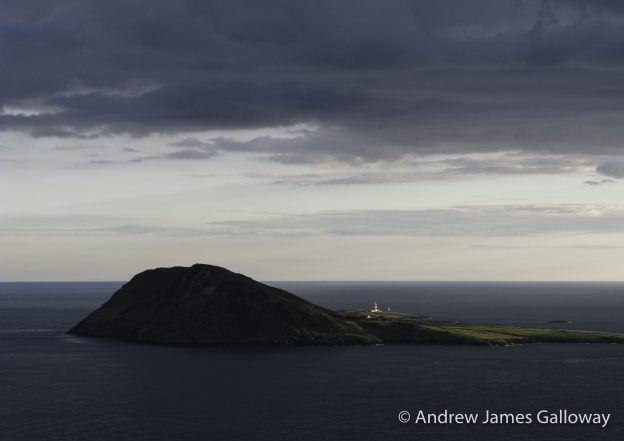
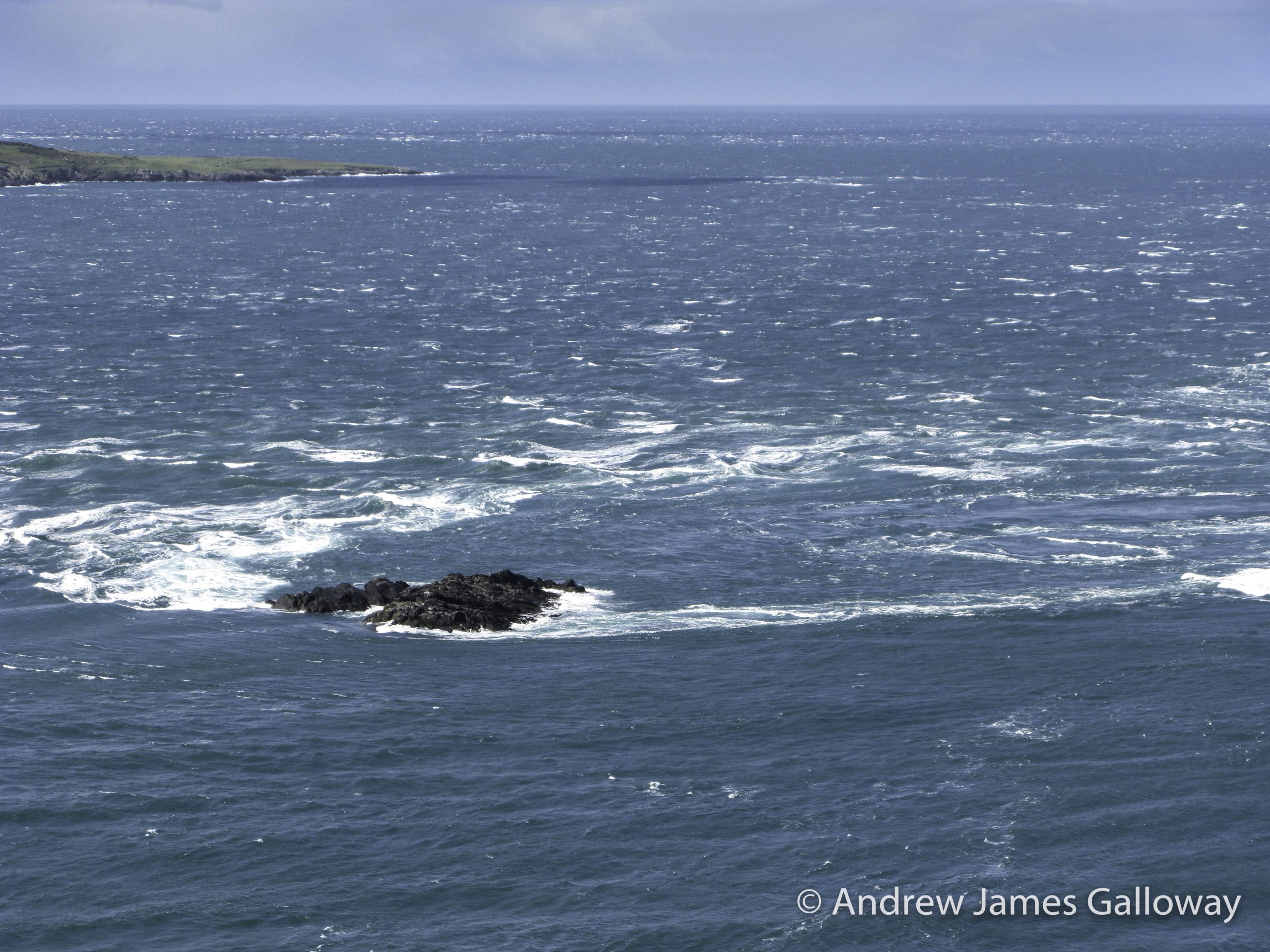
The tides in Bardsey Sound/Swnt Enlli are notorious. Between Pen y Cil and the island of Bardsey, known as Ynys Enlli in Welsh, the seabed rises up. In places it breaches the water’s surface to form clusters of treacherous reefs, such as the black rocks of Carreg Ddu. During the tidal flood, water is forced through the sound, up and over the elevated seabed, so that the surface of the sea is higher to the east than to the west. In order to maintain equilibrium the water rushes through the sound, reaching speeds of up to eight knots and creating standing waves that can be several feet in height. Being caught up in this maelstrom in a small sixth century wooden boat would have been terrifying, no doubt. Thus Porth Neigwl became known in English as Hell’s Mouth.
As Vicar of St Hywyn’s Church, Aberdaron, this was a landscape, a seascape with which RST was very familiar, within which he saw the legacy of the twenty thousand saints who journeyed to Ynys Enlli and did not return. In the company of these saints RST undoubtedly saw himself as a twentieth century pilgrim making his journey across the post-Freudian seascape of the psyche, wherein he sought God. “Was the pilgrimage/ I made to come to my own/ self.” The narration of this journey in his poems defines RST as a twentieth century modernist, in the intertextual company of poets such as T S Eliot, W H Auden and Dylan Thomas.
Flood tide running past Carreg Ddu, Swnt Enlli
Although the poems of RST can sometimes seem dark and impenetrable, there is often a subtle wit to his choice of language. As Carys Walsh points out in her book Frequencies of God, the phrase “munching the gravel/of its beaches” from Pilgrimages is likely a reference to the book of Lamentations.
He has broken my teeth with gravel;
he has trampled me in the dust.
Lamentations 3:16
But RST is also, no doubt with a cheeky wink, making reference to the following passage from Under Milk Wood written by his long-dead contemporary Dylan Thomas.
never such seas as any that swamped the decks of his S.S.
Kidwelly bellying over the bedclothes and jellyfish-slippery
sucking him down salt deep into the Davy dark where the fish
come biting out and nibble him down to his wishbone, and
the long drowned nuzzle up to him.
We have already seen reference to the imagery of this passage in the poem This to do. Imagery and themes are cyclical in RST’s poetry, as no doubt he experienced them in his exploration of God. In the second stanza of Pilgrimages RST contemplates again the idea of the timeless moment.
There is no time on this island.
The swinging pendulum of the tide
has no clock; the events
are dateless
This imagery once again calls to mind T S Eliot’s “history is a pattern of timeless moments.”
We know for sure that RST was familiar with Eliot’s works as he made reference to them in his personal letters.
RST lived in the company of all the saints, and the poets, and saw himself as a fellow pilgrim in the journey towards God. What I see in the cyclical imagery of his poems is a growing awareness that the origin of the pilgrim’s journey is God and the destination is God.
This phrase from Little Gidding is now quoted so often it has become a cliché, but for sake of completion, I quote it again.
We shall not cease from exploration
And the end of all our exploring
Will be to arrive where we started
And know the place for the first time.
Out of necessity life involves a physical journey. Undoubtedly, there are places we encounter along the way, suspended in place and time, such as Ynys Enlli, that are portals to an inner journey. But it is through this inner journey that we are ultimately reconciled to God.
Thoughts inspired by the poem The Moor by R S Thomas. #adventbookclub
It was like a church to me.
I entered it on soft foot,
Breath held like a cap in the hand.
It was quiet.
What God was there made himself felt,
Not listened to, in clean colours
That brought a moistening of the eye,
In the movement of the wind over grass.
There were no prayers said, But stillness
Of the heart’s passions – that was praise
Enough; and the mind’s cession
Of its kingdom. I walked on,
Simple and poor, while the air crumbled
And broke on me generously as bread.
Over the past fifteen years I’ve spent a fair bit of time walking across moorland, sometimes with fellow walkers, more often than not on my own.
In contrast to the craggy, ice scarred mountains and cwmoedd that define the drama of Snowdonia, open moorland is the predominant landscape of the gritstone uplands of the Pennine hills. The spine of Old England, as they were once known. It is a landscape with which I have become reacquainted as a result of recent travel restrictions, and the increasing restrictions of my ageing body. It is a landscape scarred not by ice but by the slash and burn practices of humans in their quest for the mineral wealth of the earth and their blood lust for the tragic little bird known as the grouse. There are no trees here where the watershed divides the ancient counties of Lancashire and Yorkshire as bloodshed once did. Nothing higher than the hearts of the sheep, as Sylvia Plath noted, where the wind pours by like destiny.
There is something about open moorland that is conducive to communion with a consciousness that is both within and beyond ourselves. Perhaps it is the absence of form and colour. There are fewer distractions here for the conscious mind to latch onto. In bad weather, with visibility lost, wind and rain being the soul determinants of direction, the moor can take on the aspect of an isolation tank. Separating me from all the anchors I have attached to my fears.
This is the mind’s cession that RST speaks of. The ego letting go of it’s kingdom. It’s just me, simple and poor, and rude weather. Oh, how I yearn for that simplicity.
For some years now I have participated in an Advent Book Group located on social media. I have, in the past, found it helpful to reflect upon the meaning of the Christian season of Advent, as a way to reflect upon the year gone by and a time to review the path ones own life has taken. Advent is so often overshadowed by the commercial celebrations of Christmas, which now begin immediately following the American festival of Thanksgiving at the end of November. As far as the Church is concerned, officially, the season of Christmas does not begin until midnight on Christmas Eve, but as we all know, our culture’s aversion to delayed gratification means Christmas starts when multi-national corporations say it starts.
And so I see my participation in the little online book group as a form of rebellion against the leviathan of corporate capitalism. That said, I have just put up my Christmas tree on 1 December. Something which would have been unthinkable when I was a child.
This year the group is reading Frequencies of God by Carys Walsh, a collection of reflections on the work of the Welsh poet R S Thomas.
R S Thomas
The poem for Week 1, Day 3 is In Church.
Often I try
To analyse the quality
Of its silence. Is this where God hides
From my searching? I have stopped to listen,
After the few people have gone,
To the air recomposing itself
For vigil. It has waited like this
Since the the stones grouped themselves about it.
These are the hard ribs
Of a body that our prayers have failed
To animate. Shadows advance
From their corners to take possession
Of places the light held
For an hour. The bats resume
Their business. The uneasiness of the pews
Ceases. There is no other sound
In the darkness but the sound of a man
Breathing, testing his faith
On emptiness, nailing his questions
One by one to an untenanted cross.
Here we have some powerful imagery from R S Thomas. Imagery with which I am familiar. There have been many times I have sat, alone, in country churches as the darkness thickens around me.
It’s a bit of a Boxing Day tradition for me to walk from Tegg’s Nose, through Macclesfield Forest, up to St Stephen’s Church, also known as the Forest Chapel. By the time I have walked through the forest to the church it is often early afternoon, but at that time of year the darkness has already mustered on over the Pennine Hills to the west.
The following is from an article I wrote for the Great Outdoors magazine.
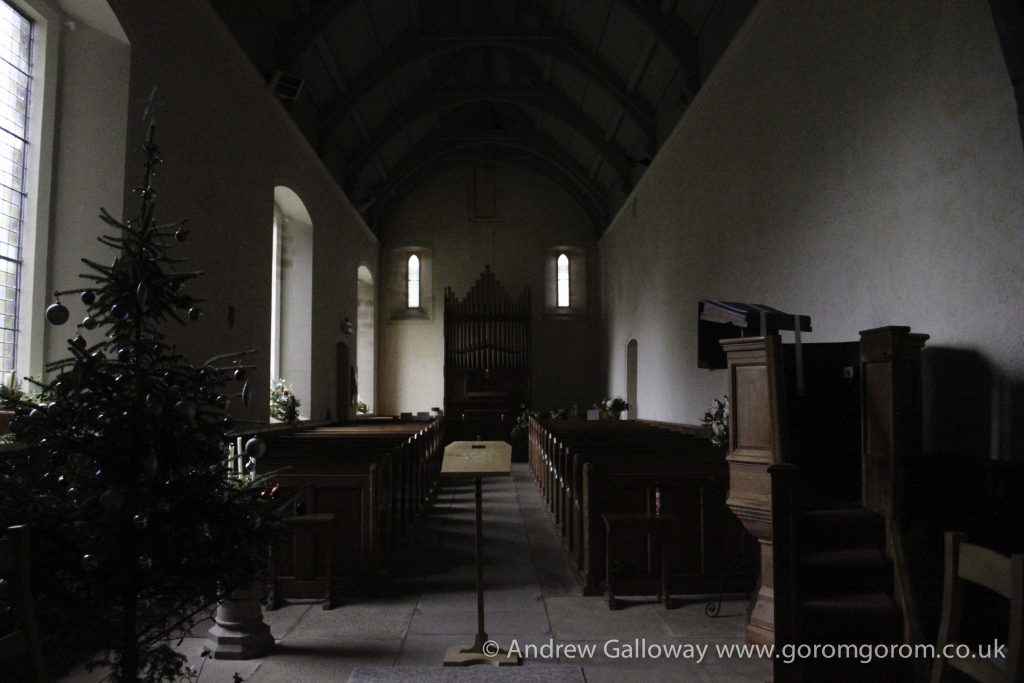
To the north I took refuge from the inclement weather inside one of the jewels of the western Peak District. As the dates above the gabled entrance indicate, the Forest Chapel, or Saint Stephen’s Church as it was consecrated, was almost entirely re-built in 1834 following a fire, but stands on the site of a former chapel of ease constructed in 1673, the stone bearing this inscription having been preserved from the original building. To step inside the Forest Chapel is to step backwards in time to the austere non-conformist existence of the generations who have eked out a harsh living from the bleak Pennine moorlands since the Royal Forest of Macclesfield became common land in the 15th Century.
I sat for some time as rainwater from the stone-clad roof collected in the lead guttering and splish-splashed onto the paving outside, until ultimately the light in the chapel brightened and brief shafts of sunlight, at acute angles from the south transept windows, blessed the silent nave, and the rain stopped, like the silence that follows the prayers of four hundred years.
Saint Stephen’s Church, Macclesfield Forest
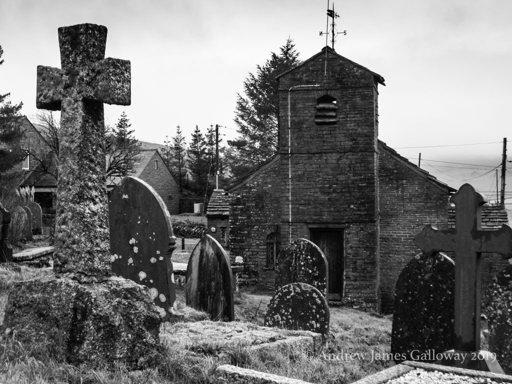
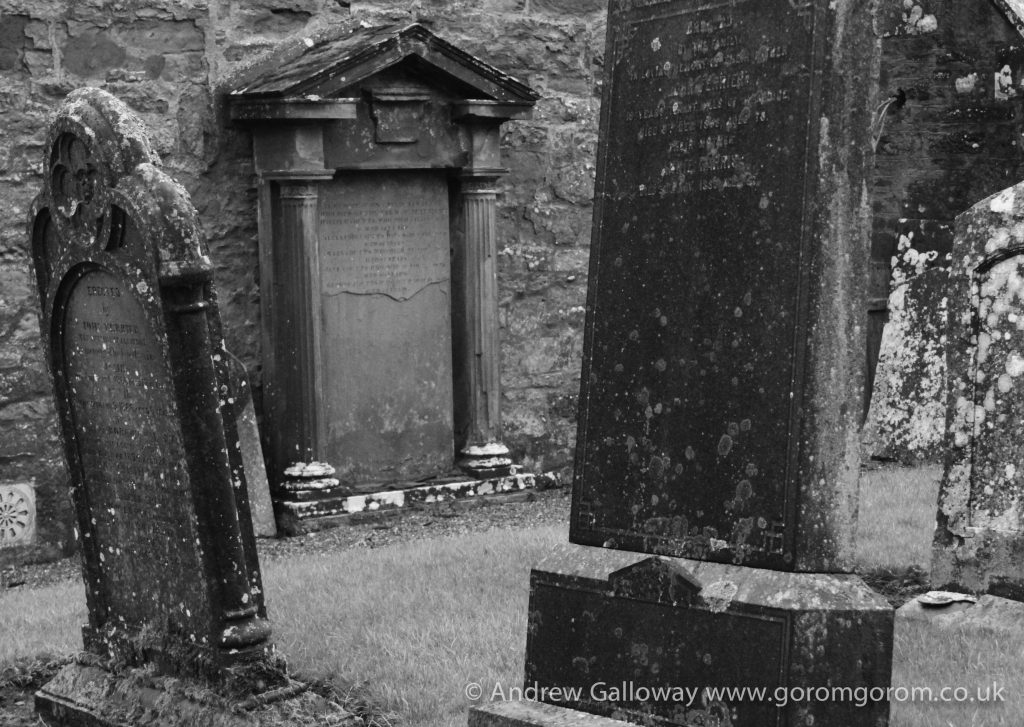
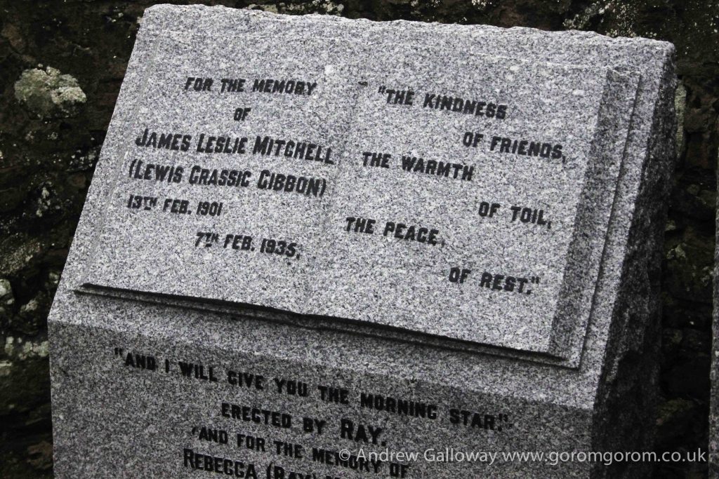
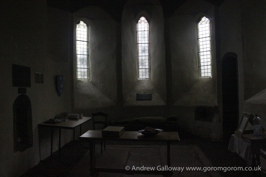
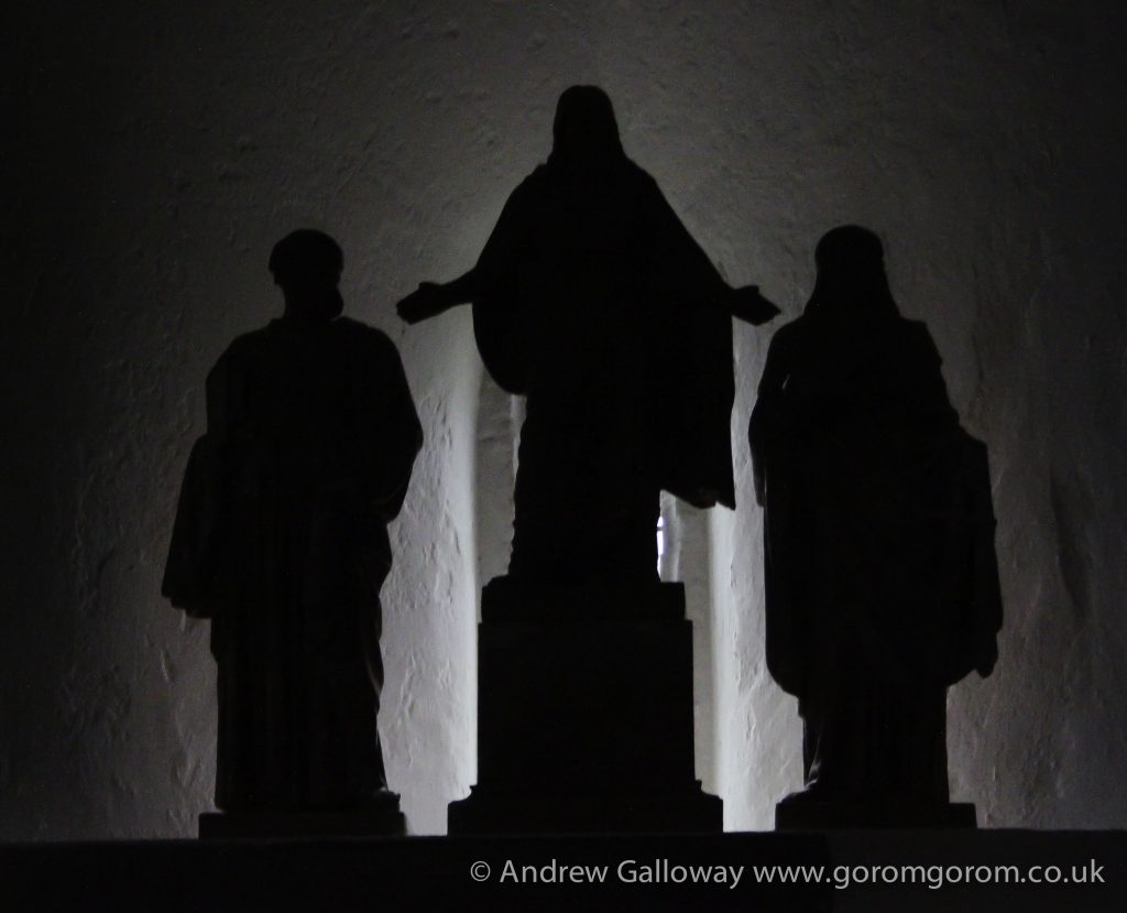
A similar experience too place some years earlier in The Kirk of Saint Ternan, Arbuthnott, Laurencekirk. I had been walking in snow and ice the day before on the eastern edge of the Cairngorms; had fallen and twisted my knee quiet badly. Deciding to assign the next day to low-impact activities I paid a visit to the Lewis Grassic Gibbon Centre.
For those unfamiliar with LGG, he wrote Sunset Song, a novel set in the early twentieth century about the loss of tradition agricultural practice in rural Scotland. It is a short walk from the visitors centre to the kirkyard of St Ternan’s, where LGG is buried. At that latitude during the liminal week betwixt Christmas and New Year’s Eve the light begins to fade not long after lunch. Not a soul in sight I took refuge in the church and sat for sometime contemplating the wreckage of my life and the pain searing through my knee. Nailing my questions one by one to an untenanted cross.