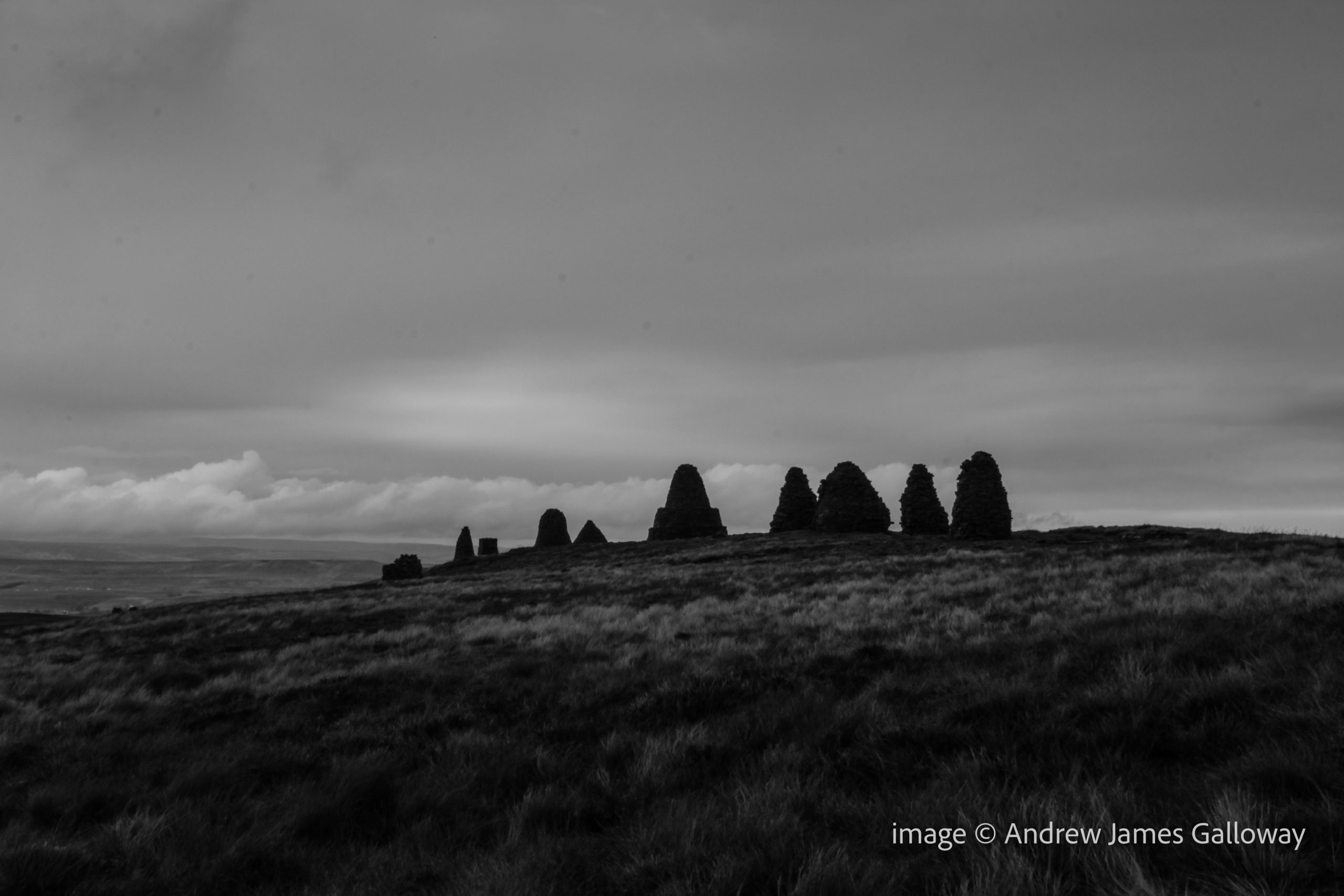
Nine Standards, a line of nine dry-stone cairns, standing proud on the skyline above the Cumbria market town of Kirkby Stephens, approximately half-way along Wainwright’s coast-to-coast route and just seven kilometres west of where the Pennine Way passes the famous Tan Hill Inn, provoke the inquisitive hiker to ask questions about their origin. One might imagine there would be many local legends and stories to tell about these enigmatic sentinels, placed by some unknown party high upon the gritstone moorland. But ask a local livestock farmer or passing farrier about the origin of these hurrocks of stone and you are more than likely to receive a shrug of the shoulders than any elaborate mythological tale. Fascinated by the prospect of an unsolved mystery linked to two of the country’s most famous long distance footpaths, I set out from Kirkby Stephens early one morning to investigate.
The path climbing from the River Eden folded around the ruins of Hartley Castle and entered a coppiced hazel wood where wild garlic grew in abundance. Over thousands of years the water of Ladthwaite Beck has carved its way through the Carboniferous limestone rock like a knife through wedding cake. Tilting steeply to the West, the rocks provided a path of least resistance for the ghyll as it cascaded in parallel to the ancient stratigraphy.
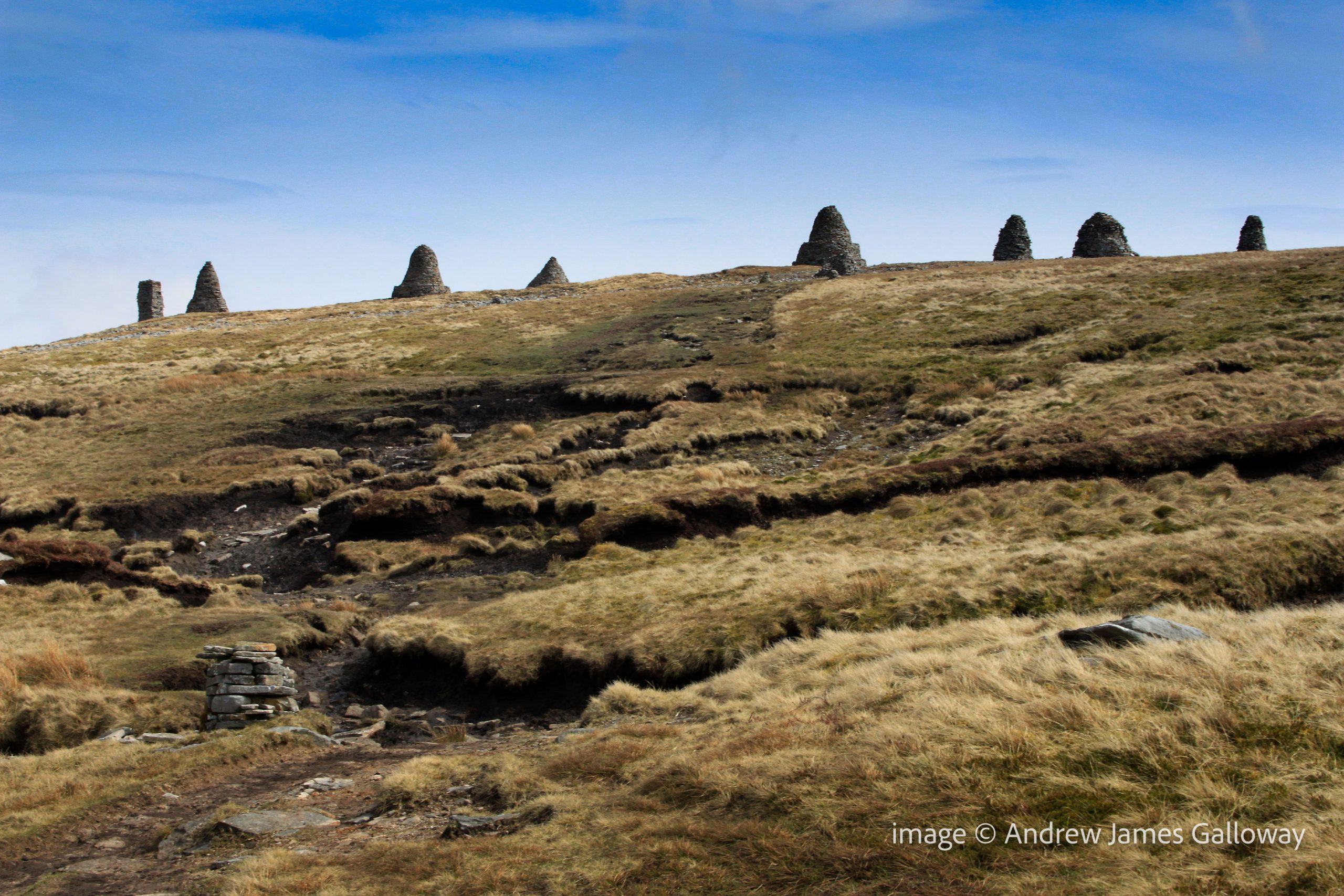
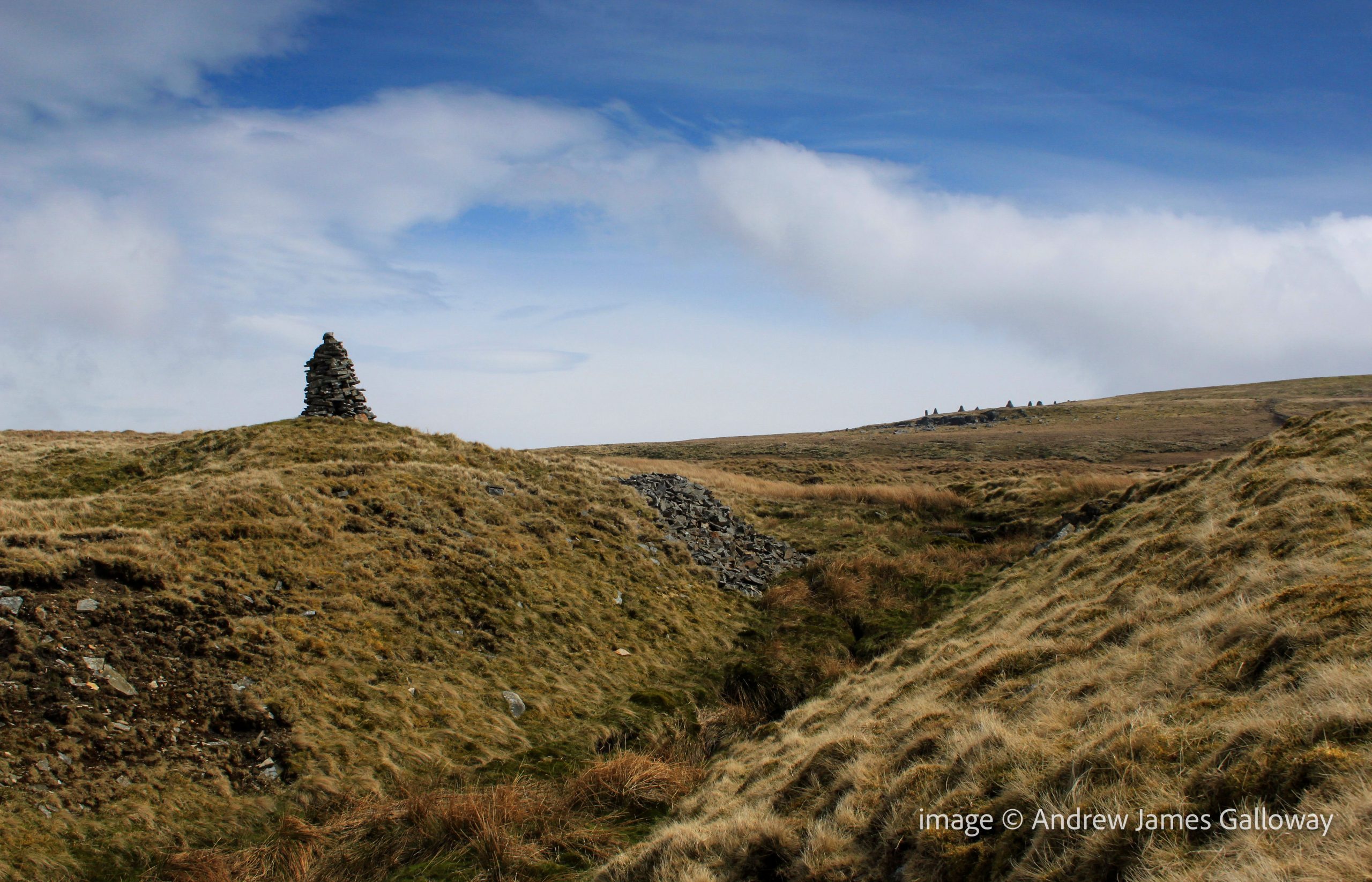
Passing the remote settlement of Ladthwaite the path climbed onto Hartley Moor where the Nine Standards appeared on the horizon like a vanguard of petrified Daleks from a 1970’s episode of Dr Who. A slightly more plausible explanation given for the position of the cairns is that they were built by local people during the medieval wars between England and Scotland to give the impression of an army encamped upon the hill, and hence, the idea suggests, deterring any potential Scots marauders. The clear flaw in this theory being not only that the cairns are only visible on the skyline from the west and not from the north, east or south, but also that there are just nine cairns – no great army. As I drew nearer to the cairns along the path that ran beside Faraday Gill (Ghyll surely Mr Ordnance Survey?), it became apparent that the cairns themselves were of a variety of shapes and sizes and appeared to have been designed to represent more than mere figures standing on a hill.
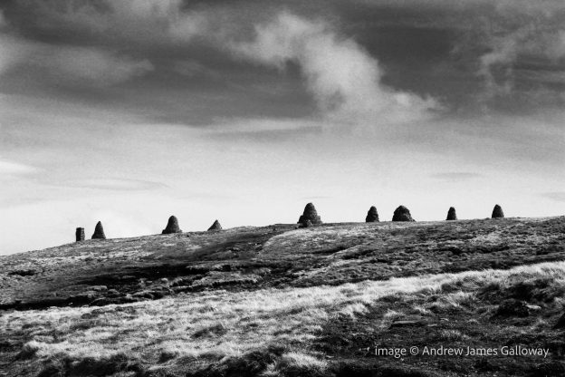
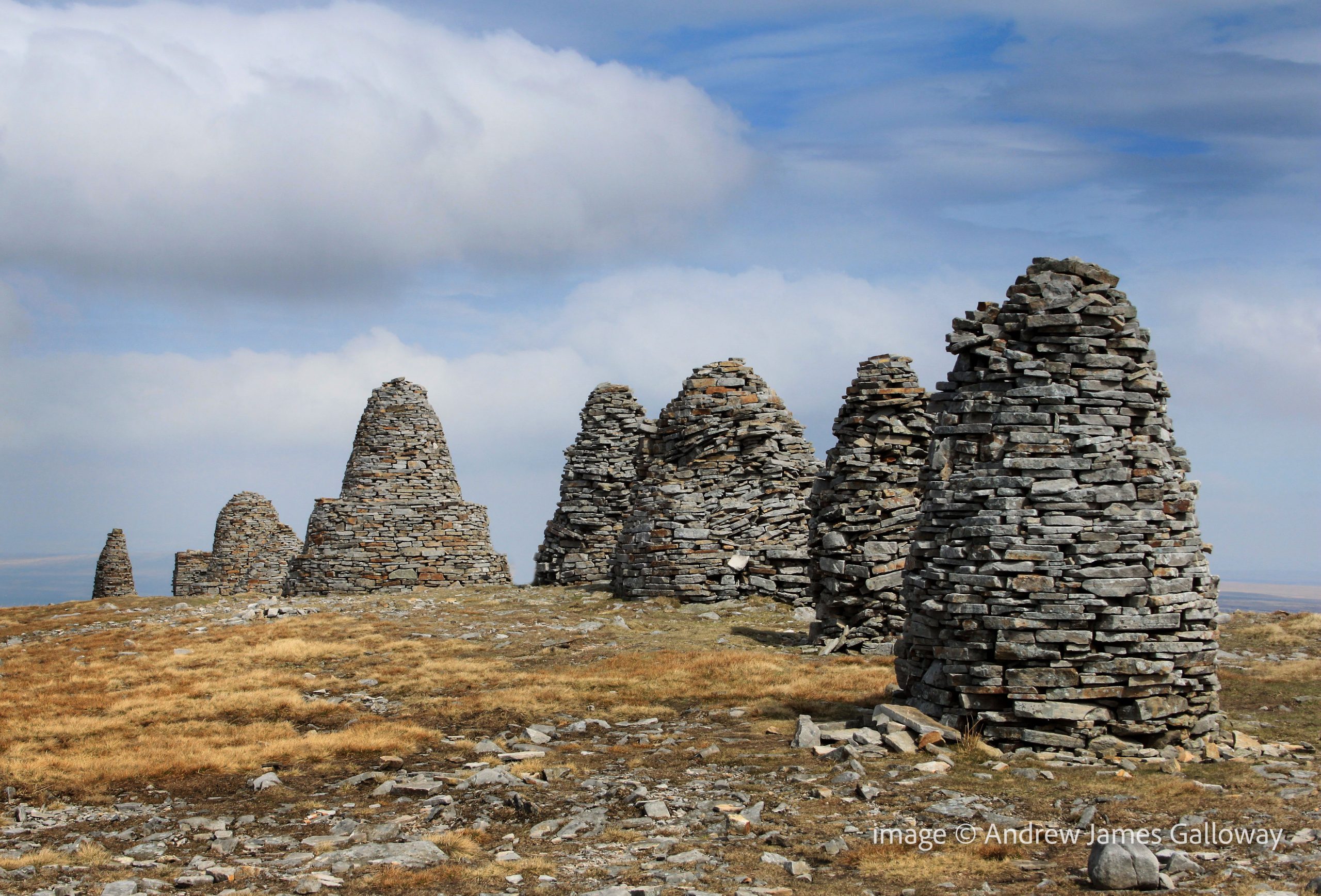
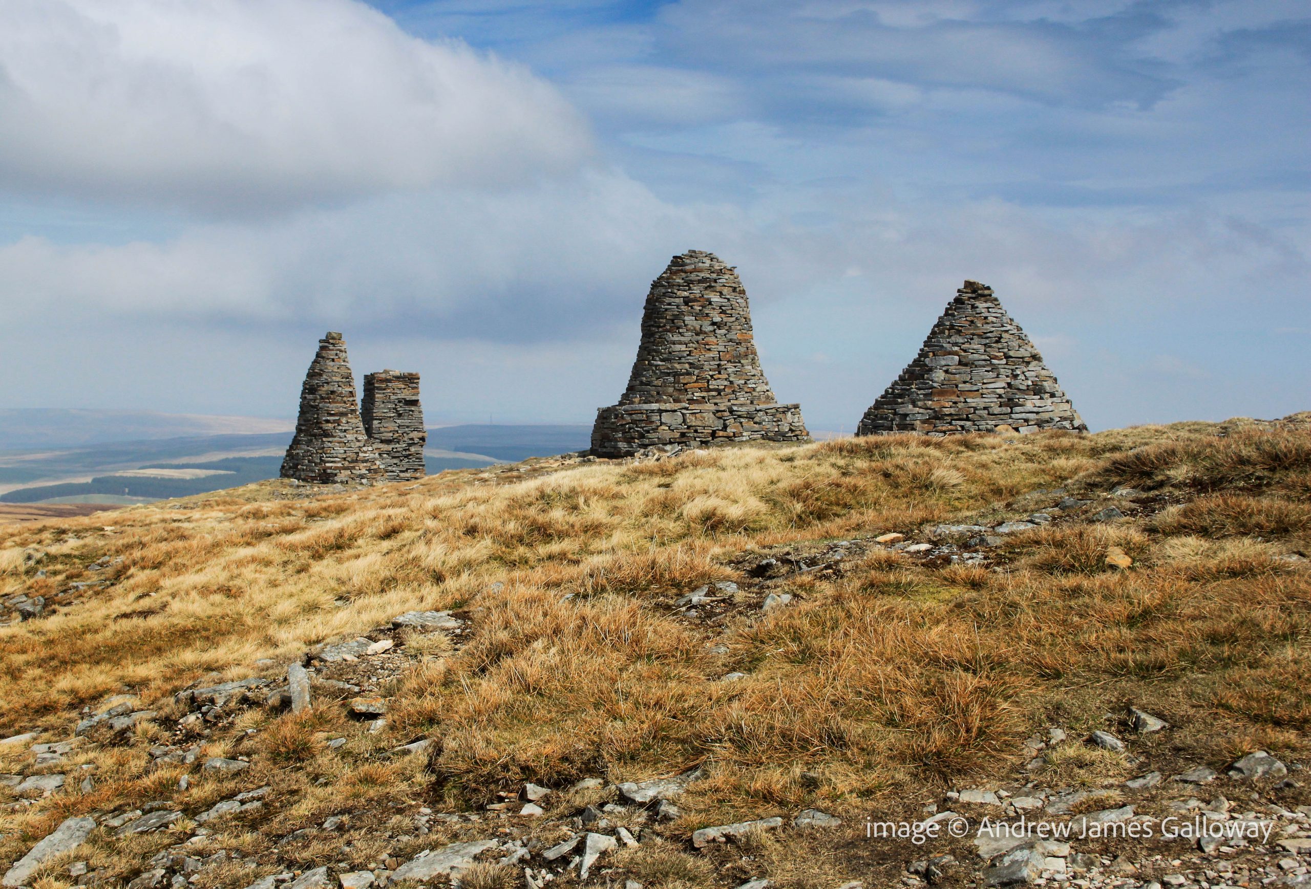
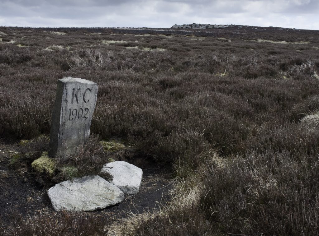
Dry Stone Cairns on Nine Standards Rigg
A W Wainwright mentioned them in his description of the coast-to-coast route, and although rightly dismissive of frankly patronising notions that they were built by local miners or shepherds who had nothing better to do, he regarded them merely as boundary cairns. The Standards sit on the boundary between the ancient counties of Yorkshire and Westmoorland, which is also the watershed dividing the Pennine Hills east and west. From here the Eden runs west to the Solway Firth and the Swale runs east to the North Sea. Due to the exposed position of their location, the notoriously harsh winters of the northern Pennine Hills and the natural human instinct to climb on them, the cairns do suffer occasional structural damage and require intermittent maintenance. The last major re-build was commissioned by East Cumbria Countryside Project in 2005, which means that the cairns are currently in pretty good condition. Visitors are requested to treat them with respect, ensuring no stones are removed.
But what of their origin? How old are they and who built them? If we disregard the rebellious Scot deterrent theory, we must look elsewhere. Dr Stephen Walker, himself of Kirkby Stephen, has undertaken an extensive search of archives both local and national in an attempt to establish the facts about these strange cairns. His findings are remarkable.
The cairns appear on the 1862 Ordnance Survey Six Inch (1:10,560) First Edition maps of Westmorland. They are marked on a variety of tithe, enclosure and estate maps dating from as early as 1738. They are mentioned on many boundary rolls, or perambulations as they are also known, written between 1400 and 1699. A perambulation was simply a list of landscape features which marked the boundary of particular estates, parishes or townships. The oldest historical reference to the cairns is contained within a transcription of a perambulation of Gilbert Gant, Lord of Swaledale, dating to sometime from the late 12th or early 13th century, thus proving that the Nine Standards cairns were standing above Kirkby Stephens no more than a hundred years after the Norman Conquest.
Prior to 1066 there is currently only speculation and hearsay. In 954 AD, Eric Bloodaxe, the last independent Viking king of York was ambushed and killed by Earl Maccus, son of Olaf, as he crossed the pass at Stainmore, now the route of the A66 from Scotch Corner to Penrith. Tradition held that Eric was buried at Rey Cross, but when the site was excavated to make way for the new dual-carriageway in the 1990’s, no burial was found. Only four miles to the south-west, do the nine standards mark the actual crossing point of the Pennine Hills used by Eric and thus his grave, and those of his noble companions?
Moving further back in time, in 118AD the Legio IX Hispana of the Roman Army was ordered north from York and, according to some scholars, was never seen again, allegedly annihilated by the Picts. It has been suggested that the nine standards are a lasting memorial to the defeated ninth legion. The obvious flaw in this theory being if the legion was wiped out, who was left to build the Cairns?
In his book, Nine Standards: Ancient Cairns or Modern Folly*, Dr Walker is clear and vociferous, “They were not built to give the invading Scots the impression that an English army was camped up there. Nor were they a job creation scheme for indigent lead miners by some eighteenth or nineteenth century philanthropist, still less a ‘folly’ built by one of the more deranged landed gentry, as some have suggested. They are in fact ancient and demonstrably so.” Nor are they simply boundary cairns. In number they are unique in the British landscape, repeated on no other watershed or county boundary from Sutherland to Cornwall. They are undoubtedly a work of art, created by a Damien Hirst or Tracey Emin of the time. Their very presence is meant to communicate a message. We have simply forgotten what the message was.
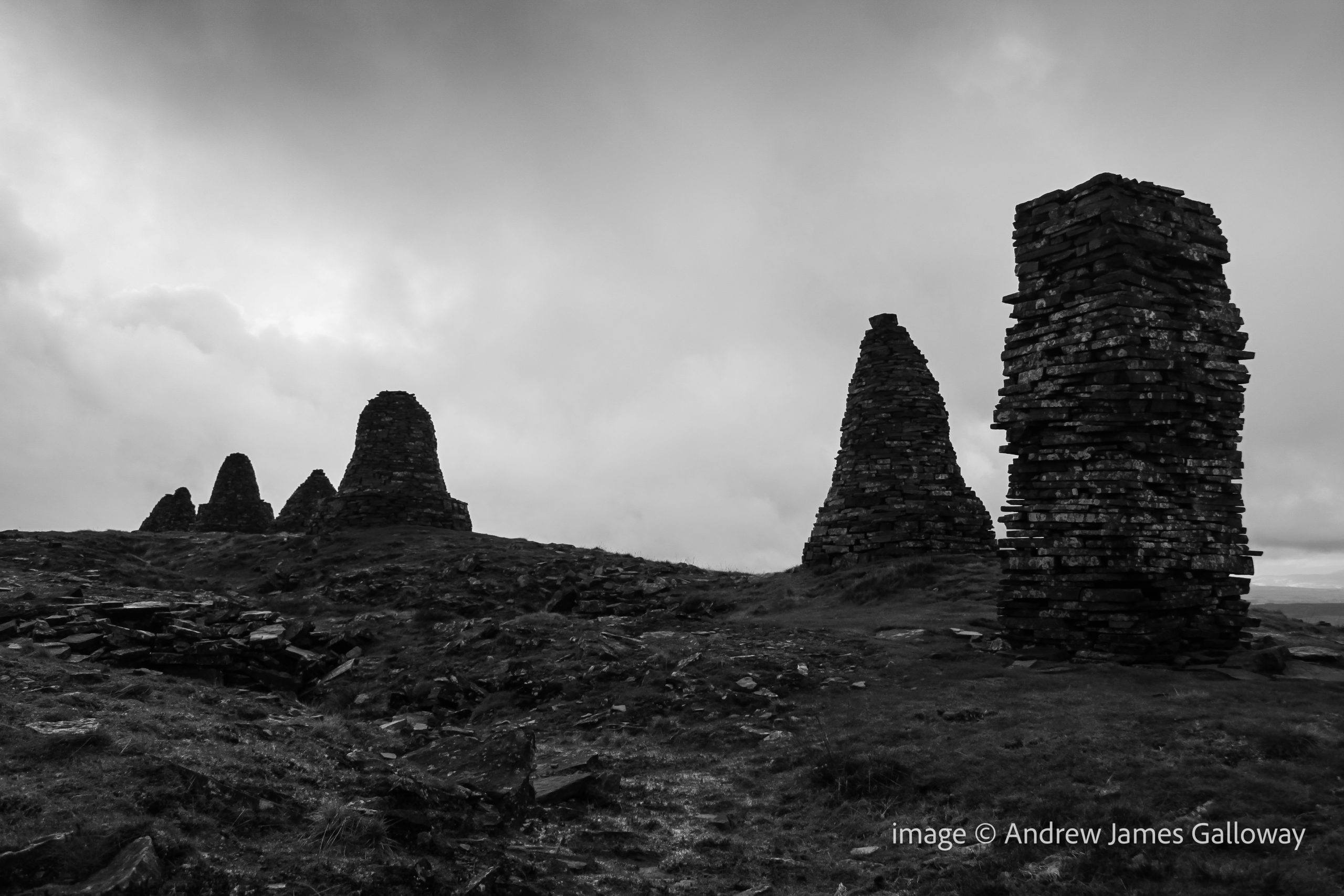
Nine Standards: do the cairns commemorate a long forgotten battle?
A striking curiosity about Nine Standards Rigg, the hill upon which the cairns stand, is that its name is derived from the cairns themselves and hence post-dates them. They are not, for example “Old Harry’s Cairns on Backstone Hill”. The implication here is that for the topography to be named after a man-made feature, the feature must be very old indeed. Within the Brut y Bryttaniat, a 15th century manuscript copy of a 12th century script in Kymraec (Old Welsh), which was translated in to Latin by Geoffrey of Monmouth, an account is given of a battle between the Britons and the Saxons at York in 504AD. The manuscript states that the Saxons were routed and fled into the mountains to take refuge at a place named “mynydd daned” or toothed mountain. The Britons rallied and attacked the mountain at night, slaying the Saxons. If “toothed mountain” is taken as a description of Nine Standards, this manuscript may indicate that the cairns date to as early as the 6th Century.
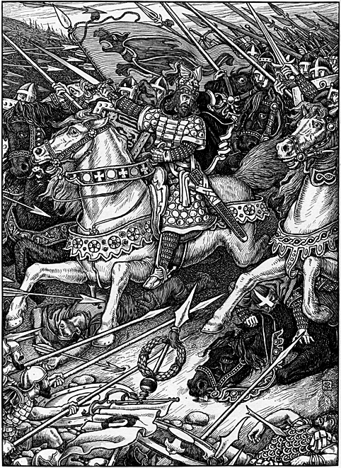
The landscape around Kirkby Stephens contains other mythological echoes. Pendragon Castle, the supposed birthplace of Uther Pendragon lies just 6 miles to the south-west. Some would suggest Arthurian associations with the cairns. The 6th century British cleric Gildas places a Romano-British commander by the name of Ambrosius Aurelianus at a battle against the Saxons at a place known as Badon Hill, location now unknown. It is my own belief, and nothing more than a belief mind you, that Baidon Hill is the lost name of Nine Standards Rigg and that each cairn was built to bear the flag or “standard” of each tribe of the Britons who defeated the Saxon hoards there. The watershed west and east would be a most likely location for these two armies to meet, the Saxons having arrived form the east, Ambrosius Aurelianus from his Welsh stronghold in the west. Could Ambrosius Aurelianus be the historical fact behind the mythological legend we know as King Arthur?
Rhead, George Wooliscroft & Louis. “Arthur Leading the Charge at Mount Badon” from Tennyson, Alfred. Idylls of the King: Vivien, Elaine, Enid, Guinevere. New York: R. H. Russell, 1898.
But all this is speculation and conjecture. In the mists and shadows of time, names and places become confused. Distorted and manipulated by subsequent generations the truth rapidly becomes the first casualty of history. It is perhaps astounding then that no formal archaeological investigation of the Nine Standards has ever been undertaken. Until that time, it is only natural that people will look to the cairns and attach their own stories to explain their presence. For now the origin of the curious nonad of dry stone cairns upon Nine Standards Rigg must remain a mystery.
*Dr Walker’s book is available from Hayloft Publishing Ltd http://www.hayloft.eu/
This article first appeared in Cumbria Magazine, February 2014
With a heavy heart I left the sanitised materialism of the Parsonage Museum gift shop, a packet of Brontë Rum and Raisin fudge stuffed in my the pocket of my rucksack, and wandered into the anarchic anthology of gravestones in the churchyard, each moss covered stone a remembrance of a family internment from before 1856, when due to public health concerns, the cemetery was closed. The horse chestnut, Scots pines and birch trees, so evocative of a windy afternoon in Haworth, were planted in 1864, long after the departure of the Brontë family, to help disperse the estimated forty-four thousand corpses contained within an acre of land. A photograph of the old church and churchyard, taken around 1860, shows only a few small trees in the Parsonage garden, tall enough barely to reach the first-floor windows and in the meadow to the south what appears to be a drinking trough, or possibly even an old bath, indicating that then, as now, the meadow was used for keeping livestock[i].
The churchyard of St Michael & All Angels, Haworth
A well-marked footpath led beside the meadow then dog-legged towards Penistone Hill, where the overflow cemetery for Haworth was built in 1856 and where a slim finger of the Haworth Moor extends from Wether Hill to touch the skirts of the town. It was onto the moors here that the young Brontës would take their daily afternoon exercise, often accompanied by the family servants Sarah and Nancy Garrs, whilst Patrick attended to parish business. As the children grew older they were allowed to venture out on their own to explore the countryside. Ellen Nussey recalled in her memoires that Emily’s favourite walk was along Sladen Beck to a place known by Emily as ‘The meeting of the waters’[ii]. The Ordnance Survey 1:25,000 scale map of the South Pennines, published in 2008, shows Sladen Beck as emanating from the foot of the earth and clay dam of Lower Laithe Reservoir, built in 1925. Upstream of the reservoir, the beck extends to a point now known as the Brontë Bridge and the Brontë Waterfall. It is safe to assume that this is the location to which Ellen Nussey referred, where a tributary tumbles over gritstone boulders into the afore mentioned beck from the south, although, the Ordnance Survey mark the beck to the west of here as South Dean Beck. Here the children would sit in the sunshine and play in the russet waters that fell from the heather clad moors.
The moors, however, were not always so benign. In the September of 1824, during a long period of hot weather, whilst the eldest three Brontë children, Maria, Elizabeth and Charlotte, were away from home at the Clergy Daughters’ School in Cowan Bridge, Branwell, Emily and Anne had, as was their daily routine, ventured out onto the moors in the company of Sarah and Nancy Garrs. On this particular Thursday afternoon, the little group was late in returning and Patrick had become concerned. He went to a first floor bedroom window to gain a vantage point from which to look for the children returning and was surprised to see that the skies above the moors to the west had turned black with heavy cloud. Timpani of thunder and shock of lightning soon followed as the whole moor was engulfed in a tempest of biblical proportions. Patrick later recalled in a sermon given to the congregation of St. Michael and All Angels how he heard a “deep, distant explosion” whilst feeling the house about him tremble. Distressed with worry, Patrick set out into the storm to search for his young family and eventually found them, cowering under Sarah’s cloak in the porch of a house.
Boundary Stone on Haworth Moor
Patrick was a pious man and believed the occurrence to have been an earthquake brought about by the electrical discharge of the storm and the recent hot weather, which of itself he believed to be a “solemn visitation”, a warning from God himself to the inhabitants of moor and town, calling them to repentance. In fact the earth tremor Patrick had experienced was the result of the collapse of a large area of bog between Middle Moor Hill and Crow Hill. The resulting deluge of liquefied peat, mud and moorland vegetation, which Patrick himself described as being up to sixty yards wide and between five to six yards deep, coursed down from the moor into Ponden Kirk and thus into the River Worth, flattening just about everything in its path, including trees, stone walls and a number of bridges. The wheels of mills along the length of the Worth were clogged with mire. At Horsforth, a good eight miles downstream from Haworth, over a thousand kilogrammes of dead fish, mostly trout and perch, were removed from the river Aire, having been suffocated by the quantity of mud and silt in the water system[iii].
Patrick had clearly been deeply shaken by the event, emotionally as well as physically, and by his frantic concern for his children. He concluded his sermon with the following prognostication:
“We have just seen something of the mighty power of God: he has unsheathed his sword, and brandished it over our heads, but still the blow is suspended in mercy – it has not yet fallen upon us. As well might he have shaken and sunk all Haworth, as those parts of the uninhabited moors on which the bolts of his vengeance have fallen. – Despise not this merciful, but monitoring voice of Divine Wisdom.[iv]”
Merciful indeed, for if a report in the Leeds Mercury was to be believed the young Brontës came closer to catastrophe than was originally perceived.
“The torrent was seen coming down the glen before it reached the hamlet, by a person who gave the alarm and thereby saved the lives of several children who would otherwise have been swept away.[v]”
It isn’t clear if the children referred to in the report were the Brontë children, but it is possible. How utterly different the course of English literature might have been, if not for the timely intervention of that unnamed person.
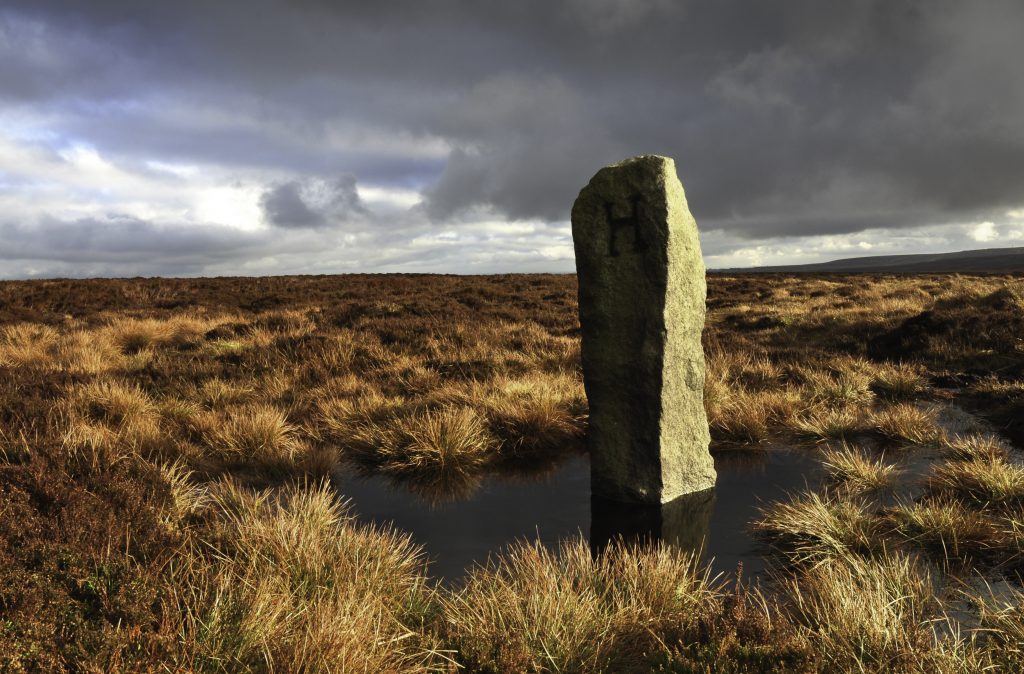
Rather than follow the indicated route along the Brontë Way (there is little here which does not now have the epithet ‘Brontë’ applied to it) I turned south from Penistone Hill and followed the line of a dry stone wall above Leeshaw Reservoir, where in the depression of Spa Hill Clough were patches of ink black bog deeper even than a fully extended walking pole, an thus to be avoided at all cost. Above Spa Hill began the exhausting climb through sodden purple moor grass and large patches of lime green sphagnum moss, to Oxenhope Stoop Hill, where I came upon a tall boundary stone, hewn from the local gritstone and carved with a large letter ‘H’. I considered for a moment if the ‘H’ stood for a certain misanthropic character in Wuthering Heights, but having consulted my map found I was standing on the invisible boundary between the county parish of Haworth, in the borough of Keighley and Hepton in the borough of Calderdale.
H for Heathcliff? Boundary Stone between Haworth and Hepton
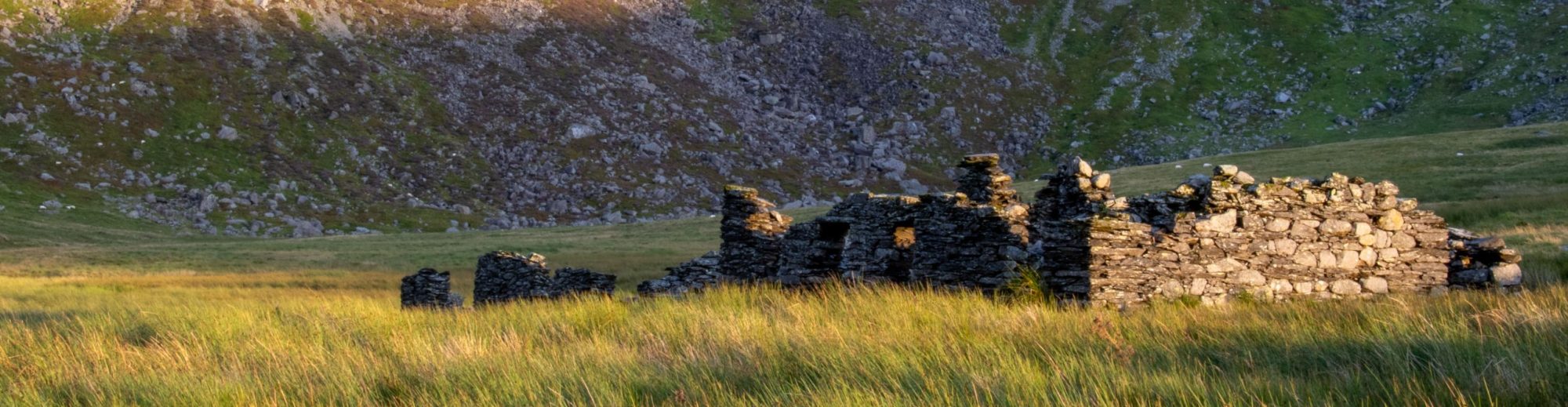
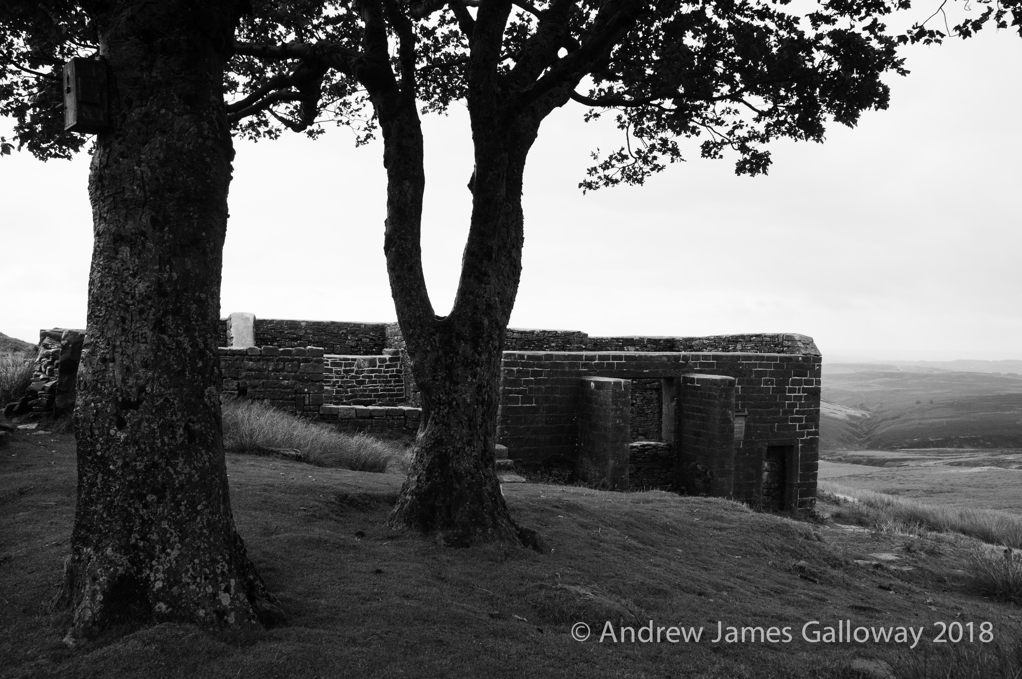
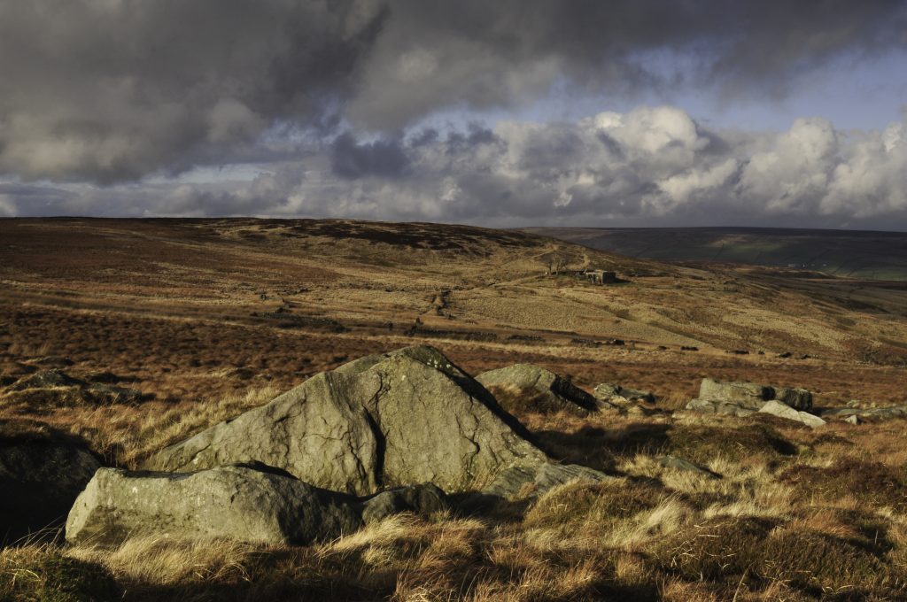
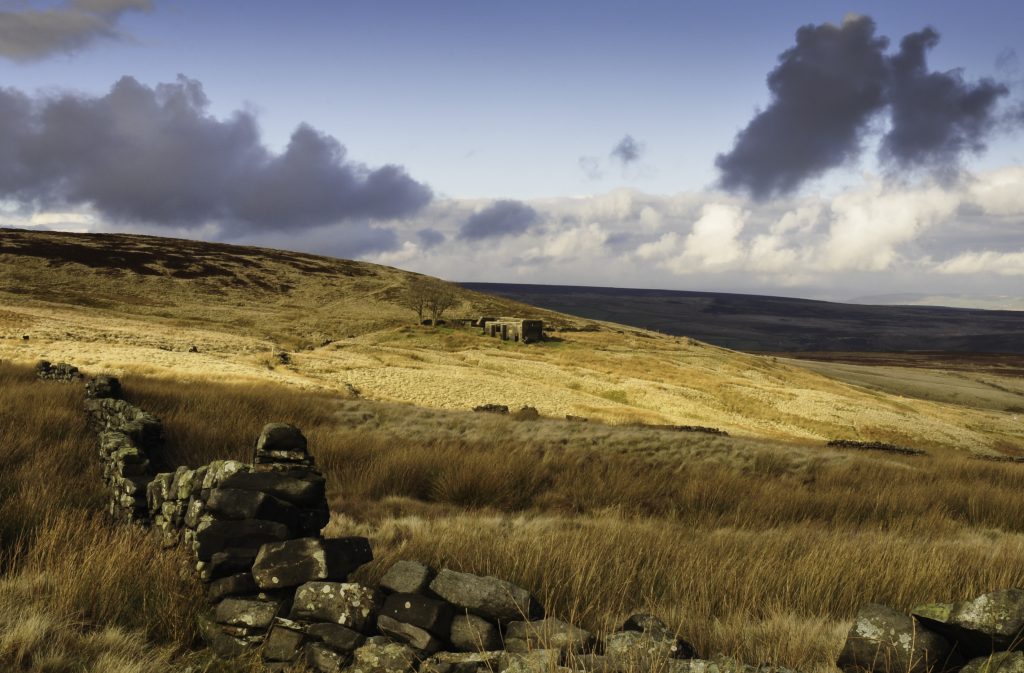
Following the line of this boundary roughly west for a mile or so I came upon the Pennine Way as it climbed from Walshaw Dean to the gap between Round Hill and Dick Delf Hill, before falling into the valley to the north, where beneath the bows of two sycamore trees stand the quartered ruins of a small Pennine farm, the rough hewn blocks of millstone grit weathered and encrusted with lichen and mosses, the inhabitants having long departed, home now only to half a dozen Swaledale ewes with piercing stares.
Top Withens is about as far as it is possible to be from the sea in the north of England and although the distances involved are by no means great in the age of the internal combustion engine, a hundred and fifty years ago they were considerable. From the crook of Delph Hill, beneath which the ruins sit, it is over seventy miles eastwards to Hornsea and the algid waters of the North Sea. To the west the Fylde coast lies somewhat closer at forty miles distance, none-the-less a journey of at least two days on foot in 1824. The former Ordnance Survey triangulation pillar on Withins Heights stands at 444m above sea level and has line of sight along a ridge north-west via Crow Hill, across the gap at Coombe Hill Cross to Great Wolf stones, surveyed at just a metre in height below the Heights, for this is the backbone of the north of England, the watershed east and west, in the 18thCentury given the sobriquet ‘Apennine’ in deference to the Italian mountains of the same name and now more commonly referred to as the Pennines.
A view of Top Withens from Delf Hill
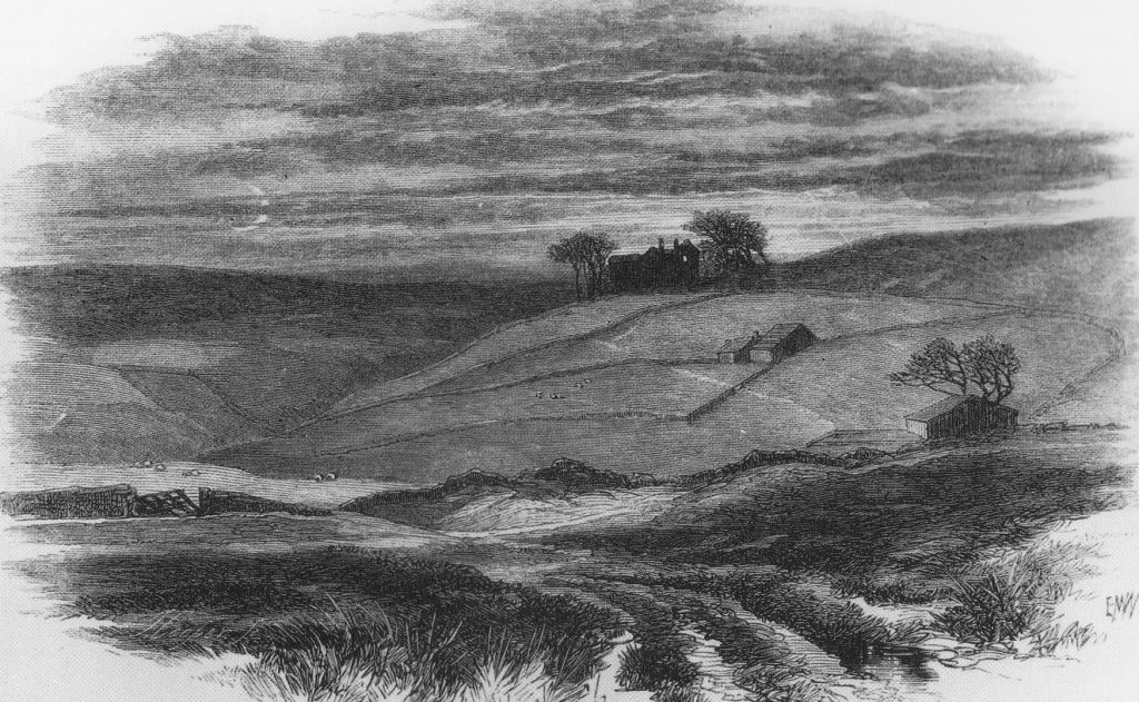
In 1567 an area of sixteen acres of land upon the Pennine hills known as ‘Wythens’ was sold by Thomas Crawshaye and his sister Anne to a George Bentley, who subsequently passed the ‘Wythens’ on to his descendant William Bentley. Bentley had three sons; Luke, Martyn and John between whom the land was divided into three farms known as Top, Middle and Near Withens. The change in spelling of the name is a common feature of the farms throughout their history, the original deeds to the land having given the name as ‘Wythens’, but the 1852 six inch to one mile map of the Haworth gives the name as ‘Withins’, as does the current Ordnance Survey map, last printed in 2008. However, ‘Withens’ is also in common usage as indicated on William Edmondson’s photograph of ‘Top Withens’ dated 1895 which shows the moor top dwelling as a working farm, complete with a gaggle of white geese. Such variations of spelling are indicative of the transition of a pre-literate culture where oral tradition held primacy, into a culture dominated by administrative literacy.
The etymology of the name ‘Wythens’ holds particular interest for me because the particularly homogenous council estate to the south of Manchester on which I grew up was known as Wythenshawe[vi], so named after the 16thCentury timber framed house and associated parkland, once home to the Tatton family and now owned by Manchester City Council. The teachers of my primary school, which bore the emblem of a weeping willow, would often instruct that the etymology of ‘Wythen-shawe’ is old English, meaning a coppice of willow trees[vii]. The implication here is that the correct form is indeed ‘Wythens’ as indicated by the original deeds, but whether or not there is any association between the three Pennine farms of the Sladen Valley and the growth of willow, is unknown. The two remaining trees which have stood faithfully beside Top Withens throughout the twentieth century, loyal partners isolated in a sea of moorland grasses and heather, are in fact Sycamores.
The ruins of Top Withens from the Pennine Way
By 1813 Top Withens was owned by a John Crabtree, who leased the farm to Jonas Sunderland, who eventually bought the property and passed it on to his son, also Jonas. During the time of the Brontë sister’s excursions onto Haworth Moor, Jonas had married and had three children: John, James and Ann. The income of the farm came from livestock on pasture, the associated dairy produce and was also supplemented by handloom weaving, as the income from such a small holding alone was unlikely to be sufficient to keep the family. It is tempting then to imagine the Brontë sisters calling upon the Sunderlands as they took their daily perambulations upon the moor. The author Glen Hughes in his fictionalised biography Brontë took this idea a step further and imagined the Brontë children taking refuge from that September Storm and its associated landslip in the relative safety of Top Withens.
“The darkened cottage – the firelight and rushlights flickering – with its flagged floor, its rough, stone fireplace under the rack of drying oatcakes, was bare and severe; no rugs, but a scrubbed table, wooden chairs, crude pots and wooden spoons. Pat Wainwright and Nancy were sitting by the fire, with Tom and Mary Sunderland, and their two smaller children. At one side of the fireplace, Mrs Sunderland was praying, the huge shut bible, with its brass clasp fastened, on her lap.”[viii]
It was Ellen Nussey who, as far as is recorded, first intimated the connection between Top Withens and Wuthering Heights, the family home of the Earnshaw family. In 1872 the publishers Smith, Elder & Co had undertaken a re-print of both Jane Eyre and Wuthering Heights and had employed the artist Edward Morrison Wimperis to provide engravings to illustrate the works. George Smith wrote to Ellen asking if she might know the identity of some of the places described in the novels. Although her reply to Smith is not extant, it is clear from the resulting engravings and from a letter Smith wrote to Ellen thanking her for the information that Ellen had responded to the request. The most famous image produced by the artist is a dark and brooding, moonlit scene of the view from below Scar Hill showing the three Withens farms, the third, most elevated and most remote having been transformed into the “large jutting stones” of Wuthering Heights. Thus established, the association began to burrow its way into the popular consciousness.
Lithograph of Wuthering Heights by Edward Wimperis 1872, suggestive of the location of the Top, Middle and Lower Withens farms.
Commentators draw on at least two other contenders for the inspiration of Wuthering Heights. The first is High Sunderland Hall, a large manor house, which until the 1950’s stood in parkland to the north of Halifax and which Emily is thought to have visited during her time as a teacher at Law Hill School. The description of Wuthering Heights at the opening of the novel in which Mr Lockwood sees “a quantity of grotesque carvings lavished over the front” and “a wilderness of crumbling griffins, and shameless little boys” is thought to have been inspired by the seventeenth century stately home. However, an examination of the text shows that the descriptions of the interior of Wuthering Heights in the novel are not those of a large ancestral manor house, but rather of a less substantial farm building. Indeed, ‘the Heights’ are often referred to in the text as being a farmhouse. In the letter Isabella Linton sends to Ellen Dean following her elopement with Heathcliff, she writes:
“The sun set behind the Grange, as we turned on to the moors; by that, I judged it to be six o’clock; and my companion halted half-an-hour, to inspect the park, and the gardens, and, probably, the place itself, as well as he could; so it was dark when we dismounted in the paved yard of the farmhouse, and your old fellow servant, Joseph, issued out to receive us by the light of a dip candle.”[ix]
Joseph, the acerbic servant is often described as retreating to his garret, a feature far likely to be found in the Pennine farms of the Sladen Valley than in a stately manor close to the centre of Halifax and, in the first chapter, as Lockwood enters the building he describes a single room reaching to the very roof.
“One step brought us into the family sitting-room, without any introductory lobby, or passage; they call it here ‘the house’ pre-eminently.” Lockwood continues, “One end, indeed, reflecting splendidly both light and heat, from ranks of immense pewter dishes, interspersed with silver jugs and tankards, towering row after row, in a vast oak dresser, to the very roof. The latter had never been underdrawn, its entire anatomy laid bare to an inquiring eye, except where a frame of wood laden with oatcakes, and clusters of legs of beef, mutton, and ham, concealed it.”[x]
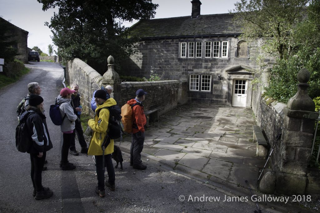
The above is no description of a manor house, but may be the description of Ponden Hall, a substantial farmhouse, also built in the seventeenth century, located below Ponden Clough on a spur of land that now extends into Ponden Reservoir. The Brontë children often visited Ponden Hall to make use of the extensive private library which was housed there and the oak beamed rooms of its interior may have fired Emily’s imagination. Certainly, it was here that Emily encountered an upper chamber with a small, latticed window, enclosed by the frame of a box bed[xi].
Ponden Hall
Perhaps most convincingly, again and again Emily Brontë, describes Wuthering Heights as a hilltop dwelling rather than the parkland setting of High Sunderland Hall.
“Pure, bracing ventilation they must have of it up there at all times, indeed: one may guess the power of the north wind, blowing over the edge, by the excessive slant of a few stunted firs at the end of the house;”[xii]
“On that bleak hill-top the earth was hard with black frost, and the air made me shiver through every limb.”[xiii]
“heaven did not seem to be my home; and I broke my heart with weeping to come back to earth; and the angels were so angry that they flung me out, into the middle of the heath on the top of Wuthering Heights, where I woke sobbing for joy.”[xiv]
The above powerful discourse given by Cathy to Nelly Dean makes apparent a factor that I believe is often overlooked. Wuthering Heights in not merely the dwelling in which the Earnshaws live, but the whole area of moorland about their farmhouse. This is also true of the Withens farms. The 1852 six inch to one mile map gives the name of the area of raised moorland immediately to the west of Delf Hill, below which Top Withens sits, as ‘Withens Heights’. This association of name is for me far more than coincidence, especially given that ‘Wuthering’ is a Yorkshire dialect variant of the Scottish dialect ‘Withering’. The novels of Sir Walter Scott were particular favourites of Emily’s, and Scott often used the devise of country dialect in his novels, particularly in the character of Andrew Fairservice in the novel Rob Roy.
Withens – Withering – Wuthering!
[i]Barker, Juliet op. cit. plate section one, in the care of the Brontë Parsonage Museum
[iv]‘A sermon preached in the Church of Haworth … in reference to an Earthquake’ (Bradford, T. Inkersley, 1824), in the care of the Brontë Parsonage Museum.
[v]Leeds Mercury, 11 September 1824, pp3, qu. in Atkins, William (2014) The Moor, pp176, Faber & Faber Limited.
[vi]‘was’ as the Wythenshawe estate has subsequently been divided up into numerous housing associations and private developments.
[vii]Deakin, Derick 1989 ‘Wythenshawe: the story of a garden city’pp.4