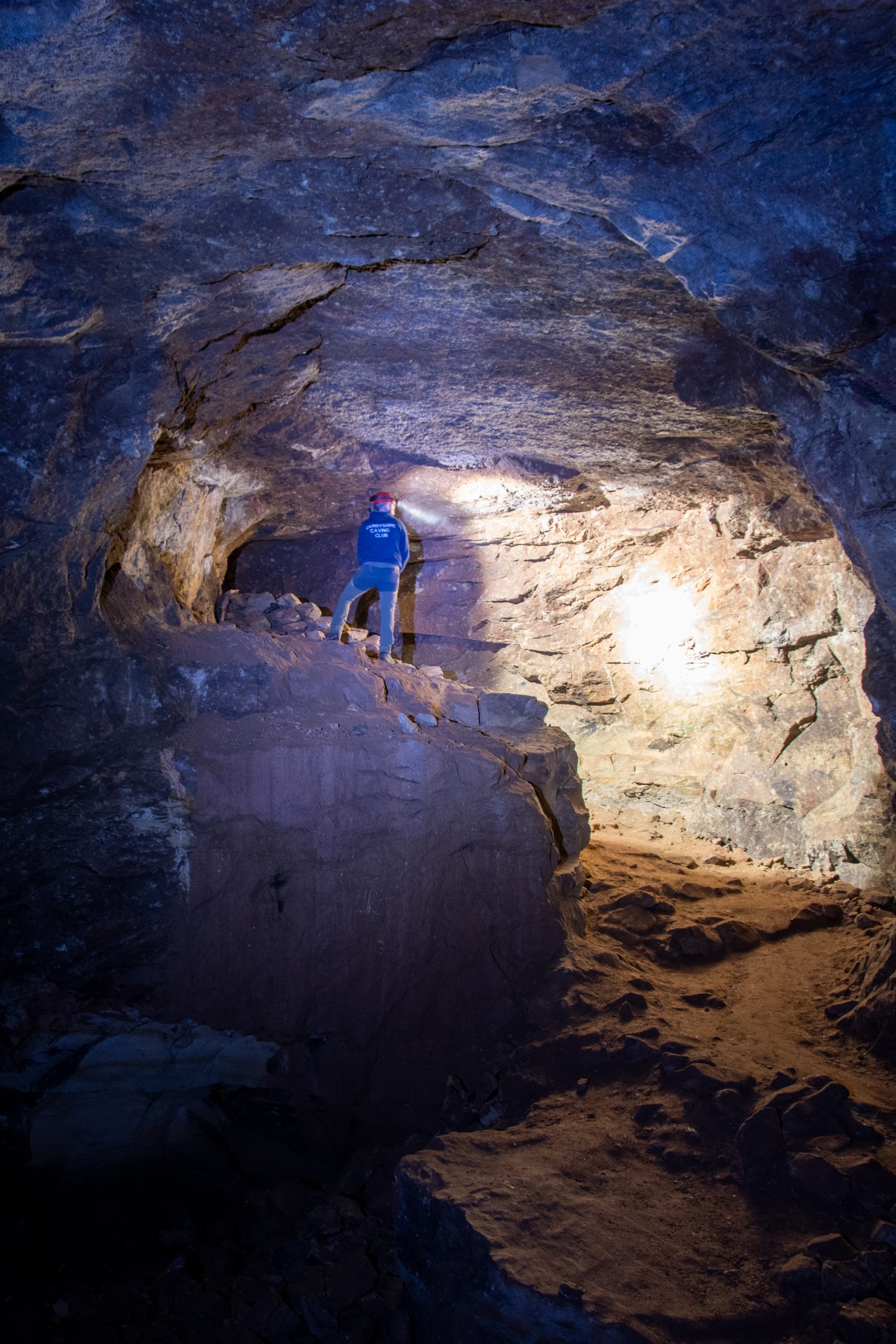
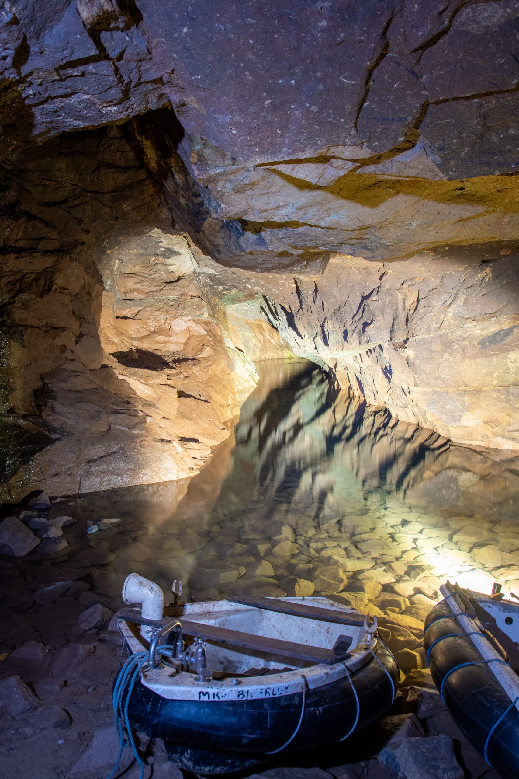


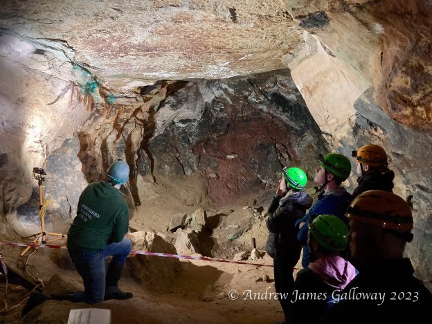
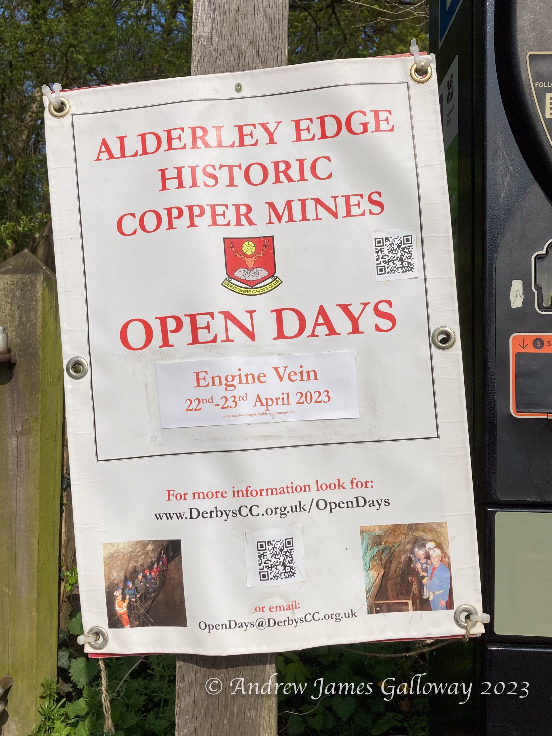
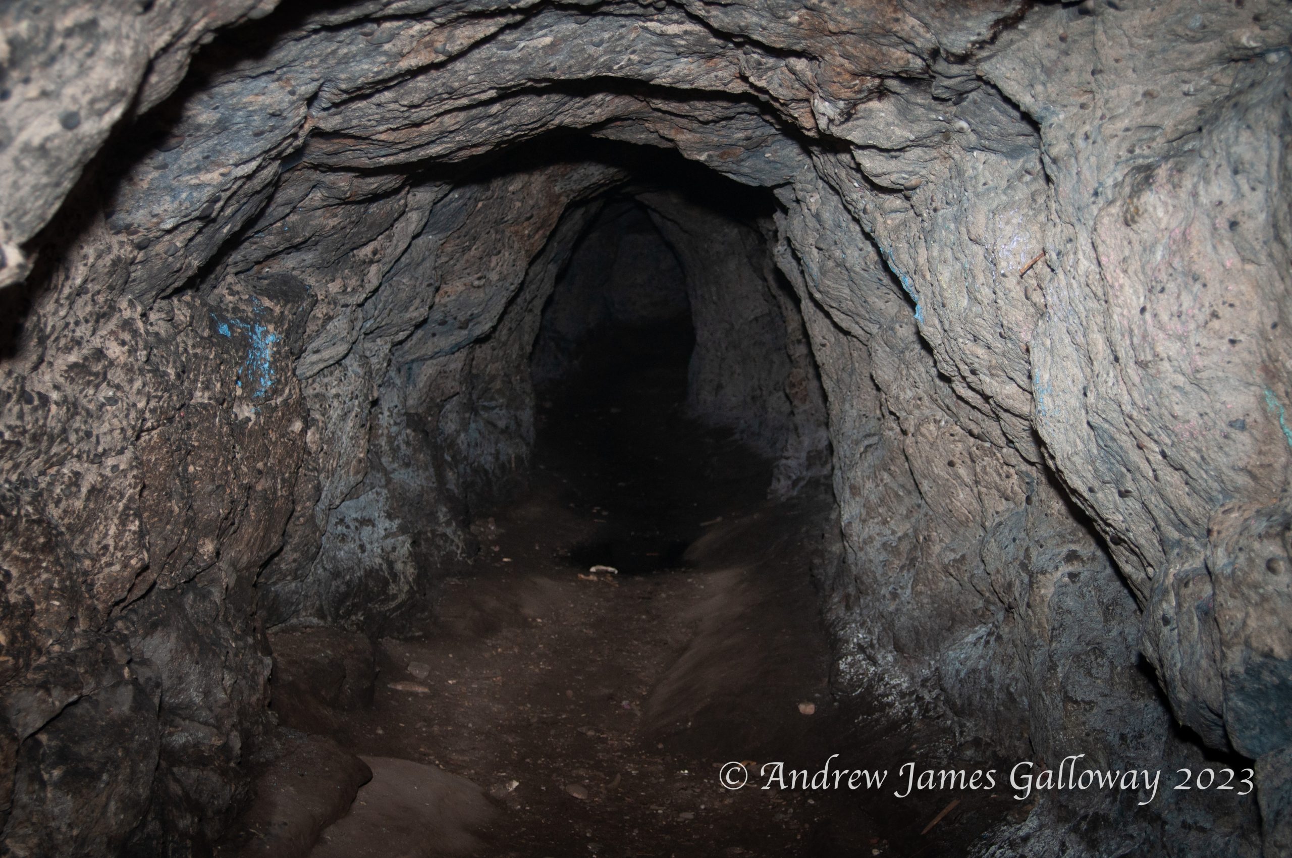
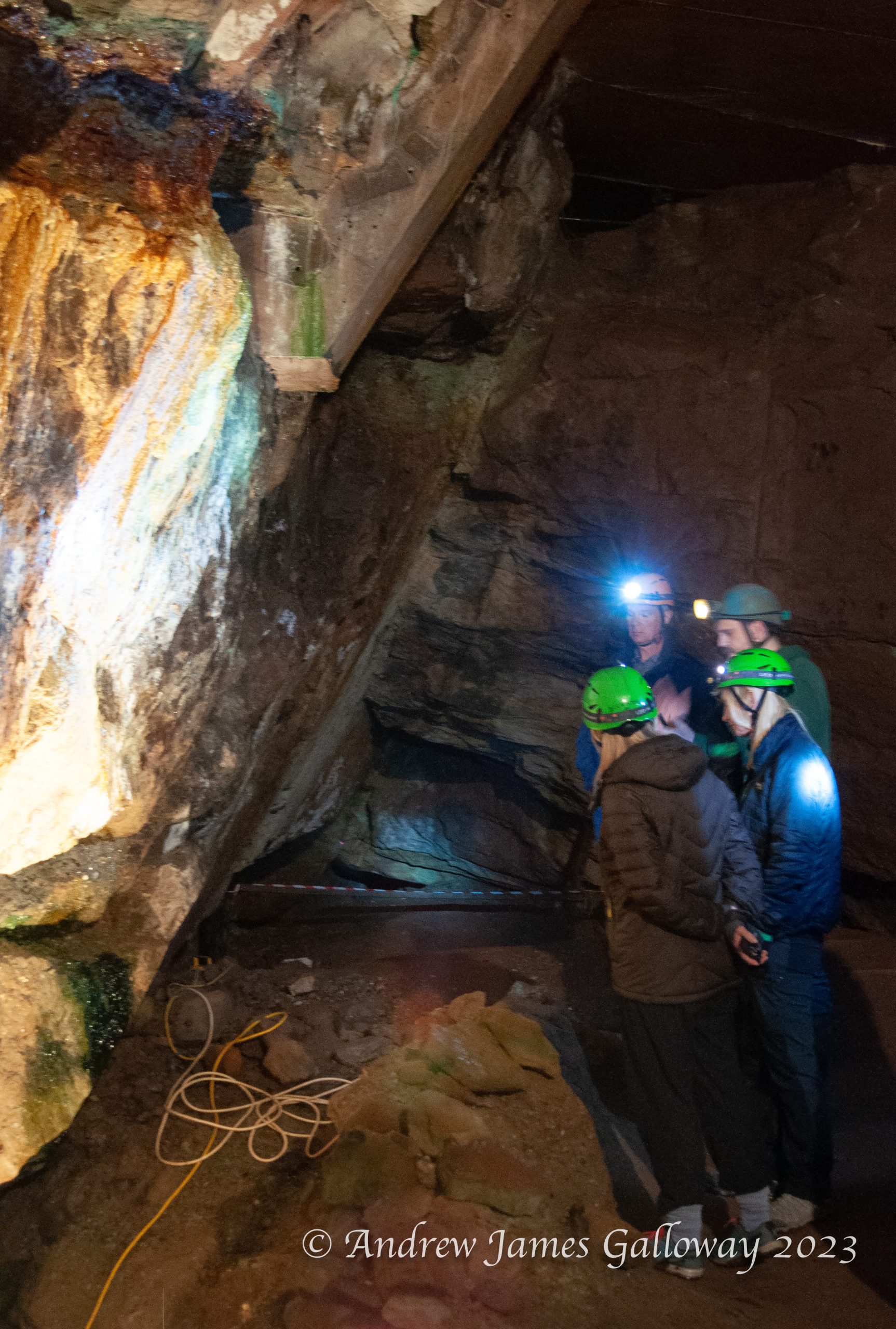
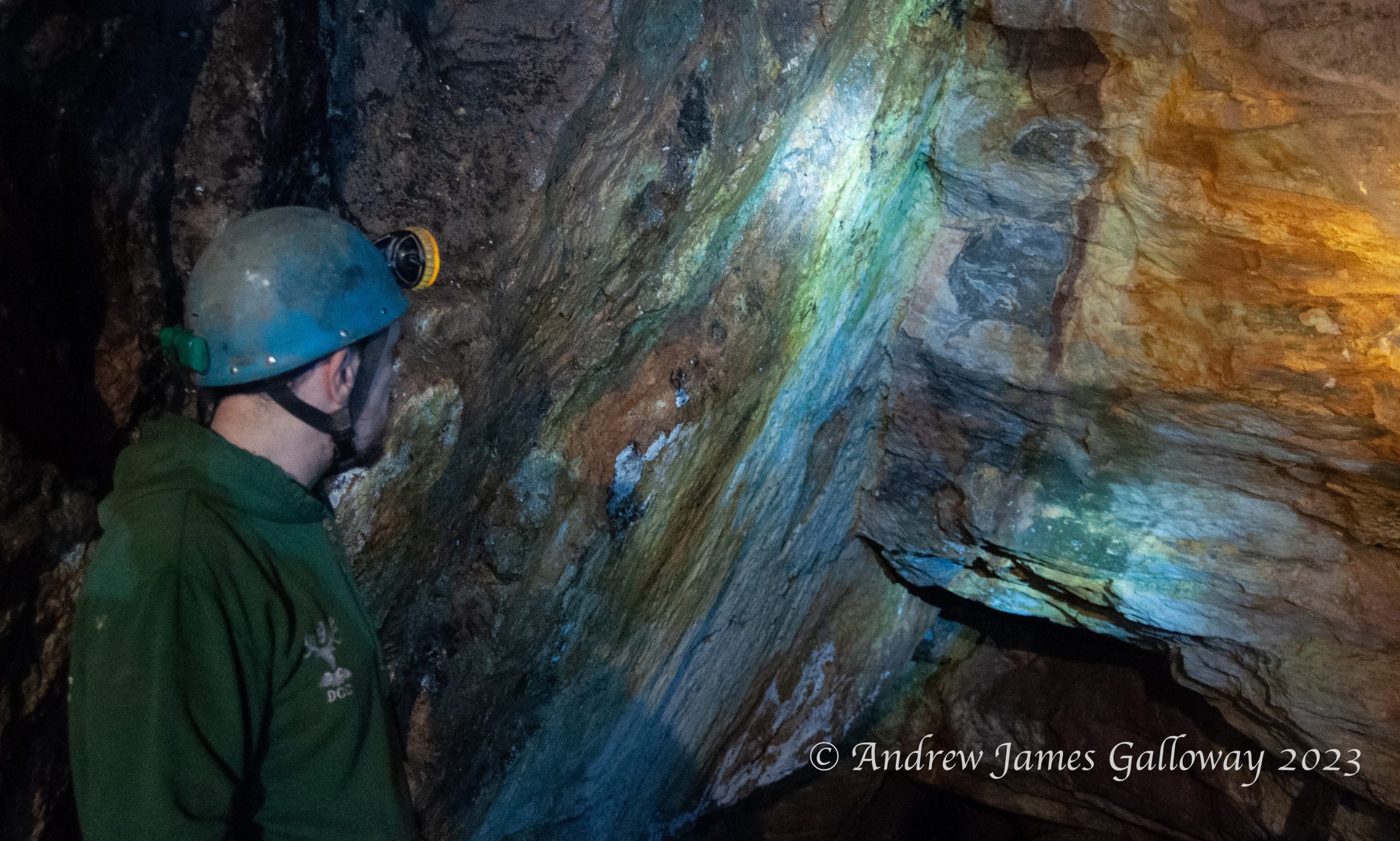
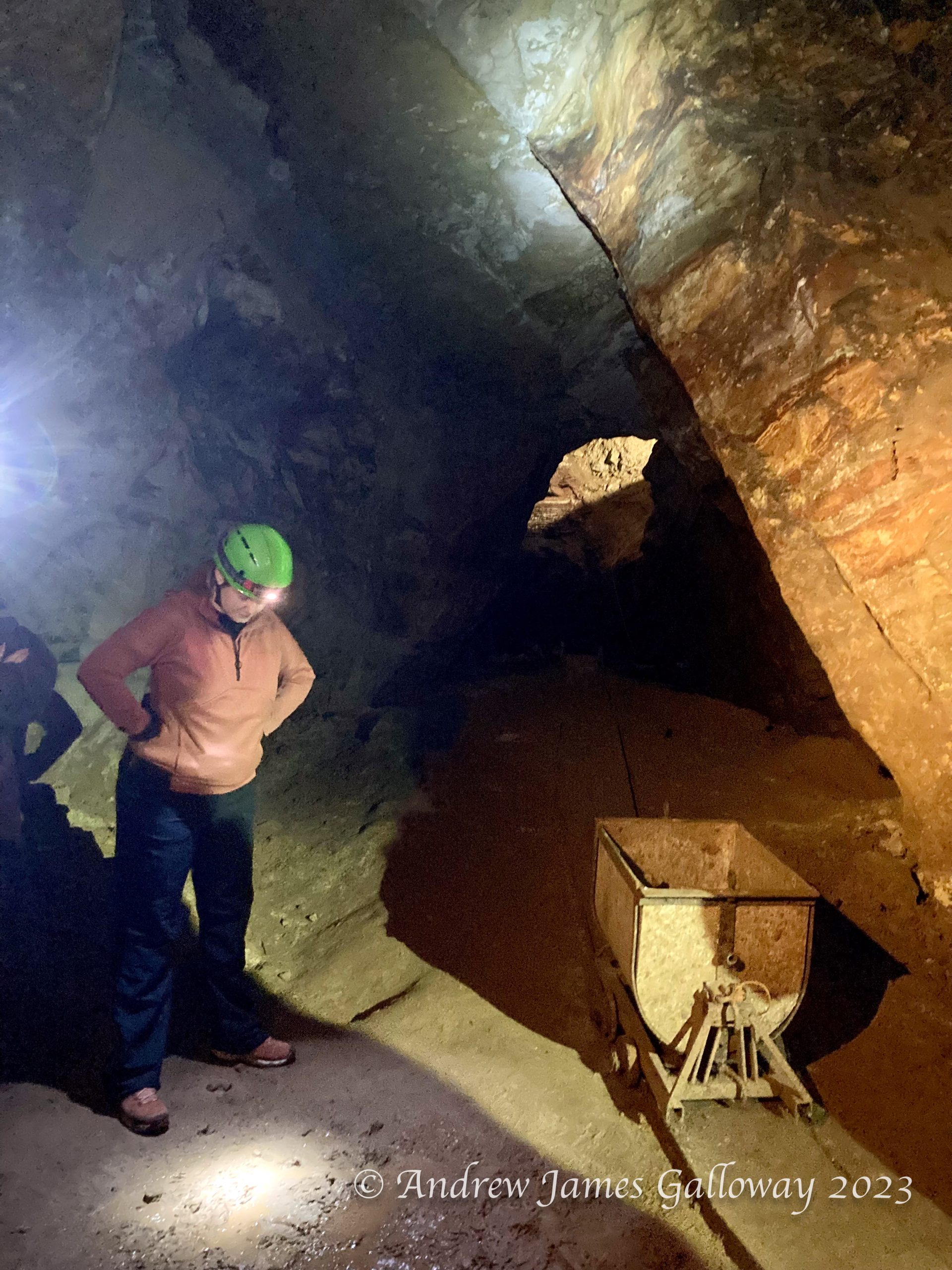
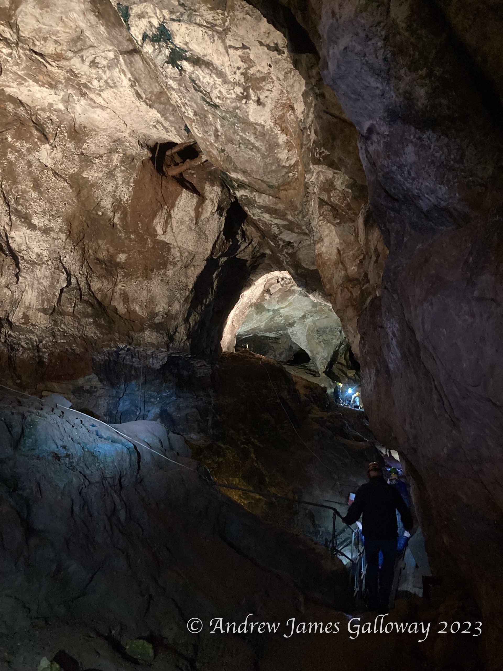
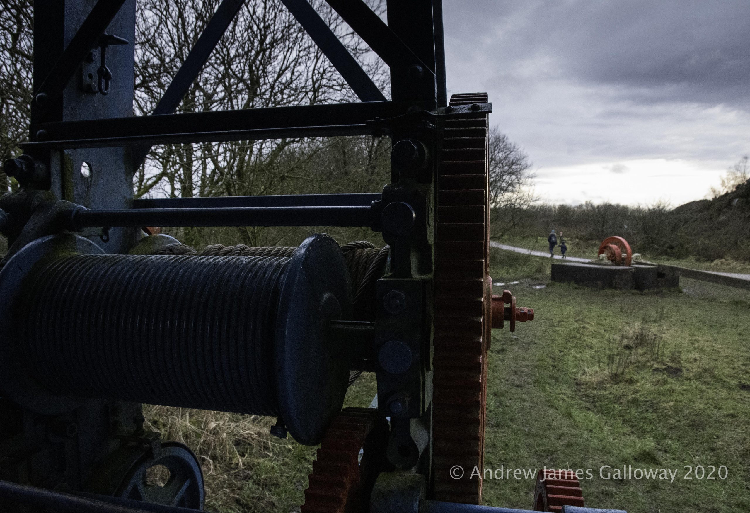
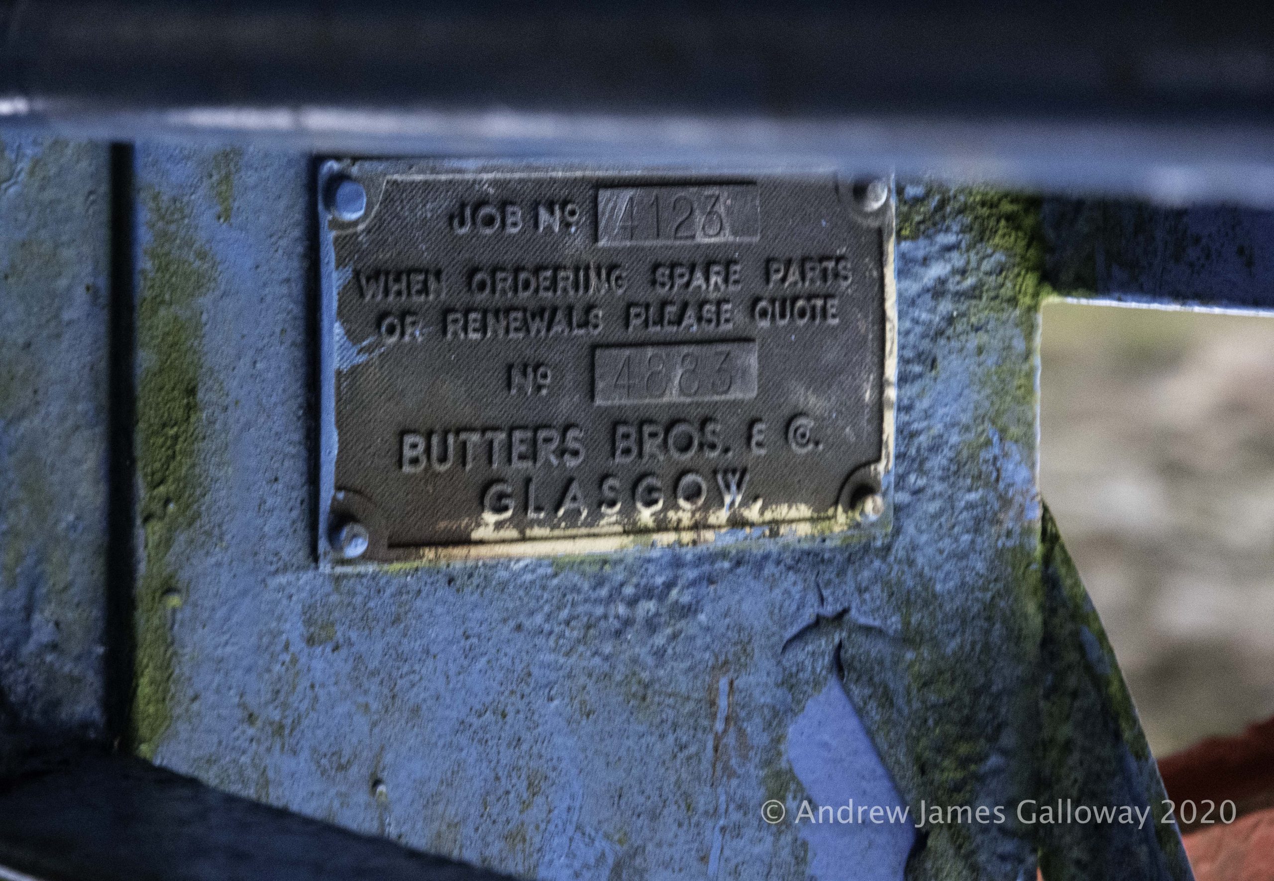
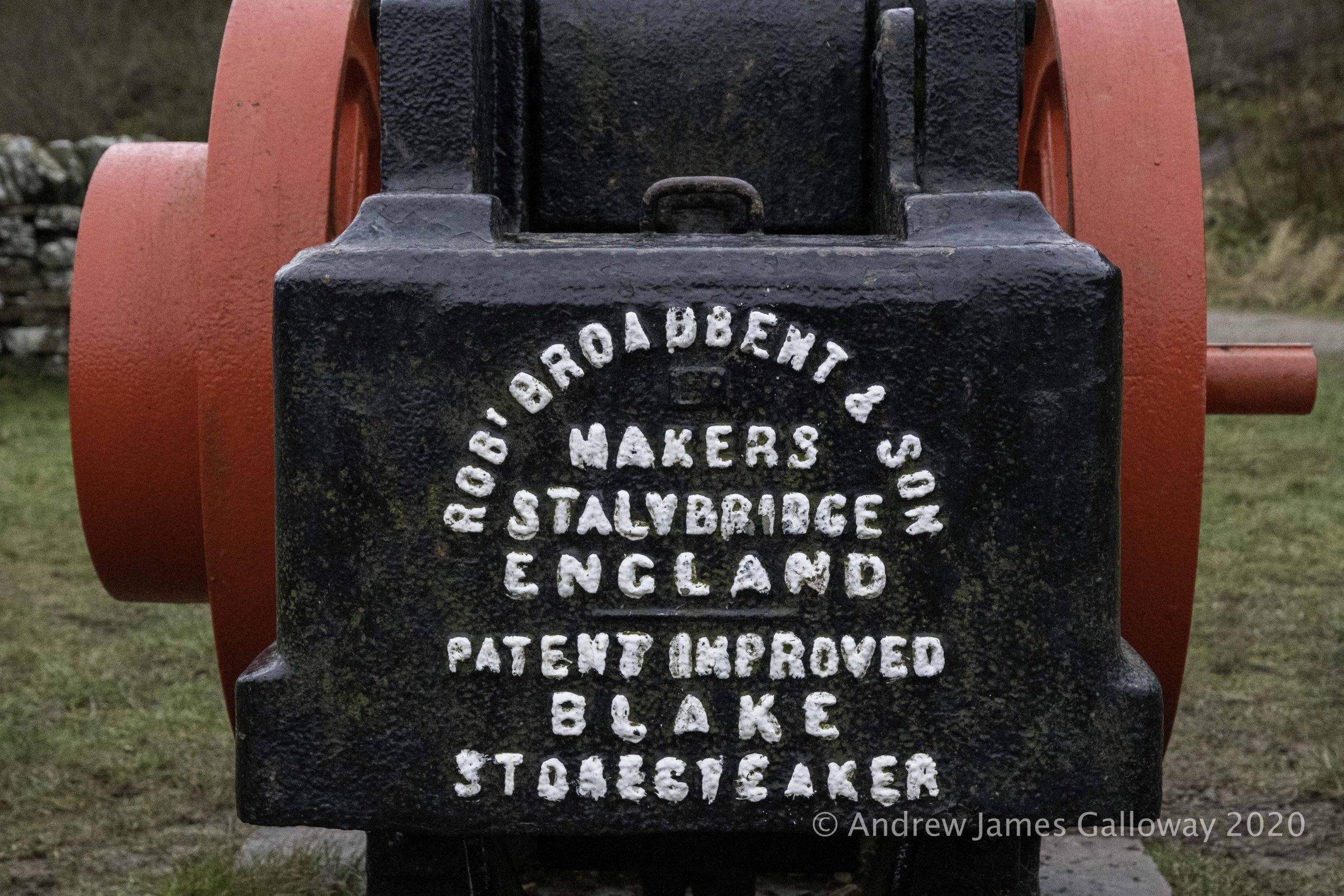
Twice a year the Derbyshire Caving Club (DCC) open up one of the old mines at Alderley to visitors. It’s a great opportunity to experience some of the history of mining at Alderley and to get a glimpse of the extent of historic excavations. I went along to reacquaint myself with subterranean Alderley and to take some photographs.


The sandstone escarpments of Alderley Edge, as distinct from the residential town, have been described by the relatively recent Alderley Edge Landscape Project (AELP) as “an anthropogenic landscape, of remarkable richness, rarity and antiquity”. The AELP was a co-operative undertaking of The National Trust and The Manchester Museum at the University of Manchester, conceived in 1995 and formally wound up on 2005. Further information about the project can be found on the DCC website at https://www.derbyscc.org.uk/alderley/current_aelp.php
Geologically, the Alderley escarpment is composed of Triassic conglomerate sandstones some 240 million years old that were laid down in an arid environment prone to flash floods, which brought down debris from the surrounding mountainous areas, rich in mineral deposits. The earliest evidence of mining at Alderley dates to the Bronze Age. The main ore extracted was copper, but cobalt, iron, lead, silver and even gold were also found. In their book Prehistoric Cheshire, Victoria and Paul Morgan recount how an oak shovel found by 19th Century miners in a section of mine at Brynlow to the south west of Engine Vein, has been radiocarbon dated to approximately 3,700 years old. A large number of stone hammer heads and similar tools were also discovered in material that had been used to backfill the open cast mine.
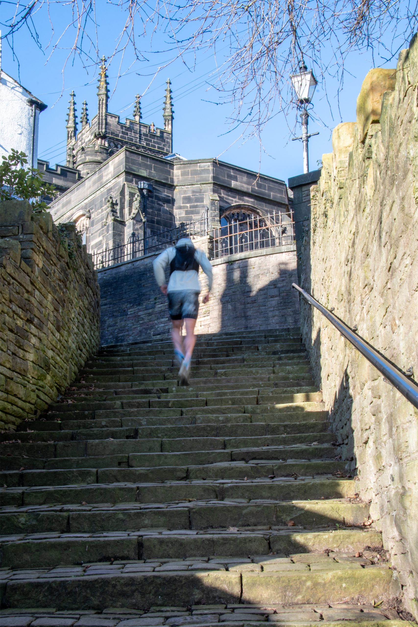
In the depths of winter lockdown, with gyms & health centres closed, two friends decided to take matters into their own hands.
Summer was a blast! With an early finish from work I could be up on the hills to the east of Manchester before half the city below had finished eating their tea, as the evening meal is often referred to in these parts, with a good three to four hours of daylight remaining.
But as the season drifted inexorably towards autumn the once warm evenings became shorter and cooler. I felt the darkness closing in around me like a pack of hounds circling a fox. With gyms and swimming pools closed there seemed little alternative, and I imagined myself gaining weight, and losing what fragile grip on sanity I had, as the sedentary months of winter stretched before me.
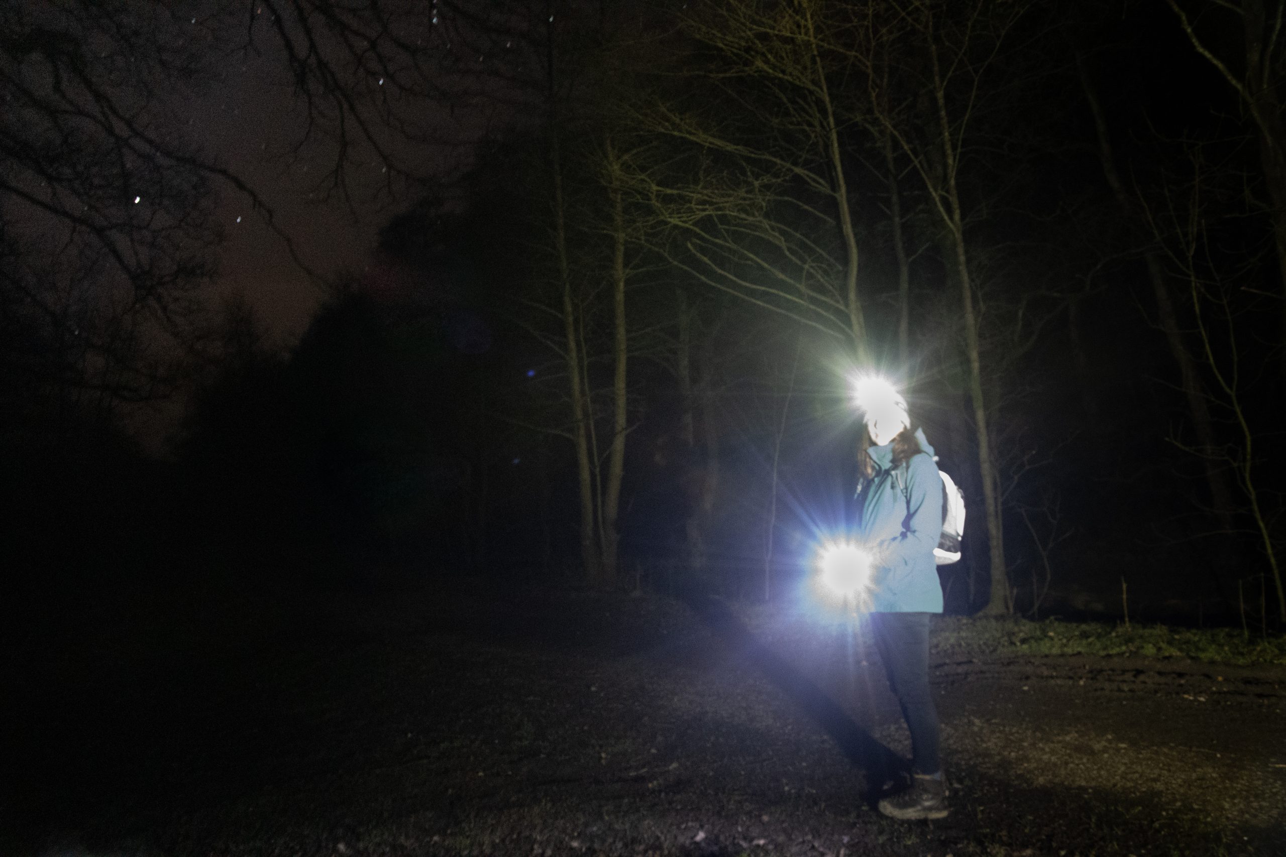
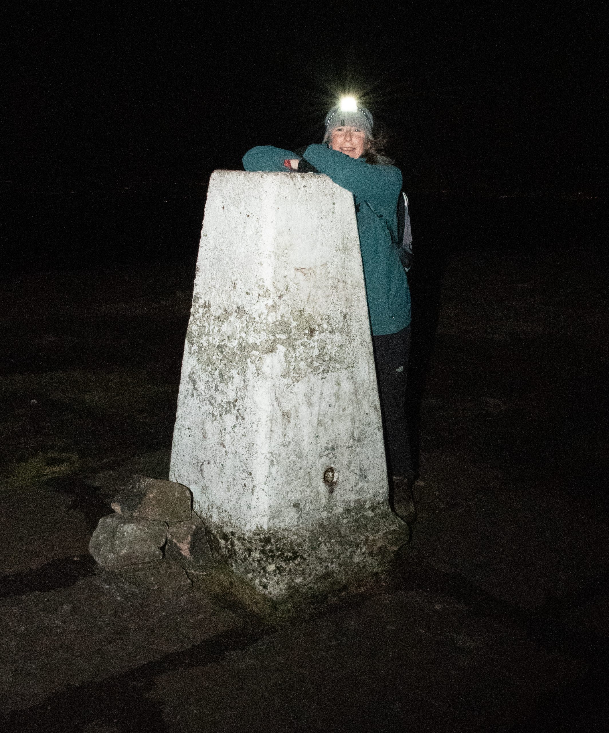
It was Alison who came to the rescue, suggesting a short twilight walk by the River Bollin. When we met at the National Trust car park the last embers of the day and familiarity of the location meant that use of head-torches was a choice rather than a necessity. As we wandered through the crepuscular woodland, the smell of bonfires and cordite upon the air, Alison mentioned she had been doing some research on local trails. She suggested we attempt to complete some of the trails in sections. And so every Tuesday evening after work we set out with head torches and ample supplies of batteries, into the darkness on the edge of town.
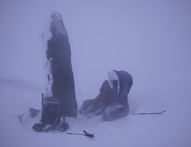
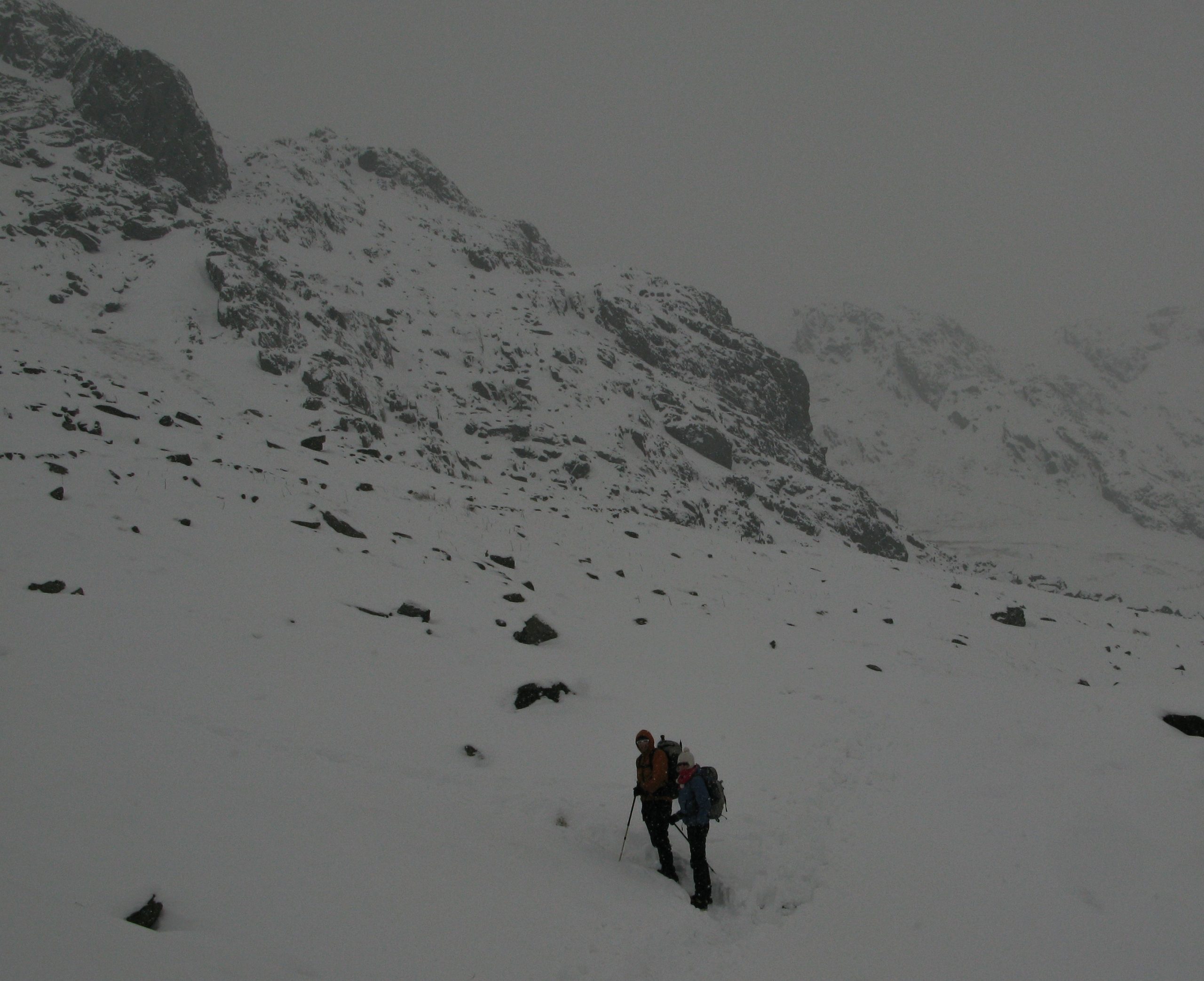
When it comes to nocturnal perambulations, Alison and I have form. Some years ago I learned there was to be a lunar eclipse on the winter solstice. For some reason lost to me now I decided it would be a great idea to observe the celestial phenomenon from the summit of Snowdon. In my imagination I had pictured a pleasant afternoon stroll to the summit in perfect conditions, returning to Pen y Pass beneath the Milky Way.
Almost inevitably the Welsh weather had other ideas. By four o’clock in the afternoon, with light rapidly fading, we had made it as far as the obelisk at Bwlch Glas but were at that point forced back by the icy blast of air streaming over the col. Temperatures were so far below zero that my thermos flask completely gave up the ghost, the contents turning into an icy Frappuccino. We quickly descended to Glaslyn and returned to Pen Y Pass via the Miners’ Track.
Overcoming Night-time Anxiety
The idea of walking in the dark may seem undesirable, illogical or just plain dangerous, but with a little knowledge and preparation there is no reason why the hours of darkness cannot be put to good use.
Location
For those new to night-walking I recommend starting local. The first local trail Alison and I decided to tackle was the Ladybrook Valley Interest Trail. This sixteen kilometre trail makes use of suburban green corridors that follow the Ladybrook, a tributary of the River Mersey, from Lyme Park in Disley, Cheshire to Cheadle in Greater Manchester. Walking on one evening a week and breaking the route up into circular sections it took us five weeks to compete the trail.
Next we turned our attention to the Goyt Way. Also sixteen kilometres in length the Goyt Way follows the River Goyt – another tributary of the River Mersey – from Whaley Bridge in Derbyshire to Etherow Country Park in Greater Manchester. Again we planned circular routes and completed the trail in four weeks, working our way up-stream passing through the village of Marple Bridge and the industrial town of New Mills, despite freezing temperatures and heavy snowfall.
Snow cover brings pluses and minuses for night-walking. As with daylight walking snow can hinder navigation by covering up footpaths. None-the-less, we found a blanket of white on the ground had the affect of reflecting ambient light, a considerable aid to navigation, at times rendering our head-torches redundant. Another unexpected bonus of night-walking in winter was seeing farms and villages bedecked with Christmas lights.
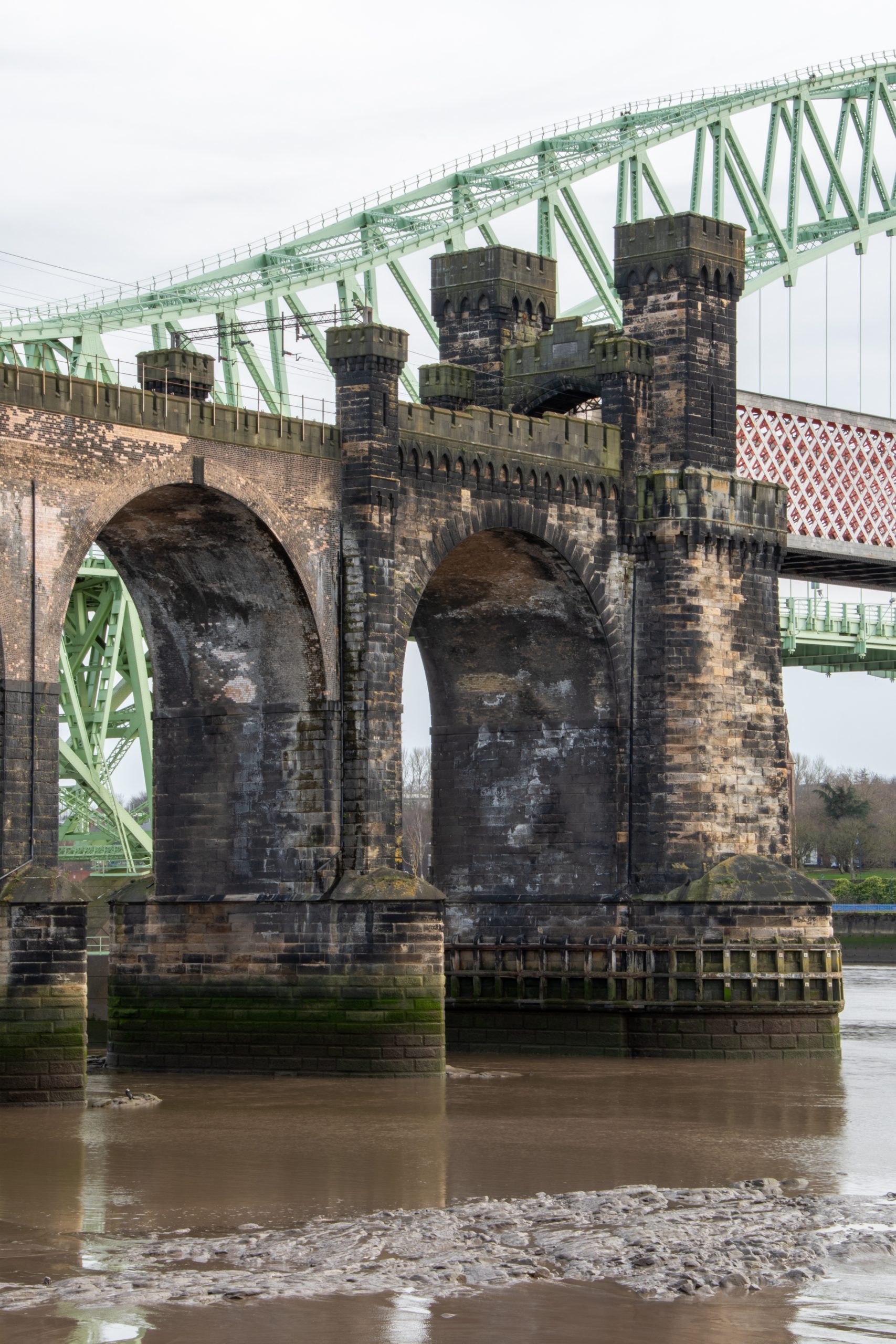
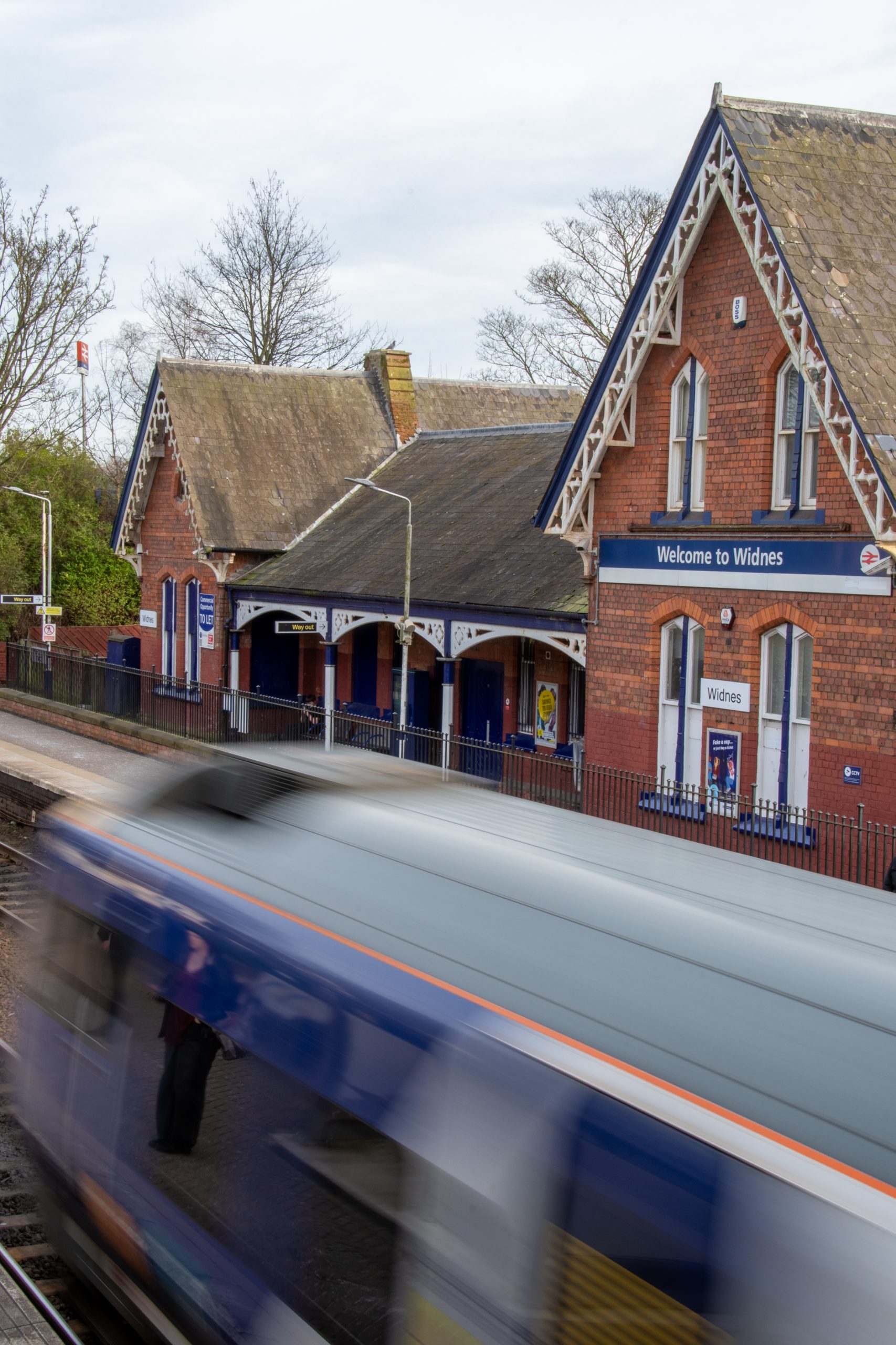
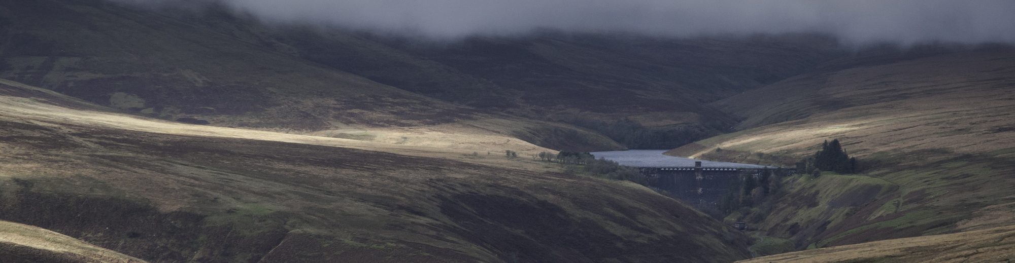
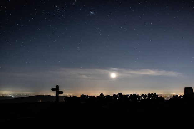
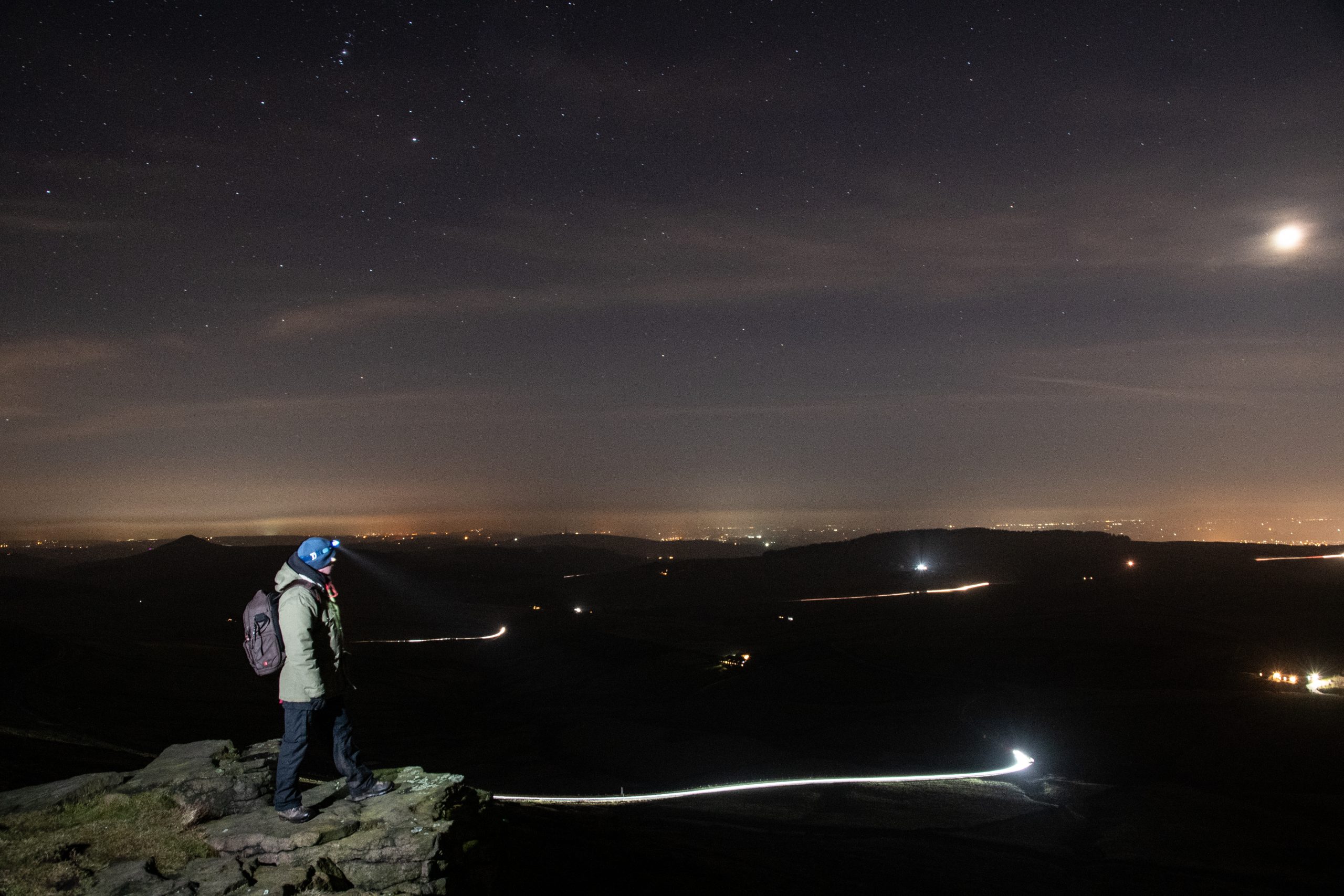
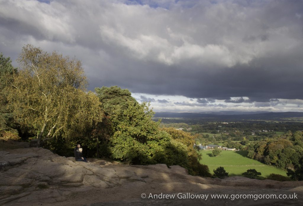
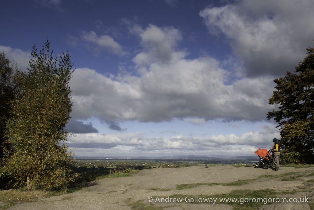
Having reached the official end of the Goyt Way at Whaley Bridge we planned additional routes to continue south into the Goyt Valley, following the former route of the Cromford and High Peak Railway to Bunsal Cob. The sodium lights of suburbia now far behind us we headed onto open moorland, traversing the ridge from Pym Chair to Shining Tor that forms the boundary between Cheshire and Derbyshire. From this vantage point, we looked down onto a million lights, spread out across Greater Manchester and the Cheshire Plain. Through the crystal clear air we could see the illuminated cooling towers at Fiddler’s Ferry Power Station, near Widnes and the distinctive chain of red lights on the television transmitter at Winter Hill, some forty miles away as the crow flies.
Navigation
The first step on the path to confident night-walking is to be confident with daylight navigation techniques. The skills used to navigate in poor weather conditions on British hills need only slight adaptation to be as effective at night.
A number of organisations offer opportunities to learn navigation skills. The National Navigation Award Scheme (NNAS) provides accreditation of over three hundred companies offering navigation training throughout the UK. There are three levels of award: Bronze, Silver and Gold. For those wishing to gain a broader understanding of hill walking, Mountain Training UK & Ireland offer a range of accredited courses and awards. In addition to navigation techniques, Mountain Training courses cover aspects such as walk planning, clothing and equipment, weather, hazard & emergency procedures and environmental awareness. Some of these training courses have specific night navigation content. I would recommend this programme for anyone who is looking to be a walking group leader. For up-to-date information check the NNAS and Mountain Training websites.
Map or GPS?
For a long time I was something of a Luddite with regard to GPS technology, but here we are in the third decade of the twenty-first century, equally cursed and blessed with hand-held devices. I have to confess that much of the navigation on our evening walks was aided by one or two apps on our phones, specifically Viewranger (now known as Outdooractive) and the OS Maps app. However, I would be failing in my duty if I did not offer a strong warning about over dependency on GPS devices. Batteries, specifically lithium batteries, do not perform well in cold weather conditions. As most smart phones are powered by integrated power sources, carrying a spare is not an option. Portable power banks provide some security but it is worth considering that any device might become inoperable in freezing temperatures. You cannot beat having the back up of a paper map and compass.
Light Source
I’ve stressed the importance of carrying a map and compass as back-up for GPS devices, but without a light source a map is unreadable. In order to leave your hands free I recommend using a good quality head torch. However, even modern LED light sources can suddenly die, as happened to me on one of the sections of the Goyt Way. Therefore, not only should you carry spare batteries for your primary light source, but also carry at least one other light source as back up. Most importantly, do not rely on the torch on your phone. If you are using a GPS app on your phone to navigate and the torch to provide a primary light source the battery will deplete in minutes rather than hours.
As exciting as night walking can be, it is important to keep in mind that you are not on manoeuvres with the SAS and as such it is vital that you are visible to others, particularly when making use of country roads. Small, portable lights can easily be attached to clothing and rucksacks. I have found the Silva Simi range, available in white (for front) and red (for rear) particularly useful for this purpose.
Clothing
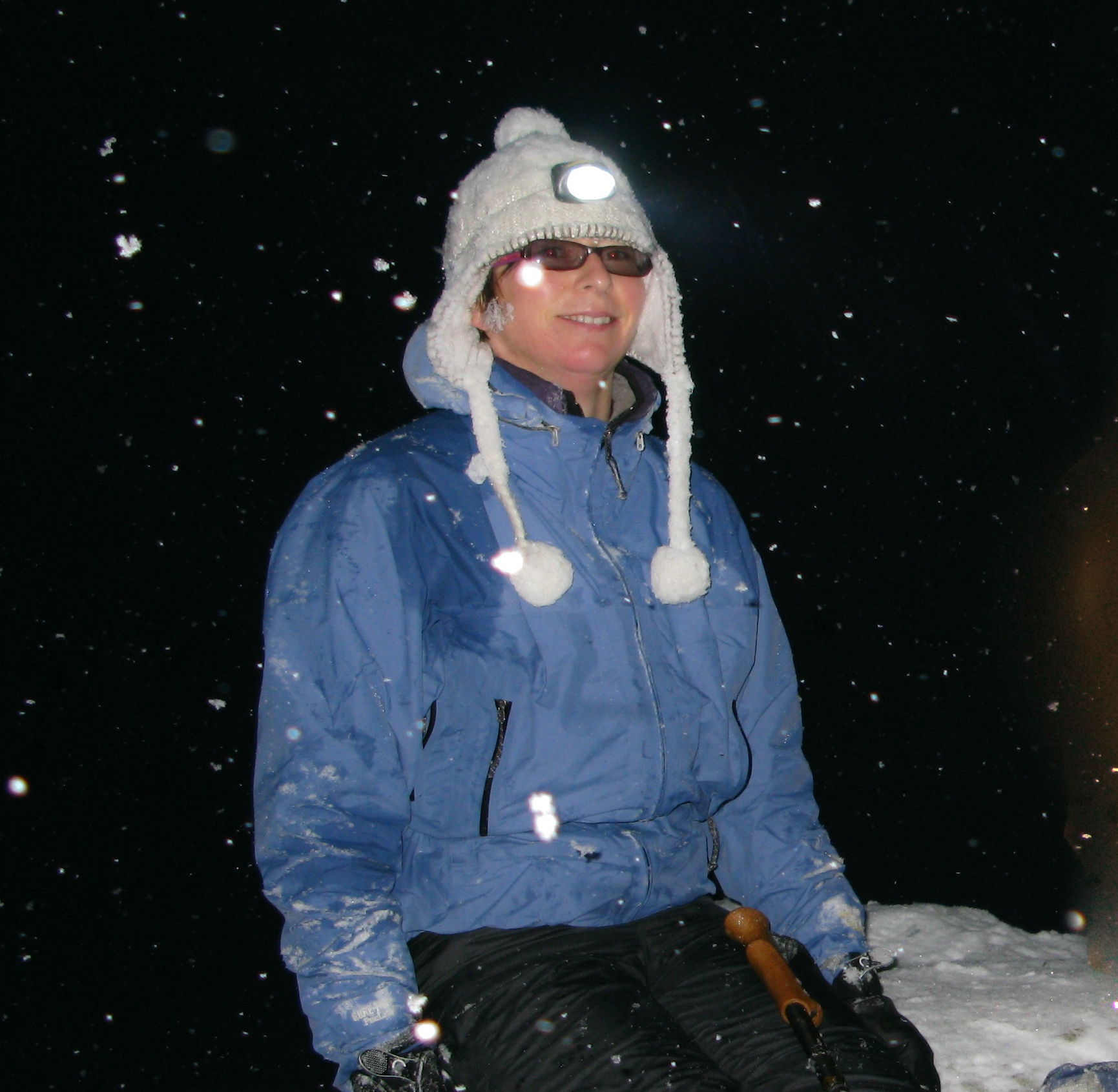
It will come as no surprise that at any time of year the absence our primary heat source means that nights are invariably several degrees cooler than the daytime. This is especially so in winter when night temperatures regularly fall below zero. The importance of keeping warm cannot be overstated. Traditional advice about base, middle and outer-shell layers certainly applies here. I also recommend carrying additional layers of clothing in your rucksack. Duvet gilets are particularly good for maintaining core temperature and can easily be worn over a waterproof jacket. Similarly, do not rely on only one pair of gloves. Even in thermal gloves, fingers can rapidly become numb when exposed to minus temperatures and wind chill. A pair of oversized woollen mittens slipped over the gloves will quickly return heat to the extremities.
Spring Again
Winter was a blast! With increasing confidence of walking in darkness we had taken on the trails and bridleways of the western Peak District and had stood on snow covered hill tops looking down onto the shimmering lights of the conurbation below.
Our weekly nocturnal wanderings had become something of a harbour in the tempest, a focal point in an otherwise dismal and at times seemingly interminable winter. As the days began to lengthen and the last patches of snow melted from the groughs of Kinder Scout, we considered bringing things to an appropriate end. But on reflection there was no logical reason to do so, and our weekly night-time walks became sunset walks. That’s the really amazing thing about the seasons: the cycle just keeps going round and round.
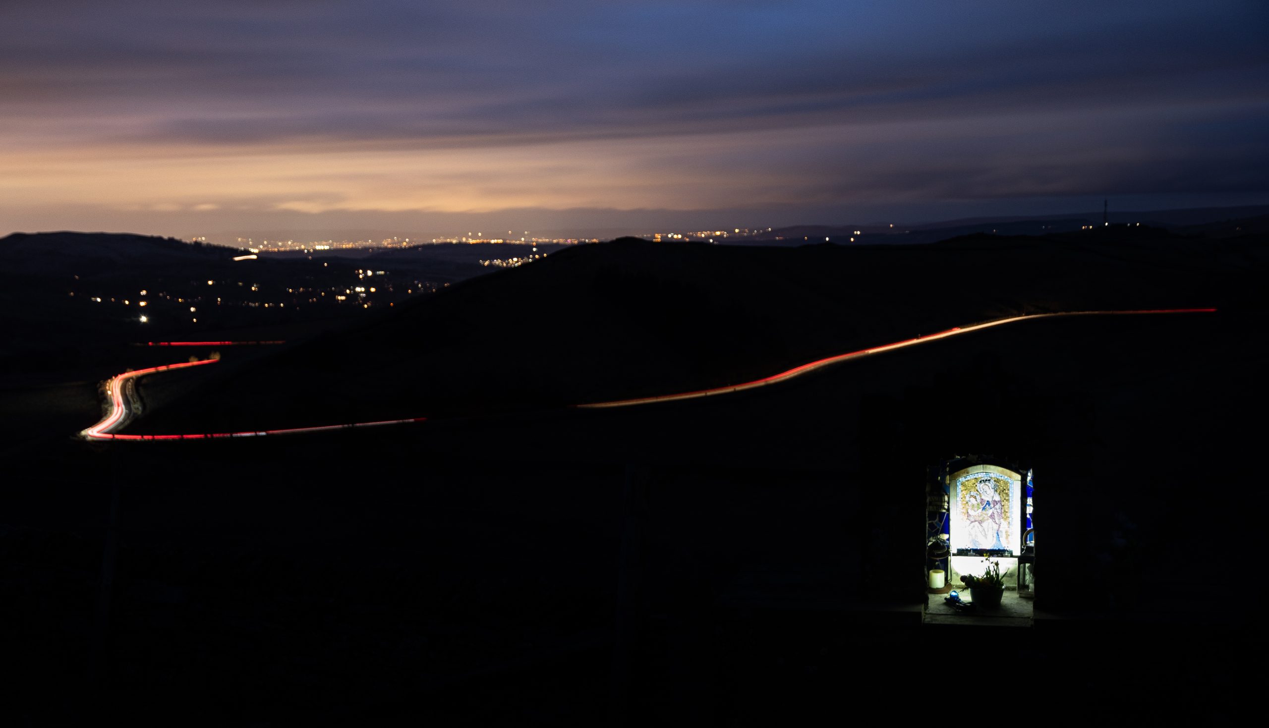
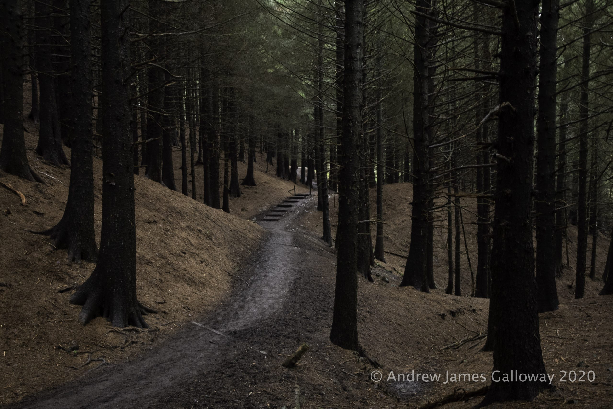
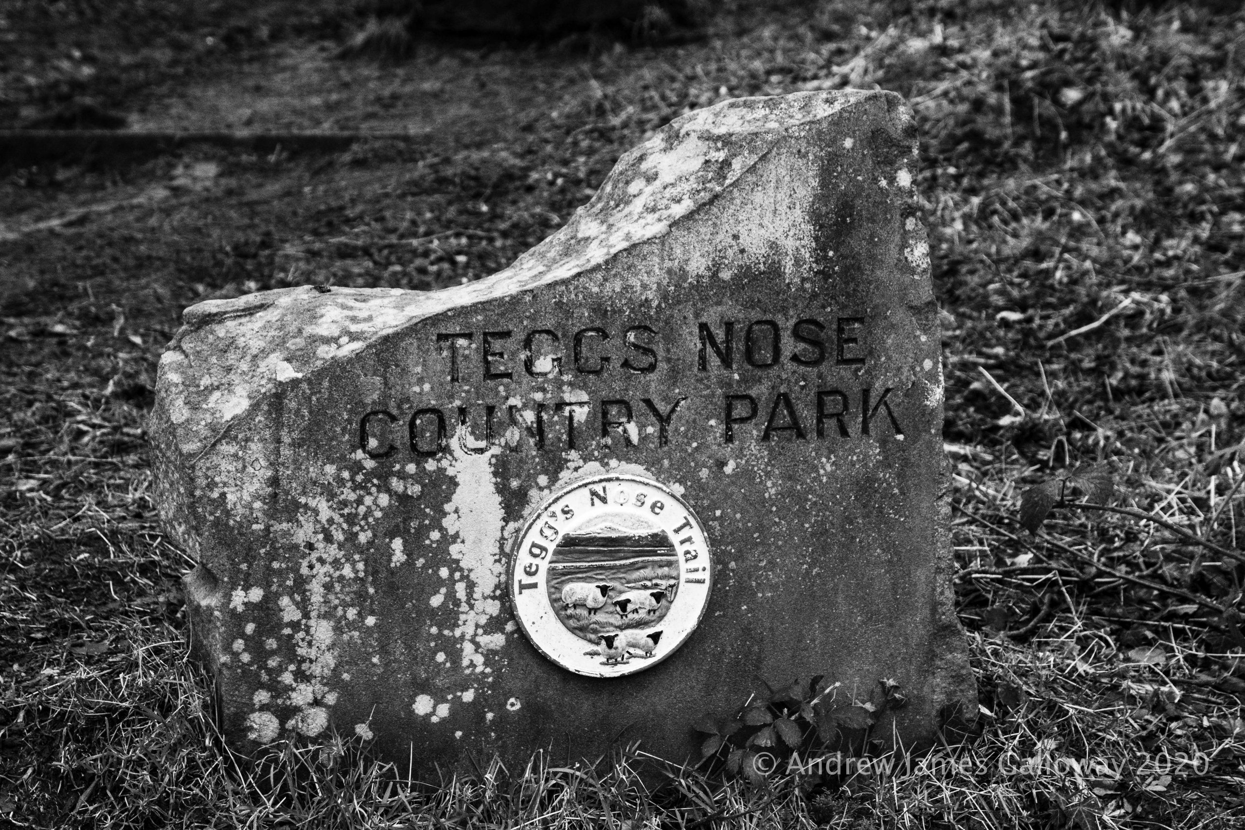
It has become something of a Boxing Day tradition to walk from Tegg’s Nose Country Park, through Macclesfield Forest, to visit St Stephen’s Church, also known as the Forest Chapel. Walking through the forest on the day after Christmas Day the traditions of centuries hang heavy in the air as the tamarisk mosses hang from the naked limbs of the trees.
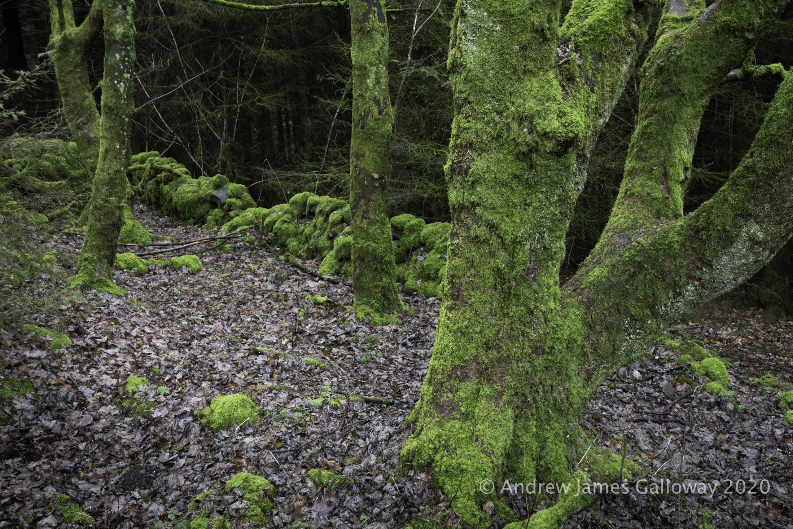
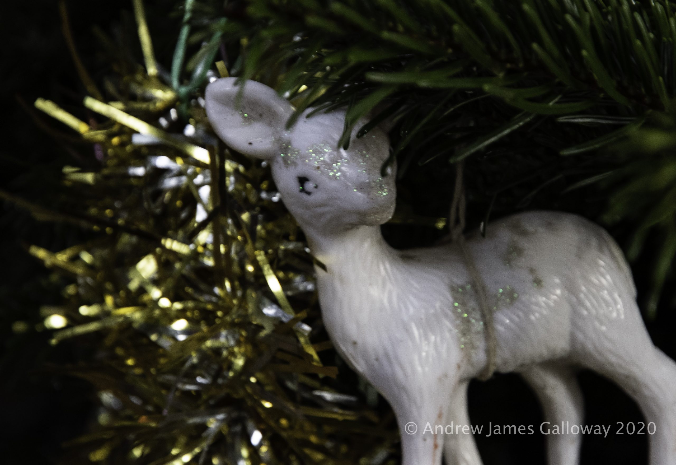
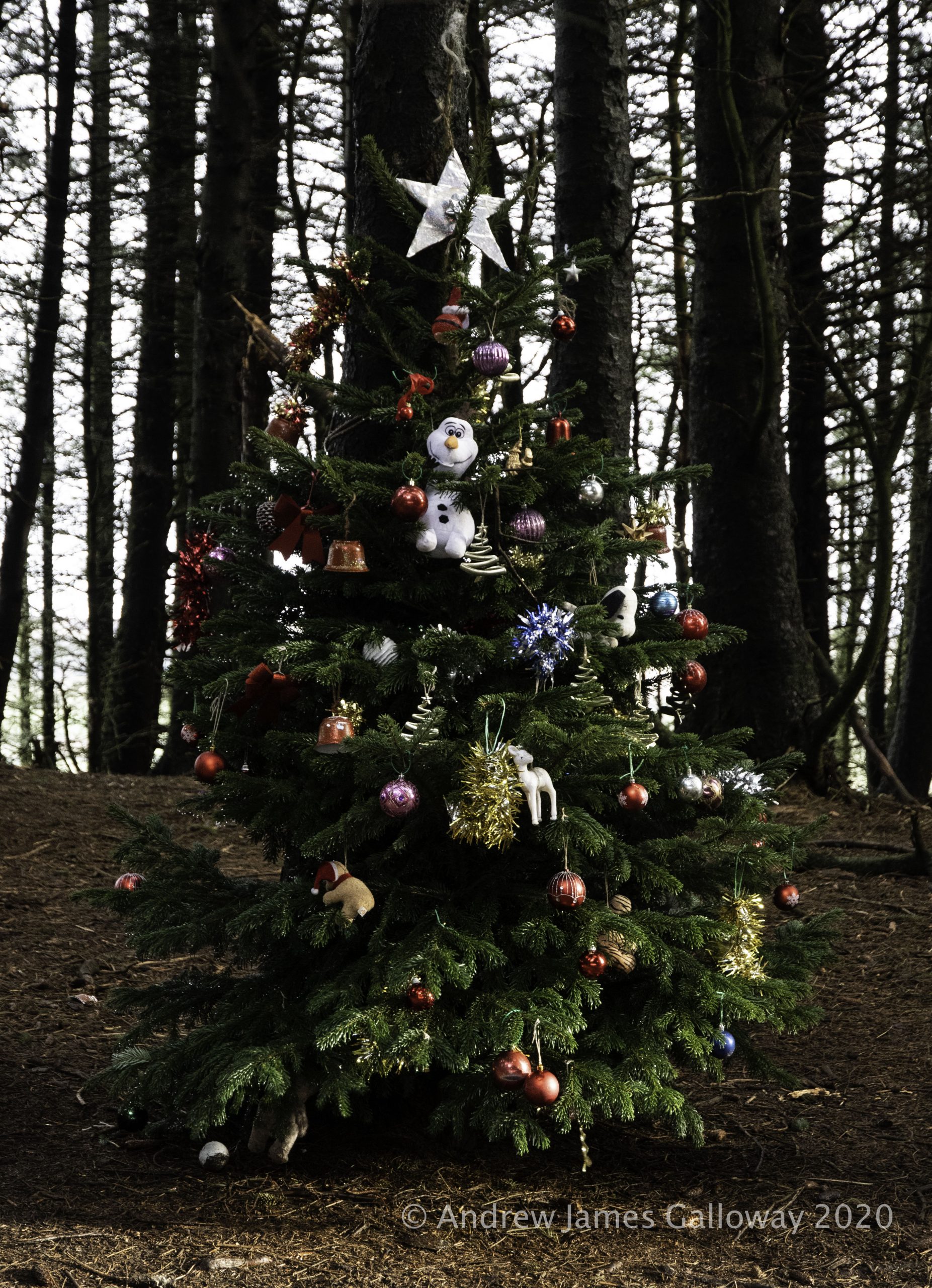
In a quiet corner of the forest, close by the Iron Age earthworks of Toot Hill, crystal clear Peak District water emerges from a spring in the forest floor. Each year at this location someone dresses a small spruce tree with Christmas decorations. A notebook protected in a small plastic container nearby contains comments of passers by and there is a little tin for donations. To whom the donations might go we can only presume as this information is not provided by the mysterious decorator of the tree. I like to think this has some connection with St Stephen’s but the genius loci of the place has more of the votive pagan tradition about it than anything related to the Christian church. I make my offering and descend Charity Lane, leaving the shadows of the forest behind me.
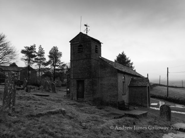
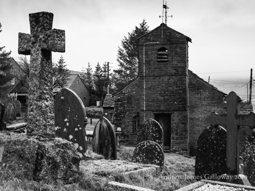
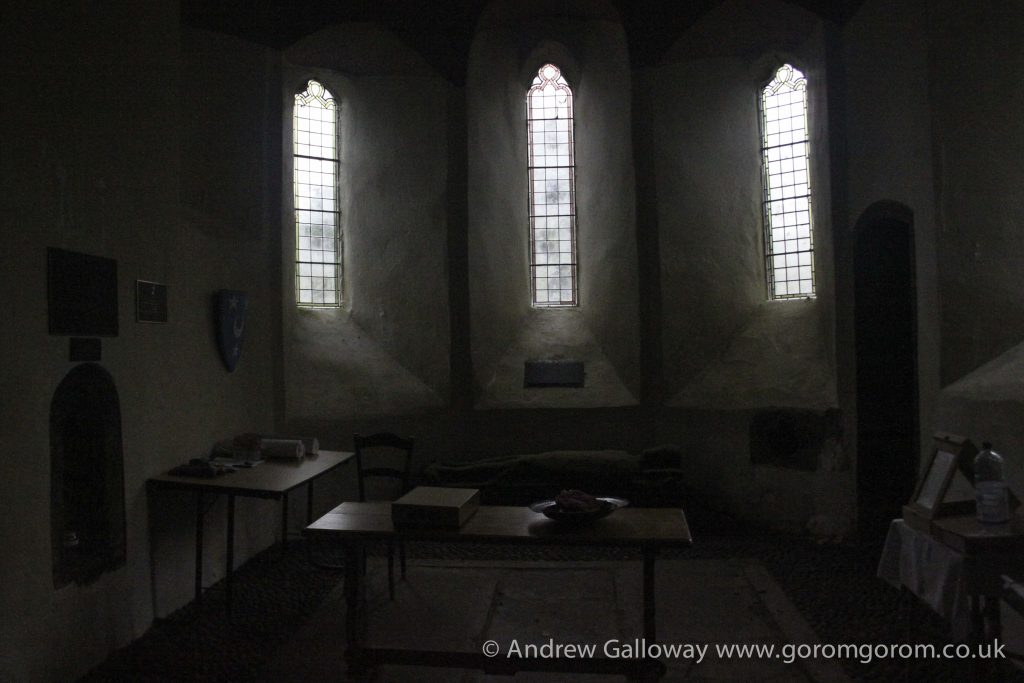
The Forest Chapel stands in a isolated depression among the northern hills of Macclesfield Forest, a stone’s throw from the curiously named Bottom-of-the-Oven.
As the dates above the gabled entrance indicate the chapel was almost entirely re-built in 1834 following a fire, but stands on the site of a former chapel of ease constructed in 1673, the stone bearing this inscription having been preserved from the original building. In about 1720 Francis Gastrell, Bishop of Chester noted that the church had not been consecrated and so was dedicated in the name of the martyr Saint Stephen.
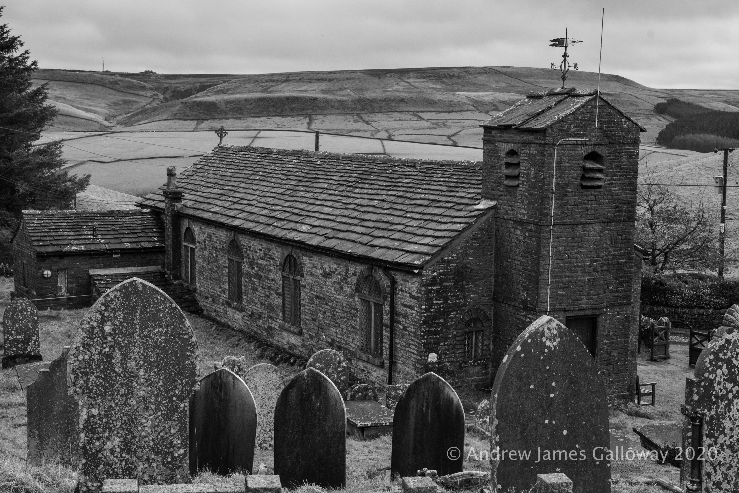
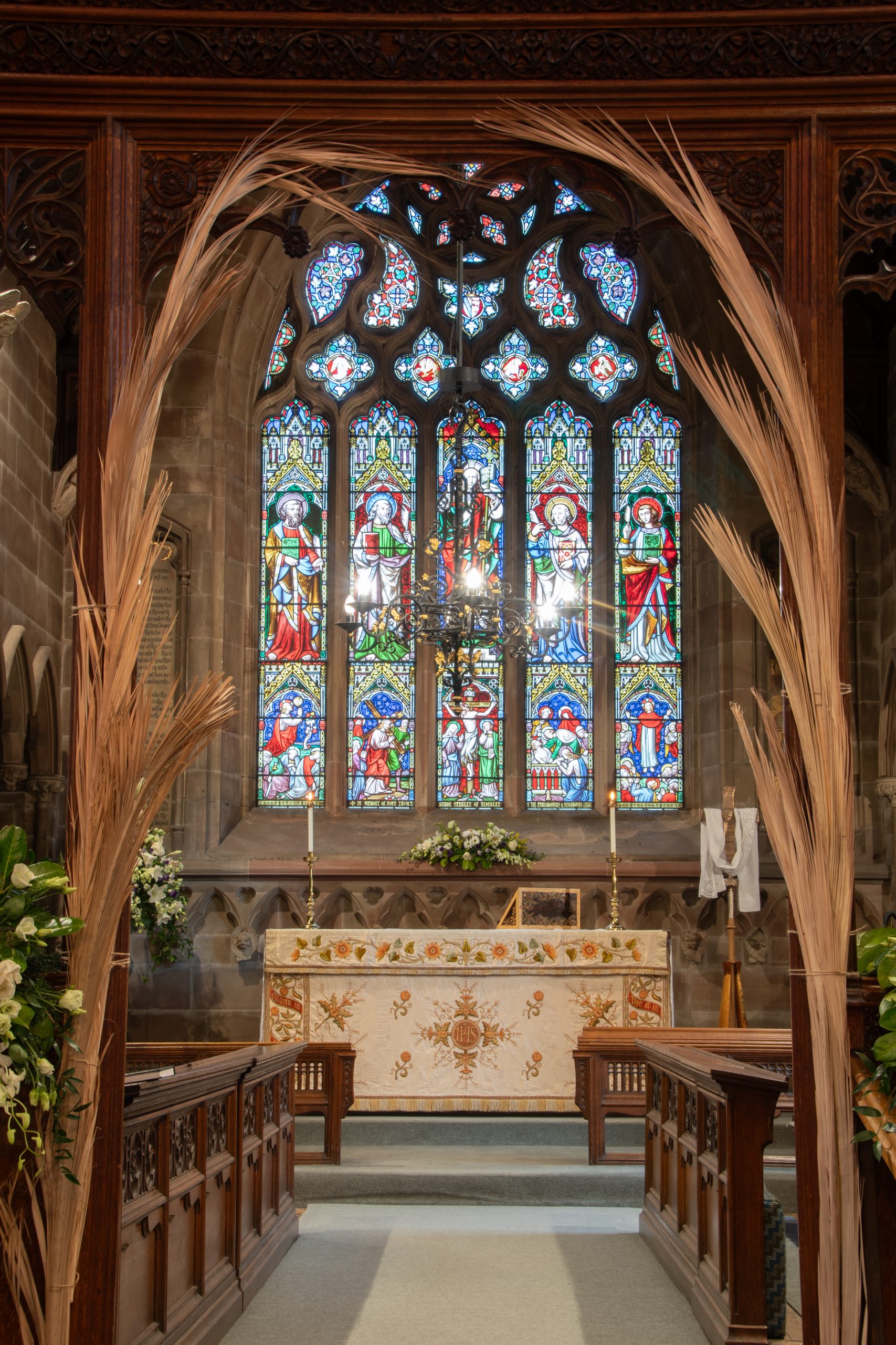
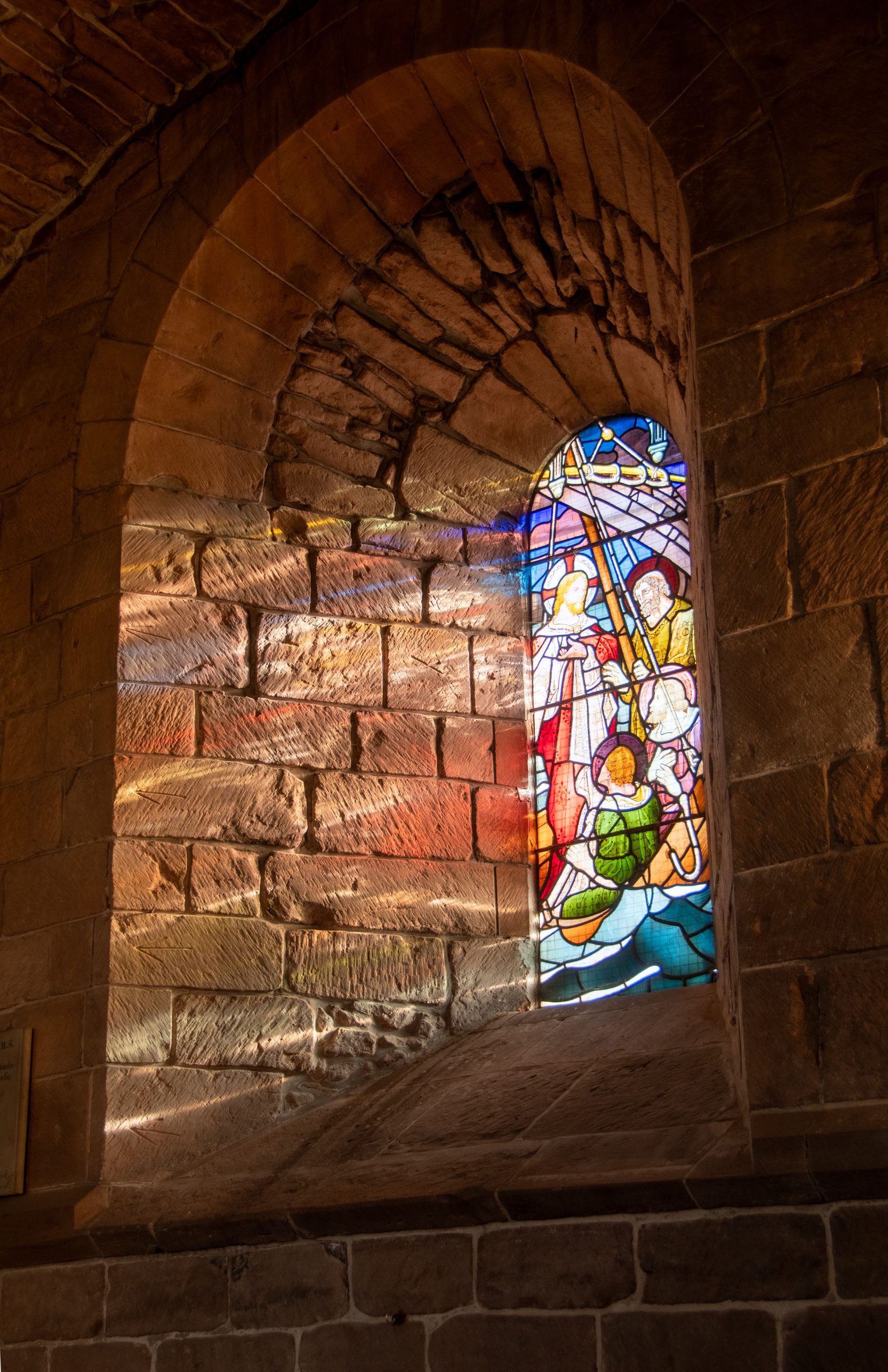
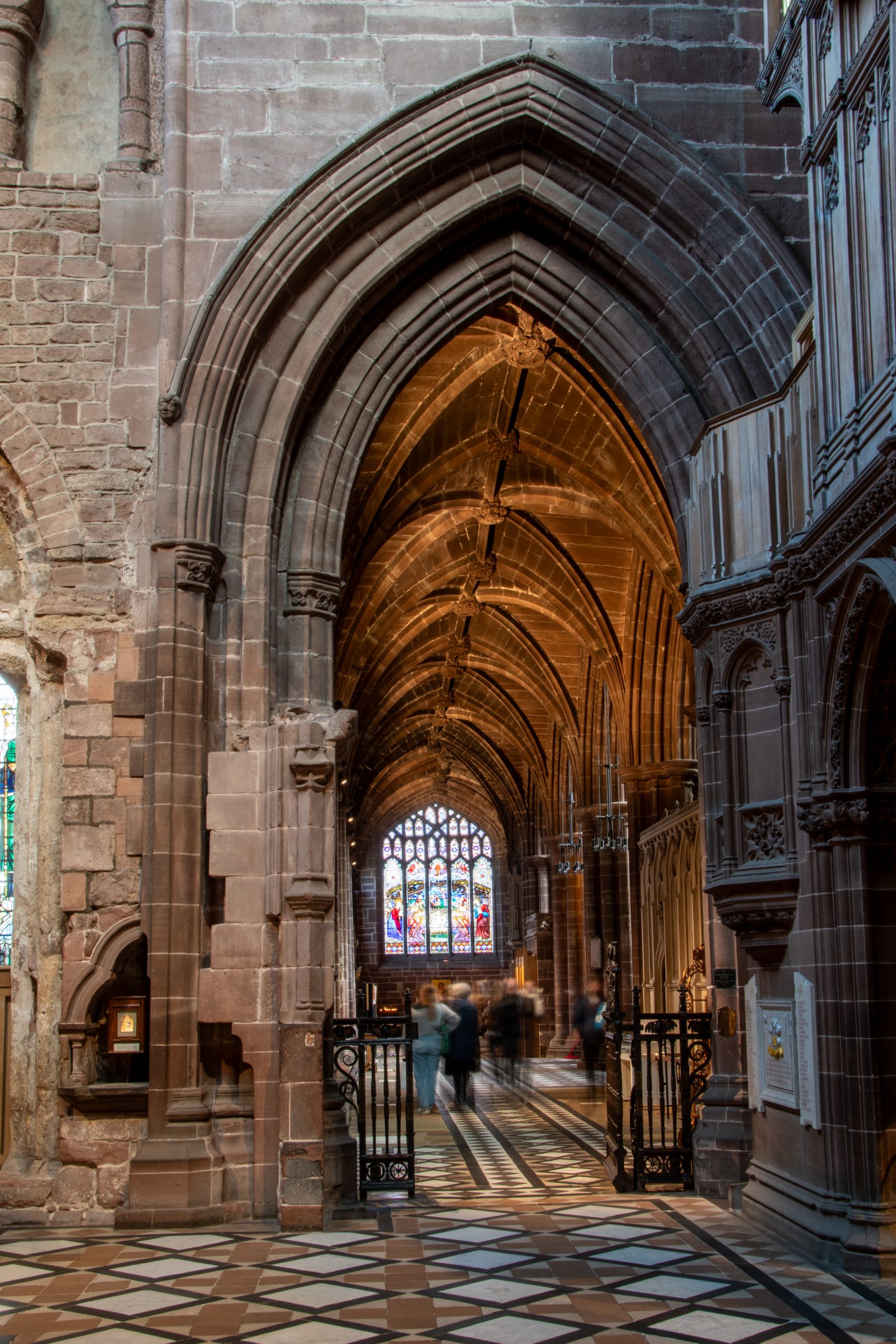
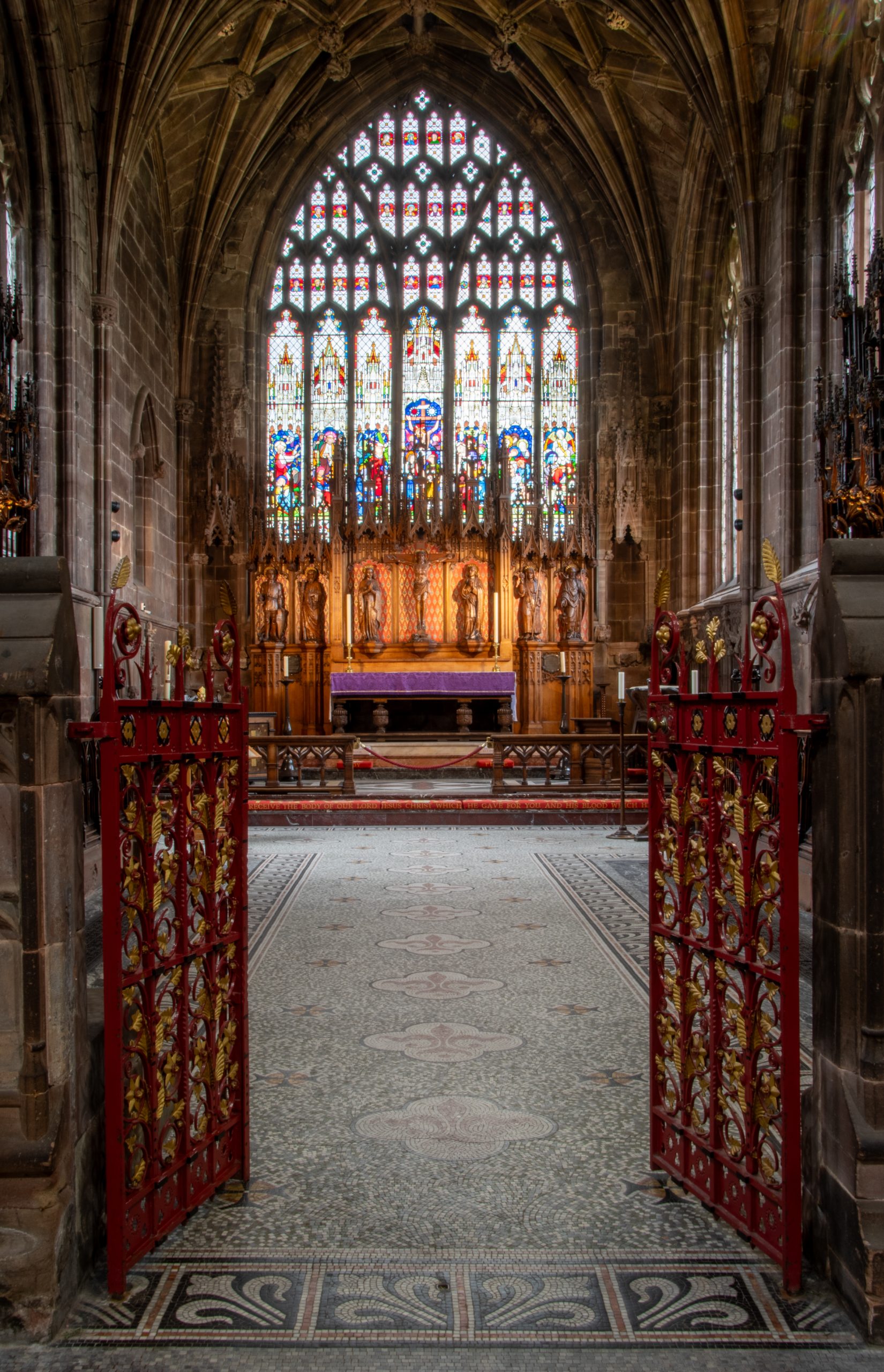
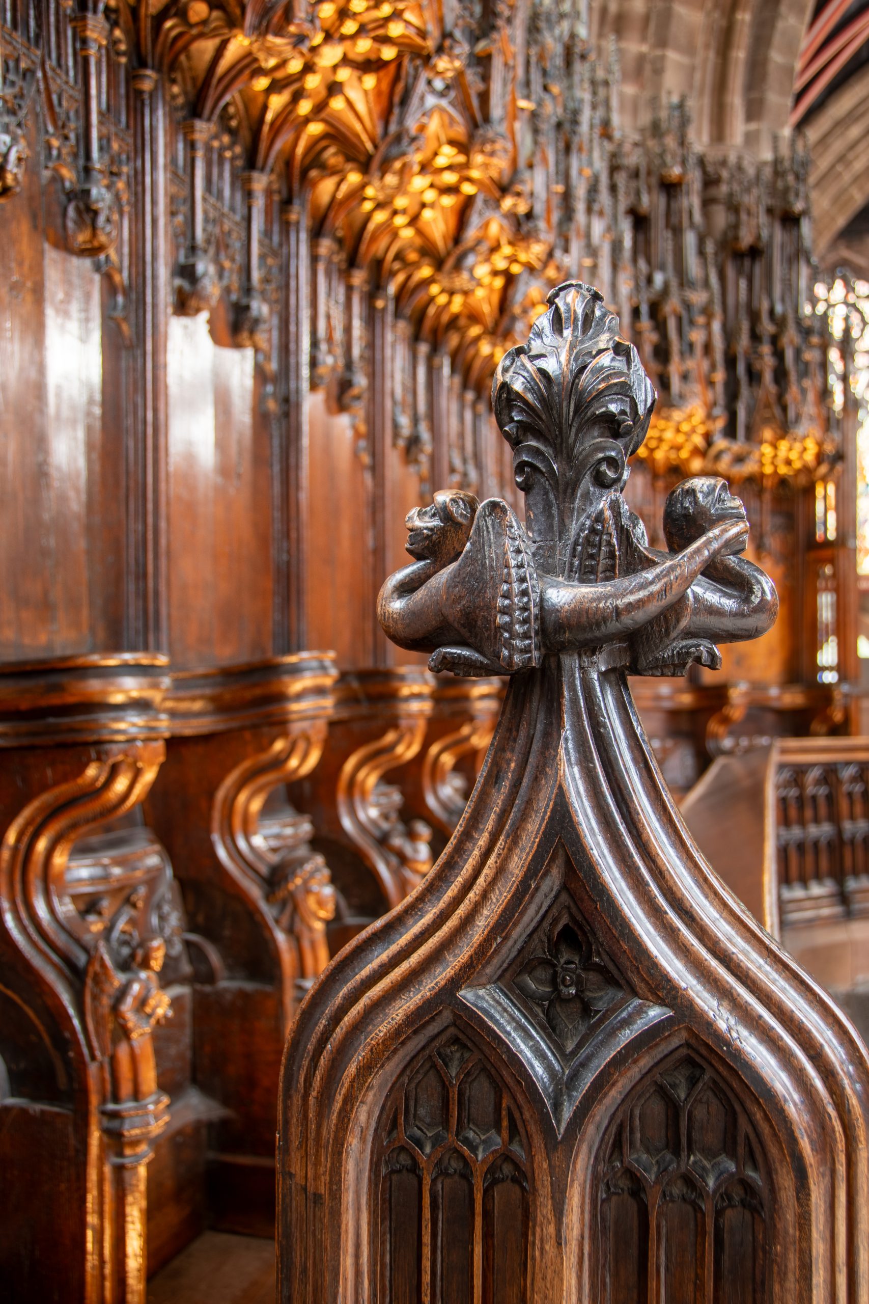
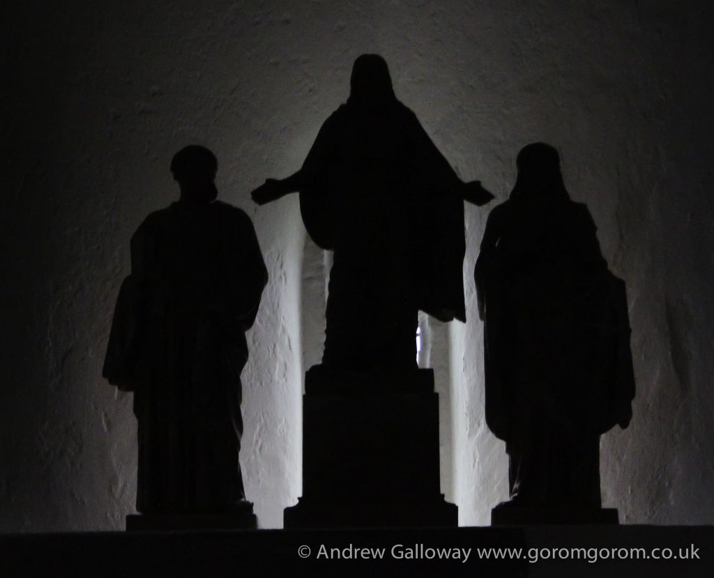
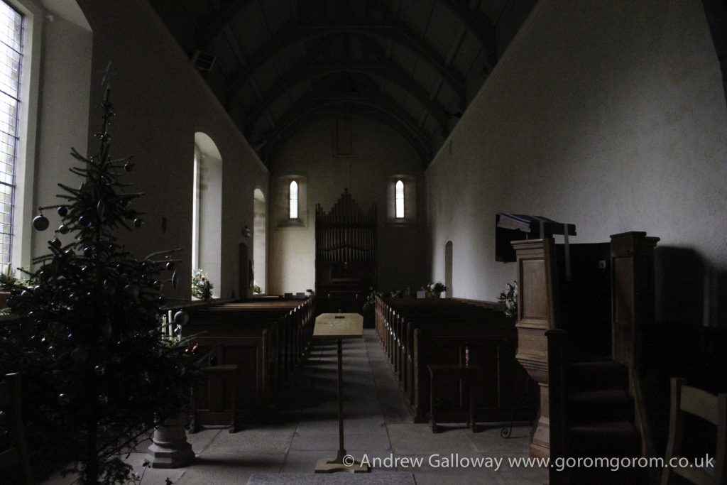
To step inside the Forest Chapel is to step backwards in time to the austere non-conformist existence of the families who eked out a harsh living from the bleak Pennine moorlands for some five hundred years since the Royal Forest of Macclesfield became common land in the 15th Century. The interior is unostentatious, the basic structure being a single rectangular room, the nave and chancel having no discernible division, covered by a simple oak-beamed vaulted ceiling. A simple stone altar set against the east wall is overlooked by a Victorian stained-glass window.
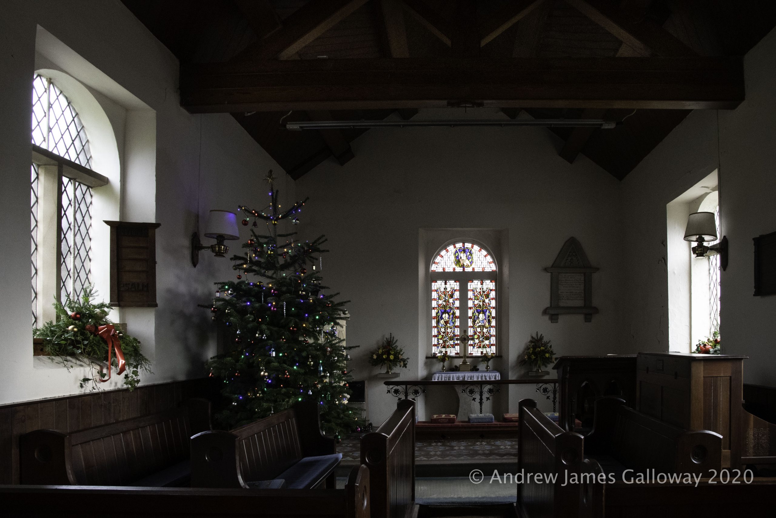
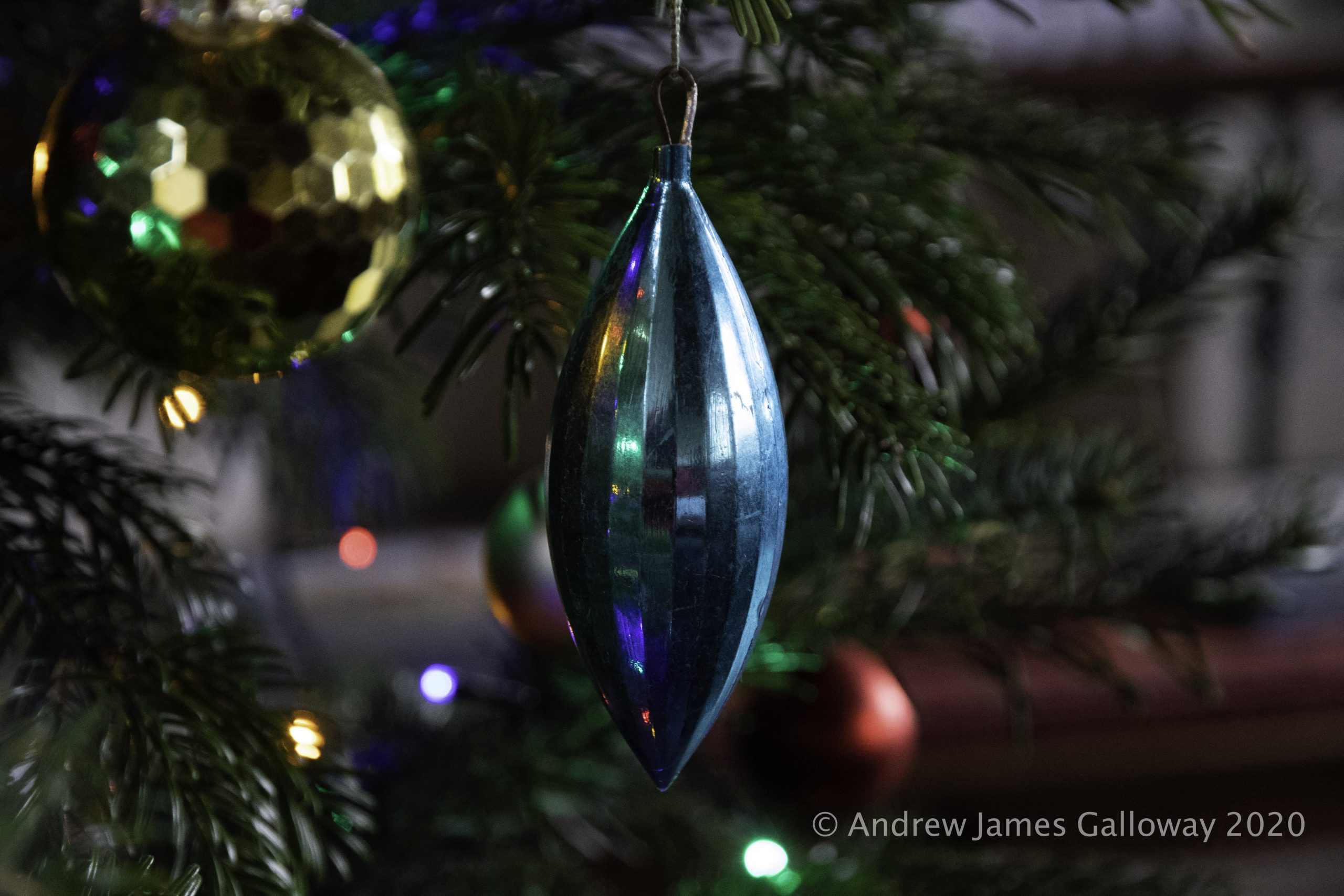
I sit for some time in the peaceful solitude of the chapel. Here too is erected a Christmas tree. In addition to the customary baubles and fairy lights the hand written prayers of visitors hang from the boughs of the tree. I pack away my flask of coffee in my rucksack and head out once again into the forest.
From Standing Stone car park I climb Buxtor’s Hill. A cold damp wind sweeps across Piggford Moor making the ascent of Shutlingsloe arduous. On the crest of the hill I tuck myself into the relative shelter of a fissure in the Chatsworth Gritstone and eat Stollen, thick with marzipan, which I wash down with coffee.
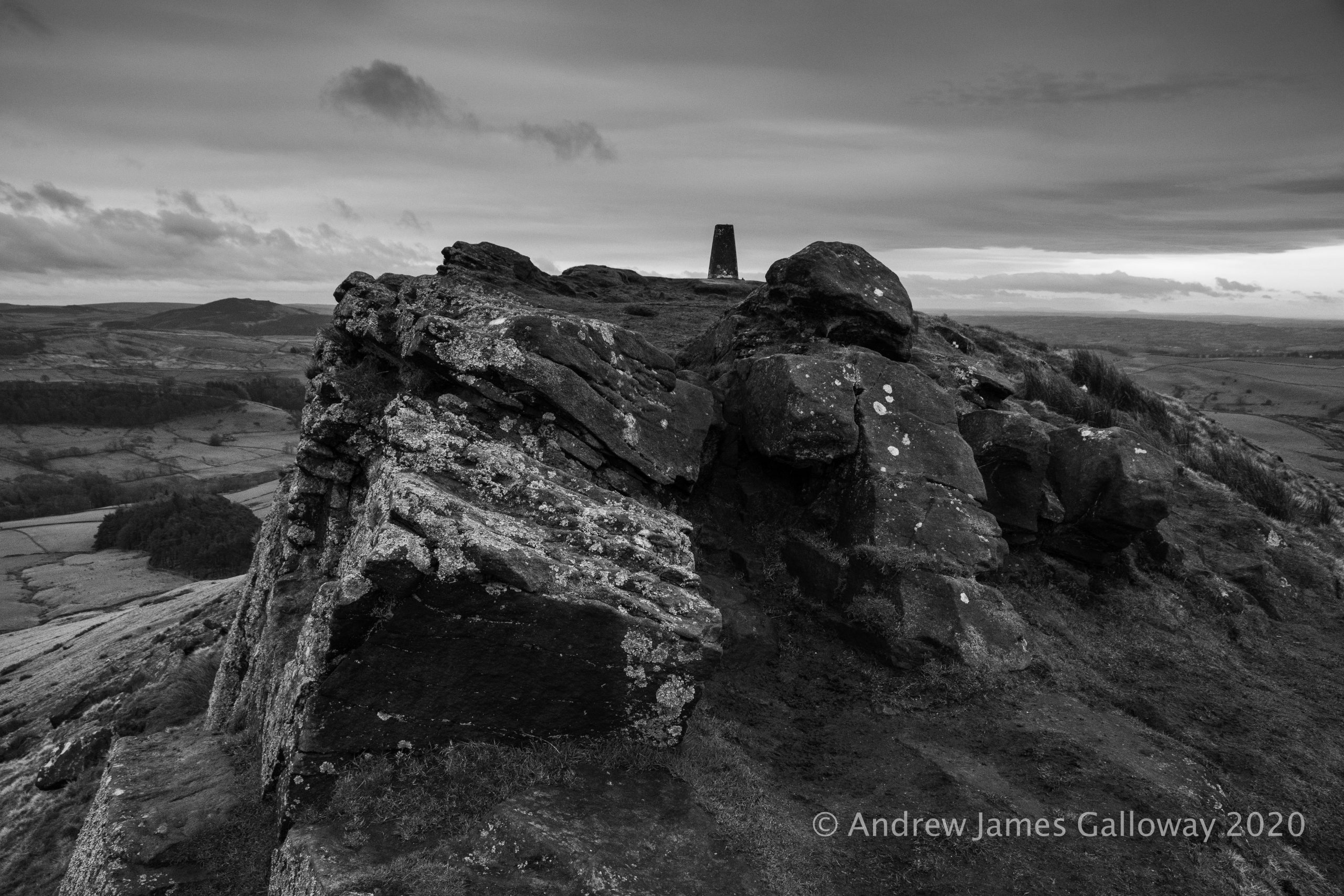
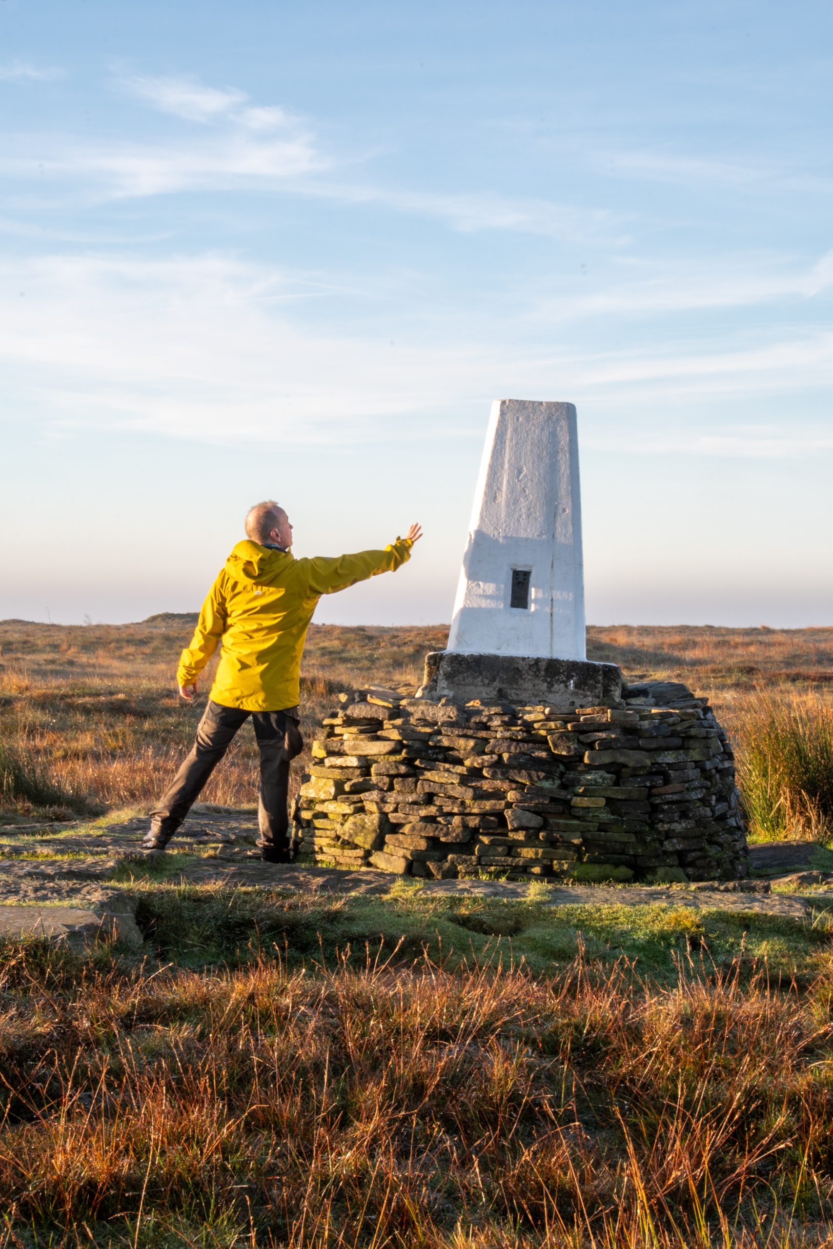
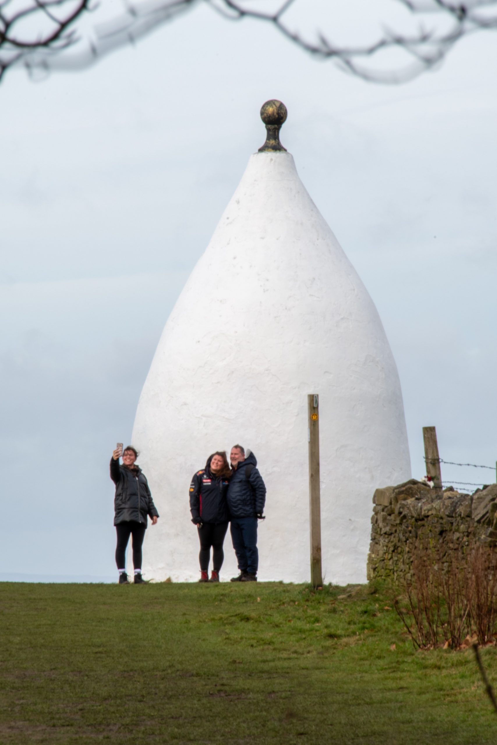
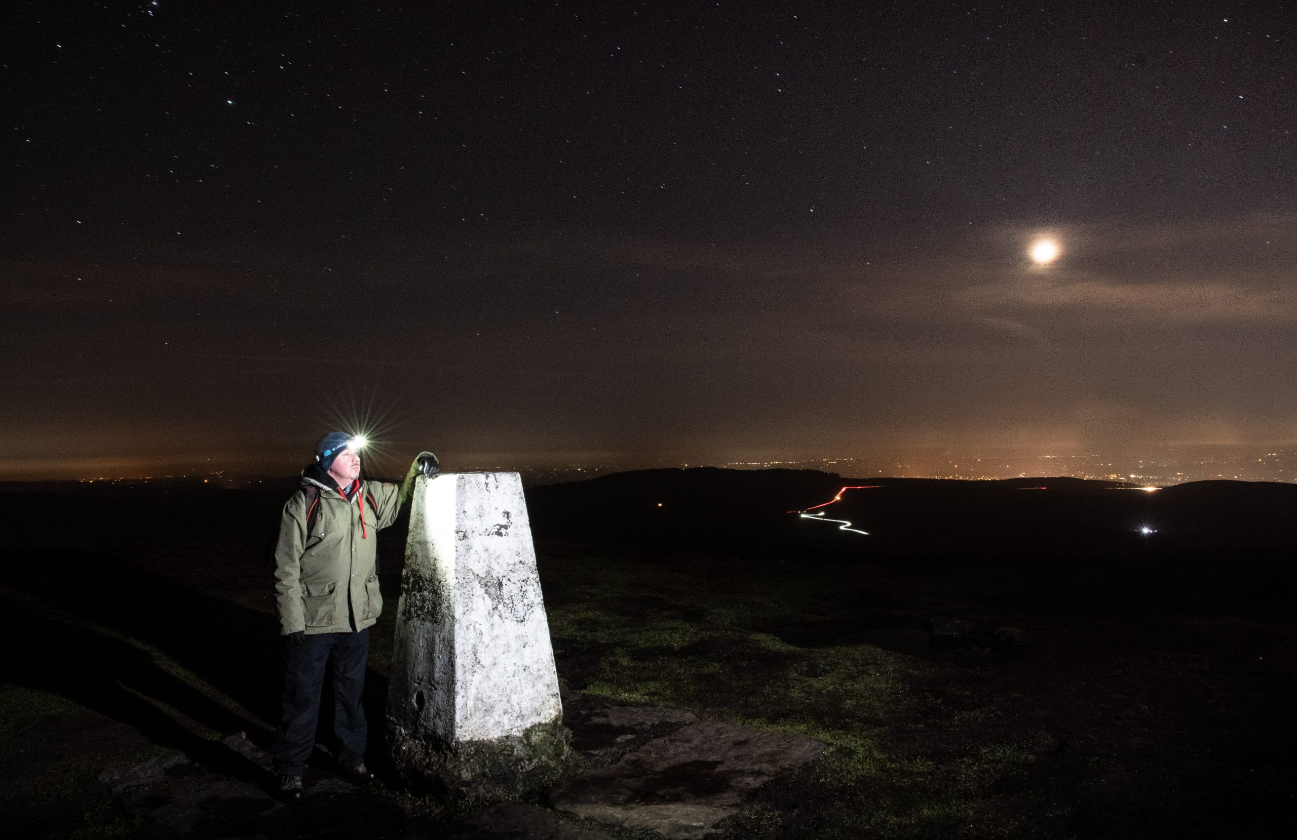
Shutlingsloe is an anchor in my landscape. The little whitewashed summit monument, once of importance to the Ordnance Survey in the measurement and mapping of this anomalistic archipelago of islands we call home, is without doubt the triangulation pillar upon which I have placed my hands more than any other. Here I place my hands once again, now to steady myself against the buffeting wind.
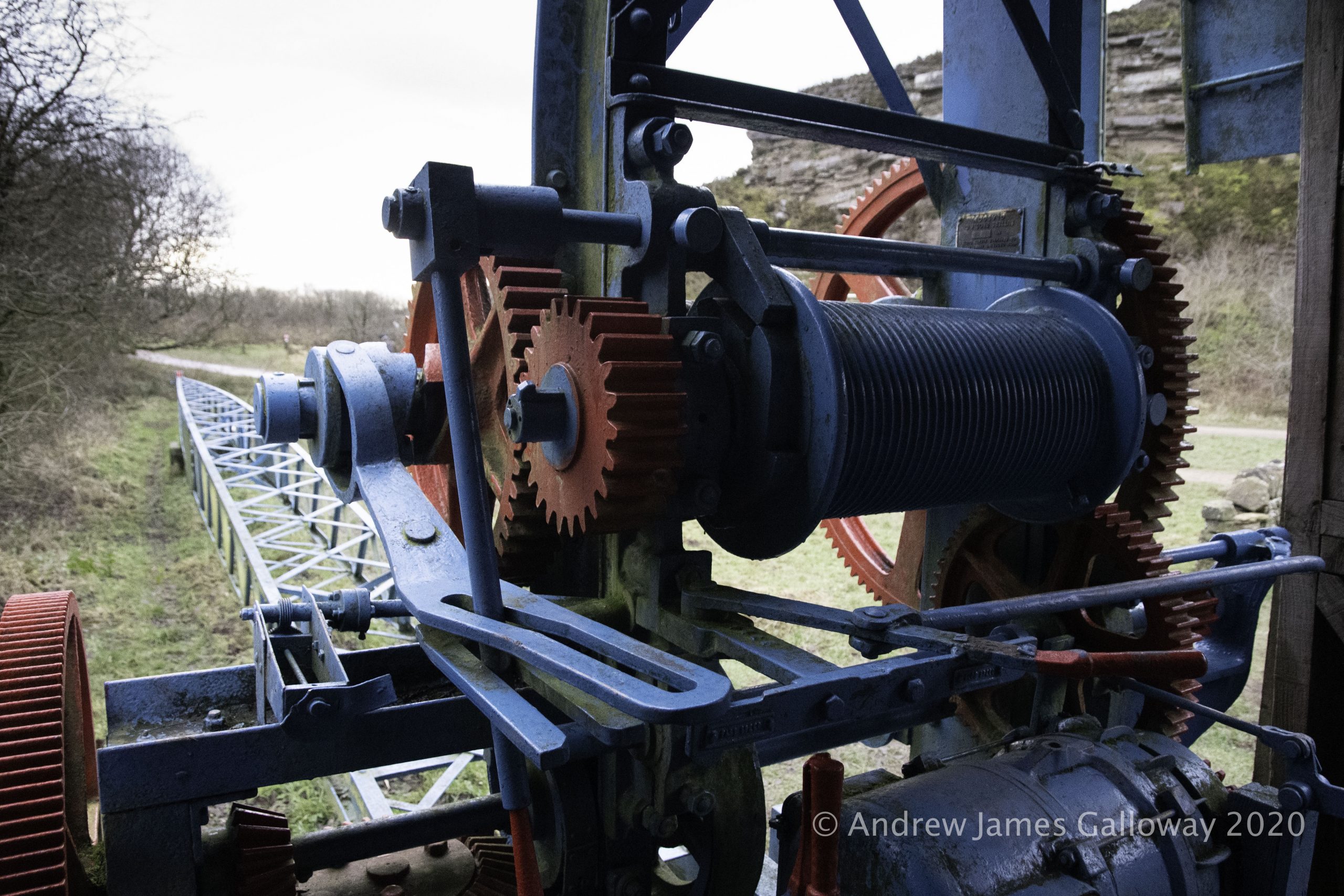
To find shelter I descend once again into the forest, pausing at Nessit Hill to admire the panorama over Trentabank and Ridgegate Reservoirs. By Bottoms Reservoir I pick up the Gritstone Trail and make the arduous ascent to the summit of Tegg’s Nose Quarry. An information board here informs me that the rocks of the quarry date from the Carboniferous geologic period and were laid down in a mighty river delta some three hundred and fifty million years ago. In comparison to this age the quarry men who split these rocks open a hundred years ago seem my contemporaries.
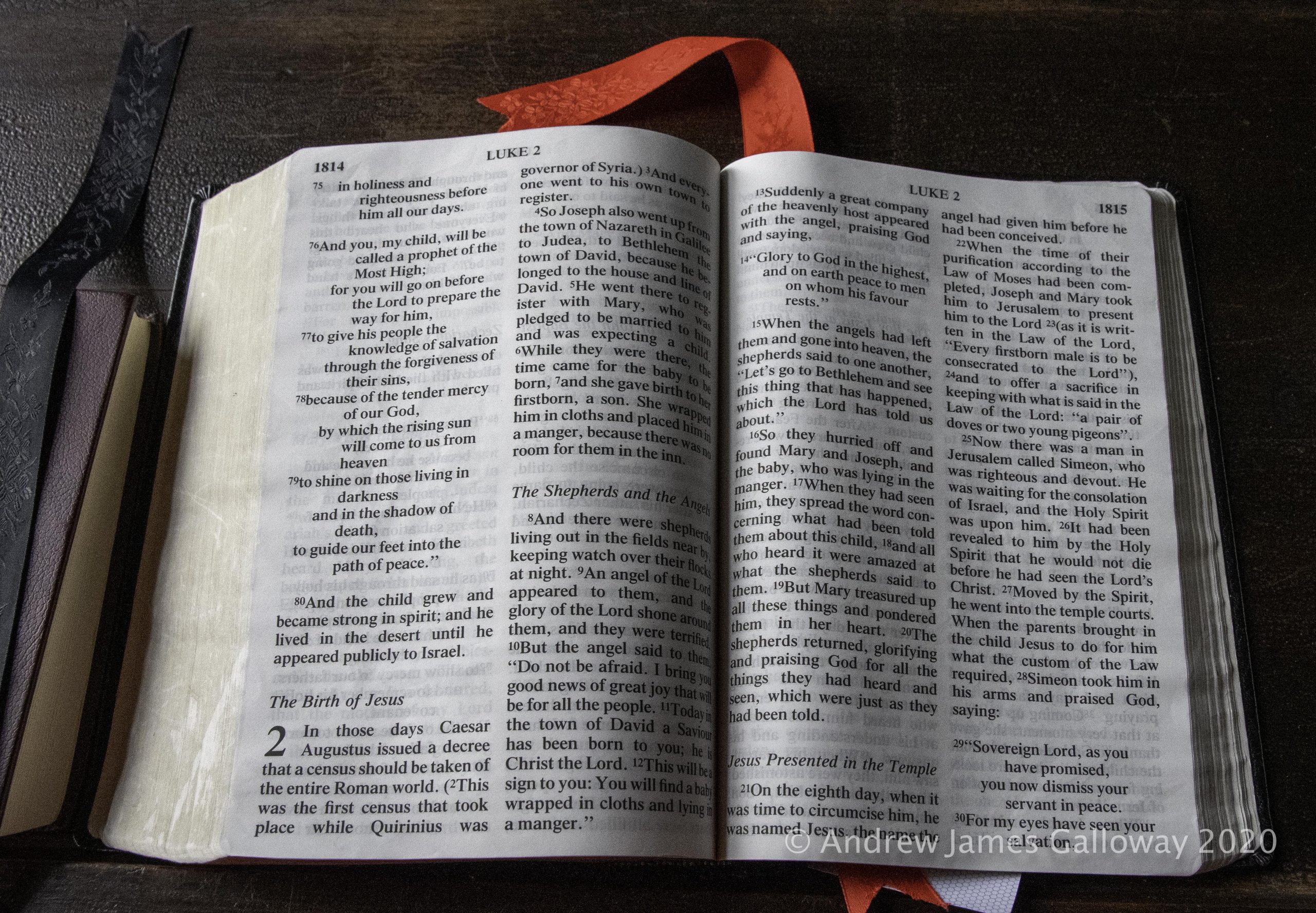
For some years now I have participated in an Advent Book Group located on social media. I have, in the past, found it helpful to reflect upon the meaning of the Christian season of Advent, as a way to reflect upon the year gone by and a time to review the path ones own life has taken. Advent is so often overshadowed by the commercial celebrations of Christmas, which now begin immediately following the American festival of Thanksgiving at the end of November. As far as the Church is concerned, officially, the season of Christmas does not begin until midnight on Christmas Eve, but as we all know, our culture’s aversion to delayed gratification means Christmas starts when multi-national corporations say it starts.
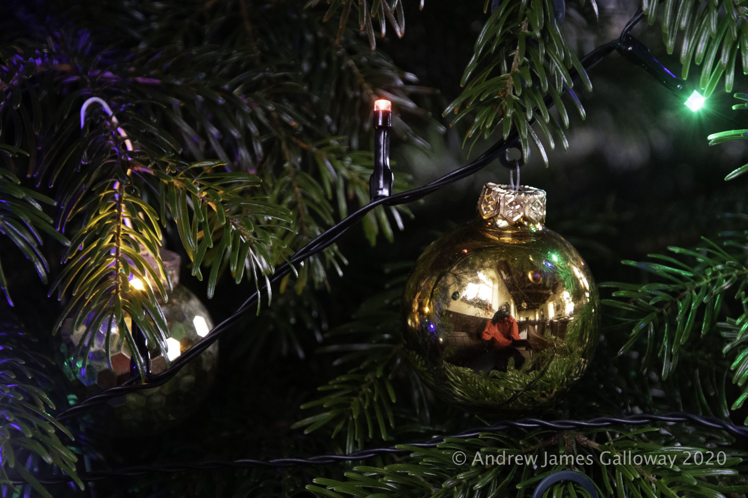
And so I see my participation in the little online book group as a form of rebellion against the leviathan of corporate capitalism. That said, I have just put up my Christmas tree on 1 December. Something which would have been unthinkable when I was a child.
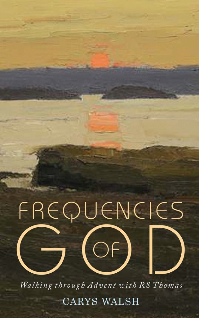
This year the group is reading Frequencies of God by Carys Walsh, a collection of reflections on the work of the Welsh poet R S Thomas.
The poem for Week 1, Day 3 is In Church.
Often I try
To analyse the quality
Of its silence. Is this where God hides
From my searching? I have stopped to listen,
After the few people have gone,
To the air recomposing itself
For vigil. It has waited like this
Since the the stones grouped themselves about it.
These are the hard ribs
Of a body that our prayers have failed
To animate. Shadows advance
From their corners to take possession
Of places the light held
For an hour. The bats resume
Their business. The uneasiness of the pews
Ceases. There is no other sound
In the darkness but the sound of a man
Breathing, testing his faith
On emptiness, nailing his questions
One by one to an untenanted cross.
Here we have some powerful imagery from R S Thomas. Imagery with which I am familiar. There have been many times I have sat, alone, in country churches as the darkness thickens around me.
It’s a bit of a Boxing Day tradition for me to walk from Tegg’s Nose, through Macclesfield Forest, up to St Stephen’s Church, also known as the Forest Chapel. By the time I have walked through the forest to the church it is often early afternoon, but at that time of year the darkness has already mustered on over the Pennine Hills to the west.
The following is from an article I wrote for the Great Outdoors magazine.
To the north I took refuge from the inclement weather inside one of the jewels of the western Peak District. As the dates above the gabled entrance indicate, the Forest Chapel, or Saint Stephen’s Church as it was consecrated, was almost entirely re-built in 1834 following a fire, but stands on the site of a former chapel of ease constructed in 1673, the stone bearing this inscription having been preserved from the original building. To step inside the Forest Chapel is to step backwards in time to the austere non-conformist existence of the generations who have eked out a harsh living from the bleak Pennine moorlands since the Royal Forest of Macclesfield became common land in the 15th Century.
I sat for some time as rainwater from the stone-clad roof collected in the lead guttering and splish-splashed onto the paving outside, until ultimately the light in the chapel brightened and brief shafts of sunlight, at acute angles from the south transept windows, blessed the silent nave, and the rain stopped, like the silence that follows the prayers of four hundred years.
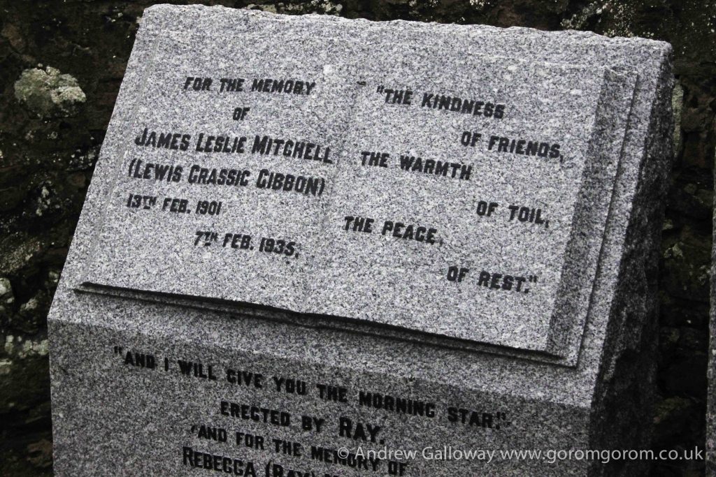
A similar experience too place some years earlier in The Kirk of Saint Ternan, Arbuthnott, Laurencekirk. I had been walking in snow and ice the day before on the eastern edge of the Cairngorms; had fallen and twisted my knee quiet badly. Deciding to assign the next day to low-impact activities I paid a visit to the Lewis Grassic Gibbon Centre.
For those unfamiliar with LGG, he wrote Sunset Song, a novel set in the early twentieth century about the loss of tradition agricultural practice in rural Scotland. It is a short walk from the visitors centre to the kirkyard of St Ternan’s, where LGG is buried. At that latitude during the liminal week betwixt Christmas and New Year’s Eve the light begins to fade not long after lunch. Not a soul in sight I took refuge in the church and sat for sometime contemplating the wreckage of my life and the pain searing through my knee. Nailing my questions one by one to an untenanted cross.
“Great novels offer us not only a series of events,
Ursula le Guin
but a place, a landscape of the imagination
which we can inhabit and return to.”
The words of Neil Philips reverberated around my head for some considerable time. “to explore the disjointed and troubled psychological and emotional landscape of the twentieth century through the symbolism of myth and folklore.” This was the landscape I had only too painfully come to know as a young adult, both the landscape of the novels of Alan Garner, but also “the troubled psychological and emotional landscape of the twentieth century.” At the age of just fifteen I had found myself contemplating thoughts of suicide, thoughts which left unchallenged and untreated continued to fester, with age ripening into a dark self-hatred, which at the age of twenty-six compelled me, in a desperate cry for help, to act upon those thoughts. One vigorous stomach pump and a good night’s sleep later I found myself at the mercy of the on-duty psychiatric team, who seemed to offer as much empathy and compassion as Caligula, and some time later I was cast out onto the streets with the vague promise of some follow up sessions with a psychotherapist, in about six months time, they said.
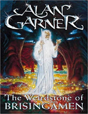
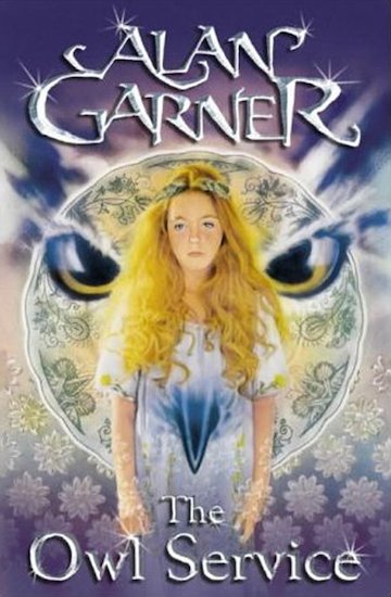
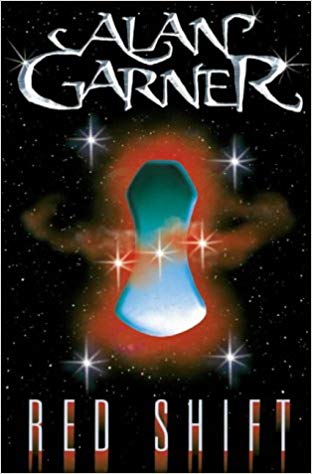
By some miracle of self-determination I fought my way through to my mid-thirties only to be faced with a further personal crisis of calamitous proportions, the consequences of which – a failed marriage, two estranged step-children, a flat-lining professional career, mounting personal debts – lay around me like the victims of a massacre. Something had gone wrong, horribly wrong. There were so many questions, but the materialist culture surrounding me, to a certain extent smothering me, seemed to hold no answers. The messages, both intentional and subliminal, seemed to be saying that my only purpose was to work to earn money to spend in cycles of the unrestrained satiation of morbid desires. I was lost. I needed a place of familiarity from which to assay what I had become. So it was that I returned to those books of my childhood: The Weirdstone of Brasingamen, The Moon of Gomrath, The Owl Service, Red Shift, in some vain attempt to find answers beyond the material.
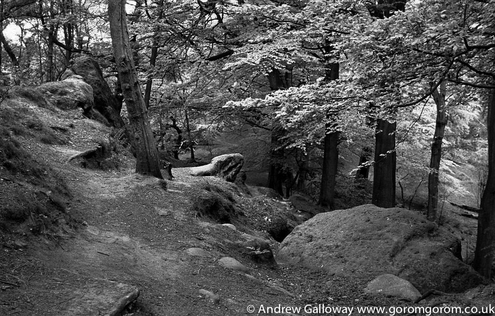
So again I found myself on Alderley Edge, as I had on many, many occasions since that first encounter, many years ago. On this particular bleached winter’s morning, an oatmeal sun straining to peer over the tops of the birches, I headed out from the warmth of the Wizard Tea Rooms to retrace familiar steps around the three hundred acres of woodland now owned and managed by the National Trust.
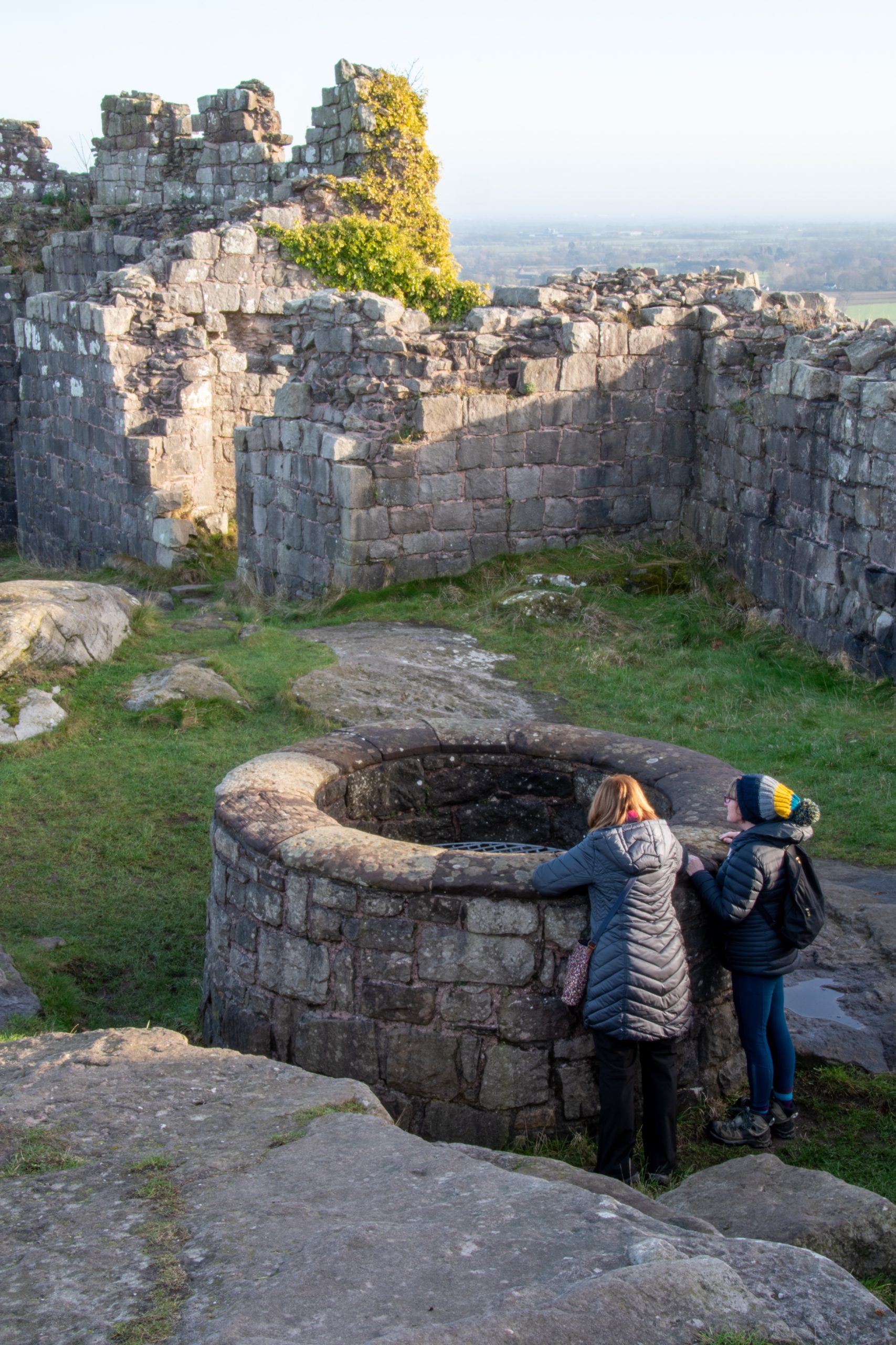
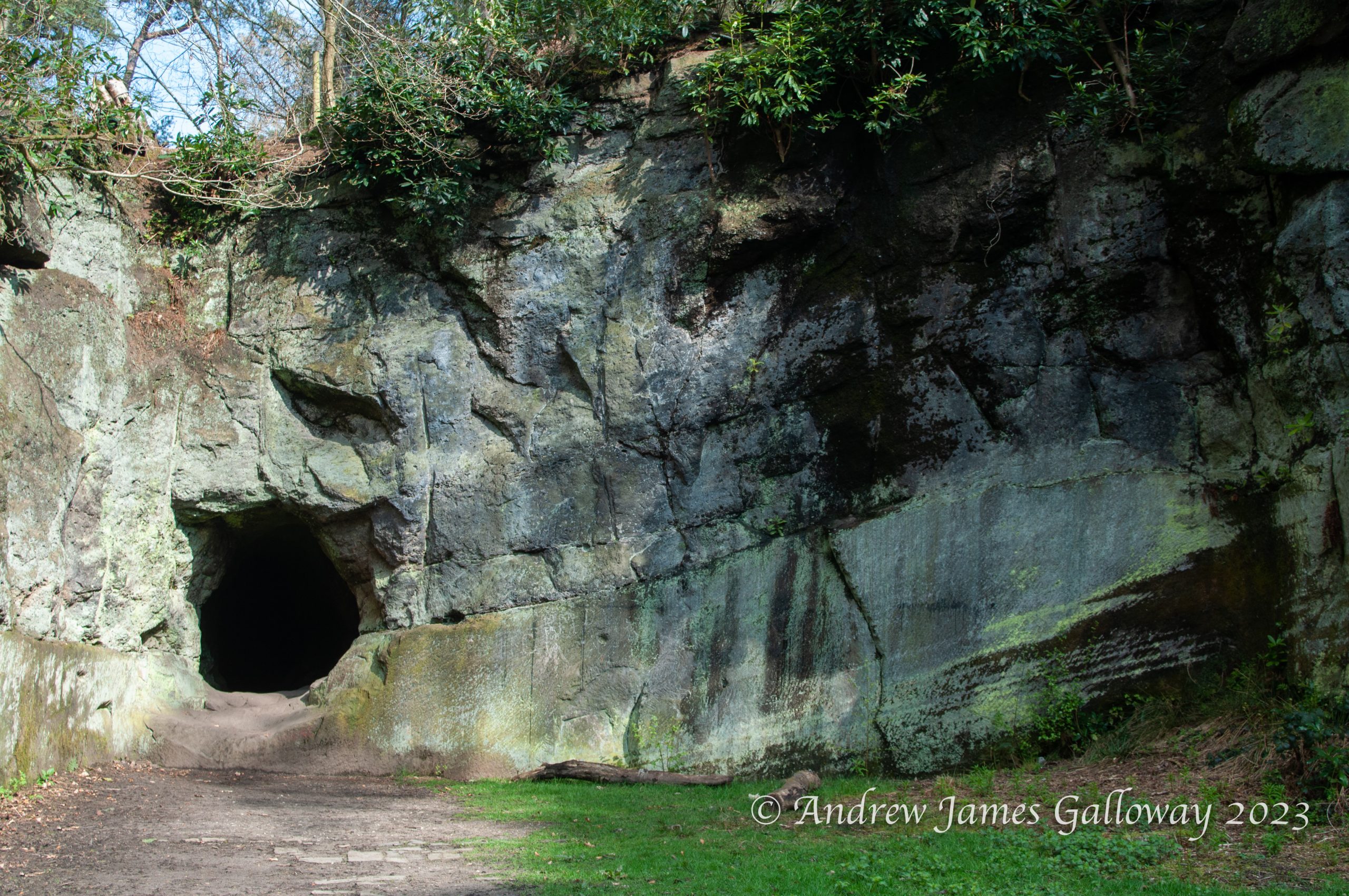
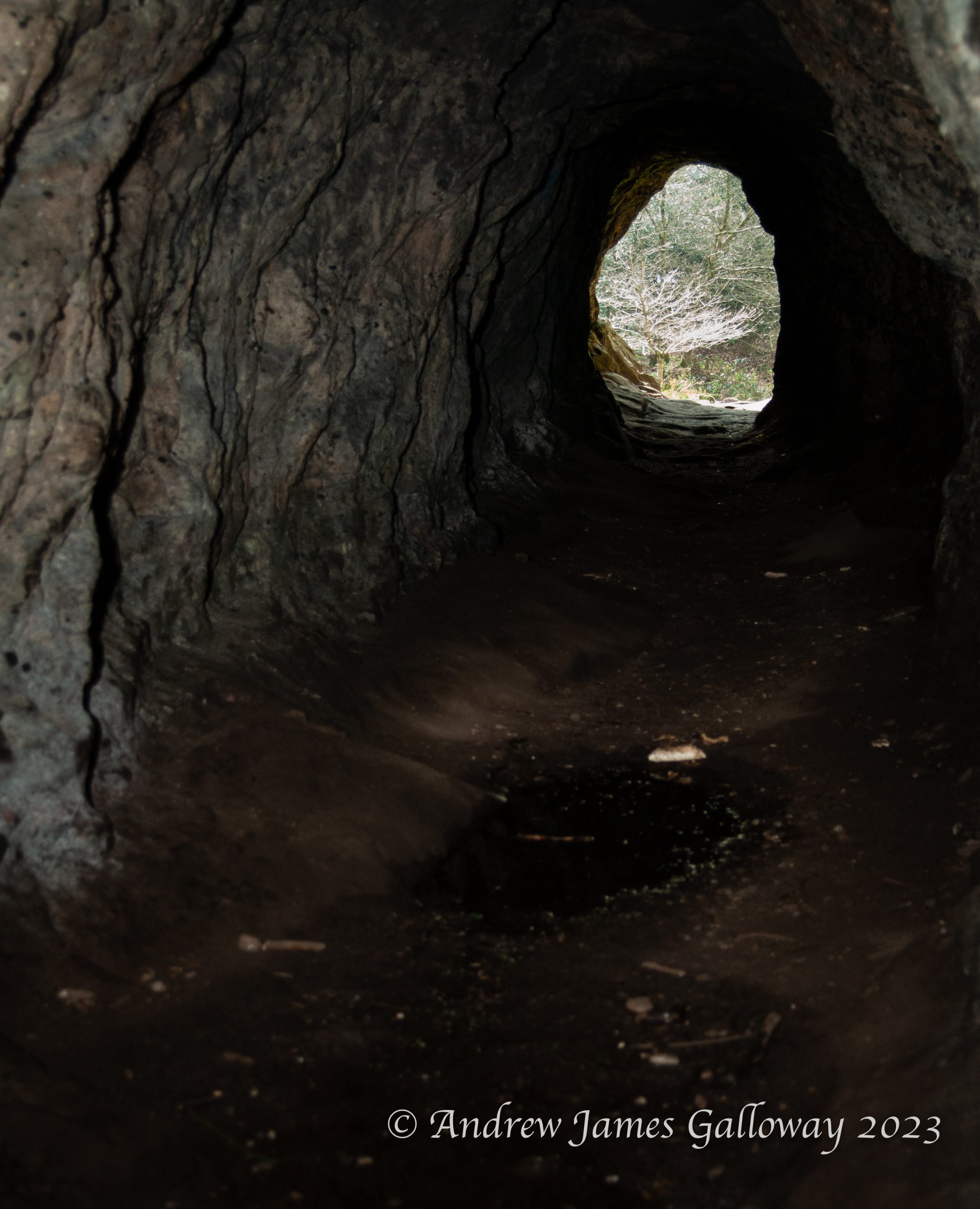
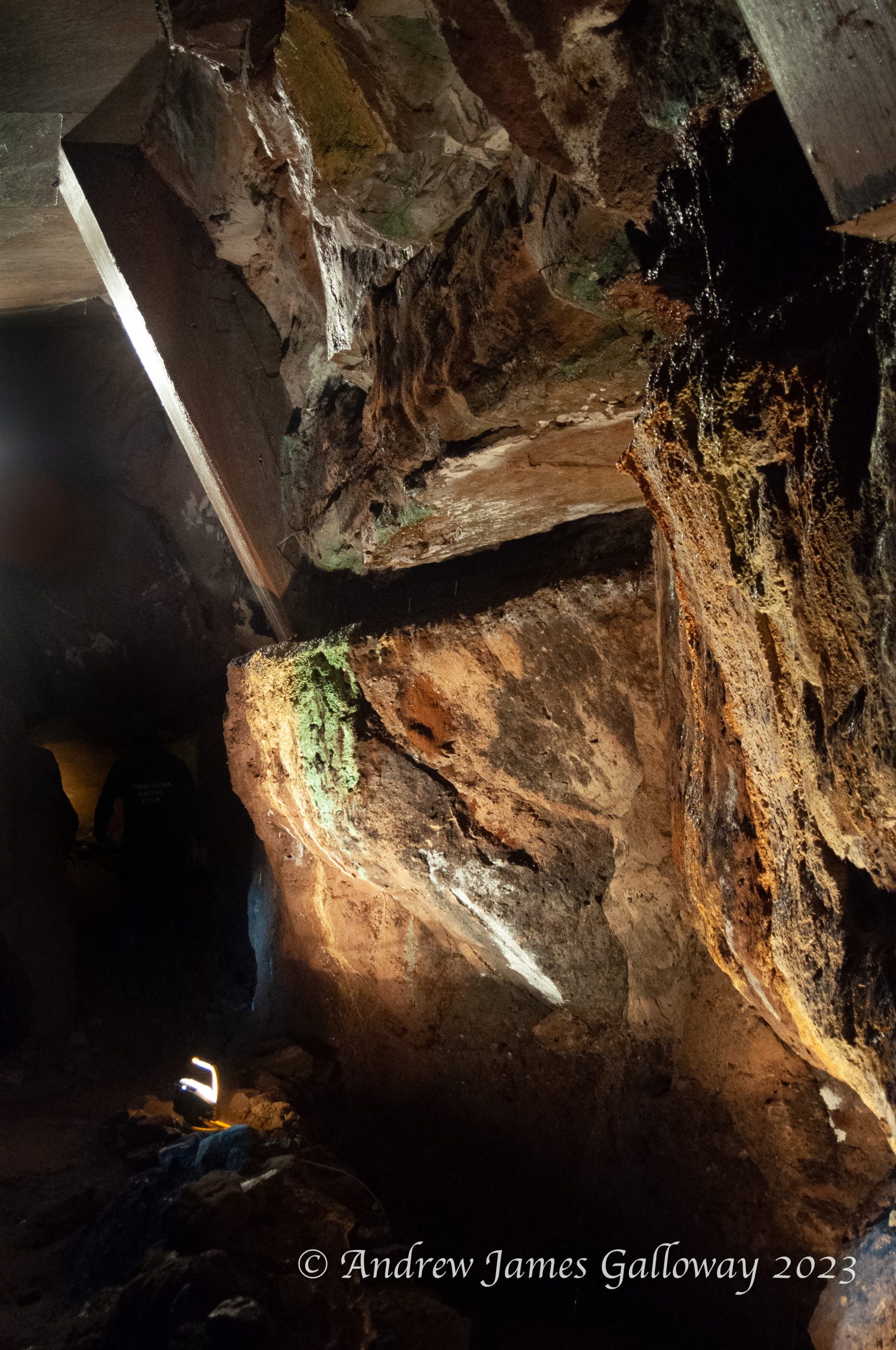
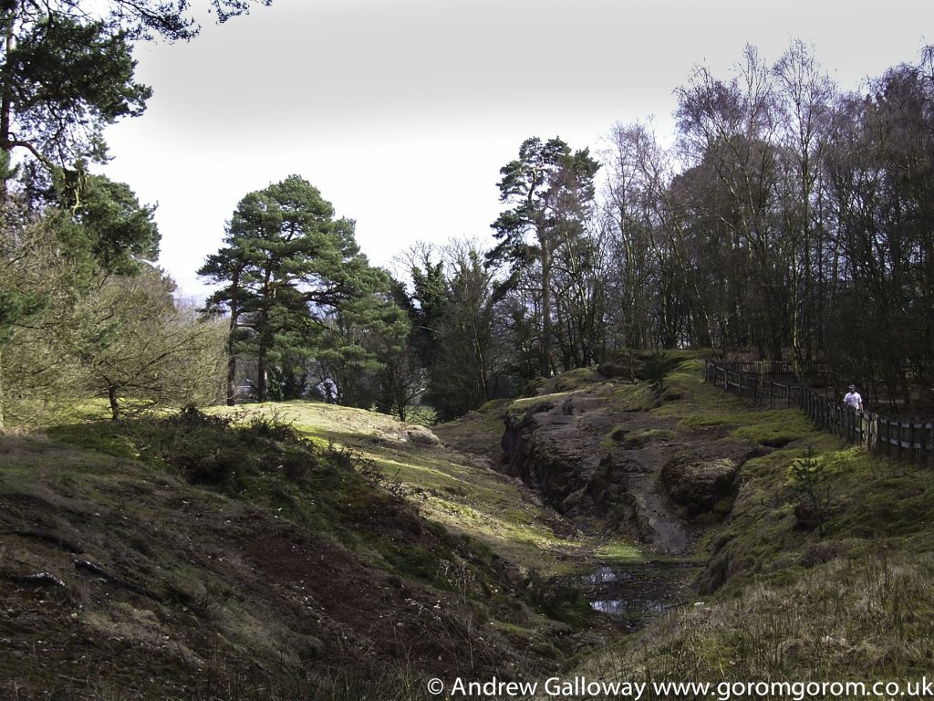
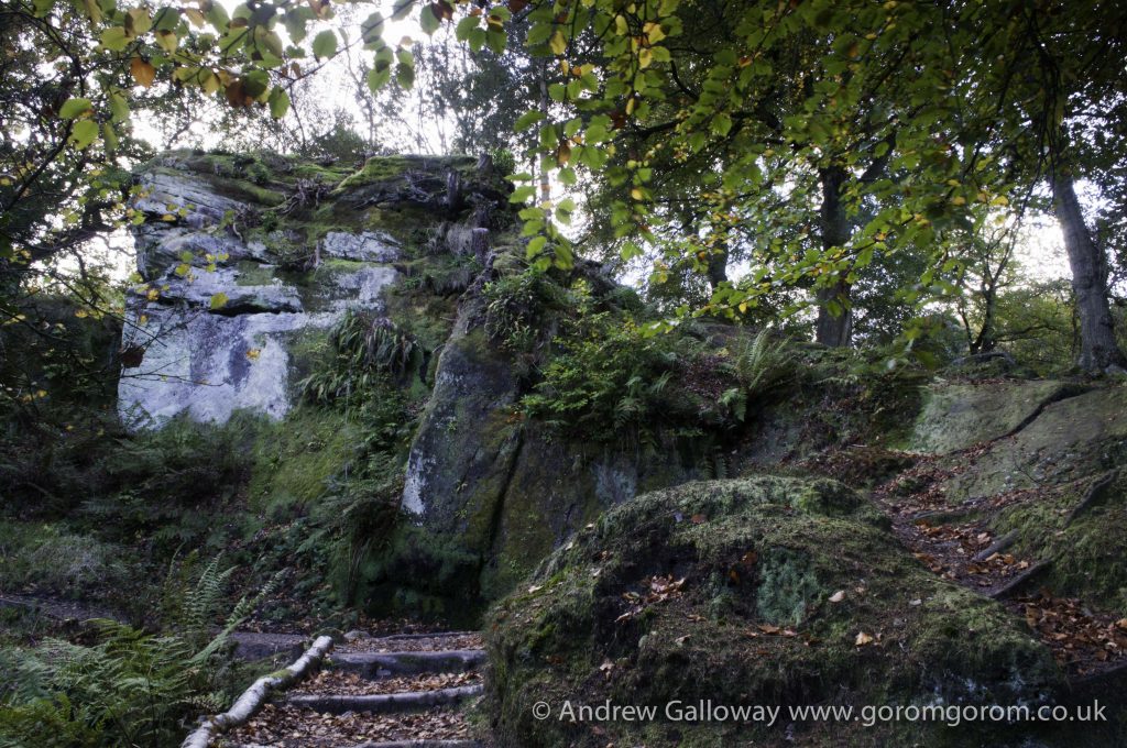
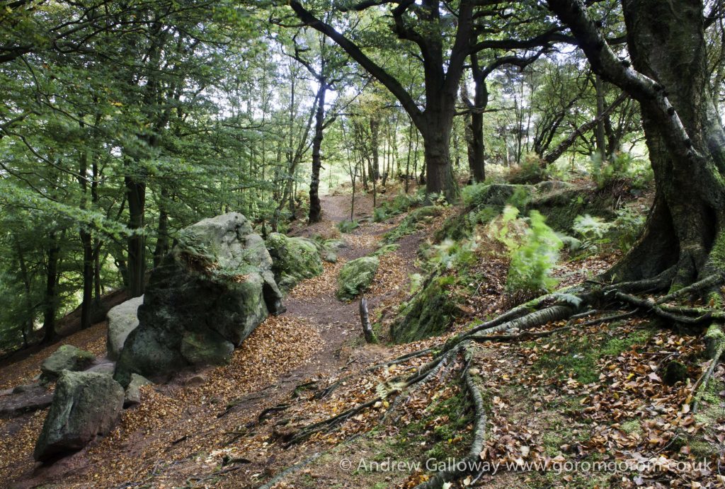
No more than three hundred metres through the trees I arrived at Engine Vein, a section of open cast and collapsed mine that once was over twenty-five metres deep but was capped with concrete in 1979 for reasons of safety (the chasm into which my younger self gazed with such awe and wonder). A small iron door on the southern side of the cleft leads through a narrow passageway to the extensive chamber below, from where a labyrinth of drifts, levels and adits criss-cross and interconnect for mile upon mile. Back filled passages are still being discovered at Alderley, often by the Derbyshire Caving Club who have taken responsibility for the up keep of the mines under the direction of the National Trust, and who regularly hold open days for those wishing to take a subterranean exploration of these fascinating features[i].
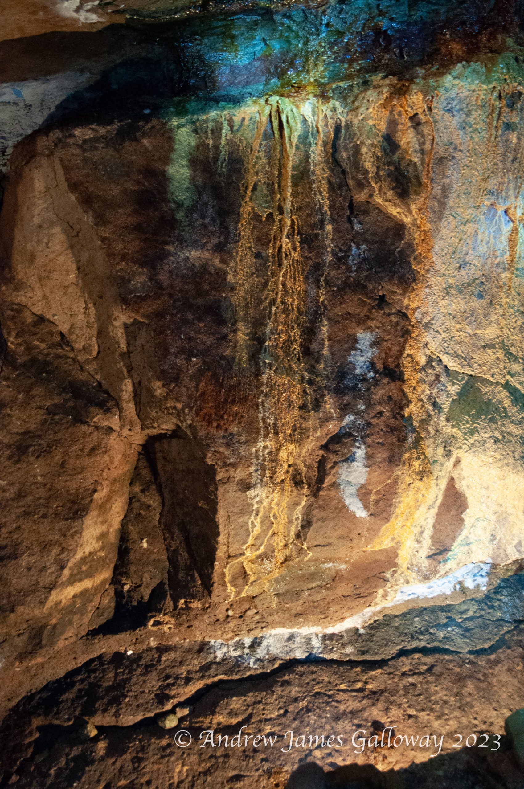
The earliest evidence of mining at Alderley is to be found at Engine Vein and dates to the Bronze Age. The main ore extracted was copper, but cobalt, iron, lead, silver and even gold have also been found[ii]. In their book Prehistoric Cheshire, Victoria and Paul Morgan recount how an oak shovel found by 19thCentury miners in a section of mine at Brynlow to the south west of Engine Vein, has been radiocarbon dated to approximately 3,700 years old[iii]. A large number of stone hammer heads and similar tools were also discovered in material that had been used to backfill the open cast mine. The process of open cast mining at Engine Vein is believed to have involved the digging of small circular pits into the rock, the adjacent sides of which were then knocked though to expose the full length of the mineral vein. Evidence of this process can still be seen along the side of Engine Vein today, together with significant blackening of the rock, indicating the use fire setting to make the rock faces brittle in order to ease excavation.
From Engine Vein I headed to Beacon Lodge and crossed the Macclesfield Road. The hollows and depressions of the thick oak woodland still held the frost of the previous night as I made my way to lower ground and a clearing of sandy deposits. This was known as Sandhills, and is all that now remains at surface level of a considerable mining enterprise that took place during the 19thCentury. In 1857, James Mitchell obtained a twenty-year lease from Lord Stanley to extract ore in this location, initially using open cast excavation, which became known as West Mine. By 1860 the excavations were extended using tunnels into the rock both at West Mine and also at a new location in Windmill Wood, the no less imaginatively named Wood Mine. Between 1857 and 1863 the Alderley Edge Mining Company excavated an estimated 80,000 tons of ore producing 1,071 tons of copper metal with an estimated value of £84,132.[iv] Extraction of copper ore continued until 1878, by which time competition from overseas mining operations became too great, resulting in a global fall in the price of copper. The Alderley Edge Mining Company opted for voluntary liquidation and all mining activity ceased. At the beginning of the 20thCentury there were brief periods of renewed interest in ore extraction at Alderley, but again global economic forces resulted in very little profit for the prospectors and by 1919 the mines were once again abandoned. This heralded a darker era in the history of the mines and one that I must confess to having played a minor (not miner) role in, the problem of trespass. In 1929 two young Stockport men had wandered into West Mine and had become lost in the labyrinth of passageways, their torches eventually giving up, unable in the dark to find a way out. Their emaciated bodies were found in a side passageway three months later. Public concern at the fatalities did little to deter persistent trespassers. Between 1934 and 1937, forty-one people were fined by Wilmslow magistrates for offences of trespass in the mines[v]. In 1946 a man fell sixty-five feet to his death in ‘Plank Shaft’, again in West Mine, but the mine was not filled-in and fully sealed until 1960, the year The Weirdstone of Brisingamen was published.
“The widest shaft they had yet come upon lay before them, and stretched across its gaping mouth was a narrow plank.”[vi]
The ancient mines of Alderley claimed their last victim in 1974 when a fourteen-year-old schoolgirl fell thirty feet into Engine Vein, prompting the capping of the open cast shaft with concrete[vii]. In the fields and heathland to the north of Sandhills there is now no visible sign of West Mine or Wood Mine, although the lower levels are still accessible by means of two shafts dug in 1975 by the Derbyshire Caving Club, now kept firmly under lock and key.
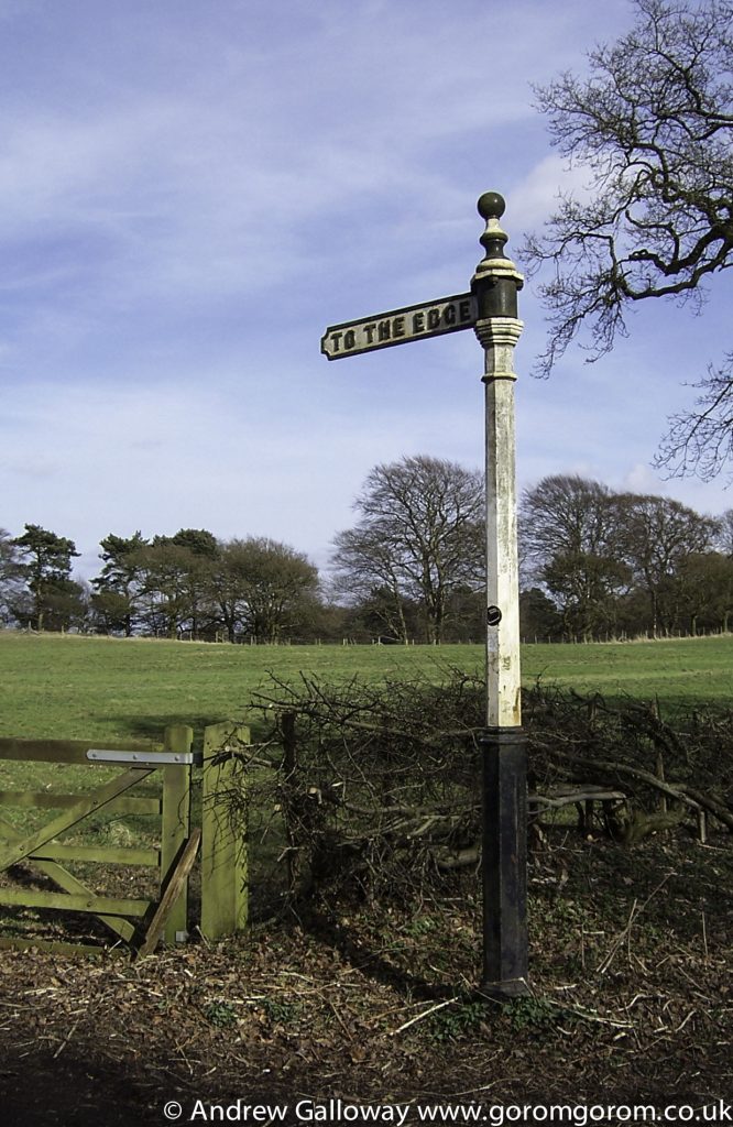
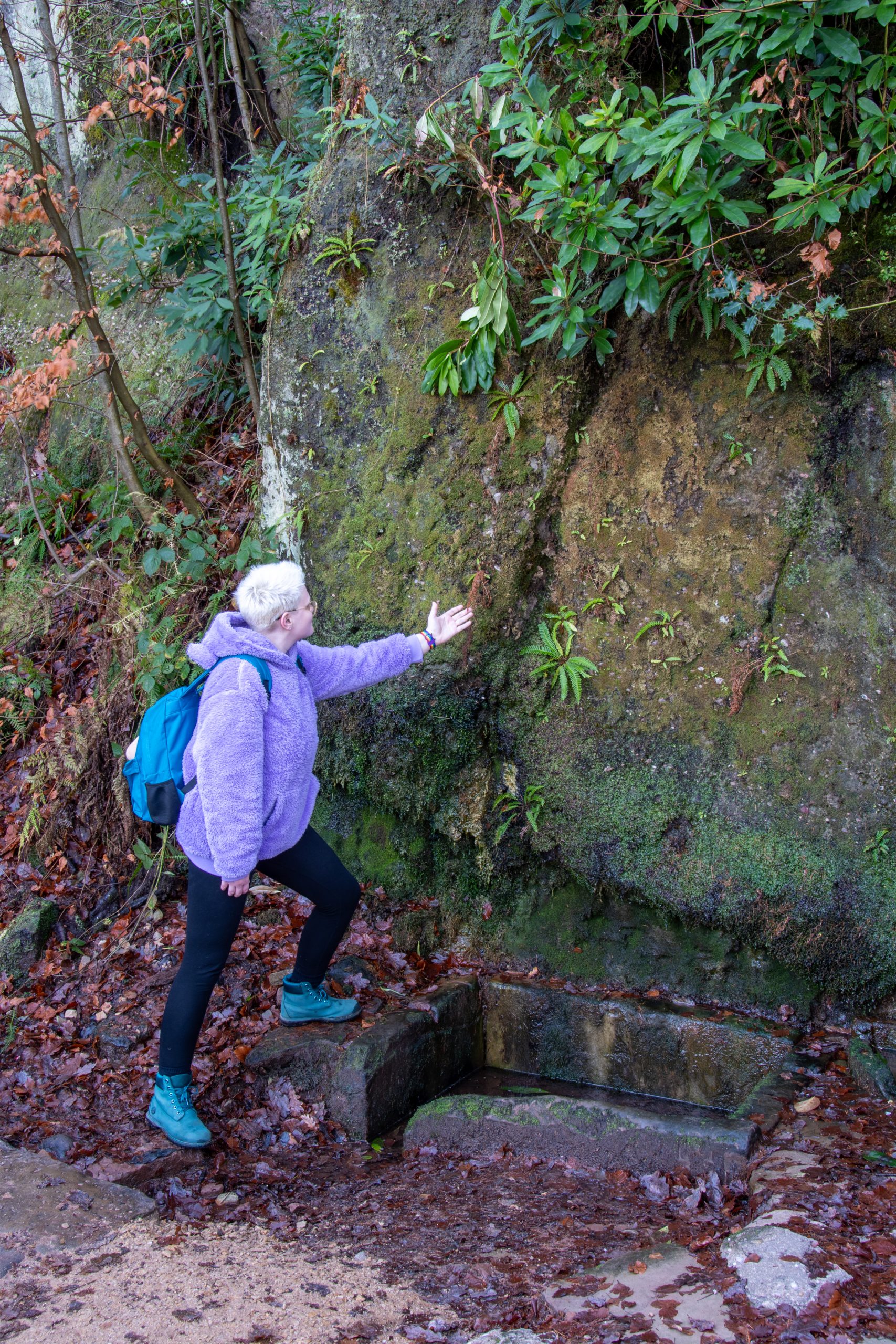
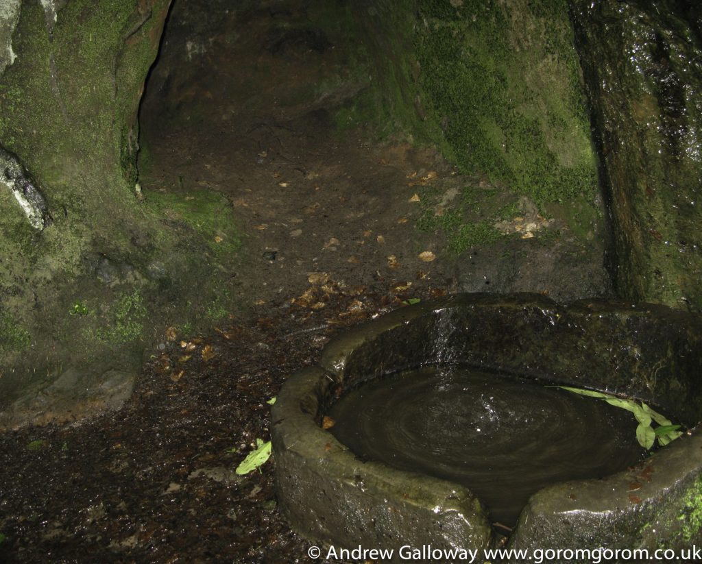
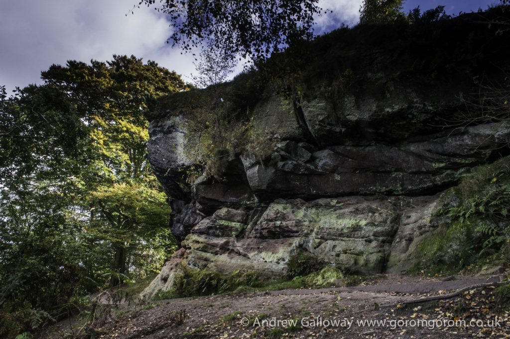
Heading back through the woods further to the north, I arrived at the Macclesfield Road by a rusted early 20thCentury sign, now a protected monument, bearing the inscription “TO THE EDGE”. The sign pointed to Castle Rock, a beautiful outcrop of the Helsby and Wilmslow conglomerates and sandstones, from which the escarpments of the Alderley edge were hewn, which were laid down during the Triassic period of geology some 240 million years ago, in an arid environment prone to flash floods, which brought down debris from the surrounding mountainous areas, rich in mineral deposits[viii]. Despite the name, no evidence exists to suggest there was ever a castle on this site, however, evidence has been found of Neolithic implements and what the Morgan’s refer to as “an original Neolithic floor” of “friable brownish sandstone” and “loose bleached sand”, dating to around 5,000 years before present[ix]. Neolithic hunter-gatherers would no doubt have been attracted to the Edge because of the shelter it provided from the prevailing westerly winds and the plentiful supply of fresh water, the Edge being irrigated by at least three natural springs.
I climbed down under the face and ran my hands along the beautiful banding within the rock, tracing the ebb and flow of ancient sand dunes and river channels, tiny crystals of silica and mica coming away on my fingers. These exposures continued to the north, gradually sloping downwards towards the village, where one of the natural springs seeped from the foot of the cliff. Looking up I saw the face of a bearded man looking back at me – Wizard’s Well. This enigmatic carving is folly believed to have been carved into the rock by the great grandfather of Alan Garner, whose family lived in the area of the Hough below the Edge (pronounced huff)for over three hundred years. Although increasingly illegible, the letters read:
“Drink of this and take thy fill for the water falls by the Wizard’s will.”
Now faced with the suburban gardens of Mottram Road, I about turned, following the sculpted sandstone eastwards to where two further springs, known as Holy Well and Wishing Well, appeared each on either side of a buttress several metres in height. By the second well, the rock was dank, coated with a curtain of moss, dripping with water rich in minerals, from deep within the ground. I cupped my hands underneath the lush vegetation and let them fill with the crystal clear water, and drank.
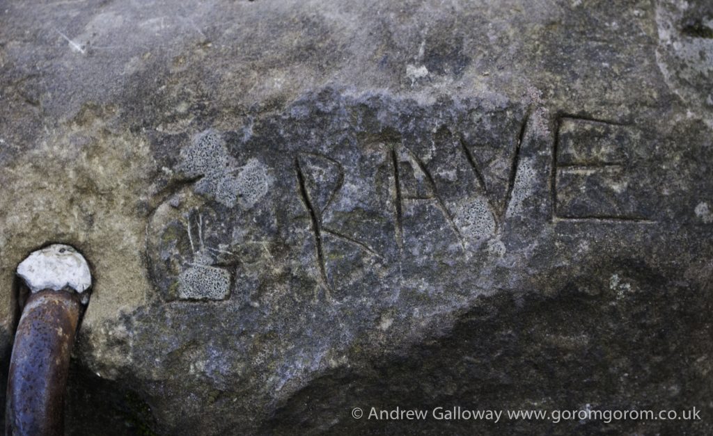
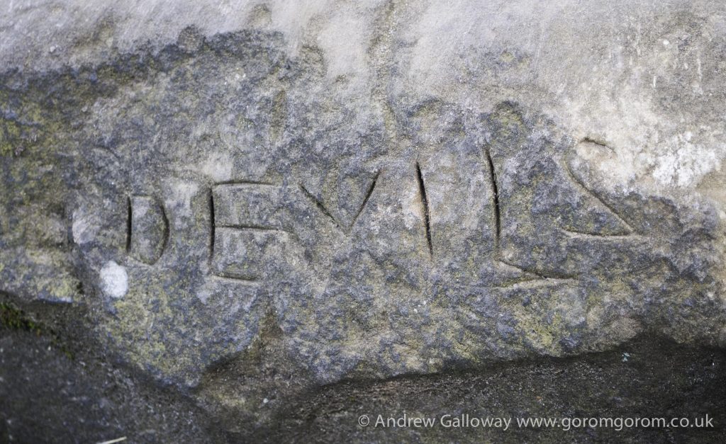
Beyond the wellsprings, the ridge of Alderley Edge climbed to an eastern prospect over looking Glaze Hill. Here at Stormy Point an impressive crust of the Triassic conglomerate sat defiantly above the softer red mottled sandstones of the Wilmslow formation, bearing the scars of past mining activities. A long fissure in the conglomerate rock around fifty centimetres wide and up to two metres deep, topped by an unusual rectangular stone capping a circular hole, is known locally as the Devil’s Grave.
“If you run round theer three times widdershins Owd Nick’s supposed to come up and fetch you.”[x]
As children we would dare each other to take up the challenge and thus by encircling the stone in and anti-clockwise direction, would invoke the very devil himself. Of course we were always bitterly disappointed when having circumnavigated the offending monolith, nothing happened.
By early afternoon the Edge began to fill with the routine assault of families of over excited children, lolloping dogs and couples wearing matching Hunter wellington boots and Barbour jackets. Barley able to contain my resentment towards these interlopers, I quickly took the path through the fir trees behind the old Pilkington Family memorial and descended into the beautiful beech woodland of Saddlebole, where the path dropped steeply into a hollow, then through the beech trees to the break of slope.
Stories are important; the telling of stories more so. In his book The Philosopher and the Wolf, Mark Rowlands describes humans as “the animals that believe the stories they tell about themselves[xi],” and there is a very real part of myself, a part that perhaps a psychologist would refer to as the child ego state, which still wishes to believe in the legend of Alderley. And although it may be my inner child who turns up the undergrowth in the nooks and dingles of Alderley wood in search of ….what? something, some recognition, some identification, this desire is by no means childish. It is the desire that has driven the creation of myth and the telling of stories since humans first acquired the ability of speech.
At Ridgeway Wood I came across a small waterfall, which tumbled over loose shale into a deep ravine. In late November of 1745, rumour spread amongst the families of the Hough that a Jacobite army loyal to the ‘Young Pretender’, Prince Charles Edward Stuart were heading south from the undefended city of Manchester to Derby, their route taking them via Alderley. The alarmed inhabitants took their beds, blankets and family heirlooms and hid out in the ravine until the ill-fated rebellion had past by.
From above the wood I returned north towards an earthen mound topped by a memorial stone. Marking the highest ground, this was the site of an Armada Beacon built around 1577 as part of an Elizabethan early warning system comprising a chain of fire signals strategically located on high ground, stretching from the south coast of England, to London and onwards throughout the country. The original building was a simple construction of four walls around a fire basket or pot, within which wood, pitch and tar were to be lit should the need arise, as it did in 1588 when the Spanish fleet attacked the English coast[xii]. Lord Stanley, owner of the Alderley estate during the 17thCentury, arranged for the beacon to be re-built as part of landscaping works, with higher walls and a pitched roof. This building collapsed during a storm in 1931, the remains of which lay scattered around the site and were used to build the current memorial stone.[xiii]
The earth mound upon which the beacon stood has been scheduled as a Bronze Age barrow, a type of prehistoric burial site also found at Seven Firs just to the south of Engine Vein and in Brynlow wood, nearby[xiv]. It is not inconceivable that the association of the legend of the sleeping knights with Alderley Edge lies in the presence of these barrows, possibly the burials of Bronze Age chieftains. Alderley was certainly of great importance to Bronze Age people because of the mineral wealth held within the earth. As the Bronze Age passed into the Iron Age, the ceremonial rights and traditions of the former people would have been forsaken, remembered only as stories and passed from generation to generation by oral tradition.
Through the thickness of trees: fir, pine, oak, ash and birch, I could hear them shouting after me, calling my name. Adult voices, distant and dislocated from the hypnotic draw of the open wound in the Cheshire woodland. I believed I had found the fabled Iron Gates deep within the tactile rocks of Alderley Edge and was intent on discovering the whereabouts of the elusive Wizard. Unbeknown to the child, the wizard in question was not Ambrosius, or Merlin, or Cadelin, but Alan Garner himself. For undoubtedly a spell had been cast over me, one from which I would never recover, and what in fact I had discovered was not the mythic Iron Gates, but something far more precious. Precious to the child, even more precious to the man as he now found himself, stumbling around in the mid-life forests and spiritual vacuity of twenty-first century Britain, desperately searching for some vestige of meaning.
[i]Derbyshire Caving Club www.derbyscc.org.uk
[ii]Chris J. Carlon, The Alderley Edge Mines, 1979, John Sherratt & Son Ltd, pg29
[iii]Victoria & Paul Morgan, Prehistoric Cheshire, Landmark Publishing Ltd. 2004, pg71
[iv]Carlon, Chris, J. The Alderley Edge Mines, John Sherratt and Son Ltd, 1979, pg 52 and 66.
[v]Ibid. pg122
[vi]Alan Garner, The Weirdstone of Brisingamen, Op. cit. pg127
[vii]Carlon, Chris, J. The Alderley Edge Mines, Op. cit. pg124
[viii]The nomenclature of the Upper Triassic sequence was changed during the 1980’s. What had originally been referred to as the Bunter and Keuper Sandstones, became incorporated into the Sherwood Sandstone Group. The two main stratigraphic sequences visible at Castle Rock, Alderley Edge are the Upper Mottled Sandstone (formerly part of the Bunter sequence), above which is the Engine Vein Conglomerate (formerly part of the Keuper sequence). See Benton, M.J., Cook, E. & Turner, P. (2002) Permian and Triassic Red Beds and the Penarth Group of Great Britain, Geological Conservation Review Series, No. 24, Joint Nature Conservation Committee, Peterborough, 337 pp.
[ix]Victoria & Paul MorganPrehistoric Cheshire, Op. cit. pg33.
[x]Alan Garner, The Weirdstone of Brisingamen, Op. cit. pg33
[xi]Rowlands, Mark. The Philosopher and the Wolf, Granta Publications, 2008, pg2
[xii]Stanley, L. Alderley Edge and its neighbourhood, Op. cit.
[xiii]Ron Lee, Portrait of Wilmslow, Hanforth & Alderley Edge, 1996, Sigma Press, Wilmslow, pg72.
[xiv]Victoria & Paul MorganPrehistoric Cheshire, Op. cit. pg119

So, while the light fails
T.S. Eliot
On a winter’s afternoon, in a secluded chapel
History is now and England
Many years ago, before the onset, or so it would seem in retrospect, of cultural consumerism, the unbridled self-gratification of Thatcherism, the ubiquitous narcissism of social media, and all the other ills of the neoliberal dream, on a russet-red sandstone escarpment on the eastern edge of the Cheshire Plain stood a ten year old boy: precocious, intelligent, a bit of a misfit, crowned with a mop of white-gold hair, dressed in a rather tatty C&A jumper, flared corduroy trousers and Start-Rite sandals. Offspring that he was of the homogenous council estate tucked away as an afterthought at the southern limit of a hazy industrial city, he none-the-less yearned for magic and enchantment, in pursuit of which he now gazed with unbridled awe and wonder into a slim chasm cut some seventy feet into the jagged rock below, a dog-eared copy of Alan Garner’s The Weirdstone of Brisingamenclasped firmly in his slightly grubby hand.
As I recall, the book had been given, or lent (though possibly never returned) to me by a school pal named Stewart whose father taught at a school in the village of Mobberley, Cheshire, a rather bourgeois settlement to the south of what is now Manchester Airport most famous for being the home of the ill fated George Mallory, who died attempting to summit Mount Everest in 1924. Why one of my school pals from a rather run down primary school on the southern fringes of the city of Manchester should have a father teaching in such an esteemed location I cannot remember, but I do remember being taken to the school one day to look for ‘conkers’ which had fallen from the lofty horse chestnut trees that encircled the school. Perhaps my pal’s dad was the gardener or something like that and I’ve got it all wrong[i]. Notwithstanding, it was he, the father that is, that introduced me to the book, the legend of Alderley and vicariously, the works of Alan Garner.
The Weirdstone of Brisingamen, a children’s novel about a geographically displaced brother and sister, Colin and Susan, who encounter Cadellin, the Wizard of Alderley and are pursued through the Cheshire landscape by the forces of evil, was the first book I had an emotional relationship with. I was not an avid reader as a child. Having a propensity for attention deficit long before the advent of Ritalin, I preferred picture books. Raymond Briggs and Jan Pienkowski were particular favourites. But the progressive social policies of Manchester City Council’s Education Committee of the 1970’s meant that books were regularly thrust into my hands, and by the time I entered lower Primary I had an above average reading age. For a child with a tendency towards visual dominance, the Weirdstone appealed not only because its narrative was particularly visual but because the book also contained maps, two of them, which gave me enough confidence to face head on the pages of daunting text, knowing that should I lose my way, I would have the maps to help locate myself.
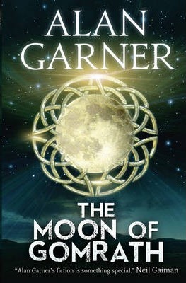
The Weirdstone and its sequel, The Moon of Gomrath were Alan Garner’s first two books, most decidedly intended for children, published in 1960 and 1963 respectively. Although perhaps somewhat dated in terms of characterisation compared to more recent popular children’s fiction, the books had a compelling energy and mystery that appealed to the adolescent mind. More importantly for me, they were rooted in a verifiable location; and not merely the broad brush of a fictional narrative located in a particular town or city, which might as well have taken place in any town or city, as with, for example, Holden Caulfield’s relationship to New York in J D Salinger’s The Catcher in the Rye, but a narrative entwined within substantive geographical features, which were as much a part of that narrative as the human characters who inhabited them. The Weirdstone of Brisingamenand The Moon of Gomrathcould only have taken place on Alderley Edge, a prominent ridge of sandstone escarpment some three kilometres long and reaching over a hundred and ninety metres above sea level, which all the more engaging for my younger self was less than ten miles from my parents house, and easily reachable by bicycle.
“And late one Sunday afternoon at the end of the first week in January, Colin and Susan climbed out of Alderley village, pushing their bicycles before them. They walked slowly, for it was not a hill to be rushed, and the last stretch was the worst – straight and steep, without any respite.[ii]”
With my bicycle chained to an old fence post and the headlamp employed as an improvised miners lantern, I would spend many hours exploring the near surface adits and passageways of the old mines. Locations such as Devil’s Grave, Pillar Mine and Doc Mine were familiar places for adventures, following in the footsteps of Colin and Susan. Upon the Edge I discovered that where Colin and Susan had “walked down the trench, and were rather disappointed to find that it ended in a small cave, shaped roughly like a discus, and full of cold damp air,” there was in fact, upon Stormy Point, among the towering Scott’s Pines, such a cave where, “there were no tunnels or shafts: the only thing of note was a round hole in the roof, about a yard across, which was blocked by an oblong stone.”The Wizard Inn with its “white walls and stone roof”, and above the door a painted sign showing “a man, dressed like a monk, with long white hair and beard[iii]” actually stood alongside the woods on the Macclesfield Road. The Weirdstone was a picture book then, except that the pictures existed in the landscape.
The story of the Weirdstone was partly inspired by the Legend of Alderley, the first known publication of which was in 1805 in the Manchester Mail. A newspaper correspondent is thought to have obtained the story from a servant of the local Stanley family, a Thomas Broadhurst, also known as “Old Daddy”. However, Parson Shrigley, the Clerk and later Curate of Nether Alderley was believed to have recounted the tale as early as 1753, himself believing the story to have originated a good eighty years prior to his telling.[iv]
The fable tells of the meeting early one morning on the Edge of a farmer from Mobberley and a tall, strangely dressed older man, who attempts to buy the farmers milk-white horse. Preferring to take his chances at Macclesfield market, the farmer is disappointed to find that his horse will not sell. Upon returning to the Edge that evening the farmer again meets the stranger and having reluctantly agreed to his proposal of sale, is led by the old man to a pair of iron gates mounted in the rock, the entrance to a large cavern deep within the hillside. Here the farmer is shown countless men lying in enchanted sleep, each but one with a horse by his side, his own mare to make the numbers complete. The farmer is richly rewarded with jewels and gold for his troubles and led from the cavern, the iron gates closing behind, never to be seen again.
The tale is not unique to Alderley. The myth of a hero and his knights entombed within a particularly striking feature of the landscape has been associated with several locations in Britain, notably the Eildon Hills of the Scottish borders, as recounted by Sir Walter Scott in his Ballad of Thomas the Rhymer[v]and the precipitous face of Y Lliwedd, which forms part of the Snowdon Horseshoe range in North Wales[vi]. In the Welsh version of the tale a shepherd is seeking a lost sheep on the slopes of Y Lliwedd when he stumbles across a small cave, known locally as Ogof Llanciau Eryri. Letting his curiosity get the better of him he enters the cave to find, as in the Alderley tale, an army of sleeping knights.
Although never specifically mentioned, is has been assumed by various authors and by Garner himself, that the Alderley knights were the companions of one Arthur Pendragon, the bearded stranger met by the Mobberley farmer his well known magical companion, of whom Gerald of Wales referred to as Ambrosius[vii] but whom we know more commonly as the magician Merlin, and despite Alan Garner’s decision to name his wizard of his book Caddelin the legend of Alderley is in folklore often referred to as the legend of King Arthur and his knights.
Such geomythological tales are often the remnants of a folk oral tradition, the purpose of which, for ancient communities, was to make sense of prominent geographical features or to facilitate the remembrance of a specific event in the oral history of the community. Often these stories were inspired by an emotional human response to the landscape. This emotional response may be described as a subliminal ‘sense of place’ or what is often referred to as genius loci, a term often used by the 20thCentury artist Paul Nash to describe the essence of his work, and what the author Merlin Coverley describes as “an eternal landscape underpinning our own”[viii]. Although unable to describe my emotions in such a manner as a child, for my adolescent self, both The Weirdstone of Brisingamen and The Moon of Gomrath evoked the genius loci of Alderley and the surrounding landscape, both books being firmly rooted in the mythology and landscape of eastern Cheshire. As Neil Philips puts it, “The importance of place to these two books cannot be over emphasised. Alderley is not simply the setting: it shapes the stories.[ix]” Or as Garner himself states in the notes to The Moon of Gomrath, “every thing and place mentioned (…) does exist, although I have juggled with one or two local names.[x]”
More than this the landscape of the stories is embodied with its own sentience, a consciousness that drives the narrative. Take for example the following passage from The Weirdstone:
“They all looked. A mile away, above the crossroads on Monk’s Heath, a grassy hill stood out above the land. It was like a smaller Shuttlingslow – or a tumulus. It had the tumulus’s air of mystery; it was subtly different from the surrounding country; it knew more than the fields in which it had its roots.[xi]”
The union of myth and landscape was to become the defining characteristic of Alan Garner’s writing, and in subsequent works, such as The Owl Service, which won for Garner the Carnegie Medal and later Red Shift, the relationship between landscape and mythology, and the psychological effect of these twin forces upon the lives of the characters who inhabit the stories, became increasingly complex, possessing an emotional maturity, which drew into question the idea of Garner as being ‘merely’ a children’s author. Always seeing the past as a key to the interpretation of the present, Garner employed the juxtaposition of myth and landscape to make a dissection of contemporary society, as Neil Philips states, “Garner is one of the most able of the writers who have sought (…) to explore the disjointed and troubled psychological and emotional landscape of the twentieth century through the symbolism of myth and folklore: myth is used as a diagnostic tool in the examination of contemporary ills.”[xii] As already indicated, for my younger self these concepts were if anything, subconscious, leaving only an emotional response to what I encountered both in the pages of the books and on the hills above Cheshire. But the very power of this emotional response, its hypnotic appeal, cannot be overstated.
[i]With the wonders of the internet I discover that the school did indeed exist and was in fact an ‘Approved School’ for boys aged between thirteen and fifteen and under the control of Manchester City Council, which makes perfect sense. The school closed in 1986 and is now a Health Spa. Thus the gentrification of North Cheshire marches on.
[ii]Alan Garner, The Weirdstone of Brisingamen, William Collins Sons & Company Ltd 1960, pg99.
[iii]Ibid. pg24
[iv]Stanley, L. Alderley Edge and its neighbourhood, Swinnerton, 1843, pg25
[v]Ibid. pg26
[vi]Sir John Rhys, Celtic Folklore: Welsh and Manx(Clarendon Press, 1901) pg.660 as referenced by Jim Perrin, Snowdon, The Story of a Mountain, Gomer Press Ltd, 2012.
[vii]Gerald of Wales, The Journey Through Wales, Book II, Chapter 8, translated by Lewis Thorpe, Penguin Books, 1978.
[viii]Merlin Coverley, Psychogeography. Pocket Essentials, London 2010.
[ix]Neil Philip, A Fine Anger, a critical introduction to the work of Alan Garner, William Collins Sons & Co Ltd, 1981, pg13.
[x]Alan Garner, The Moon of Gomrath, Harper Collins Ltd, 1963, pg187.
[xi]Alan Garner, The Weirdstone of Brisingamen. Op. cit. pg219.
[xii]Neil Philip, Op. cit. pg21.