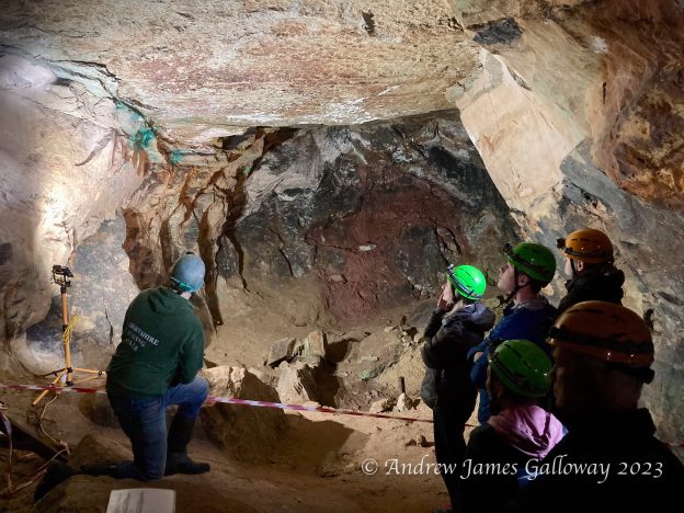
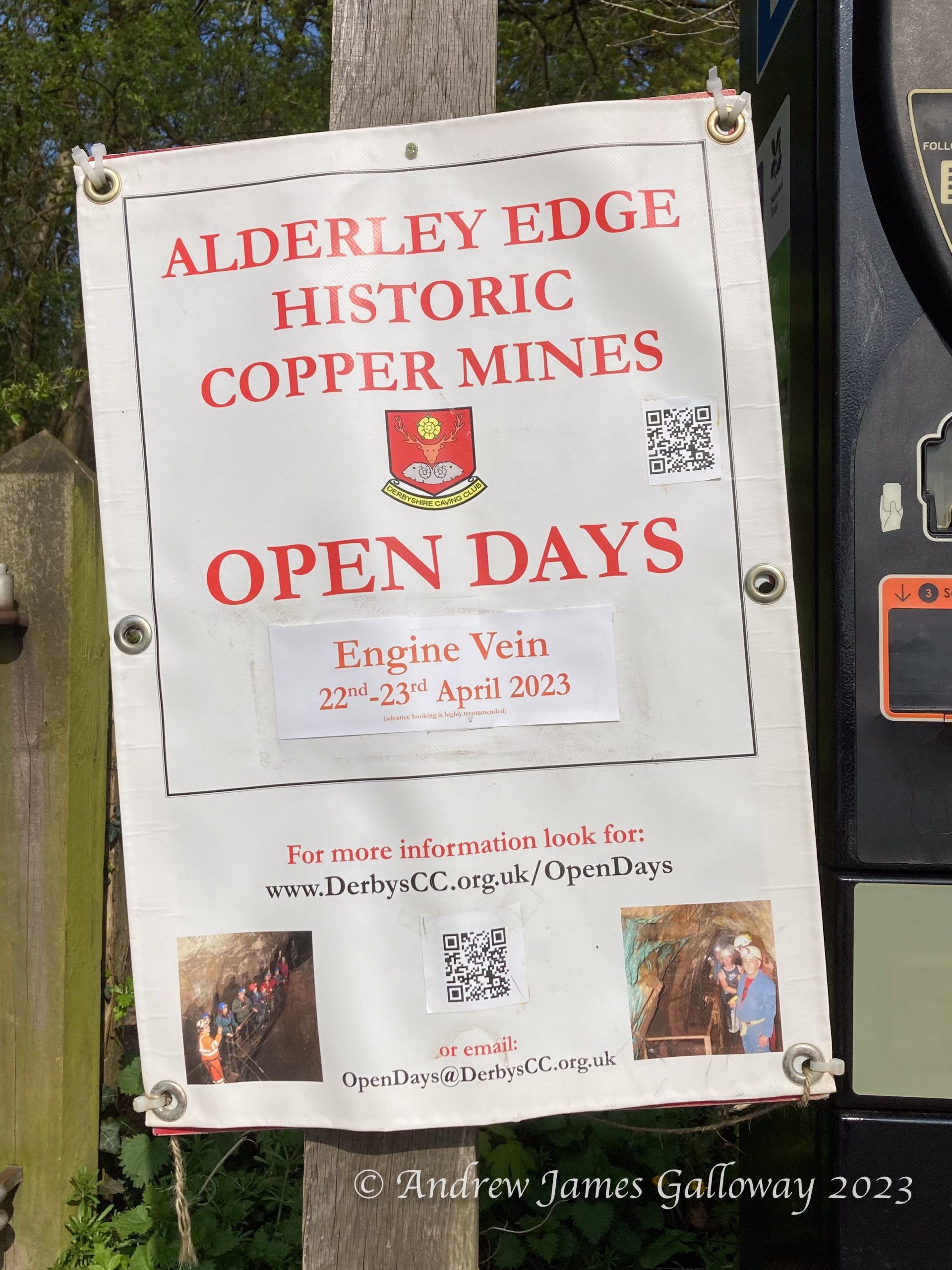
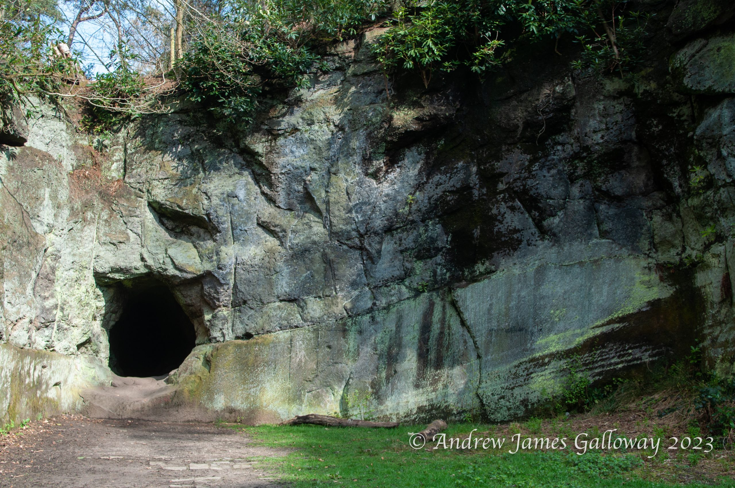
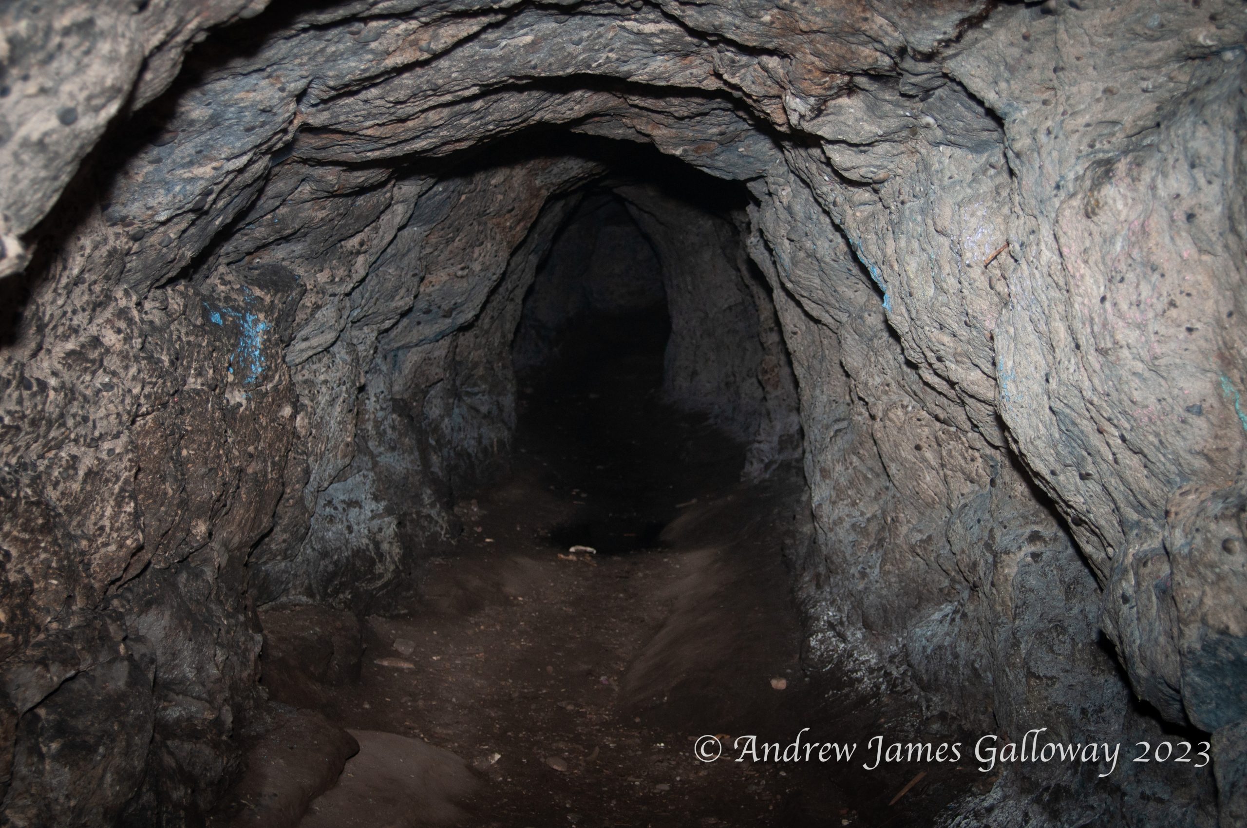
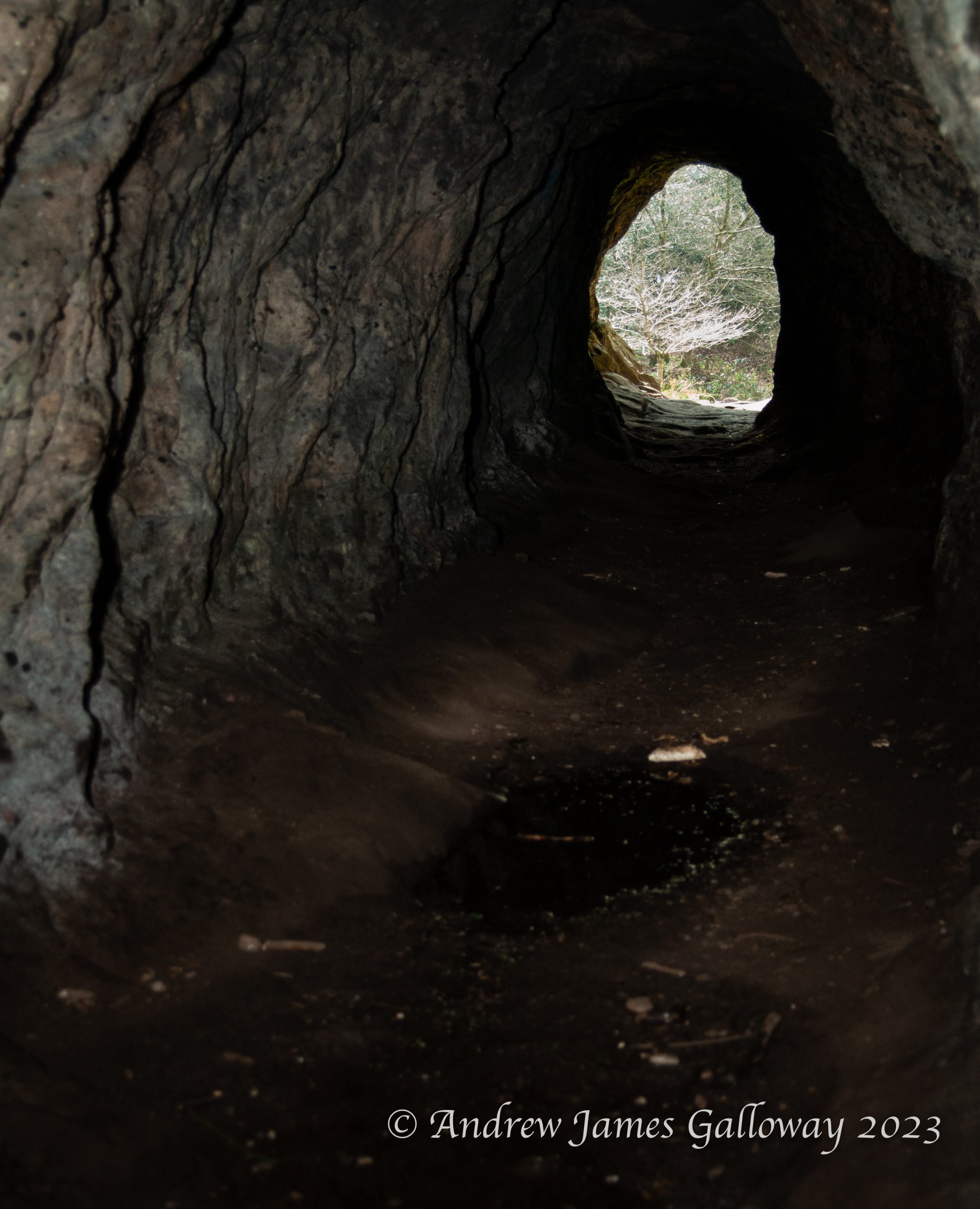
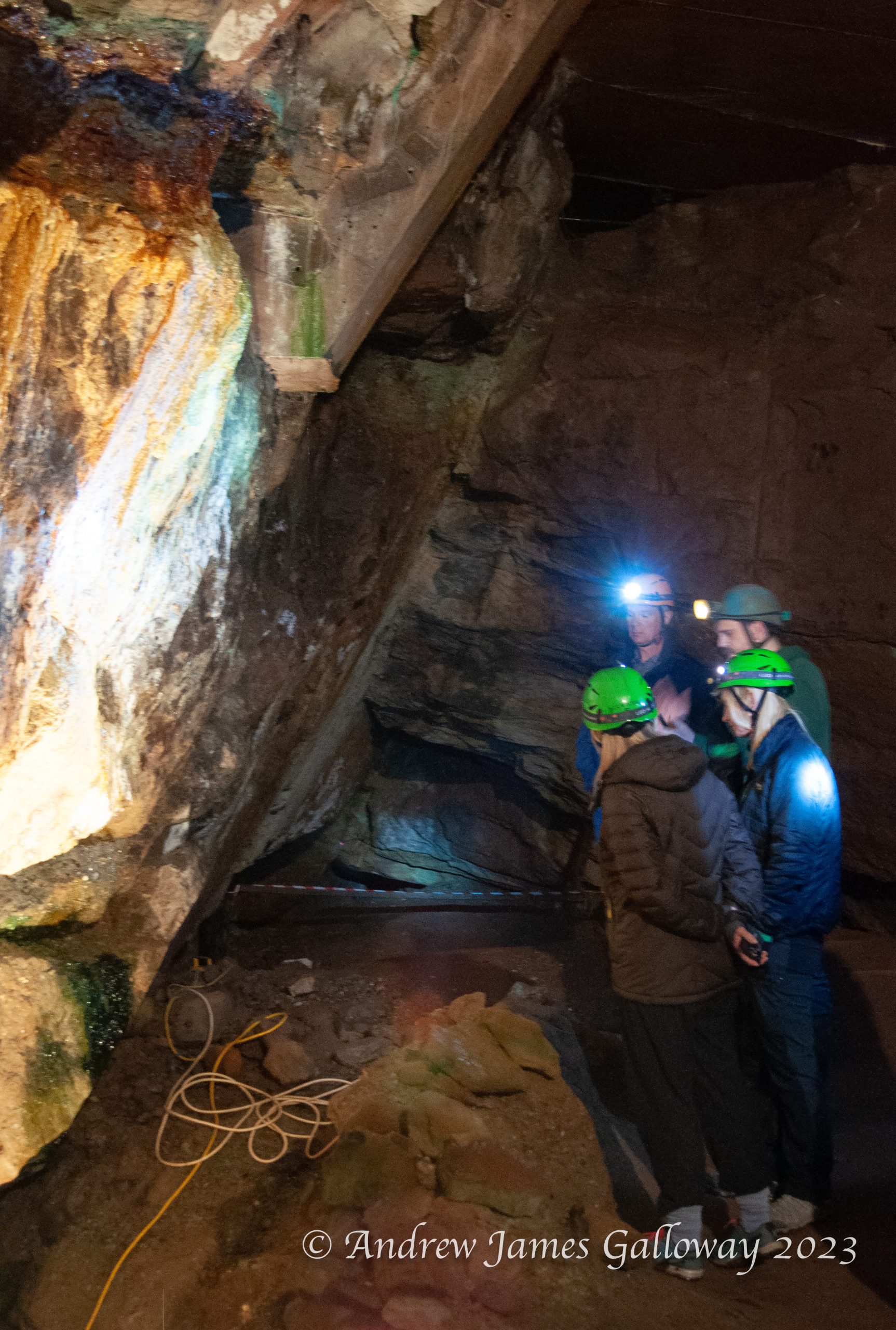
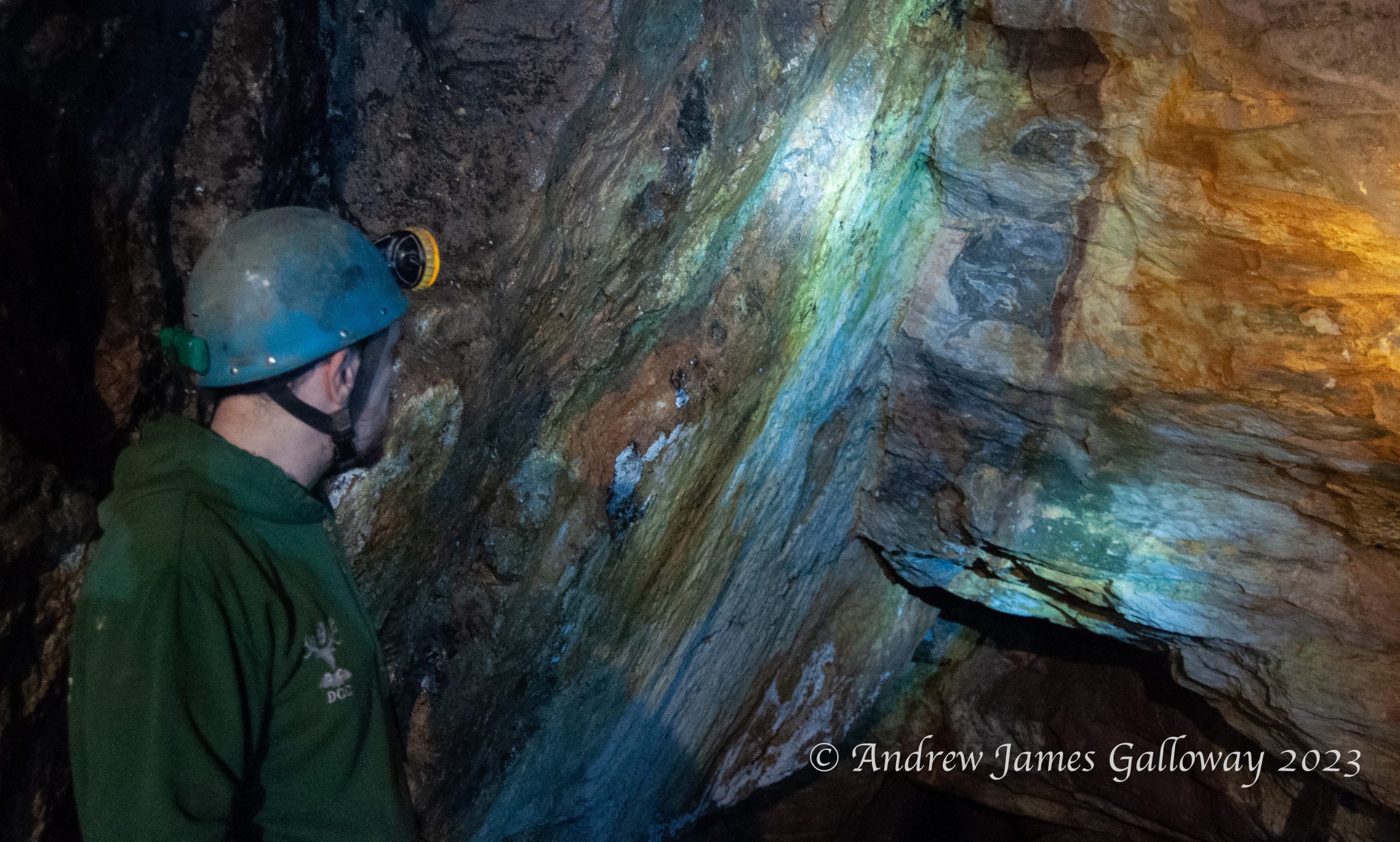
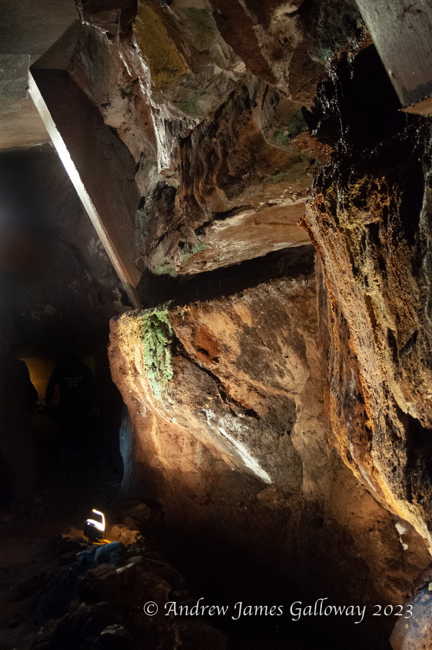
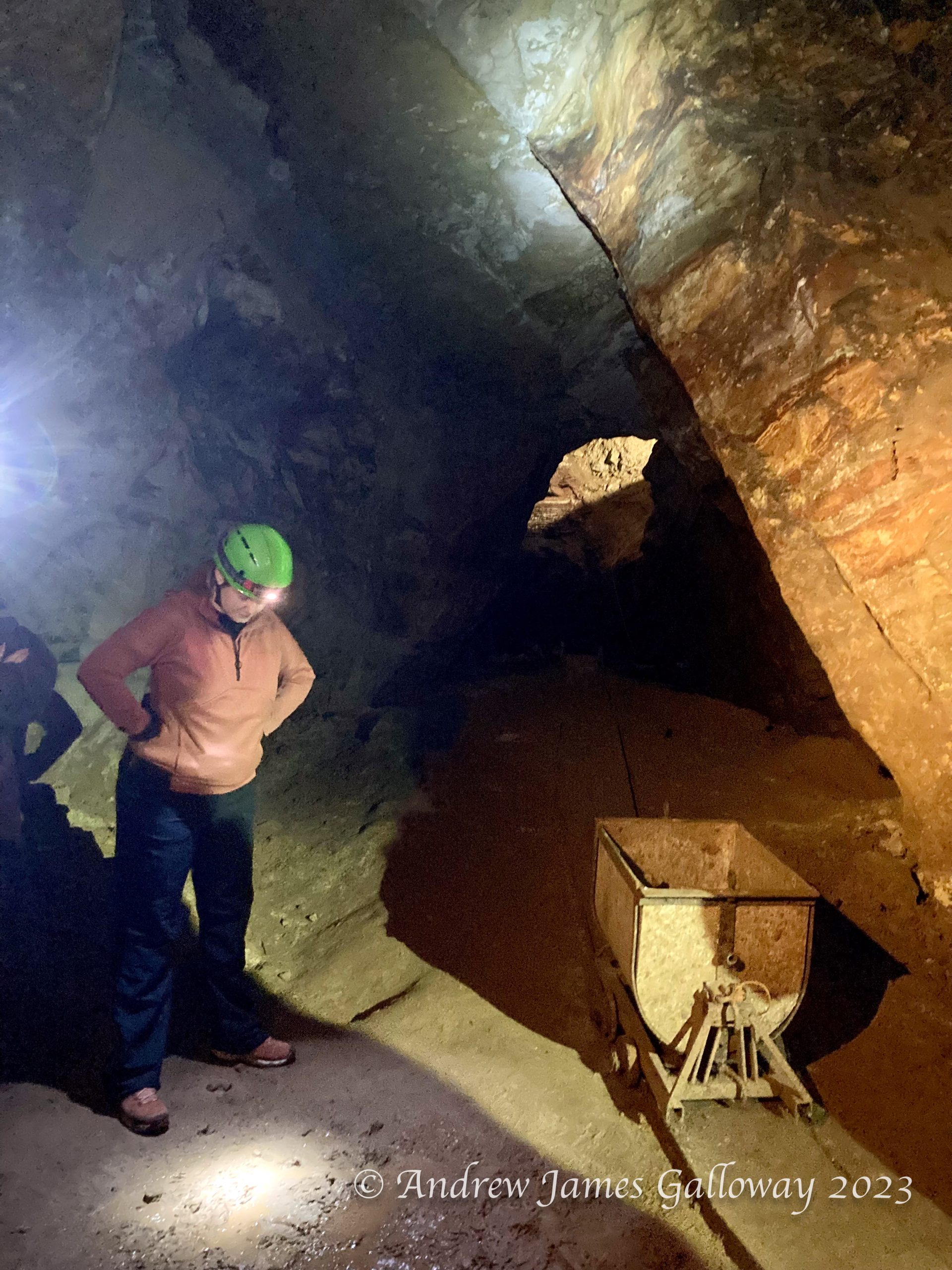
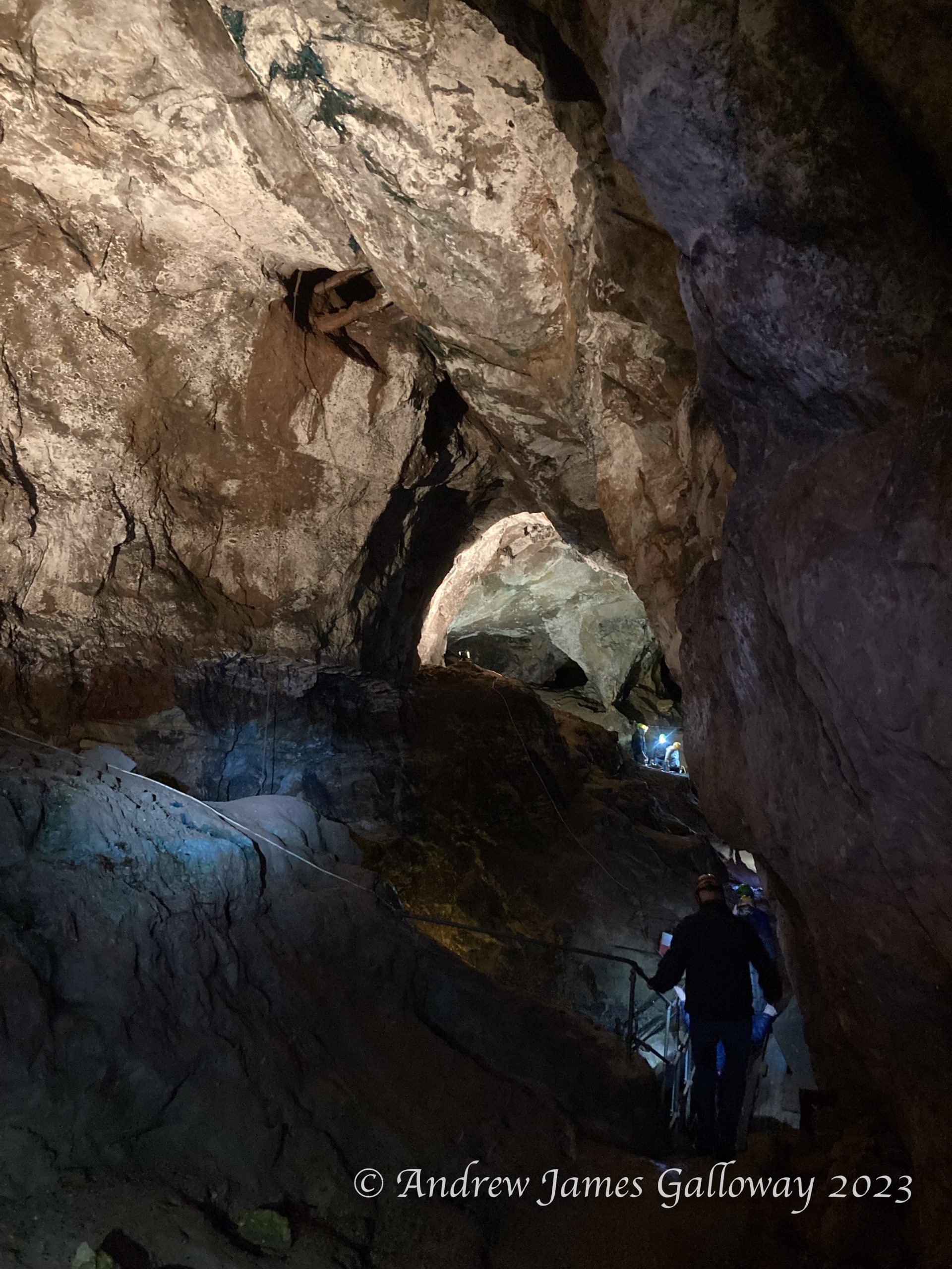
Twice a year the Derbyshire Caving Club (DCC) open up one of the old mines at Alderley to visitors. It’s a great opportunity to experience some of the history of mining at Alderley and to get a glimpse of the extent of historic excavations. I went along to reacquaint myself with subterranean Alderley and to take some photographs.
The sandstone escarpments of Alderley Edge, as distinct from the residential town, have been described by the relatively recent Alderley Edge Landscape Project (AELP) as “an anthropogenic landscape, of remarkable richness, rarity and antiquity”. The AELP was a co-operative undertaking of The National Trust and The Manchester Museum at the University of Manchester, conceived in 1995 and formally wound up on 2005. Further information about the project can be found on the DCC website at https://www.derbyscc.org.uk/alderley/current_aelp.php
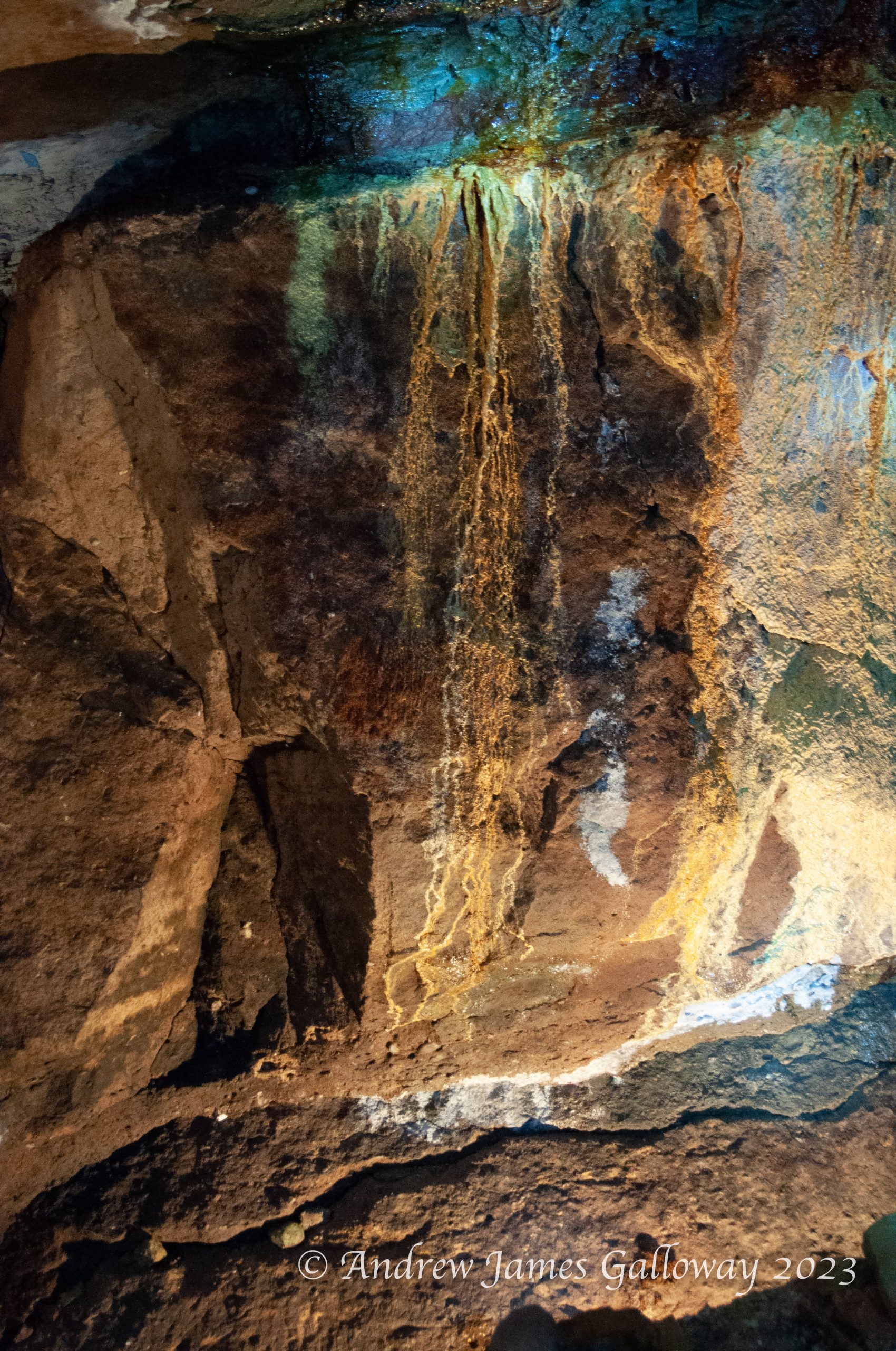
Geologically, the Alderley escarpment is composed of Triassic conglomerate sandstones some 240 million years old that were laid down in an arid environment prone to flash floods, which brought down debris from the surrounding mountainous areas, rich in mineral deposits. The earliest evidence of mining at Alderley dates to the Bronze Age. The main ore extracted was copper, but cobalt, iron, lead, silver and even gold were also found. In their book Prehistoric Cheshire, Victoria and Paul Morgan recount how an oak shovel found by 19th Century miners in a section of mine at Brynlow to the south west of Engine Vein, has been radiocarbon dated to approximately 3,700 years old. A large number of stone hammer heads and similar tools were also discovered in material that had been used to backfill the open cast mine.
In the depths of winter lockdown, with gyms & health centres closed, two friends decided to take matters into their own hands.
Summer was a blast! With an early finish from work I could be up on the hills to the east of Manchester before half the city below had finished eating their tea, as the evening meal is often referred to in these parts, with a good three to four hours of daylight remaining.
But as the season drifted inexorably towards autumn the once warm evenings became shorter and cooler. I felt the darkness closing in around me like a pack of hounds circling a fox. With gyms and swimming pools closed there seemed little alternative, and I imagined myself gaining weight, and losing what fragile grip on sanity I had, as the sedentary months of winter stretched before me.
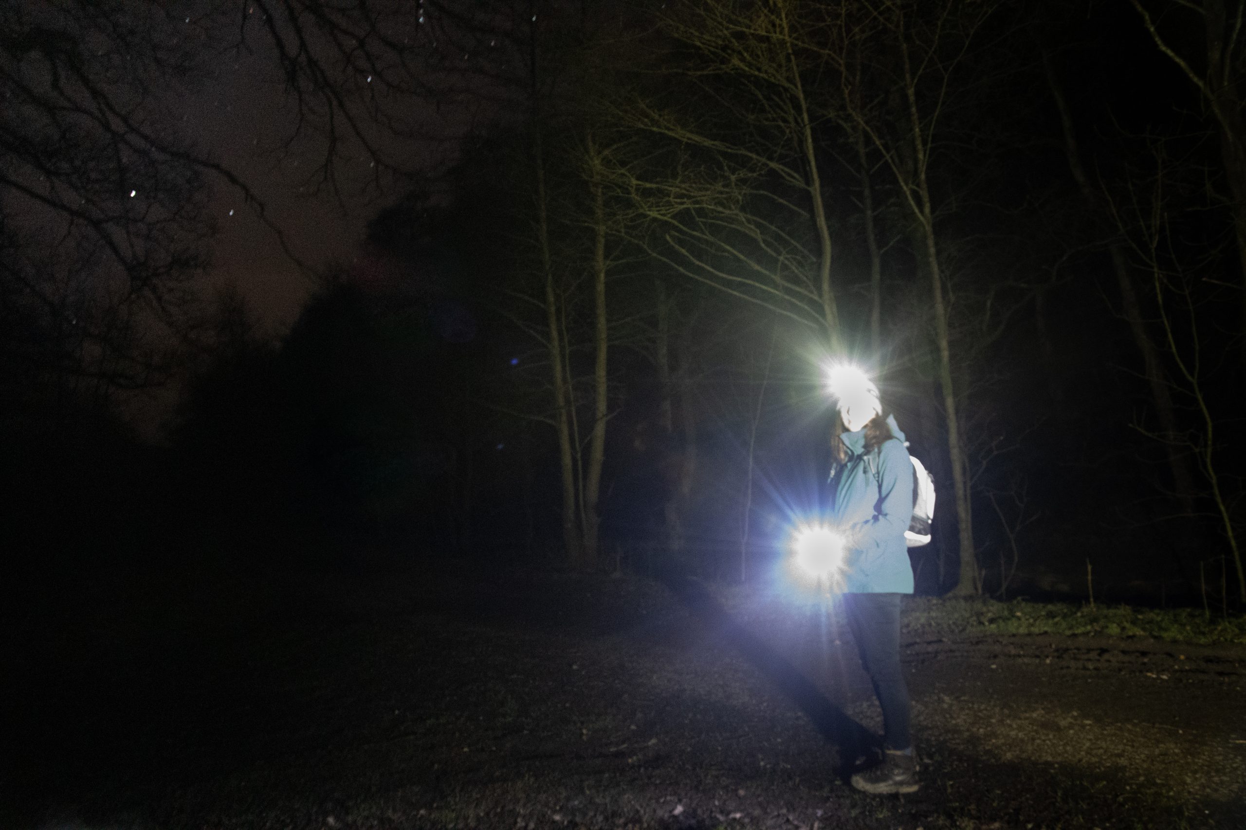
It was Alison who came to the rescue, suggesting a short twilight walk by the River Bollin. When we met at the National Trust car park the last embers of the day and familiarity of the location meant that use of head-torches was a choice rather than a necessity. As we wandered through the crepuscular woodland, the smell of bonfires and cordite upon the air, Alison mentioned she had been doing some research on local trails. She suggested we attempt to complete some of the trails in sections. And so every Tuesday evening after work we set out with head torches and ample supplies of batteries, into the darkness on the edge of town.
Alison, checking battery levels.
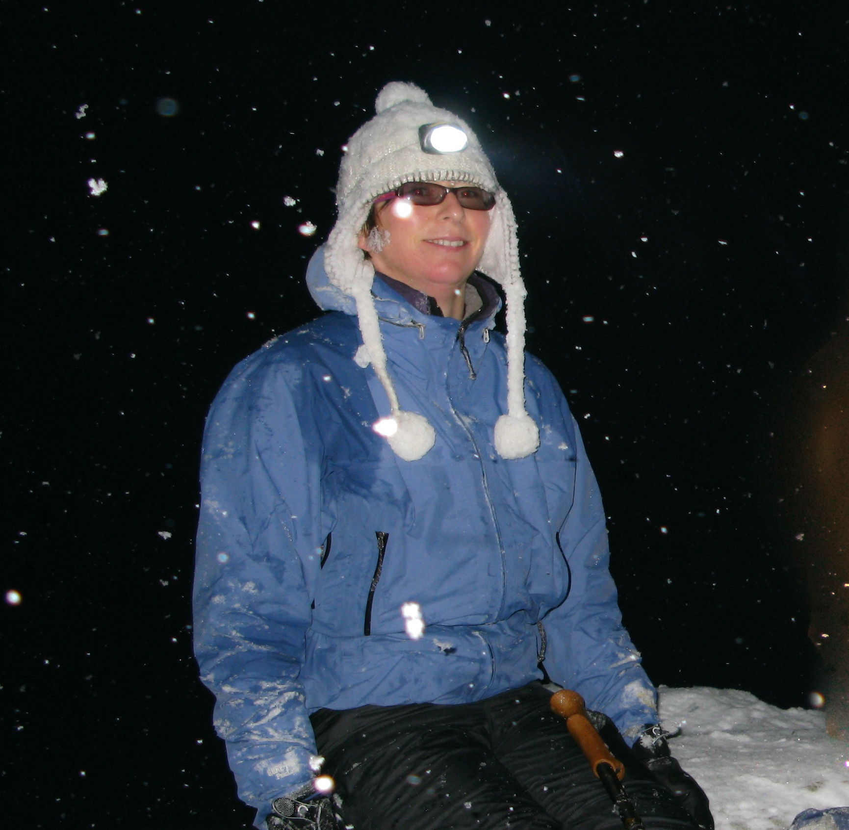
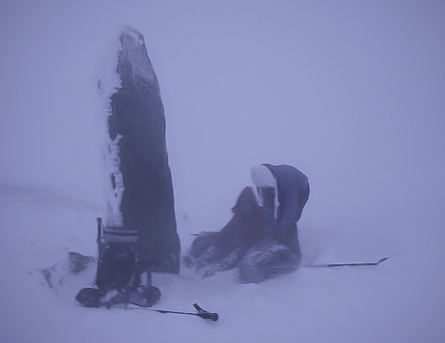
When it comes to nocturnal perambulations, Alison and I have form. Some years ago I learned there was to be a lunar eclipse on the winter solstice. For some reason lost to me now I decided it would be a great idea to observe the celestial phenomenon from the summit of Snowdon. In my imagination I had pictured a pleasant afternoon stroll to the summit in perfect conditions, returning to Pen y Pass beneath the Milky Way.
Almost inevitably the Welsh weather had other ideas. By four o’clock in the afternoon, with light rapidly fading, we had made it as far as the obelisk at Bwlch Glas but were at that point forced back by the icy blast of air streaming over the col. Temperatures were so far below zero that my thermos flask completely gave up the ghost, the contents turning into an icy Frappuccino. We quickly descended to Glaslyn and returned to Pen Y Pass via the Miners’ Track.
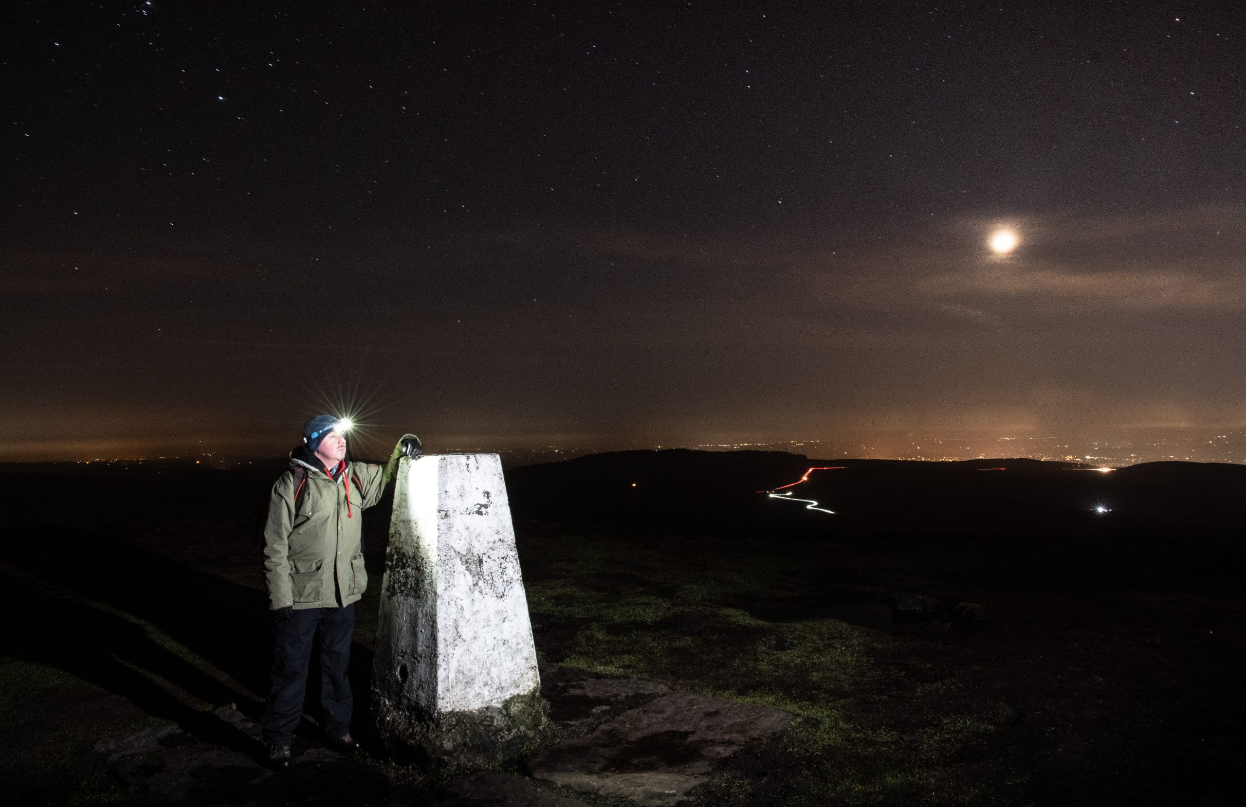
Alison and myself on Snowdon
Overcoming Night-time Anxiety The idea of walking in the dark may seem undesirable, illogical or just plain dangerous, but with a little knowledge and preparation there is no reason why the hours of darkness cannot be put to good use.
Location For those new to night-walking I recommend starting local. The first local trail Alison and I decided to tackle was the Ladybrook Valley Interest Trail. This sixteen kilometre trail makes use of suburban green corridors that follow the Ladybrook, a tributary of the River Mersey, from Lyme Park in Disley, Cheshire to Cheadle in Greater Manchester. Walking on one evening a week and breaking the route up into circular sections it took us five weeks to compete the trail.
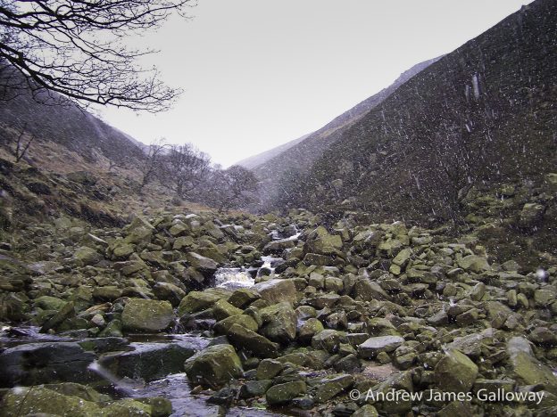
Next we turned our attention to the Goyt Way. Also sixteen kilometres in length the Goyt Way follows the River Goyt – another tributary of the River Mersey – from Whaley Bridge in Derbyshire to Etherow Country Park in Greater Manchester. Again we planned circular routes and completed the trail in four weeks, working our way up-stream passing through the village of Marple Bridge and the industrial town of New Mills, despite freezing temperatures and heavy snowfall.
Goyt Way, New Mills
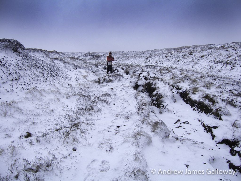
Snow cover brings pluses and minuses for night-walking. As with daylight walking snow can hinder navigation by covering up footpaths. None-the-less, we found a blanket of white on the ground had the affect of reflecting ambient light, a considerable aid to navigation, at times rendering our head-torches redundant. Another unexpected bonus of night-walking in winter was seeing farms and villages bedecked with Christmas lights.
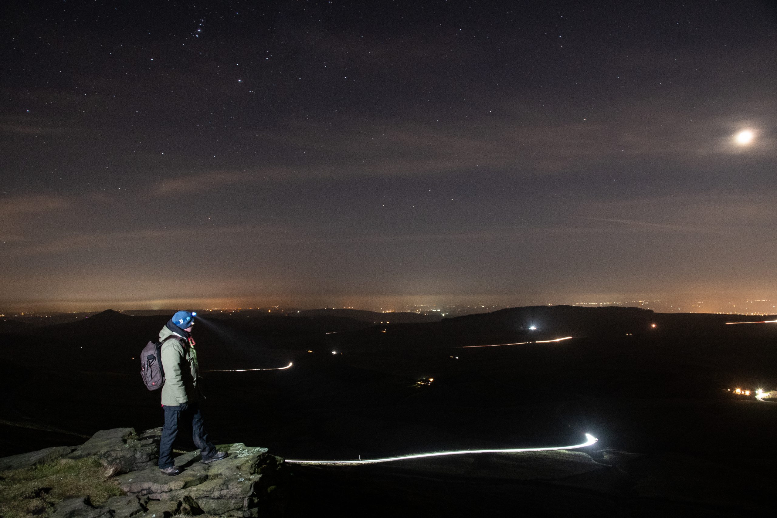
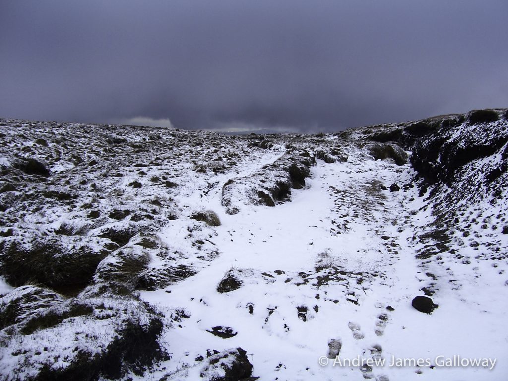
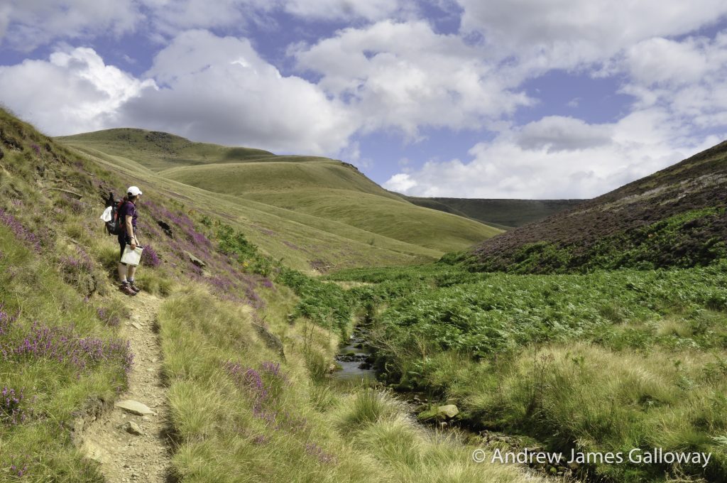
Having reached the official end of the Goyt Way at Whaley Bridge we planned additional routes to continue south into the Goyt Valley, following the former route of the Cromford and High Peak Railway to Bunsal Cob. The sodium lights of suburbia now far behind us we headed onto open moorland, traversing the ridge from Pym Chair to Shining Tor that forms the boundary between Cheshire and Derbyshire. From this vantage point, we looked down onto a million lights, spread out across Greater Manchester and the Cheshire Plain. Through the crystal clear air we could see the illuminated cooling towers at Fiddler’s Ferry Power Station, near Widnes and the distinctive chain of red lights on the television transmitter at Winter Hill, some forty miles away as the crow flies.
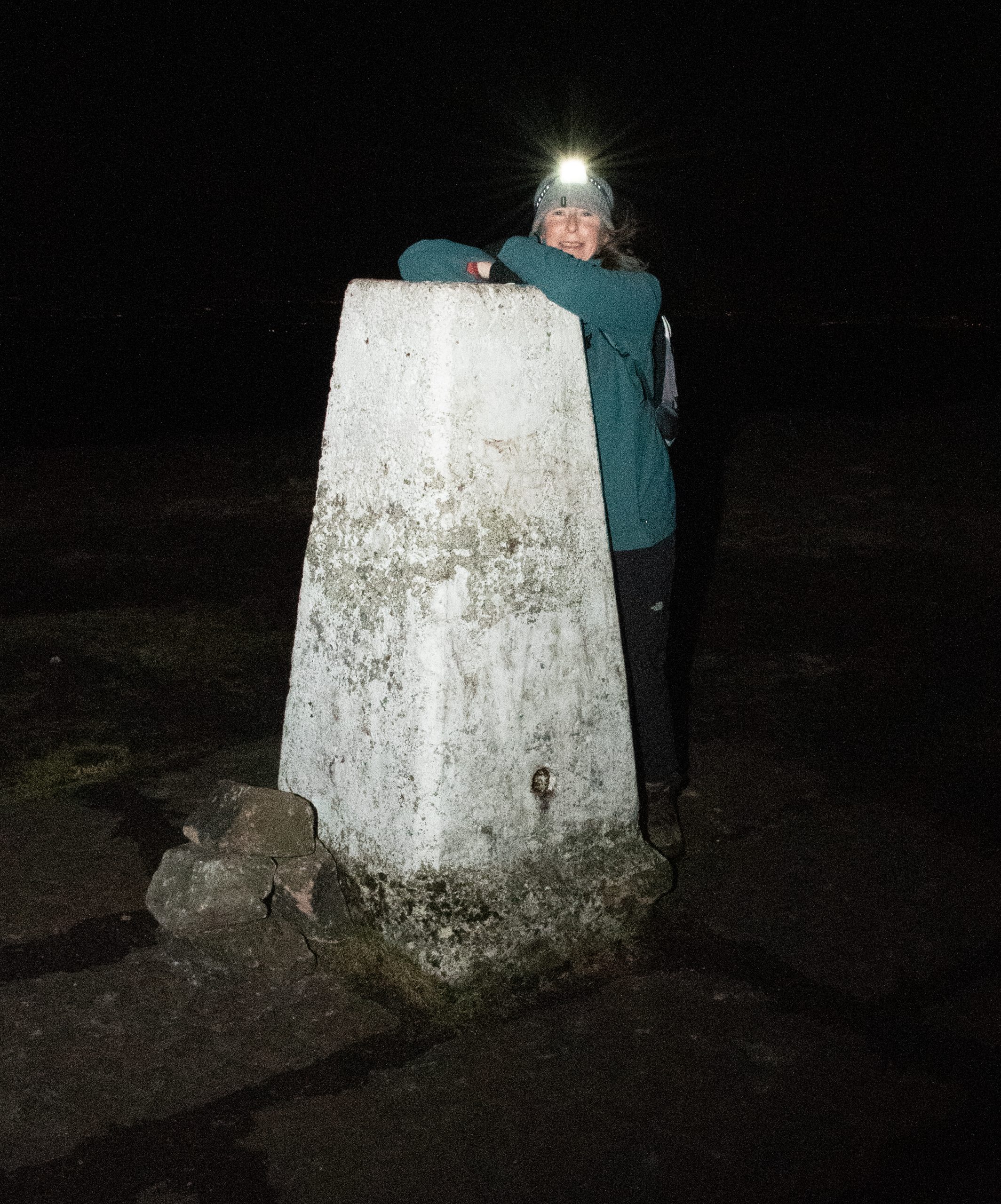
Alison at the trig point on Shining Tor
Navigation The first step on the path to confident night-walking is to be confident with daylight navigation techniques. The skills used to navigate in poor weather conditions on British hills need only slight adaptation to be as effective at night.
A number of organisations offer opportunities to learn navigation skills. The National Navigation Award Scheme (NNAS) provides accreditation of over three hundred companies offering navigation training throughout the UK. There are three levels of award: Bronze, Silver and Gold. For those wishing to gain a broader understanding of hill walking, Mountain Training UK & Ireland offer a range of accredited courses and awards. In addition to navigation techniques, Mountain Training courses cover aspects such as walk planning, clothing and equipment, weather, hazard & emergency procedures and environmental awareness. Some of these training courses have specific night navigation content. I would recommend this programme for anyone who is looking to be a walking group leader. For up-to-date information check the NNAS and Mountain Training websites.
Myself on Shining Tor
Map or GPS? For a long time I was something of a Luddite with regard to GPS technology, but here we are in the third decade of the twenty-first century, equally cursed and blessed with hand-held devices. I have to confess that much of the navigation on our evening walks was aided by one or two apps on our phones, specifically Viewranger (now known as Outdooractive) and the OS Maps app. However, I would be failing in my duty if I did not offer a strong warning about over dependency on GPS devices. Batteries, specifically lithium batteries, do not perform well in cold weather conditions. As most smart phones are powered by integrated power sources, carrying a spare is not an option. Portable power banks provide some security but it is worth considering that any device might become inoperable in freezing temperatures. You cannot beat having the back up of a paper map and compass.
Light Source I’ve stressed the importance of carrying a map and compass as back-up for GPS devices, but without a light source a map is unreadable. In order to leave your hands free I recommend using a good quality head torch. However, even modern LED light sources can suddenly die, as happened to me on one of the sections of the Goyt Way. Therefore, not only should you carry spare batteries for your primary light source, but also carry at least one other light source as back up. Most importantly, do not rely on the torch on your phone. If you are using a GPS app on your phone to navigate and the torch to provide a primary light source the battery will deplete in minutes rather than hours.
As exciting as night walking can be, it is important to keep in mind that you are not on manoeuvres with the SAS and as such it is vital that you are visible to others, particularly when making use of country roads. Small, portable lights can easily be attached to clothing and rucksacks. I have found the Silva Simi range, available in white (for front) and red (for rear) particularly useful for this purpose.
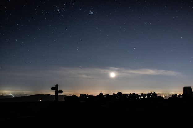
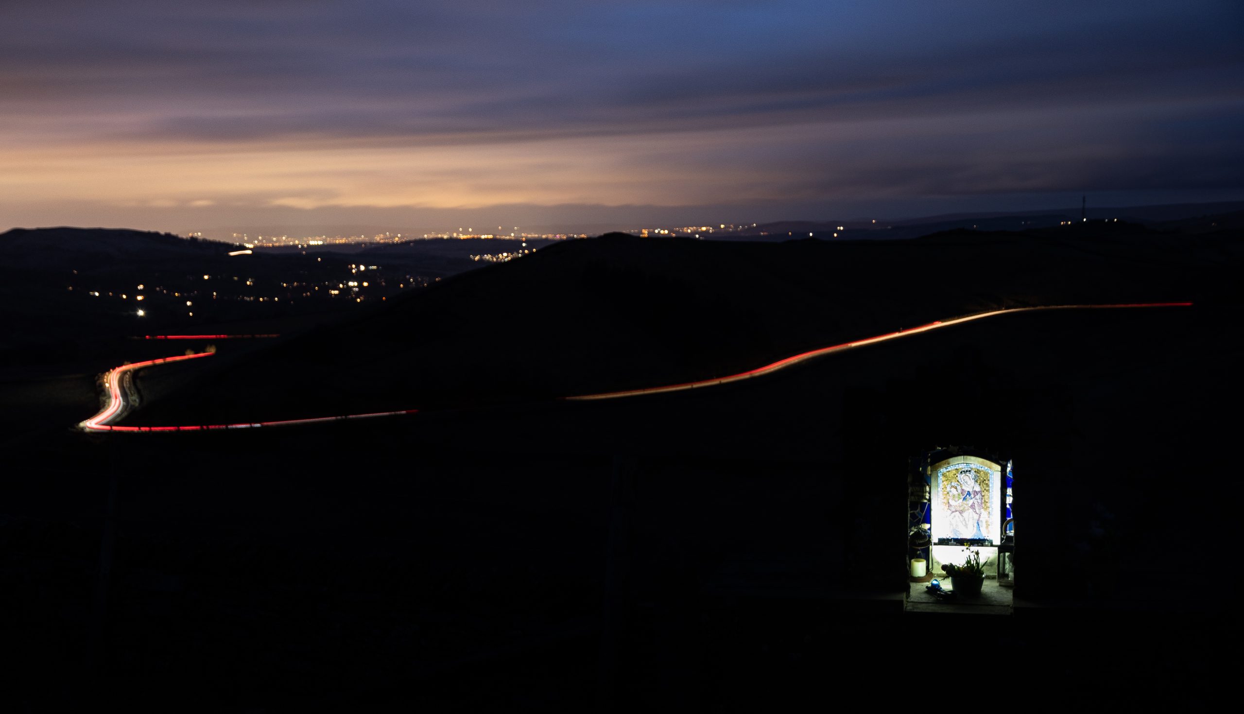
St Mary’s Shrine, above the A5004, Got Valley
Clothing It will come as no surprise that at any time of year the absence our primary heat source means that nights are invariably several degrees cooler than the daytime. This is especially so in winter when night temperatures regularly fall below zero. The importance of keeping warm cannot be overstated. Traditional advice about base, middle and outer-shell layers certainly applies here. I also recommend carrying additional layers of clothing in your rucksack. Duvet gilets are particularly good for maintaining core temperature and can easily be worn over a waterproof jacket. Similarly, do not rely on only one pair of gloves. Even in thermal gloves, fingers can rapidly become numb when exposed to minus temperatures and wind chill. A pair of oversized woollen mittens slipped over the gloves will quickly return heat to the extremities.
Well equipped for night walking
Spring Again Winter was a blast! With increasing confidence of walking in darkness we had taken on the trails and bridleways of the western Peak District and had stood on snow covered hill tops looking down onto the shimmering lights of the conurbation below.
Our weekly nocturnal wanderings had become something of a harbour in the tempest, a focal point in an otherwise dismal and at times seemingly interminable winter. As the days began to lengthen and the last patches of snow melted from the groughs of Kinder Scout, we considered bringing things to an appropriate end. But on reflection there was no logical reason to do so, and our weekly night-time walks became sunset walks. That’s the really amazing thing about the seasons: the cycle just keeps going round and round.
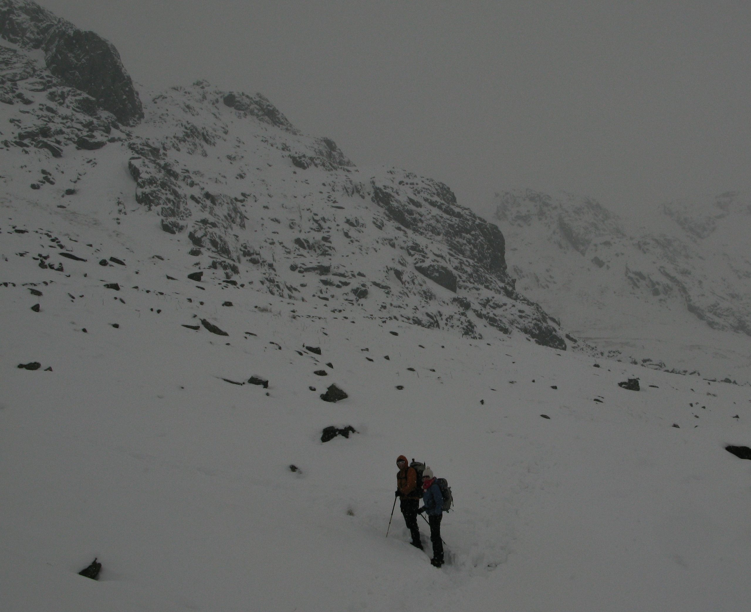
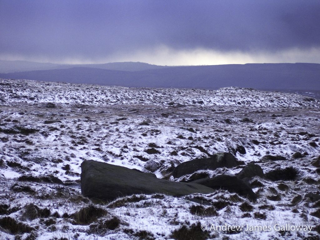
“I don’t like the look of those clouds,” said Alison, as we made our way beside Torside Clough onto the plateau expanse of Shelf Moor, an icy north-easterly wind picking up the spindrift of the overnight snowfall and whipping it against our faces. “We’ll head for the Wain Stones at Bleaklow Head,” I suggested, “we might get a little shelter there.”
“I don’t like the look of those clouds” on Bleaklow Hill
Alison’s meteorological prediction was correct. As the black clouds pressed down on the featherbed heather of Bleaklow Hill, they gave up their cargo of ice crystals in abundance. Carried along by the same northeasterly wind a wall of white soon bleached the sky and moorland of any contrast and within minutes where there had been clearly distinguishable shapes, there was only whiteout. “We best get the emergency shelter out,” I suggested. Alison, daughter of a Malpas farmer and raised to the harsh conditions of the farming calendar gave me a look far colder than the blizzard which now engulfed us. “Behind the stones will be fine,” she shouted above the now howling wind. We crouched down in the few metres of relief from the wind that the kissing gritstone gave and searched for the hot chocolate hidden somewhere in our rucksacks.
Boom! And then again, Boom!
From the south the heart stopping sound of explosion fell through the cloud with oppressive weight. “What the hell was that? It sounds like they are dropping bombs over there.” “I don’t know,” said Alison, “but I don’t think we should stick around to find out.” “It could be thunder,” I suggested, “but I’ve never heard thunder like that. And we’re at the highest point here. Not a good idea in a storm. We’d best get to lower ground.” But the Pennine Way, elusive at the best of times on Bleaklow Hill, had vanished into a chiaroscuro landscape of black peat groughs and white snowdrifts glimpsed briefly through the brief respite of the spindrift swirling around us. “We’ll have to do this on compass,” I said.
I took a bearing to the north-east and began to pace out the three-hundred metres to where, as indicated by the map, our intended path turned northwards, but the undulations of the peat groughs, the eye stinging snow and the rapidly deepening snowdrifts made the going almost impossible. The cairn that indicated the swing in the Pennine Way to the north was lost somewhere between the rough white landscape and the bleached white sky.
“I think we’re lost,” I shouted to Alison above the wind. “We can’t be,” insisted Alison.
I suggested we retrace our steps on a back bearing to Bleaklow Head, but that wasn’t going to get us off the moor, or down to lower ground. Instead we decided to head out north from our current position, the logic being that ultimately we would descend into the Woodhead Pass. Staggering north through the biting wind, we eventually reached a wire fence transecting our path, which, for no other reason than it being the only distinguishable feature since leaving the cairn at Bleaklow Head, we elected to follow it to the west, which thankfully, turned out to be a good decision as it led directly into Wildboar Grain from whence we had originally come.
Even the harshest winter will give way to snowdrops and catkin-tails, so spring once again took it’s fecund hold over the Derbyshire hills and I was keen to return to Bleaklow Hill to retrace navigationally challenging steps and to explore what I knew to be up there on the sandy soils of the gritstone plateaux and what had been eating away at my imagination since Alison and I had heard the sounds of explosion in that blizzard.
Approach to Higher Shelf Stones along Doctor’s Gate
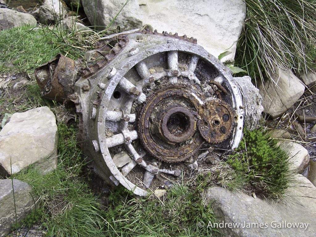
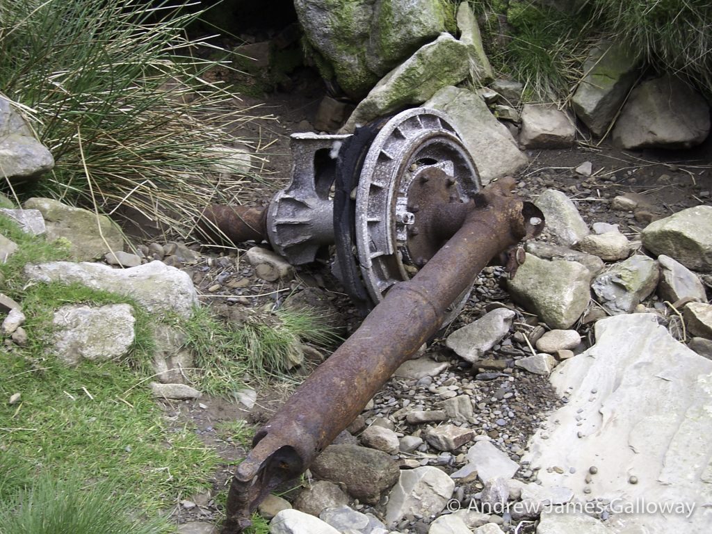
On this occasion Allison (same name, spelt with two l’s, different person) and I approached from Glossop along the course of Doctor’s Gate, the old Roman route across the Snake Pass, the precipitous cloughs sweeping down from the high moorland making one of the most dramatic landscapes in the Dark Peak. The magnificent re-entrants slicing through the Namurian millstone grit proved too tempting and so we crossed Shelf Brook and began to scramble up Ashton Clough. We had not climbed far when we stumbled upon the first evidence of what I had been expecting to find. A hunk of silver metal, possibly some type of steel, about a metre in diameter and very badly weathered was sitting in the centre of the small stream that falls from Ashton Clough, its once moving parts petrified by decades of rust.
Sure enough, another fifty metres higher, now half buried by soil, we found what was still just discernable as the fuselage of an aircraft. The skeleton of this airframe was thin and flimsy, constructed of aluminium alloy. This cocoon like relic was the remains of a C-47 Dakota aircraft operated by the 314thTroop Carrier Group, which crashed on 24thJuly 1945 on Shelf Moor. Over the course of seventy years parts of the aircraft, including this section of the rear fuselage, have been moved down slope into Ashton Clough. Alan L. Clark, author of a walkers guide to aircraft wrecks in the British Isles, reports that the aircraft was on a transport sortie from Poix, near Amiens, northern France to Renfrew (now Glasgow airport) but failed to arrive at destination. All five crewmembers and two passenger were killed. The official USAAF report on the accident blamed low cloud.
USAAF C-47 Dakota crash site at the top of Ashton Clough
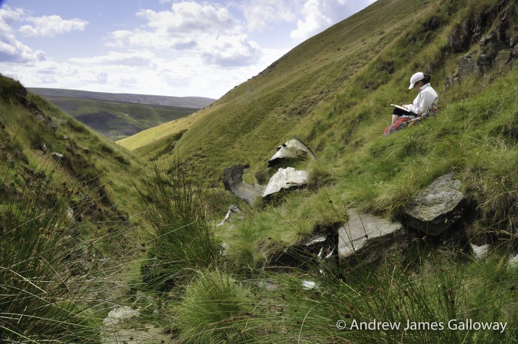
At its steepest point, in situ gritstone causing the little stream of water to tumble in pleasant cascade, Ashton Clough suddenly pops out onto Shelf Moor below James’s Thorn and the full unsheltered expanse of the Bleaklow plateau becomes visible (in good weather that is). Allison wishing to practice some navigation skills suggested we ‘leap-frogged’ our way over to the trig-point at Higher Shelf Stones. The navigation technique of ‘leap-frogging’ can be used in restricted visibility, such as in low cloud or at night whereby two or more people can use each other as reference points from which to correct a directional bearing.
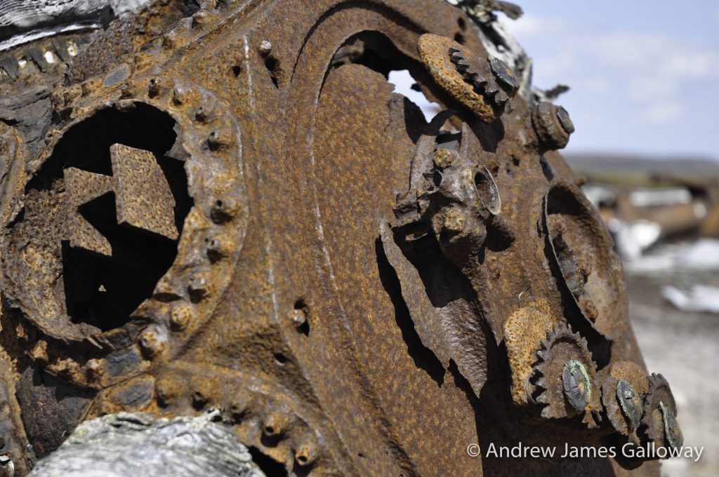
Just a few hundred metres north of the trig-point we found the first piece of twisted aluminium lying against the black peat, shining in the sun as if it were newly cast, while in fact it had lain here, high upon the moor, for seventy years.
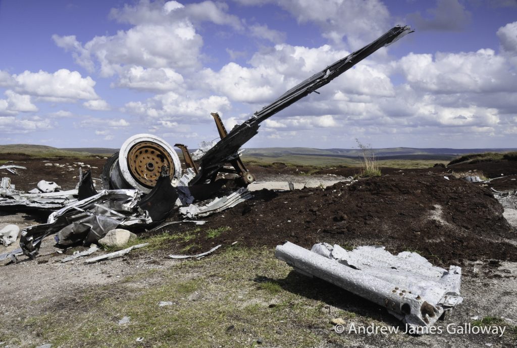
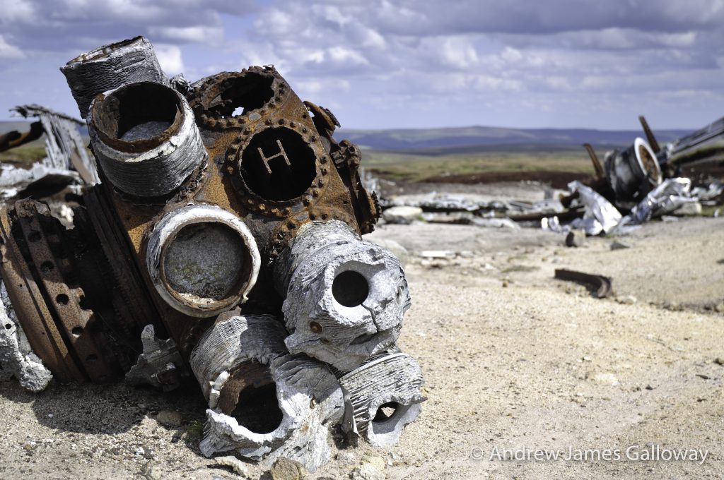
It can take a little while to orientate yourself over the expanse of wreckage spread out over a hundred square metres, but eventually the fragments of an aeroplane begin to knit together to form a whole: engines first, four of them, then undercarriage, wings, tail-plane, and then you think of the crew. This USAF Boeing RB-29 known as “over-exposed” on 3rd November 1948 was taking payroll and mail from Scampton in Lincolnshire to Burtonwood near Warrington, once one of the largest USAF supply bases in the UK. Due to poor weather conditions the flight was being conducted on instruments, the pilots effectively flying blind. It is thought that due to a navigational error the captain understood his position to be further to the west than it actually was and began to descend on the approach into Burtonwood too early, with disastrous consequences. All thirteen crewmembers were killed.
It is perhaps difficult to imagine in todays age of computer assisted flight and instrumental landing systems, but the vast majority of wartime aircraft did not carry on-board radar and did not have pressurised cabins. This meant high altitude flight was often not an option and that navigation in poor visibility could only be achieved by a process using compass bearing, airspeed indicator and stopwatch, a type of aeronautical Naismith’s Rule. As a consequence, errors were common. The high ground of Britain, in particular the Peak District is littered with such tragic sites.
USAF Boeing RB-29 “over-exposed” crash site on Higher Shelf Stones
Unsurprisingly, a modern mythology has grown up around the area. There are tales of phantom aeroplanes and ghostly apparitions. Gerald Scarratt of Longdendale, whilst exploring the RB-29 crash site discovered what he thought to be a washer, but on later inspection found to the gold ring belonging to the aircraft’s captain Langdon P. Tanner. Returning to the site with a group of aircraft enthusiasts, Gerald was recounting his tale when his companions turned ashen faced and began to walk away from the site. They later claimed to have seen a pilot in full post-war flying gear standing behind Gerald, although Gerald himself remembers seeing nothing of the sort.
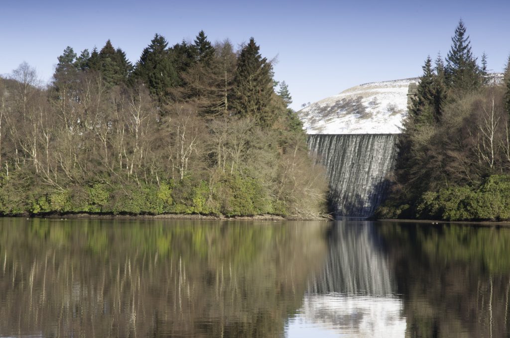
The reservoir cascade of Howden, Derwent and Ladybower were famously used during the second world war as practice locations for the attack on the dams of the Ruhr Valley in western Germany by the specially adapted Lancaster bombers of the 617 Squadron, now more commonly known as the Dambusters. Something has undoubtedly become lodged in the collective unconscious and folk memory of that part of the Peak District. Urban myths of plane crashes and ghost aircraft about.
Howden Dam, Upper Derwent Valley
Dr. David Clarke of Sheffield Hallam University has recorded the tale of how on 24thMarch 1997, police in the Dark Peak area received calls from various members of the public, including a special constable and two gamekeepers, claiming to have witnessed an aircraft crashing into the moors above Howden Reservoir. Taking the calls seriously, the police alerted the local Mountain Rescue Team, but despite a widespread search, no evidence of any crash could be found.
And what of my own experience? The sound of explosion heard by Alison and myself above the wind at the Wain Stones on that icy cold day. Of course, it could have simply been thunder (but it didn’t sound like thunder) or some other meteorological phenomenon. Or perhaps we heard the sound, somehow transmitted across the decades, of that fateful accident in 1948 when thirteen young airmen lost their lives.
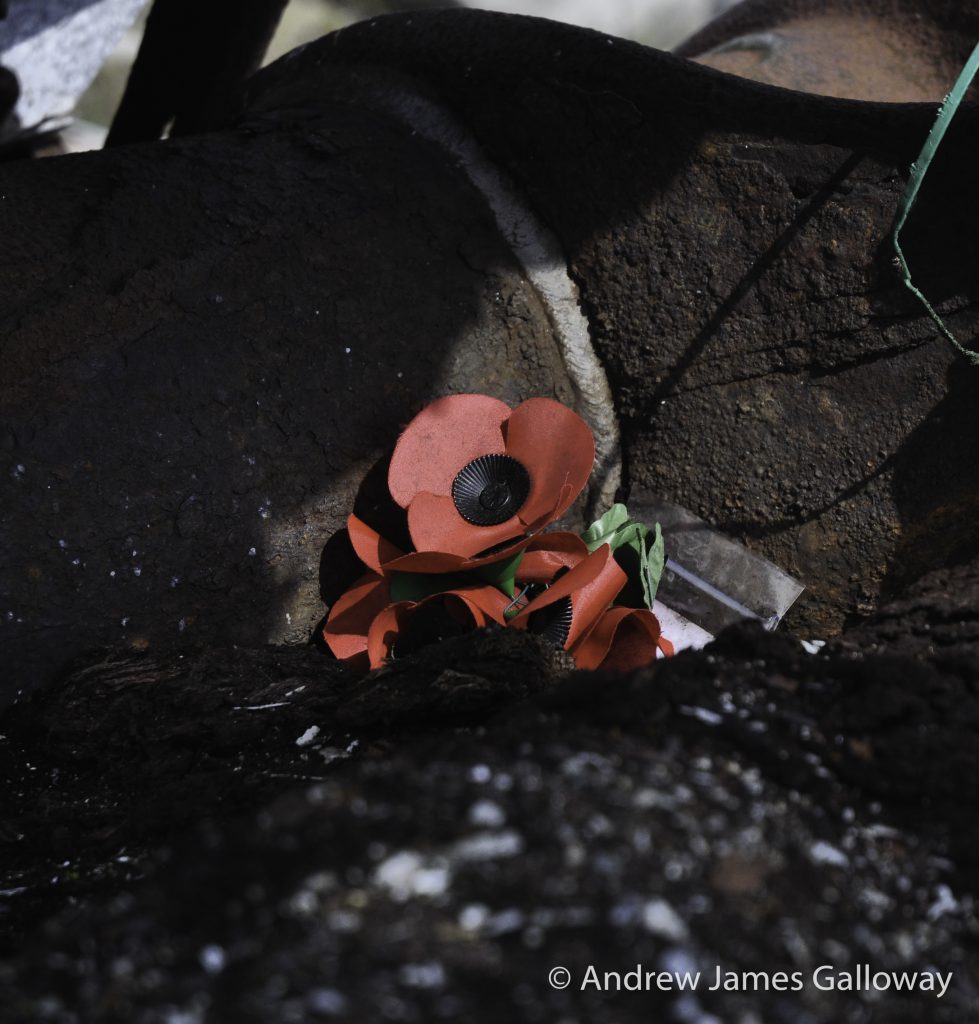
On Higher Shelf Stones, the sense of pathos is tangible. Here and there people have placed small wooden crosses and silk poppies, which stand out white and red against the silver-grey of the weathered wreckage and the monochrome pallet of the exposed peat hags, a reminder of the young men who’s sense of duty led them to a cold, windswept moorland in an unfamiliar country.