Tag Archives: Patrick Brontë

Haworth, Chapter 6: Unquiet Slumbers

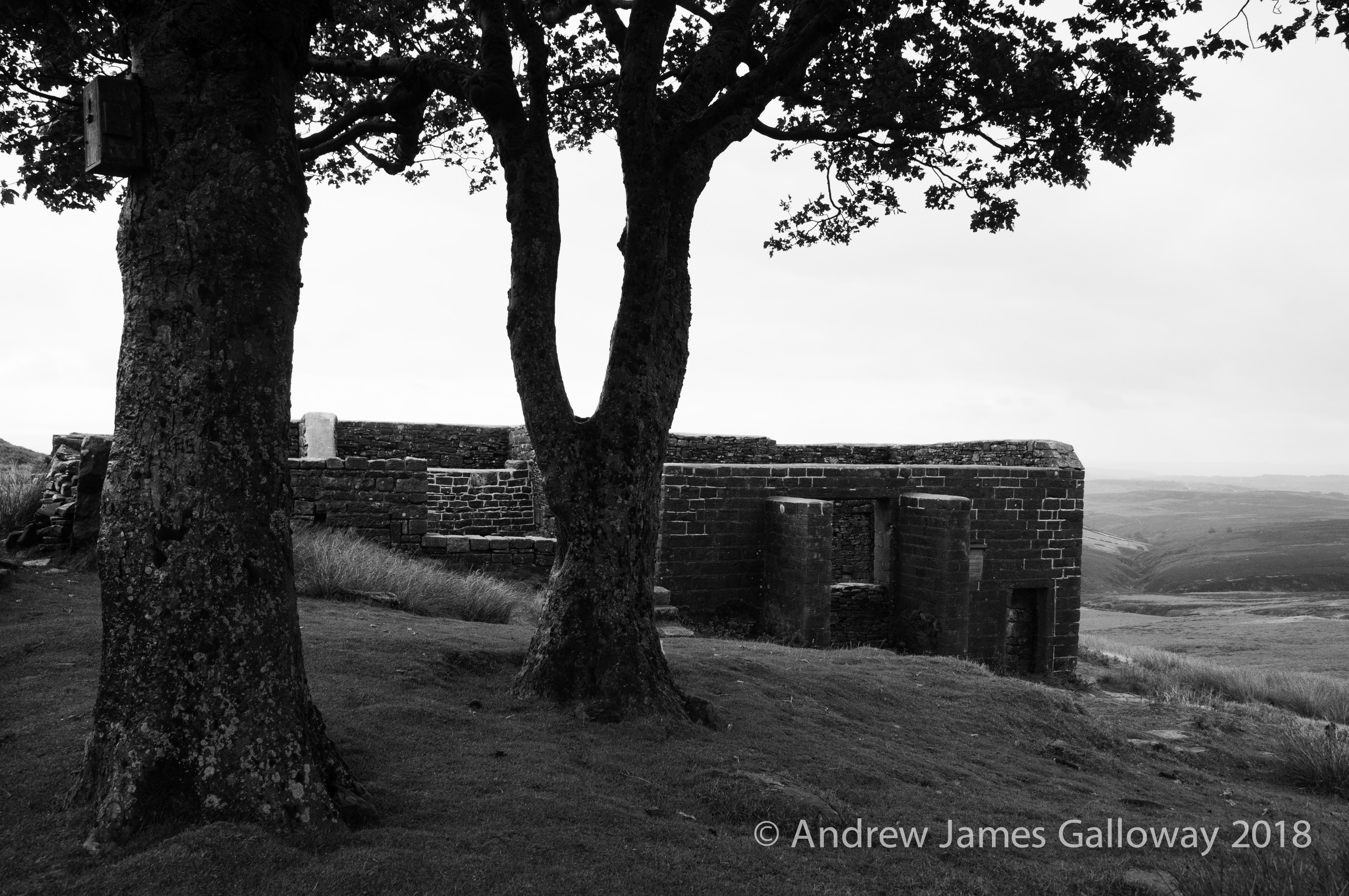
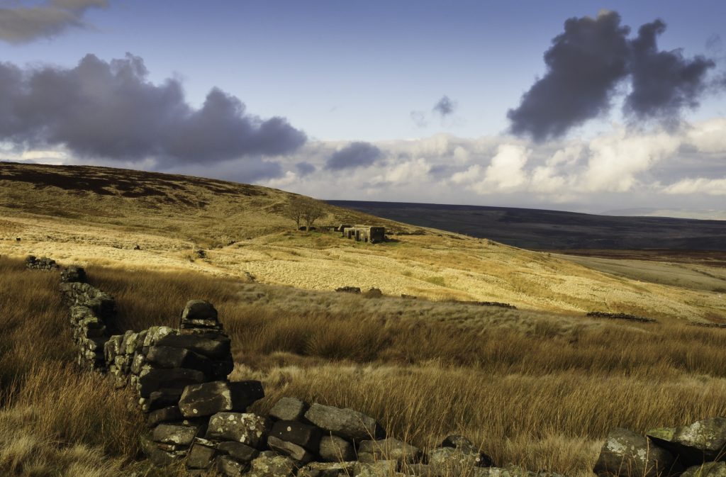
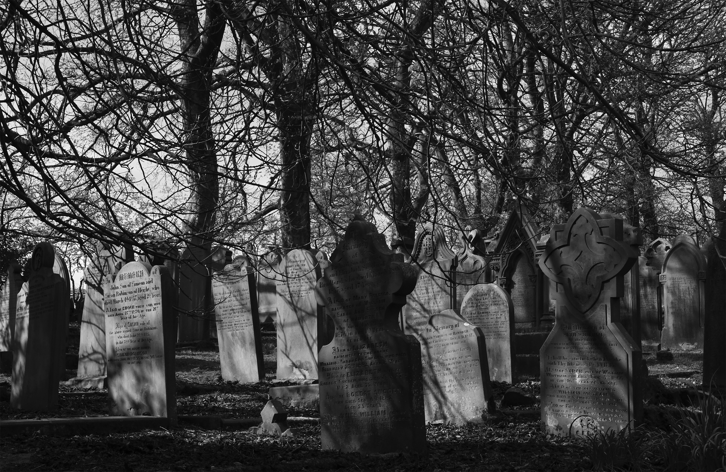
The sheep at Top Withens are evil. I say this without a word of exaggeration or hyperbole, and have learned to beware their very presence. Being so accustomed to the perpetual drip-drip of visitors, from Haworth, from Stanbury, from Heptonstall, they have become tame – no, fearless – to the point of sociopathy. They will take the sandwich from your hand without a second thought and stand before you whilst they eat it. They will harass small children, friendly dogs, hikers and foreign visitors alike and will ultimately claim Top Withens as their own. I wonder sometimes if Emily Brontë did not take as the model for the sadistic and vengeful Mr Heathcliff one of these ovine inhabitants of Haworth Moor with their demonic yellow eyes and curling horns. 

Top Withens
Top Withens

Perhaps it is the sheep that imbue Top Withens with its maleficent energy. Perhaps it is the location, its foundations higher than the grasstops. Perhaps it is the north wind blowing over the edge that begins to invoke the spell; a conjugation of myth, history and fiction, an association of memories from our own lives and the lives of others, weaving these disparate strands together as the Sunderland family wove the strands of wool from their own and their neighbours sheep to produce a thick, hispid material. Or perhaps it is simply a human instinct to see patterns in the landscape: faces in the rocks, voices in the wind, and stories in the ordinary lives of the hill farming families. But the patterns are seductive, drawing us in, until the landscape is transformed by our imagination and the patterns take on a life of their own.

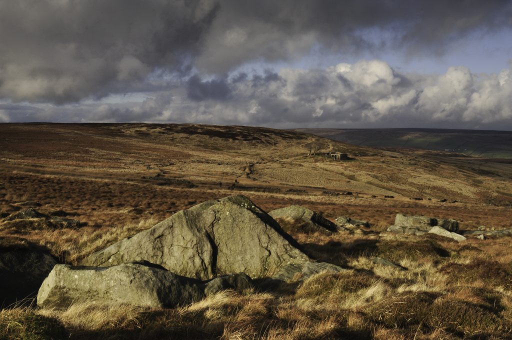
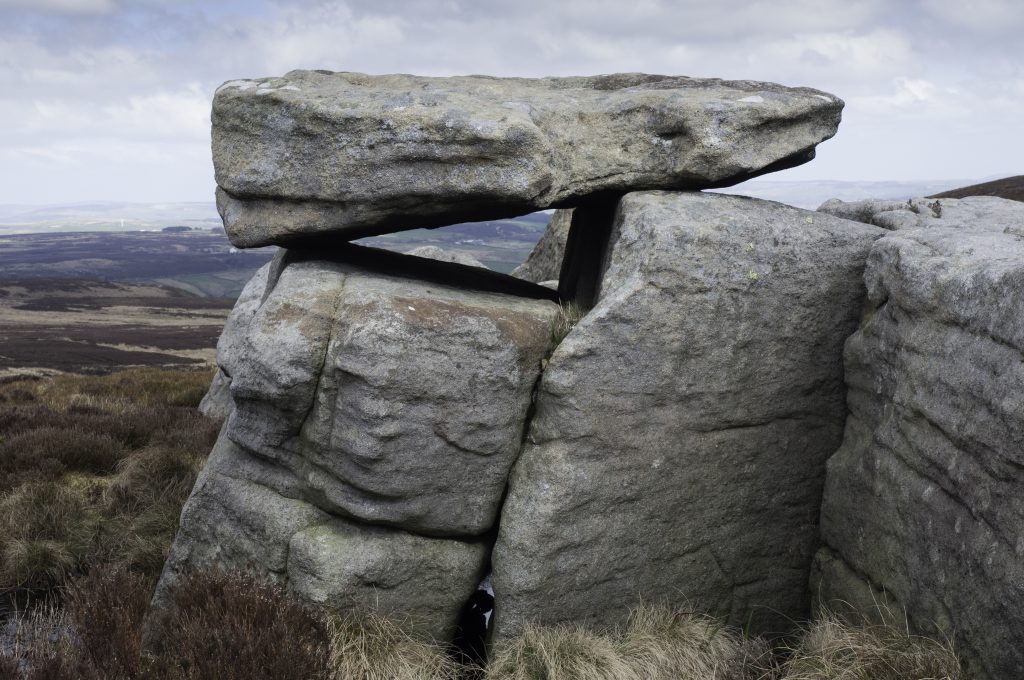
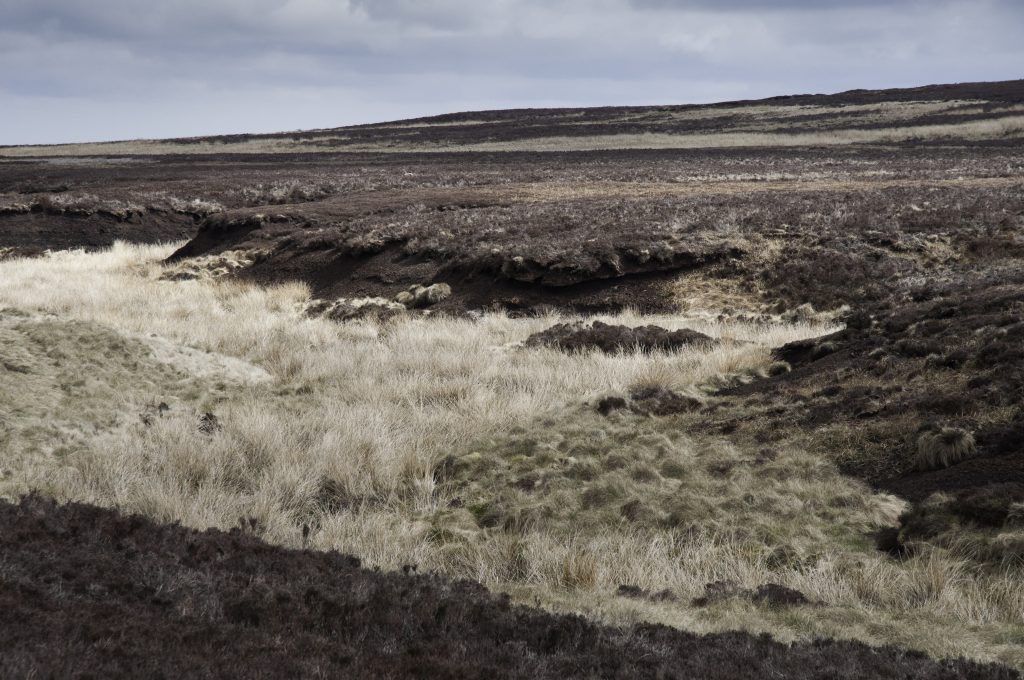
Beyond Delf Hill, the plateau of moorland stretched out before me to the north and west. On the high expanses of the moor, distances become elusive, and it can be difficult to determine scale. I walked for almost a kilometre across the ling heather and tussocks of cotton grass with little alteration in elevation and without passing anything higher than my kneecaps. In low cloud it is remarkably easy to become disoriented and lost on the high moorlands, as the uninitiated and poorly prepared often discover. Thankful of good visibility, I was able to use the considerable scattering of frost shattered, wind-eroded boulders known as the Alcomden Stones as a visual guide. The intricate shapes and patterns made on these stones by thousands of years of wind, rain and ice suggest human involvement in their creation, a pre-historic Henry Moore perhaps. A precariously positioned rocking stone is thought by some to be a Bronze Age cromlech, known by common association as a Druidic altar for dubious sacrifice, whilst others believe the precarious stone to be a result of post-glacial erosion. I am of the former persuasion for I believe the Alcomden Stones to be a liminal zone, a place where the veil between the material and the spiritual realms is perceptibly thin, or at least perceptible to some.

Just below the cantilever in a cleft, where two of the boulders have fallen together, a tiny shelter had been fashioned by the construction of a small dry stone wall to close off the gap beneath the boulders. Judging by the extensive growth of Cladonia floerkeana, or the Devil’s Matchsticks, on the wall, it had been in place for some years, possibly having been used as a shelter for shepherds or gamekeepers caught in bad weather on the moor. Given the sheet of polythene spread out inside the cavity and a discarded, rusted gas container, someone had spent the night there not too long ago. I put the gas container in my rucksack to dispose of later.
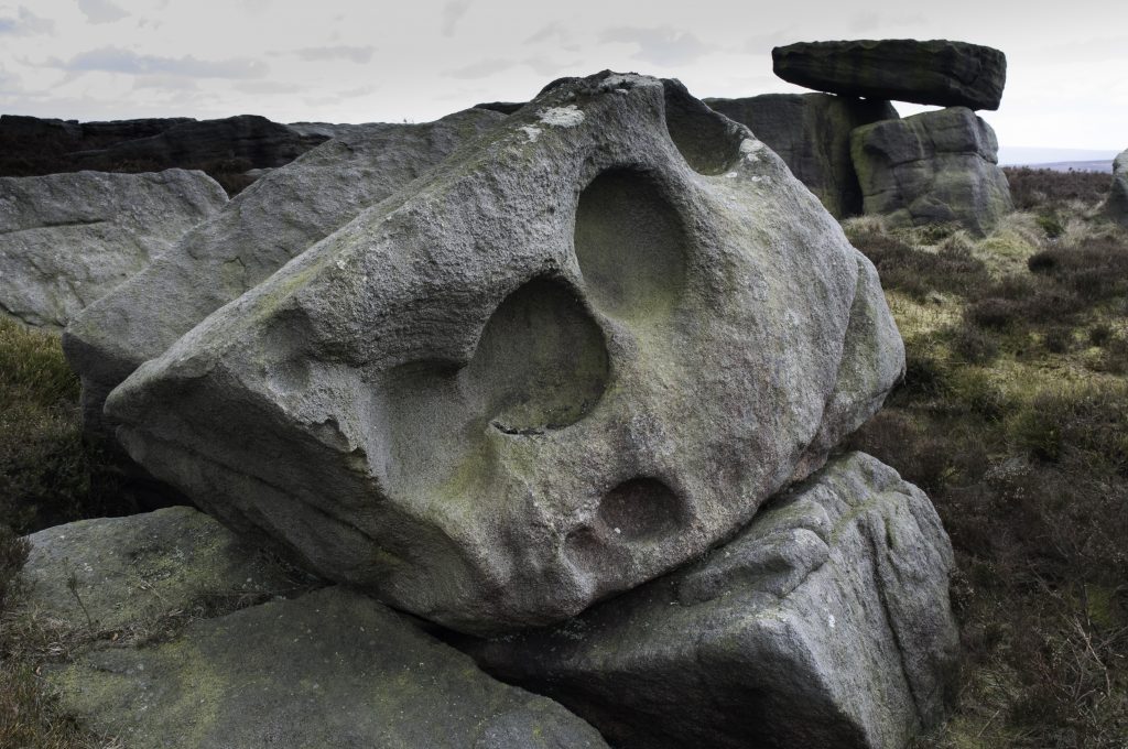
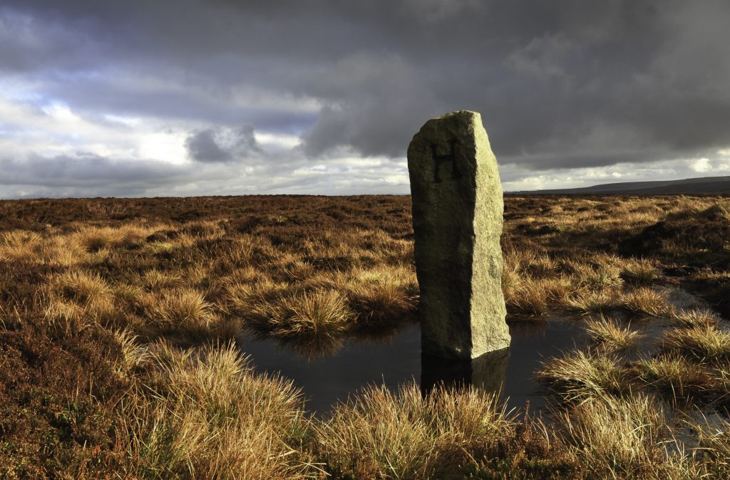
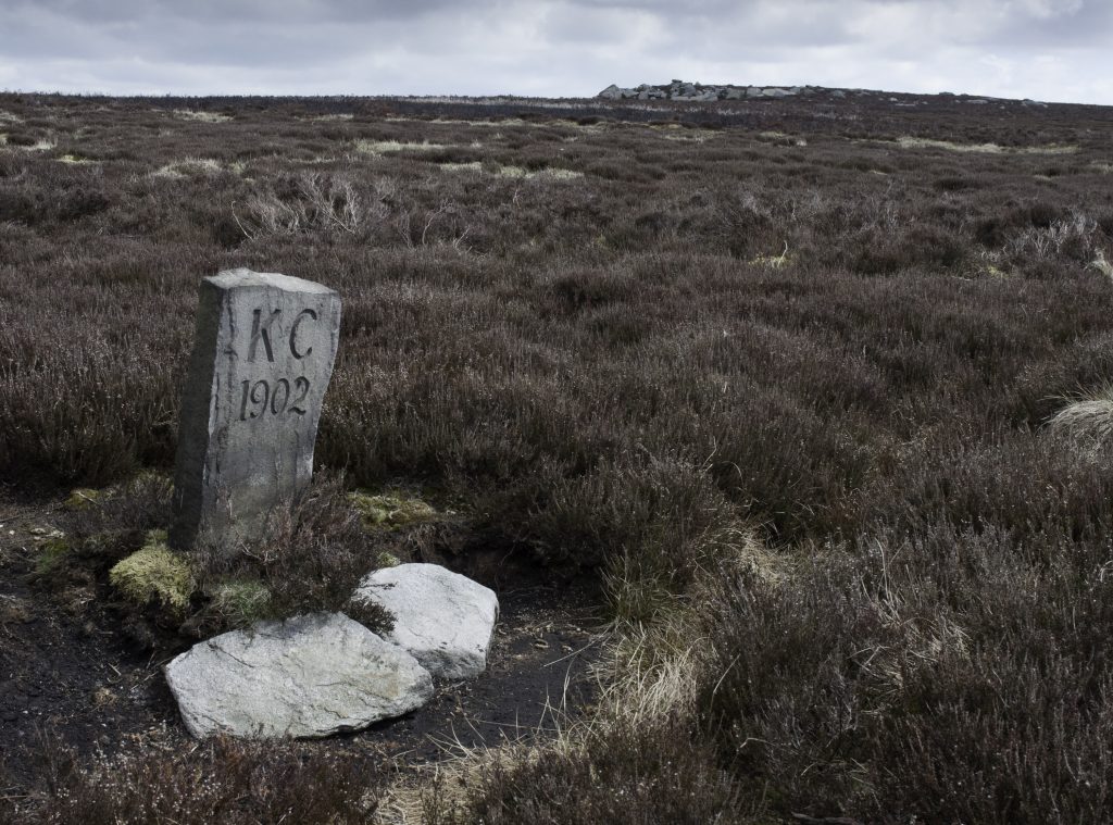
To the west of the Alcomden stones, a shallow trench marked the same constitutional boundary I had stumbled upon by Oxenhope Stoop Hill. I followed its line, passing a number of shin high boundary stones marked “KC 1902” indicating the purchase of the moor to the east by Keighley Corporation in that year. A mile or so northwest the trench meets the county boundary of Lancashire and Yorkshire as it transects from west to east before making a sharp turn to the north at a curious feature known as ‘the Lad’. Whether boundary stone or monolith, the hefty gritstone tooth protruding from the moor solicits a choice from passers by, being engraved in capitals “LAD OR SCARR ON CROW HILL” an act of vandalism thought to originate from an 18thCentury boundary dispute. Curious to see what I might find I headed out across the Wage of Crow Hill onto Stanbury Bog, finding it much less saturated than expected, undoubtedly the result of much improved drainage, introduced to encourage the growth of heather, which prefers dryer soil, for the convenience of the grouse and the shooting parties that come in pursuit of that comical little bird. Half a mile or so south of ‘the Lad’ I came across a natural drainage channel and a considerable depression in the peat, devoid of heather, which bore more than a passing resemblance to Patrick Brontë’s description of the site of the 1824 “phenomenon”, albeit somewhat reduced in depth by the accumulation of peaty material from the surrounding moor over the course of almost two hundred years.

“a part of the moors in my chapelry … sunk into two wide cavities; the larger of which measured three hundred yards in length, above two hundred in breadth, and was five or six yards deep.”[i]
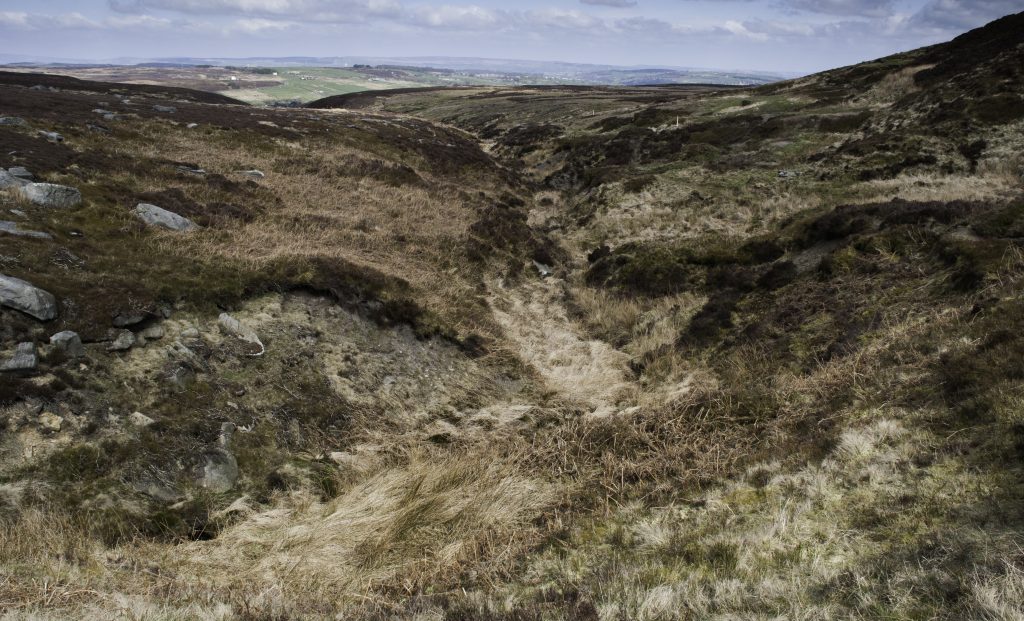
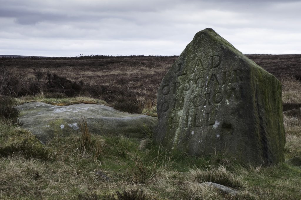
Harwood Brierley gave an account for the Leeds Mercury in 1928 of a visit to Stanbury Bog in the company of local quarry man William Kay. Brierley noted how “the very top of the bog bore evidences enough of primeval forest land … to my astonishment I beheld piles of firewood representing some hundreds of pine, fur (sic), and oak trunks or roots, some still fast in the bogland … and was informed that the lot had been exposed to view by the disruption of 1824, being the remains of a Roman Forest.”[ii] On the day I made my journey to the “swamp of Wuthering Heights”, the “piles of firewood” were nowhere to be seen, perhaps long ago removed by local inhabitants, although I did stumble upon a small exposure of preserved tree material in the peat, possibly giving credence to this heather-less depression as the site of the afore mentioned eruption.

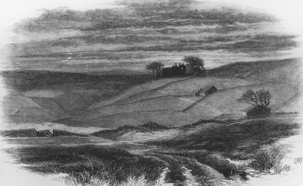
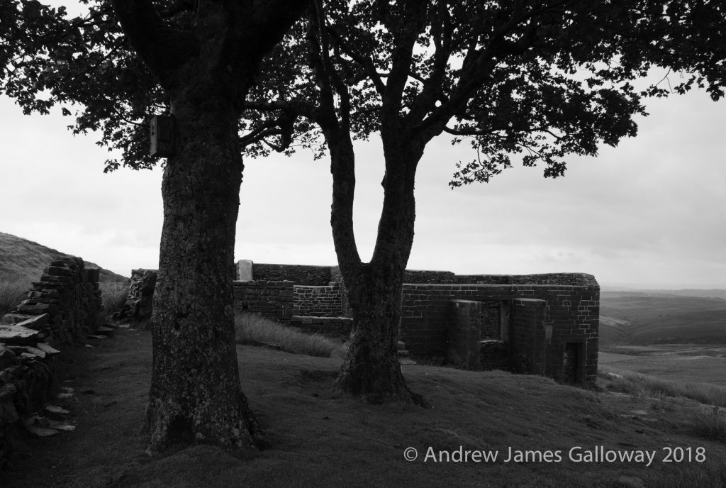
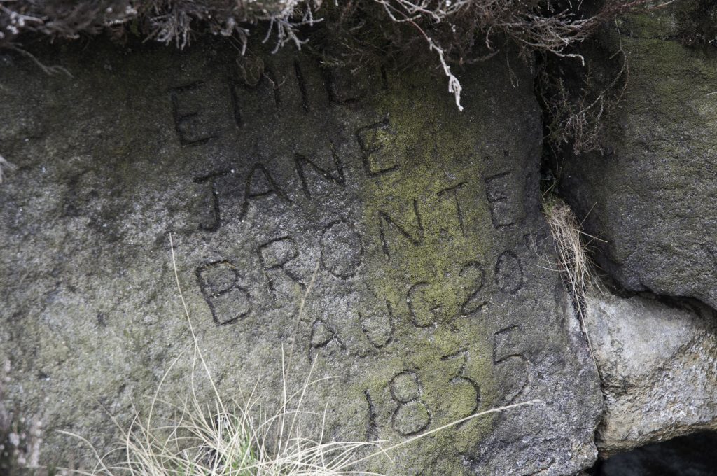
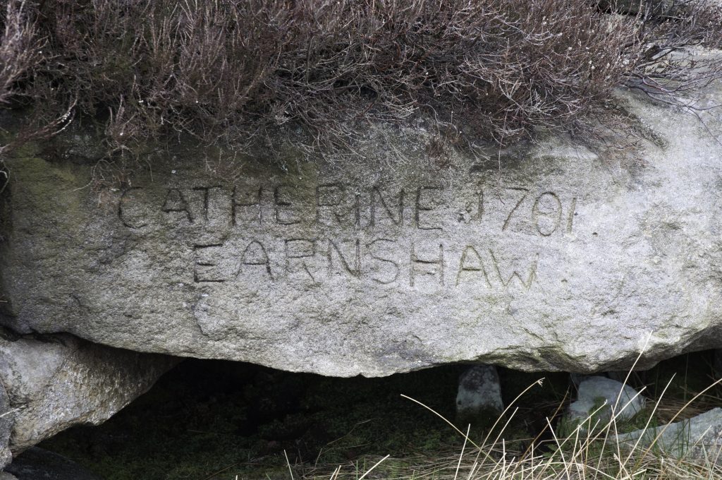
To the west the sun was lingering above the outline of Boulsworth Hill and I resolved to abandon my explorations for the day and head via Bracken Hill down to Ponden Hall. Passing by the old house I glanced up at the tiny mullioned window in the east gable where it is said Emily Brontë took inspiration for the appearance of Cathy’s ghost to Lockwood and for a brief moment thought I glimpsed a child’s face pressed against the glass. A trick of the light no doubt or a product of my over active imagination. 

The mullioned windows of Ponden Hall

In the editor’s preface to the 1850 edition of Wuthering Heights, Charlotte Brontë made concession to “what are termed (and, perhaps, really are) its faults;” but it would be churlish to drag Emily Brontë through the mire of literary criticism without an acknowledgement of the fierce individuality of her work in a time when ‘authoress’ was considered to be an unwise occupation for a lady, particularly the daughter of a parson.  Her genius was not solely in the telling of a story, for which she drew heavily on her Gondal epics, borrowed themes from her brother, creating a narrative that is sometimes incohesive and perhaps simplistic in characterisation. Her genius was in taking a scalpel to the conventionality and hypocrisy of nineteenth century society, in portraying the often brutal reality of life as it was for the inhabitants of the Yorkshire moors at a time of great industrial and social upheaval. To quote the biographer Winifred Gerin, Emily possessed an “attitude of defiance towards the social, and even more towards the national, traditions of the English novel.” More vociferously, as her sister Charlotte proclaimed in the preface to the 1847 edition of Jane Eyre, in defence of those critics who believed the Brontës to be immoral, “Conventionality is not morality. Self-righteousness is not religion. To attack the first is not to assail the latter.”

Although there are undoubted similarities between her novel and the landscape of the Haworth Moors, in the lives of those who were witness to the gradual demise of the stone house and the way of life that went with it, in reality, Wuthering Heights only ever existed in the imagination of Emily Brontë. And whatever her inspiration, if there is an association with the farm building of Top Withens, if there is a thread that, even today, binds fact and fiction together, poetry and prose, joy and tragedy; it is because we have made it thus. Ellen Nussey, Edward Wimperis, Ted Hughes, Sylvia Plath, Jane Urquhart, Glyn Hughes and every one of us who has ever made the rough journey, with a sad heart, along Sladen Beck, through the landscape that now bears her name, to the top of that stark, rain bleached moor and stood among the pitiless sheep, and the truncated ruins of Wuthering Heights, wishing the fiction could, just for one moment, be made real. 


[i]Brontë, Patrick ‘The Phenomenon; or an account in verse of the extraordinary disruption of a bog which took place in the moors of Haworth’ printed by T. Inkersley, 1824 – in the care of the Brontë Parsonage Museum.

[ii]Brierley, Harwood ‘The Swamp of “Wuthering Heights” Scene of the Bog-Burst Patrick Brontë preached on.’Leeds Mercury, 6th August 1928 – from C.M. Edgerley’s scrap books in the care of the Brontë Parsonage Museum.

Ruins of the Elizabethan farm of Top Withens, Haworth Moor

Haworth, Chapter 3: Top Withens

With a heavy heart I left the sanitised materialism of the Parsonage Museum gift shop, a packet of Brontë Rum and Raisin fudge stuffed in my the pocket of my rucksack, and wandered into the anarchic anthology of gravestones in the churchyard, each moss covered stone a remembrance of a family internment from before 1856, when due to public health concerns, the cemetery was closed. The horse chestnut, Scots pines and birch trees, so evocative of a windy afternoon in Haworth, were planted in 1864, long after the departure of the Brontë family, to help disperse the estimated forty-four thousand corpses contained within an acre of land. A photograph of the old church and churchyard, taken around 1860, shows only a few small trees in the Parsonage garden, tall enough barely to reach the first-floor windows and in the meadow to the south what appears to be a drinking trough, or possibly even an old bath, indicating that then, as now, the meadow was used for keeping livestock[i].

The churchyard of St Michael & All Angels, Haworth

A well-marked footpath led beside the meadow then dog-legged towards Penistone Hill, where the overflow cemetery for Haworth was built in 1856 and where a slim finger of the Haworth Moor extends from Wether Hill to touch the skirts of the town. It was onto the moors here that the young Brontës would take their daily afternoon exercise, often accompanied by the family servants Sarah and Nancy Garrs, whilst Patrick attended to parish business. As the children grew older they were allowed to venture out on their own to explore the countryside. Ellen Nussey recalled in her memoires that Emily’s favourite walk was along Sladen Beck to a place known by Emily as ‘The meeting of the waters’[ii]. The Ordnance Survey 1:25,000 scale map of the South Pennines, published in 2008, shows Sladen Beck as emanating from the foot of the earth and clay dam of Lower Laithe Reservoir, built in 1925. Upstream of the reservoir, the beck extends to a point now known as the Brontë Bridge and the Brontë Waterfall. It is safe to assume that this is the location to which Ellen Nussey referred, where a tributary tumbles over gritstone boulders into the afore mentioned beck from the south, although, the Ordnance Survey mark the beck to the west of here as South Dean Beck. Here the children would sit in the sunshine and play in the russet waters that fell from the heather clad moors.

The moors, however, were not always so benign. In the September of 1824, during a long period of hot weather, whilst the eldest three Brontë children, Maria, Elizabeth and Charlotte, were away from home at the Clergy Daughters’ School in Cowan Bridge, Branwell, Emily and Anne had, as was their daily routine, ventured out onto the moors in the company of Sarah and Nancy Garrs. On this particular Thursday afternoon, the little group was late in returning and Patrick had become concerned. He went to a first floor bedroom window to gain a vantage point from which to look for the children returning and was surprised to see that the skies above the moors to the west had turned black with heavy cloud. Timpani of thunder and shock of lightning soon followed as the whole moor was engulfed in a tempest of biblical proportions. Patrick later recalled in a sermon given to the congregation of St. Michael and All Angels how he heard a “deep, distant explosion” whilst feeling the house about him tremble. Distressed with worry, Patrick set out into the storm to search for his young family and eventually found them, cowering under Sarah’s cloak in the porch of a house.

Boundary Stone on Haworth Moor

Patrick was a pious man and believed the occurrence to have been an earthquake brought about by the electrical discharge of the storm and the recent hot weather, which of itself he believed to be a “solemn visitation”, a warning from God himself to the inhabitants of moor and town, calling them to repentance. In fact the earth tremor Patrick had experienced was the result of the collapse of a large area of bog between Middle Moor Hill and Crow Hill. The resulting deluge of liquefied peat, mud and moorland vegetation, which Patrick himself described as being up to sixty yards wide and between five to six yards deep, coursed down from the moor into Ponden Kirk and thus into the River Worth, flattening just about everything in its path, including trees, stone walls and a number of bridges. The wheels of mills along the length of the Worth were clogged with mire. At Horsforth, a good eight miles downstream from Haworth, over a thousand kilogrammes of dead fish, mostly trout and perch, were removed from the river Aire, having been suffocated by the quantity of mud and silt in the water system[iii].

Patrick had clearly been deeply shaken by the event, emotionally as well as physically, and by his frantic concern for his children. He concluded his sermon with the following prognostication:

“We have just seen something of the mighty power of God: he has unsheathed his sword, and brandished it over our heads, but still the blow is suspended in mercy – it has not yet fallen upon us. As well might he have shaken and sunk all Haworth, as those parts of the uninhabited moors on which the bolts of his vengeance have fallen. – Despise not this merciful, but monitoring voice of Divine Wisdom.[iv]

Merciful indeed, for if a report in the Leeds Mercury was to be believed the young Brontës came closer to catastrophe than was originally perceived.

“The torrent was seen coming down the glen before it reached the hamlet, by a person who gave the alarm and thereby saved the lives of several children who would otherwise have been swept away.[v]

It isn’t clear if the children referred to in the report were the Brontë children, but it is possible. How utterly different the course of English literature might have been, if not for the timely intervention of that unnamed person.

Rather than follow the indicated route along the Brontë Way (there is little here which does not now have the epithet ‘Brontë’ applied to it) I turned south from Penistone Hill and followed the line of a dry stone wall above Leeshaw Reservoir, where in the depression of Spa Hill Clough were patches of ink black bog deeper even than a fully extended walking pole, an thus to be avoided at all cost. Above Spa Hill began the exhausting climb through sodden purple moor grass and large patches of lime green sphagnum moss, to Oxenhope Stoop Hill, where I came upon a tall boundary stone, hewn from the local gritstone and carved with a large letter ‘H’. I considered for a moment if the ‘H’ stood for a certain misanthropic character in Wuthering Heights, but having consulted my map found I was standing on the invisible boundary between the county parish of Haworth, in the borough of Keighley and Hepton in the borough of Calderdale.

Boundary Stone between Haworth and Hepton
H for Heathcliff? Boundary Stone between Haworth and Hepton

Following the line of this boundary roughly west for a mile or so I came upon the Pennine Way as it climbed from Walshaw Dean to the gap between Round Hill and Dick Delf Hill, before falling into the valley to the north, where beneath the bows of two sycamore trees stand the quartered ruins of a small Pennine farm, the rough hewn blocks of millstone grit weathered and encrusted with lichen and mosses, the inhabitants having long departed, home now only to half a dozen Swaledale ewes with piercing stares.

Top Withens is about as far as it is possible to be from the sea in the north of England and although the distances involved are by no means great in the age of the internal combustion engine, a hundred and fifty years ago they were considerable. From the crook of Delph Hill, beneath which the ruins sit, it is over seventy miles eastwards to Hornsea and the algid waters of the North Sea. To the west the Fylde coast lies somewhat closer at forty miles distance, none-the-less a journey of at least two days on foot in 1824. The former Ordnance Survey triangulation pillar on Withins Heights stands at 444m above sea level and has line of sight along a ridge north-west via Crow Hill, across the gap at Coombe Hill Cross to Great Wolf stones, surveyed at just a metre in height below the Heights, for this is the backbone of the north of England, the watershed east and west, in the 18thCentury given the sobriquet ‘Apennine’ in deference to the Italian mountains of the same name and now more commonly referred to as the Pennines.

A view of Top Withens from Delf Hill

In 1567 an area of sixteen acres of land upon the Pennine hills known as ‘Wythens’ was sold by Thomas Crawshaye and his sister Anne to a George Bentley, who subsequently passed the ‘Wythens’ on to his descendant William Bentley. Bentley had three sons; Luke, Martyn and John between whom the land was divided into three farms known as Top, Middle and Near Withens. The change in spelling of the name is a common feature of the farms throughout their history, the original deeds to the land having given the name as ‘Wythens’, but the 1852 six inch to one mile map of the Haworth gives the name as ‘Withins’, as does the current Ordnance Survey map, last printed in 2008. However, ‘Withens’ is also in common usage as indicated on William Edmondson’s photograph of ‘Top Withens’ dated 1895 which shows the moor top dwelling as a working farm, complete with a gaggle of white geese. Such variations of spelling are indicative of the transition of a pre-literate culture where oral tradition held primacy, into a culture dominated by administrative literacy.

The etymology of the name ‘Wythens’ holds particular interest for me because the particularly homogenous council estate to the south of Manchester on which I grew up was known as Wythenshawe[vi], so named after the 16thCentury timber framed house and associated parkland, once home to the Tatton family and now owned by Manchester City Council. The teachers of my primary school, which bore the emblem of a weeping willow, would often instruct that the etymology of ‘Wythen-shawe’ is old English, meaning a coppice of willow trees[vii]. The implication here is that the correct form is indeed ‘Wythens’ as indicated by the original deeds, but whether or not there is any association between the three Pennine farms of the Sladen Valley and the growth of willow, is unknown. The two remaining trees which have stood faithfully beside Top Withens throughout the twentieth century, loyal partners isolated in a sea of moorland grasses and heather, are in fact Sycamores.

The ruins of Top Withens from the Pennine Way

By 1813 Top Withens was owned by a John Crabtree, who leased the farm to Jonas Sunderland, who eventually bought the property and passed it on to his son, also Jonas. During the time of the Brontë sister’s excursions onto Haworth Moor, Jonas had married and had three children: John, James and Ann. The income of the farm came from livestock on pasture, the associated dairy produce and was also supplemented by handloom weaving, as the income from such a small holding alone was unlikely to be sufficient to keep the family. It is tempting then to imagine the Brontë sisters calling upon the Sunderlands as they took their daily perambulations upon the moor. The author Glen Hughes in his fictionalised biography Brontë took this idea a step further and imagined the Brontë children taking refuge from that September Storm and its associated landslip in the relative safety of Top Withens.

“The darkened cottage – the firelight and rushlights flickering – with its flagged floor, its rough, stone fireplace under the rack of drying oatcakes, was bare and severe; no rugs, but a scrubbed table, wooden chairs, crude pots and wooden spoons. Pat Wainwright and Nancy were sitting by the fire, with Tom and Mary Sunderland, and their two smaller children. At one side of the fireplace, Mrs Sunderland was praying, the huge shut bible, with its brass clasp fastened, on her lap.”[viii]

It was Ellen Nussey who, as far as is recorded, first intimated the connection between Top Withens and Wuthering Heights, the family home of the Earnshaw family. In 1872 the publishers Smith, Elder & Co had undertaken a re-print of both Jane Eyre and Wuthering Heights and had employed the artist Edward Morrison Wimperis to provide engravings to illustrate the works. George Smith wrote to Ellen asking if she might know the identity of some of the places described in the novels. Although her reply to Smith is not extant, it is clear from the resulting engravings and from a letter Smith wrote to Ellen thanking her for the information that Ellen had responded to the request. The most famous image produced by the artist is a dark and brooding, moonlit scene of the view from below Scar Hill showing the three Withens farms, the third, most elevated and most remote having been transformed into the “large jutting stones” of Wuthering Heights. Thus established, the association began to burrow its way into the popular consciousness. 

Wuthering Heights
Lithograph of Wuthering Heights by Edward Wimperis 1872, suggestive of the location of the Top, Middle and Lower Withens farms.

Commentators draw on at least two other contenders for the inspiration of Wuthering Heights. The first is High Sunderland Hall, a large manor house, which until the 1950’s stood in parkland to the north of Halifax and which Emily is thought to have visited during her time as a teacher at Law Hill School. The description of Wuthering Heights at the opening of the novel in which Mr Lockwood sees “a quantity of grotesque carvings lavished over the front” and “a wilderness of crumbling griffins, and shameless little boys” is thought to have been inspired by the seventeenth century stately home. However, an examination of the text shows that the descriptions of the interior of Wuthering Heights in the novel are not those of a large ancestral manor house, but rather of a less substantial farm building. Indeed, ‘the Heights’ are often referred to in the text as being a farmhouse. In the letter Isabella Linton sends to Ellen Dean following her elopement with Heathcliff, she writes:

“The sun set behind the Grange, as we turned on to the moors; by that, I judged it to be six o’clock; and my companion halted half-an-hour, to inspect the park, and the gardens, and, probably, the place itself, as well as he could; so it was dark when we dismounted in the paved yard of the farmhouse, and your old fellow servant, Joseph, issued out to receive us by the light of a dip candle.”[ix]

Joseph, the acerbic servant is often described as retreating to his garret, a feature far likely to be found in the Pennine farms of the Sladen Valley than in a stately manor close to the centre of Halifax and, in the first chapter, as Lockwood enters the building he describes a single room reaching to the very roof.  

“One step brought us into the family sitting-room, without any introductory lobby, or passage; they call it here ‘the house’ pre-eminently.” Lockwood continues, “One end, indeed, reflecting splendidly both light and heat, from ranks of immense pewter dishes, interspersed with silver jugs and tankards, towering row after row, in a vast oak dresser, to the very roof. The latter had never been underdrawn, its entire anatomy laid bare to an inquiring eye, except where a frame of wood laden with oatcakes, and clusters of legs of beef, mutton, and ham, concealed it.”[x]

The above is no description of a manor house, but may be the description of Ponden Hall, a substantial farmhouse, also built in the seventeenth century, located below Ponden Clough on a spur of land that now extends into Ponden Reservoir. The Brontë children often visited Ponden Hall to make use of the extensive private library which was housed there and the oak beamed rooms of its interior may have fired Emily’s imagination. Certainly, it was here that Emily encountered an upper chamber with a small, latticed window, enclosed by the frame of a box bed[xi].

Ponden Hall
Ponden Hall

Perhaps most convincingly, again and again Emily Brontë, describes Wuthering Heights as a hilltop dwelling rather than the parkland setting of High Sunderland Hall.

“Pure, bracing ventilation they must have of it up there at all times, indeed: one may guess the power of the north wind, blowing over the edge, by the excessive slant of a few stunted firs at the end of the house;”[xii]

“On that bleak hill-top the earth was hard with black frost, and the air made me shiver through every limb.”[xiii]

“heaven did not seem to be my home; and I broke my heart with weeping to come back to earth; and the angels were so angry that they flung me out, into the middle of the heath on the top of Wuthering Heights, where I woke sobbing for joy.”[xiv]

The above powerful discourse given by Cathy to Nelly Dean makes apparent a factor that I believe is often overlooked. Wuthering Heights in not merely the dwelling in which the Earnshaws live, but the whole area of moorland about their farmhouse. This is also true of the Withens farms. The 1852 six inch to one mile map gives the name of the area of raised moorland immediately to the west of Delf Hill, below which Top Withens sits, as ‘Withens Heights’. This association of name is for me far more than coincidence, especially given that ‘Wuthering’ is a Yorkshire dialect variant of the Scottish dialect ‘Withering’. The novels of Sir Walter Scott were particular favourites of Emily’s, and Scott often used the devise of country dialect in his novels, particularly in the character of Andrew Fairservice in the novel Rob Roy. 

Withens – Withering – Wuthering!


[i]Barker, Juliet op. cit. plate section one, in the care of the Brontë Parsonage Museum

[ii]ibid, pp228

[iii]Barker, Juliet op. cit. pp152

[iv]‘A sermon preached in the Church of Haworth … in reference to an Earthquake’ (Bradford, T. Inkersley, 1824), in the care of the Brontë Parsonage Museum.

[v]Leeds Mercury, 11 September 1824, pp3, qu. in Atkins, William (2014) The Moor, pp176, Faber & Faber Limited.

[vi]‘was’ as the Wythenshawe estate has subsequently been divided up into numerous housing associations and private developments.

[vii]Deakin, Derick 1989 ‘Wythenshawe: the story of a garden city’pp.4

[viii]Hughes, Glyn 1996 ‘Brontë’, Bantam Press (Transworld Publications Ltd)

[ix]Brontë, Emily 1847 ‘Wuthering Heights’, published in Penguin Classics (1985), pp174.

[x]Ibid, pp46

[xi]which, incidentally, one can still see should one visit the property, although the box bed is sadly not the original.

[xii]Brontë, Emily op.cit. pp46

[xiii]Ibid, pp51

[xiv]Ibid, pp121